In Brief:
We warm up this week until a Thursday/Friday next-chance of snow.
Sunday update:
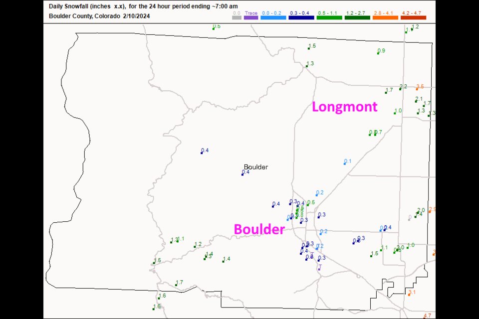
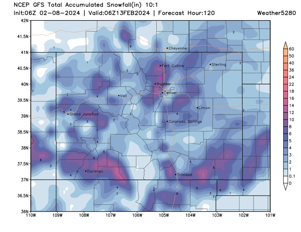
The storm DID travel further south than originally thought, but a convergence line set up east of I-25 giving Firestone and Greeley and places north and south long that line a lot more snow than I-25 received. Longmont only got around 1-3 inches (Figure 1 update) while Boulder, usually the snow leader) got less than an inch in most spots.
We dry out and warm up until a possible Thursday/Fridaty storm! Stay tuned.
End Sunday update.
Friday update:
The storm is taking, literally, a right turn, and is digging deeper to the south. The winter storm watch that was in place has been downgraded to an advisory (below). Many of the bigger impacts that were expected will now move through New Mexico and Southern Colorado. Sorry, if you were hoping for a big one.
Winter Weather Advisory
Issued: 12:47 PM Feb. 9, 2024 – National Weather Service
...WINTER WEATHER ADVISORY IN EFFECT FROM 5 PM THIS AFTERNOON TO 11 PM MST SATURDAY...
* WHAT...Snow expected. Total snow accumulations between 2 and 4 inches with a few locations seeing up to 8 inches, mainly in and near the foothills.
* WHERE...Portions of central, north central, and northeast Colorado.
* WHEN...From 5 PM this afternoon to 11 PM MST Saturday.
* IMPACTS...Roads will likely become slick and hazardous.
PRECAUTIONARY/PREPAREDNESS ACTIONS...
Roads will be slick resulting in slow and hazardous travel. Allow extra time to reach your destination.Monitor the latest forecasts for updates on this situation.
Snowfall Roundup:
Weatherunderground.com Tr-2"
GFS 2-3"
NAM 1-2"
Canadian 2-4"
Channel 7 4.5"
Channel 9 3.2"
Weather5280 (Matt M.) 1-4"
Accuweather 4-8"
My forecast: 1-3" is the best bet (yesterday I thought 3-5").
End Friday update.
Forecast Discussion:
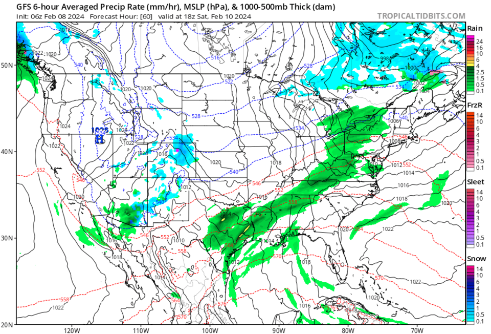
Warm temperatures and scattered shower are the story for the end of the week. Friday will see increasing chances of snow showers (a coating in spots, 1/2 in other spots) or light rain showers throughout the day. The next storm system picks up after 5-7pm with rapidly increasing snowfall chances (Figure 1). The snow will continue to dump off and on snow through midnight Sunday morning.
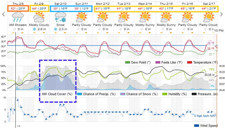
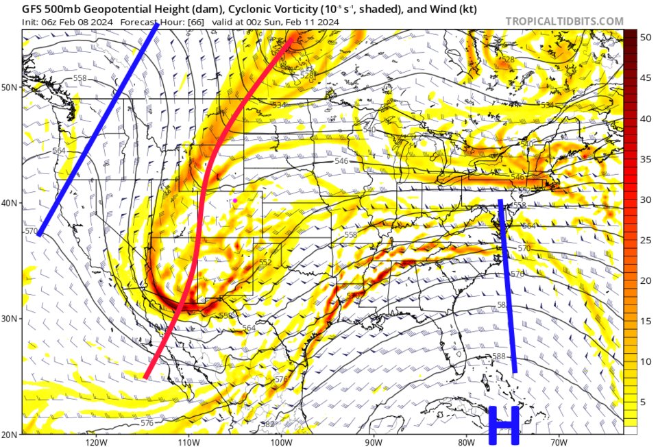
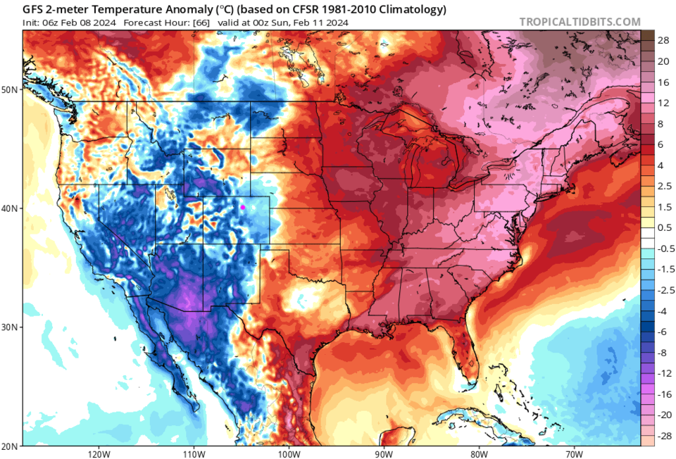
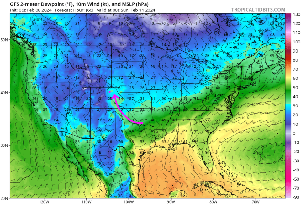
This is fueled by a deep trough (Figure 2) that is colder than the last one (highs closer to freezing than last week - see Figure 3). This system, like the last, will pull a drink of moist Gulf air in on Saturday as well (Figure 4).
The storm begins Friday night and is rather local but persistent by midday Saturday (Figure 5). I'll create the Snowfall Roundup tonight or Friday AM, but you can see the models 48 hours out below.
The GFS (Figure 6) gives Longmont 8-10 inches. The Canadian (Figure 7) 6-7 inches. Finally, the NAM puts us in the 5-7 inch zone (Figure 8). While the weatherunderground model only gives us 4-6 inches (Figure 1).
The Front Range Forecast:
After this storm, we return to quiet 40's for high temperaures into next weekend.


