This content was originally published by the Longmont Observer and is licensed under a Creative Commons license.
Forecast Discussion:
Can I blame Friday the 13th on my late posting today? Just for that, I'll include one weather media outlets winter outlook at the bottom.
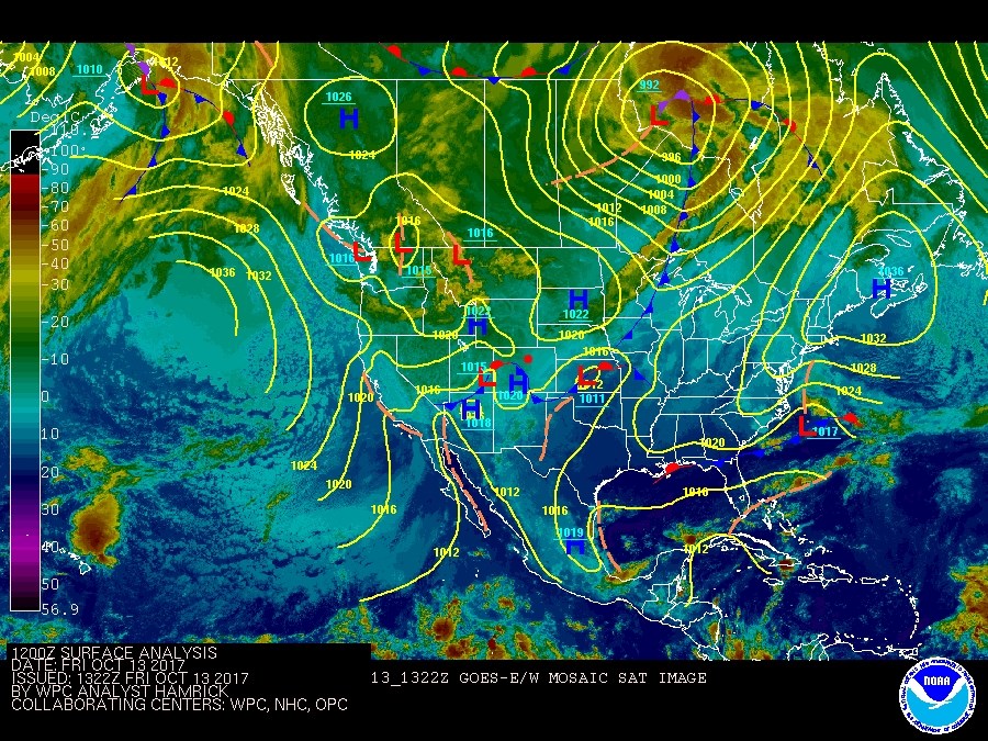
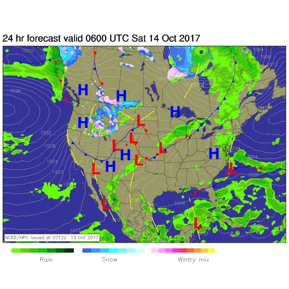
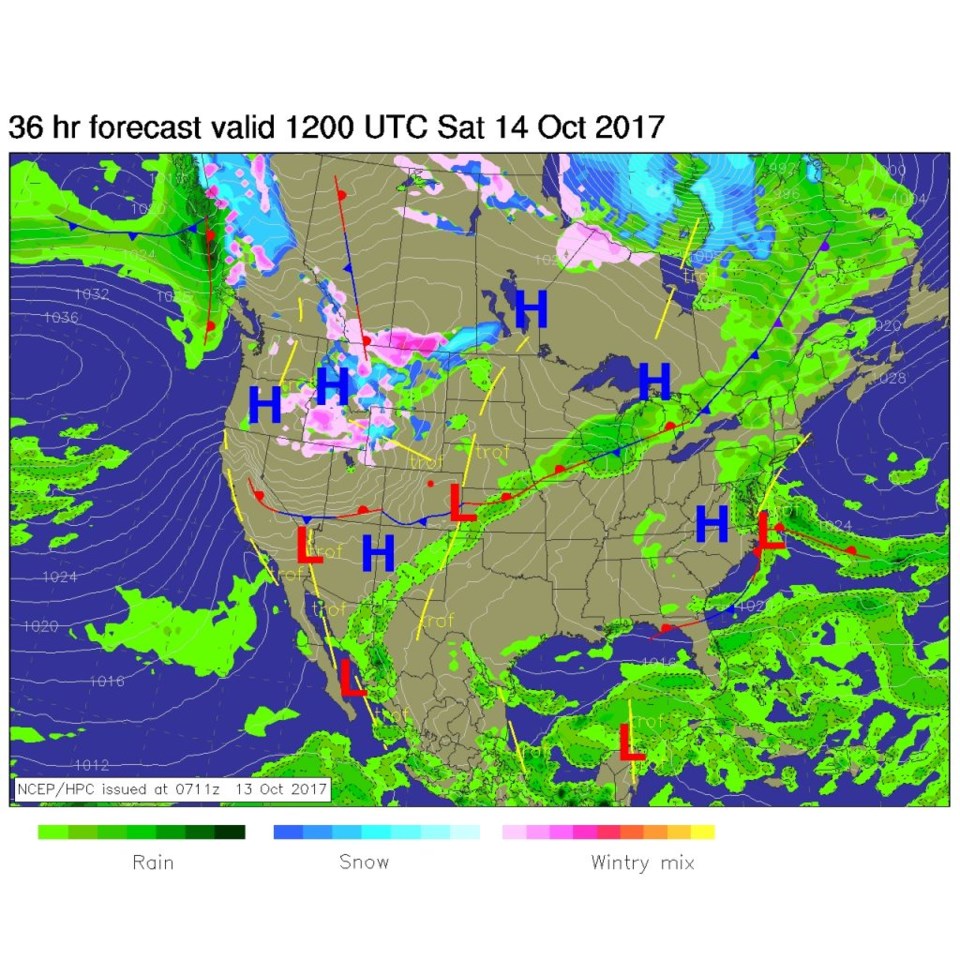
But things are very quiet right now. We have had a front push down over the region last night (Figure 1) which has cooled upper 70's highs along the Front Range to the mid 60's. By midnight tonight (Friday-Saturday), we'll have another cold front gathering to our northwest (Figure 2) which will create a gusty cooler day - upper 50's for highs - on Saturday as it sweeps by (Figure 3). You can see in Figure 2 and 3 that all the precipitation is far off in the northern Rockies.
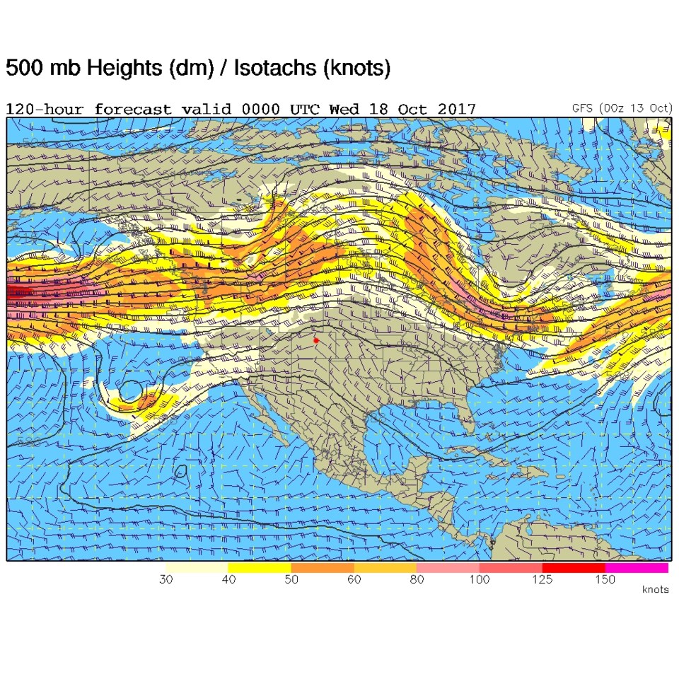
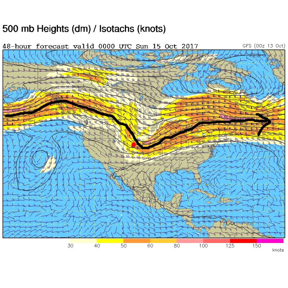
The cool down occurs as the jet stream core gets close to the state (the black line in Figure 4) but it remains to the north of us. We get cooler and windy, very little moisture or real cold air is present.
In the Longer Range:
A ridge establishes itself over the western US and the mid-west for much of the next week giving us very mild (and boring) weather - Figure 5.
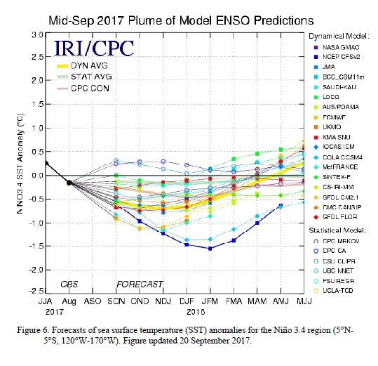
Accuweather.com has stepped out with a winter forecast for the US. A big player in their consideration seems to be the forecasted (and already started) La Nina. La Nina is a cooling of the equatorial eastern Pacific surface ocean waters caused by a weakening of the normal easterlies that ring the globe. Figure 6 is a multi model comparison of forecasts with almost all showing a dip in the index in the opposite direction of what occurs when an El Nino occurs (an abnormal, but periodic, warming of the ocean temperatures in this region).
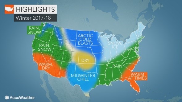
Figure 7 is the Accuweather forecast - Longmont (and northeast Colorado) is painted in the drier than normal and colder than normal side. Western Colorado is colder than normal and wetter than normal - so, if this pans out, the snow-pack will be very good while we wish we had more snow and/or rain than we get. We'll see. I'll post other outlet forecasts as they are released.