
This content was originally published by the Longmont Observer and is licensed under a Creative Commons license.
By John Ensworth
Discussion:
The story of the last week continues with the best moisture and dynamics staying down over the southeastern ½ of the state, with moisture and a few mountain and daytime heating initiated thunderstorms in the afternoon that can dump (locally) a lot of water on just a few people up here. Figure 1 is the single radar station snapshot of what thunderstorm activity was in play Sunday evening.
Figure 1: Reflectivity radar image from the Front Range airport.
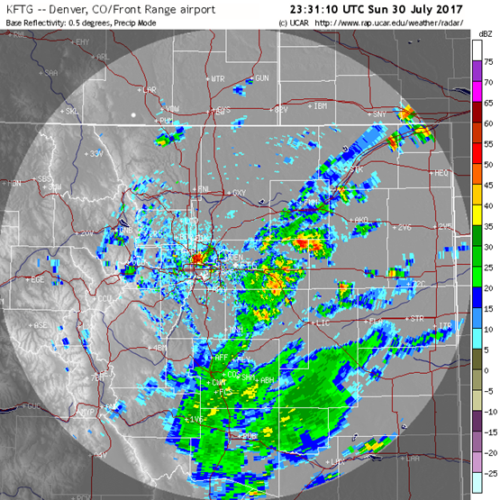
Figure 2 shows a lower slice of the atmosphere (just over ground level for much of Colorado) – the 700mb map. The high pressure center is visible in the middle-level region over western Texas. The circulation around that high is bringing in monsoon moisture for southern Colorado.
Figure 2: 700mb (lower in the atmosphere than the 500 mb map we are accustomed to. Green is higher moisture content air.
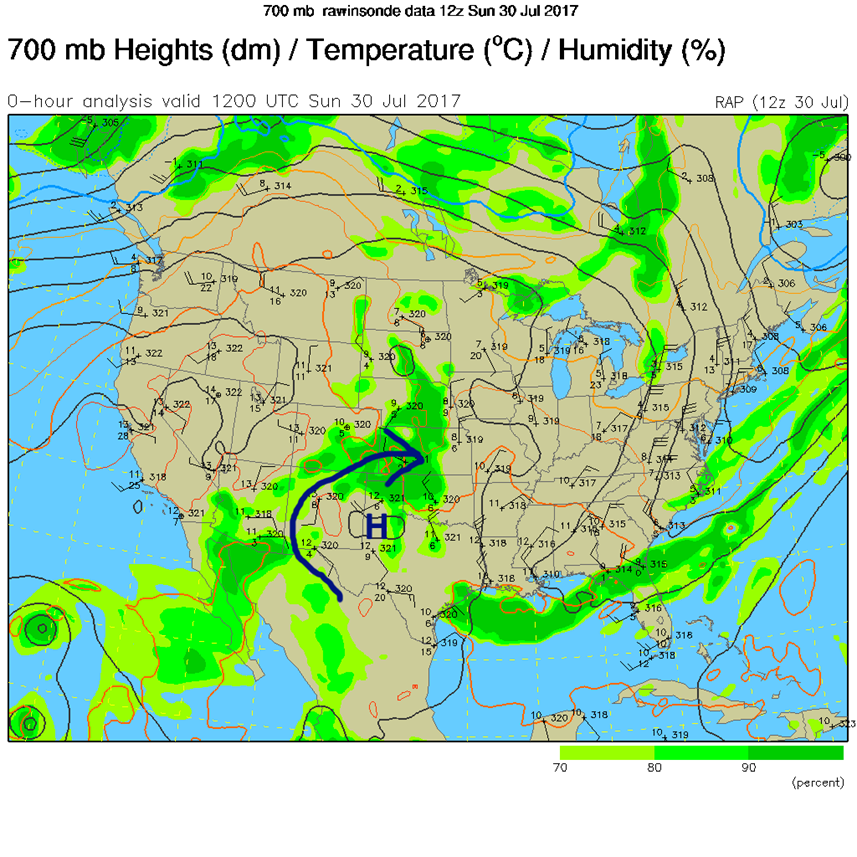
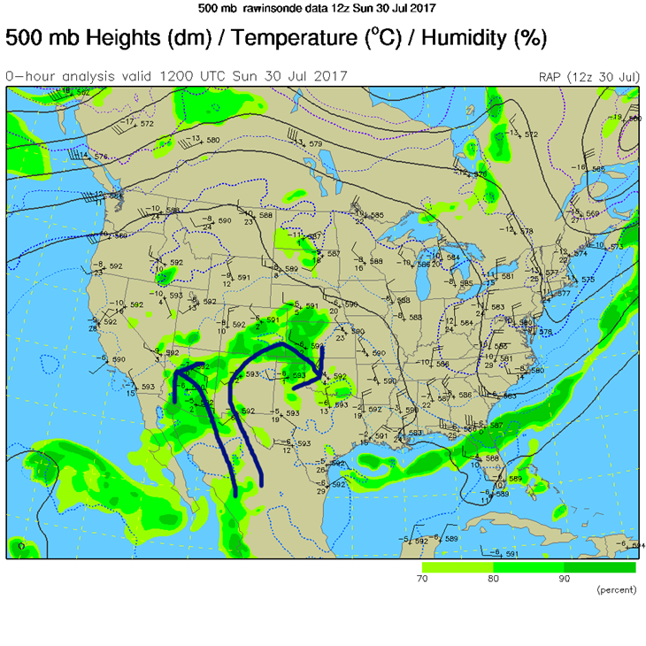
Figure 3 is our 500mb map showing a ‘not quite as clear’ story of the moisture flow, but the wind directions still reflect with this tight flow of moisture over the southeastern ½ of the state.
Figure 3: The 500mb map Green is higher moisture content air.
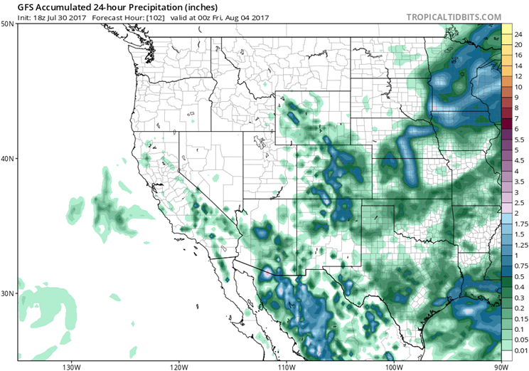
In a look at the longer range: The low level moisture sticks around into middle to late next week, but the ridge heads back west, eventually as far as California early next week. The moisture getting in under the ridge will ebb and flow giving us a chance of afternoon thunderstorms just about every day. Figure 4 and 5 show 24 hour accumulations of rain by the GFS model for Monday and Tuesday respectively. Southern regions of the state win more than we do in Longmont in the rain game. Thursday (mentioned yesterday) still has a more major frontal system approach kicking of more rain state-wide as seen in Figure 6.
Figure 4 The GFS 24 hour accumulation rainfall forecast for Monday 7/31.
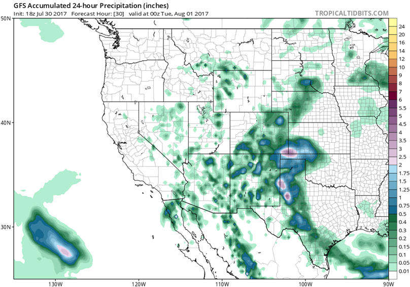
Figure 5 The GFS 24 hour accumulation rainfall forecast for Tuesday 8/1.
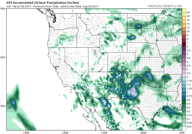
Figure 6 The GFS 24 hour accumulation rainfall forecast for Thursday 8/3.
*** This feature will run as close to daily as possible in this location on the Longmont Observer. ***
This article will provide a brief discussion concerning the ‘why’ behind the weather with a focus on severe weather, unusual weather, and snow (especially trying to predict snow depth and its human impact in Longmont).
Bio:
John Ensworth works from Longmont as the Principle Investigator for the NASA Science Mission Directorate Earth and space science education product review through the IGES (The Institute for Global Environmental Strategies – www.strategies.org) . He is in his 14th year running this review. He is an astronomer (from the 2nd grade onward) and became a meteorologist (in the 5th grade) when a thunderstorm in Arizona rained on his telescope when the weather service had only forecasted a 10% chance of rain. He has college degrees in physics and astronomy and climatology and a graduate degree in meteorology and earth science. He lectures at the Little Thompson Observatory in Berthoud, the Estes Park Memorial Observatory in Estes Park, and for a number of online universities. He built and runs a backyard observatory near Pace and 17th in northeast Longmont where he has lived for 8 years with his wife, daughter, son, and two cats. Invitations to open house nights at this observatory, LTO, and EPMO will be posted with future discussions when they are scheduled.
Forecasting severe weather and snow amounts via text lead to this column. He began texting friends about the weather right after the September 2013 flood. The readers of this column will, hopefully, keep him honest in what he ‘thought’ he had forecasted for ‘the most recent’ storm.


