This content was originally published by the Longmont Observer and is licensed under a Creative Commons license.
Forecast Discussion:
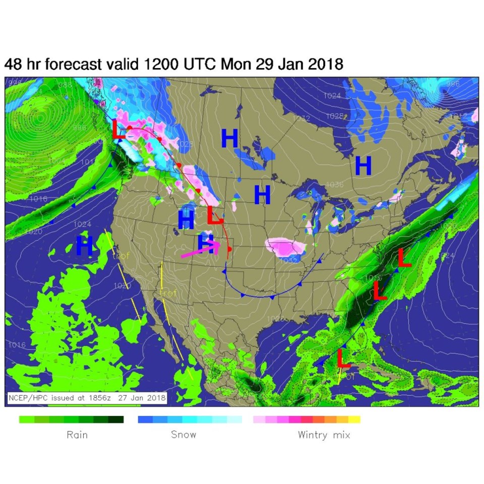
Upper air ridging and down slope flow will continue to warm us today through Tuesday (our warmest day this week). Figure 1 is the surface map for tomorrow morning...we have a warm front past us pushing eastward.
By Tuesday, we have the ridge overhead giving us lower 60'sF temperatures. Get out the shorts.
The longer range forecast:
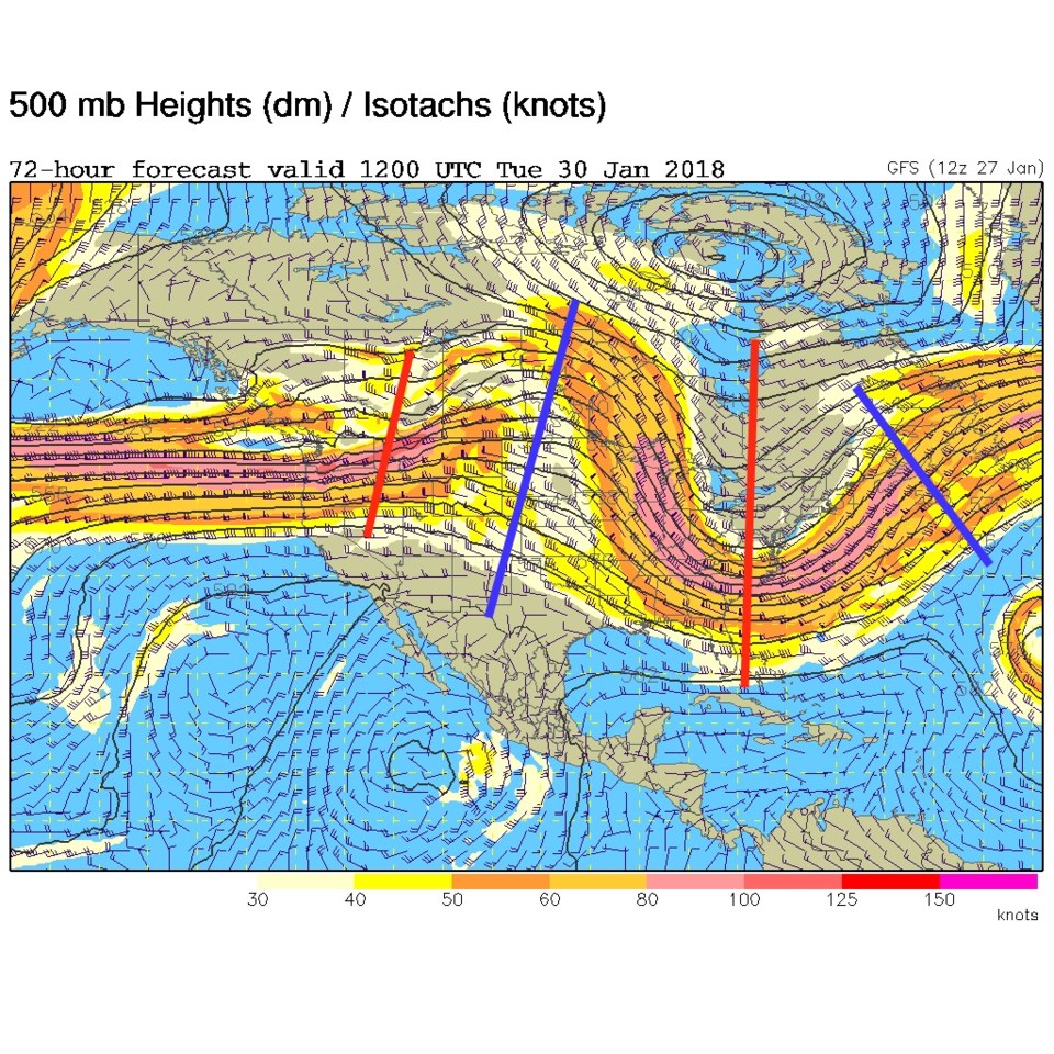
The change comes Wednesday with a trough that digs into the western U.S. states (Figure 3). We see the big ridge finally pull out west into the Pacific ocean and Alaska. The eclipse is Wednesday morning, and the forecast is for 60% overcast and temperatures around 31F. The rain/snow chances seem to be holding off until later Wednesday, so you may be able to come over to the Cherrywood Observatory at 4:45am to 6am. (See the invitation in this column from Wednesday/Thursday.)
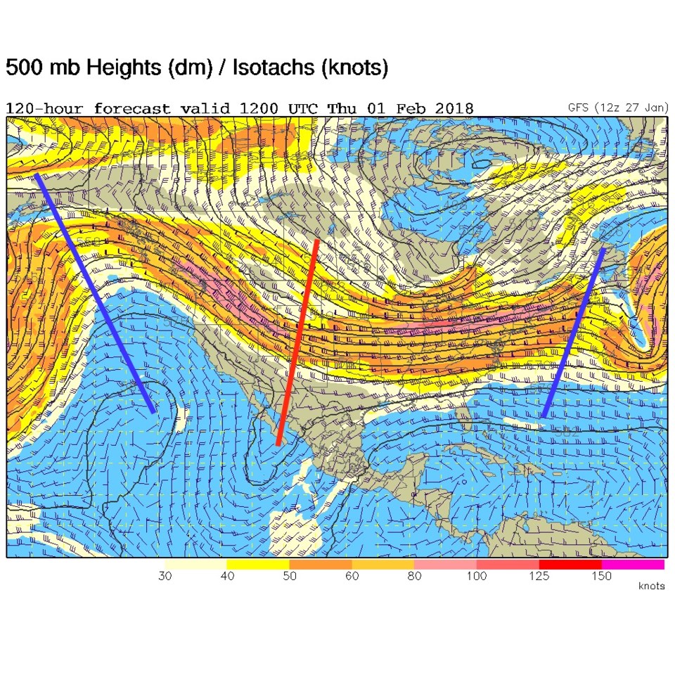
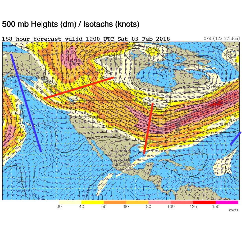
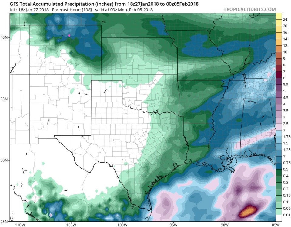
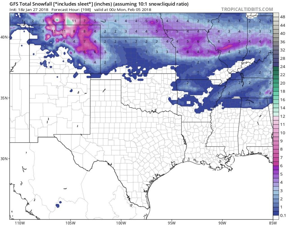
Even though this is now beyond a reasonable forecast window, the trough remains over the West (Figure 4) next weekend. There are hints from the GFS that a big change might really be coming... Figure 5 hints at almost an inch of liquid water by next Sunday evening, Figure 6 suggests 5-8" of snow. Remember, we've seen that fade out as the actual dates approach. Don't get TOO excited yet.