This content was originally published by the Longmont Observer and is licensed under a Creative Commons license.
In Brief:
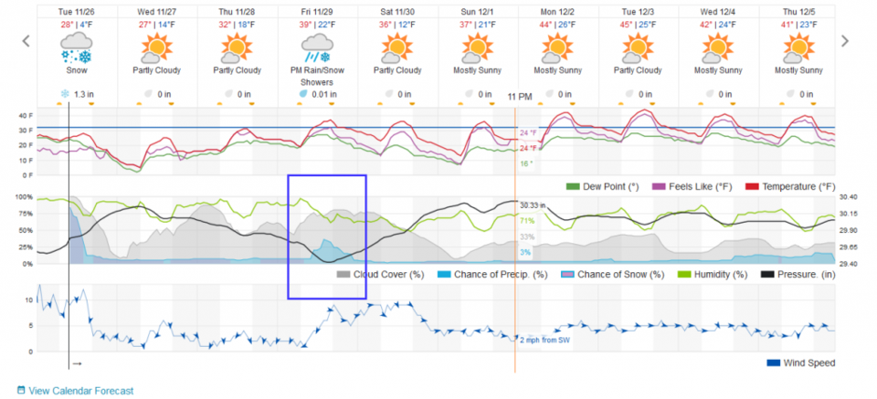
Impressive snow has- and is still falling. Longmont has a foot as a base with snow ending around 12-2pm today (Tuesday). We remain cold and snow-free until the western counties get their snow on Friday. We may see 1-3 inches along I-25 (but who will notice it?).
Update 11/28 11am:
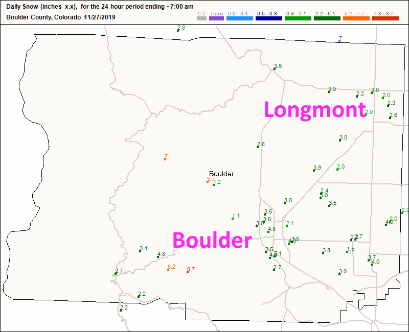
A quick recap on the last storm: with about 12 inches in Longmont through Tuesday AM, another 2 to 2.5 inches fell after 7am Tuesday bringing us to around 14-15 inches in town. Boulder seems to have added 2-5 inches more taking them over the 2 foot mark. Wow. (Figure 1 update).
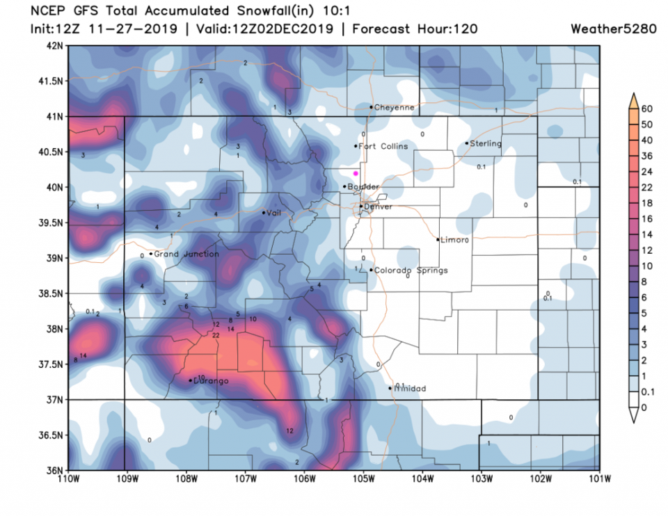
The next storm for Friday (only hitting the area from noon to 9pm) will drop a dusting to maybe an inch in town (Figure 2 update). This is much more of a western slopes storm this time. I'm watching out for flash flooding in Arizona with 2-4 inches of rain expected northeast of the Valley (and a foot or two of snow above 4500 feet in the central mountains). What a Thanksgiving week for everyone!
End 11/28 11am update.
Forecast Discussion:
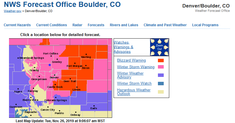
The winter storm warning is still in place through 2pm today (Tuesday). Blizzard warnings were issued for Castle Rock to Limon and up to Sterling (Figure 1).
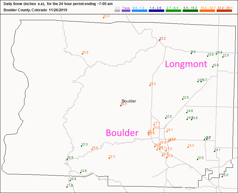
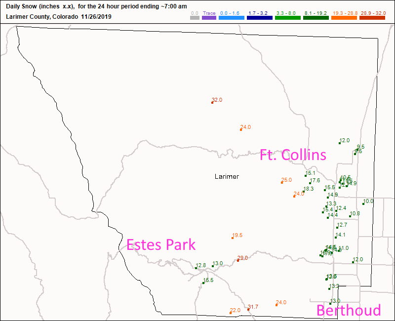
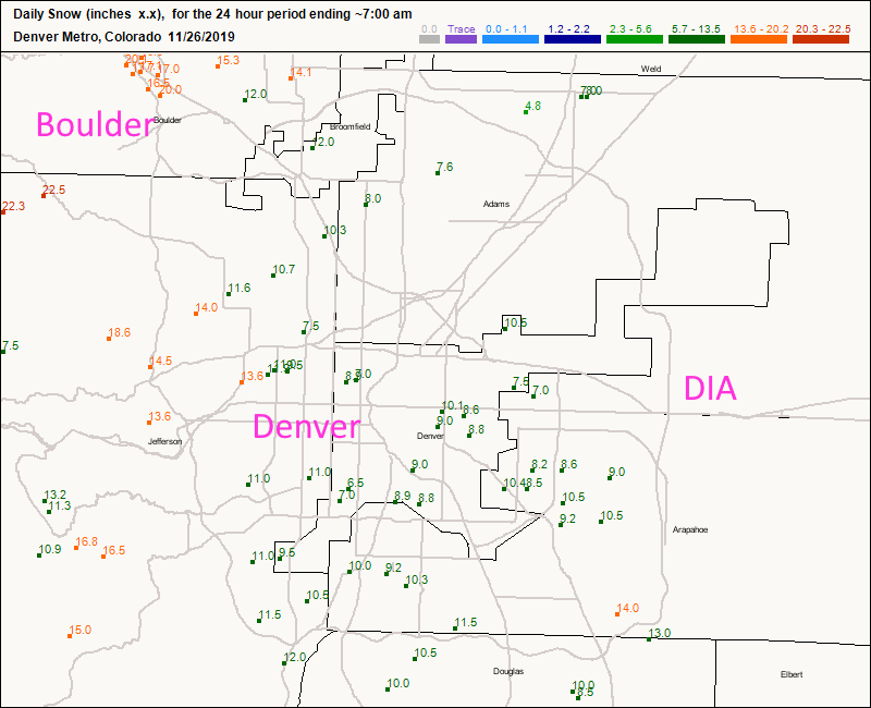
As of only 7am today, Longmont has seen 10-13 inches (my yard was at 12 inches this morning). Boulder has had 16-20 inches (Figure 2). Ft. Collins has seen 12-16 inches while Estes Park is at 13-16 inches (Figure 3). DIA was at around 9 inches while the mountains to the west of the city has almost reached 19 inches (Figure 4).
Snow tapers down around 2pm and skies clear. With light breezes, thick snow, and clear skies - we'll drop to near 0F tonight.
The Longer Range Forecast:
The western slopes pick up a good hit of snow Thursday into Friday. We might see 1-3 inches of new snow Friday afternoon and evening. We return to the 40'sF on Monday. All weather will be anticlimactic for a while after today!


.png;w=120;h=80;mode=crop)