This content was originally published by the Longmont Observer and is licensed under a Creative Commons license.
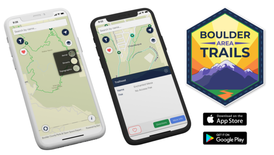
Local agencies have released a mobile application available for iOS and Android devices. The Boulder Area Trails app provides access to all trail information in and around Boulder County. The app is designed to enable users to find trails by use or type, plan routes by connecting local community trails, and link to the appropriate agency websites for more information.
The application was a collaboration of, and includes trails from, 12 agencies including Boulder County, City and County of Broomfield, City of Boulder, City of Longmont, City of Lafayette, City of Louisville, Rocky Mountain National Park, Town of Superior, Town of Erie, Town of Lyons, Town of Nederland, and the United States Forest Service.
The Boulder Area Trails app features include:
- One app for all area trails: Provides a single source for all designated public recreation trails and trailheads in and around Boulder and Broomfield counties. Includes 295 trailheads and 1,440 miles of trail.
- Real-time trail closures: Trail closures are posted as soon as they are announced by each participating agency.
- Offline maps: The app will continue to work even when there is no cellular service.
- Set favorites: Users can save favorite trails and trailheads for easy access.
The application was made possible by a grant through Colorado Parks and Wildlife and Great Outdoors Colorado.
For more information, please visit www.TrailsApp.org or contact Kristi VanDenBosch, Boulder County Parks & Open Space GIS Manager, at [email protected], or 303-678-6308.

.jpg;w=120;h=80;mode=crop)
