Skip to content

The Next Storm/Next Snow Forecast Discussion from the Cherrywood Observatory – September 29th, 2018

This content was originally published by the Longmont Observer and is licensed under a Creative Commons license.

Forecast Discussion:

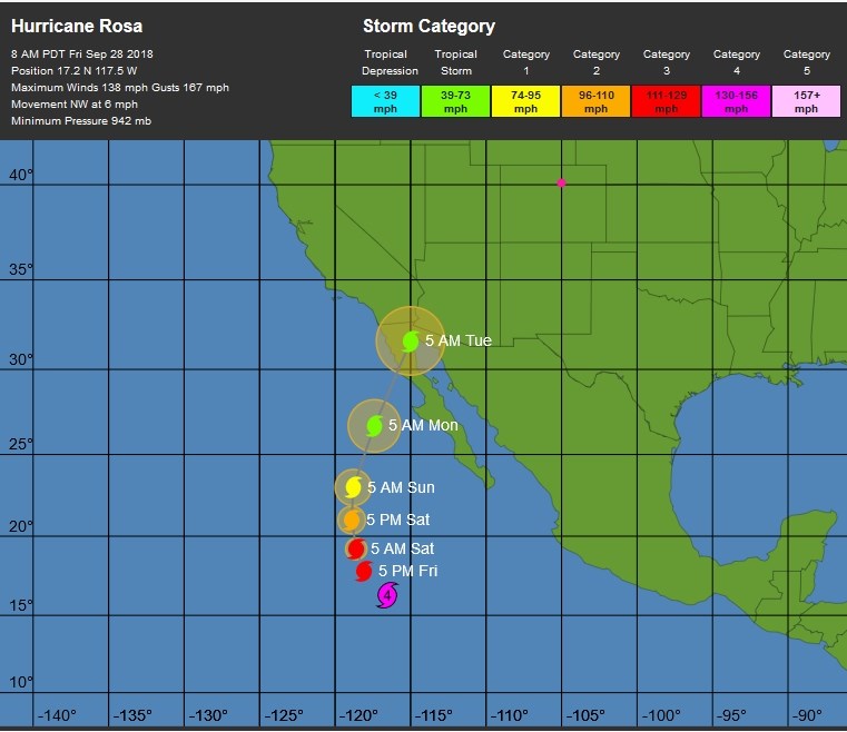
The front is in place Friday afternoon with temperatures still in the 40's F at noon (barely) - Figure 1. Hurricane Rosa is lurking to our distant southwest and is still expected to come our way. Overnight Friday, the front pushed east on southwest flow aloft and warm dry air poured back into the state (Figure 2).

We will be quite warm today again.

Figure 1: Infrared satellite image with surface front and pressure analysis for Friday noon from NOAA.

Figure 2: The forecast surface map for Saturday PM. From NCEP.

The longer range forecast:

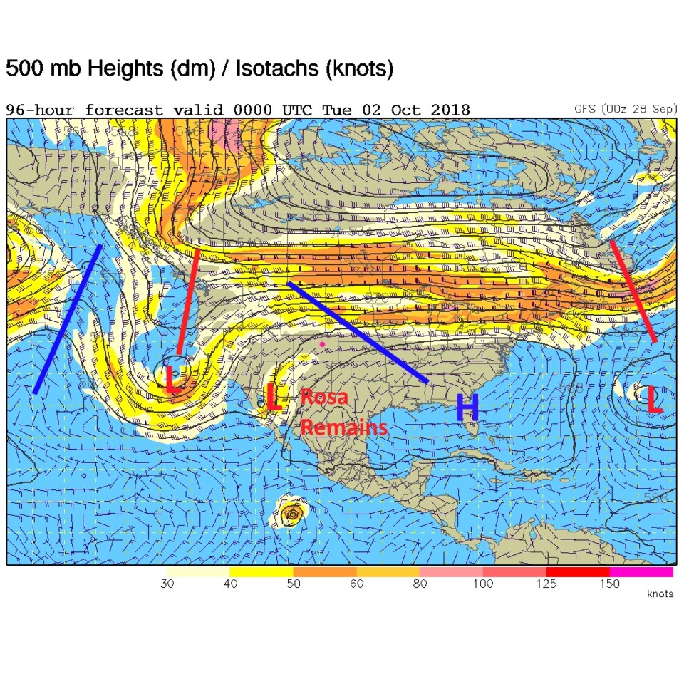
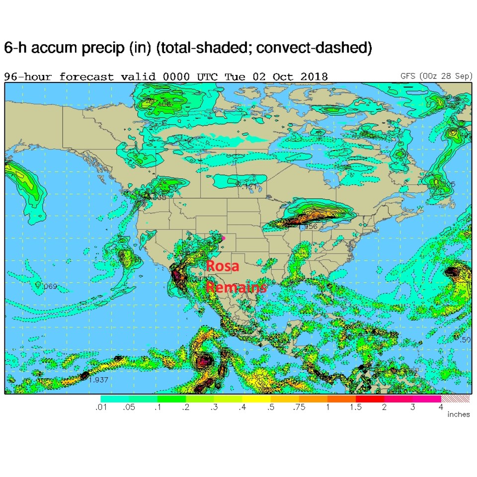
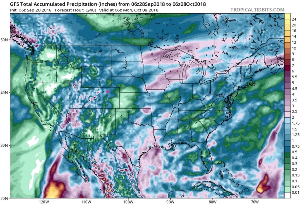
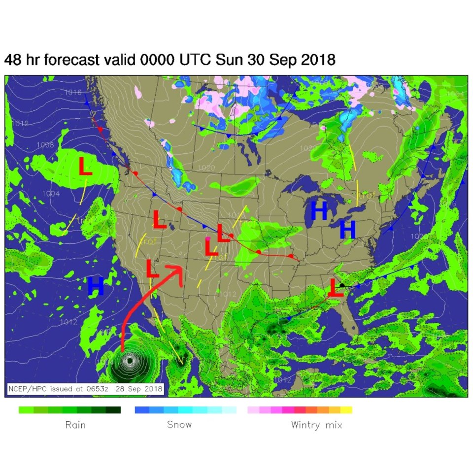
By Monday night (Figure 3) the trough in the west picks up the remains of Rosa and drives it into Arizona and eventually Utah and western Colorado. Figure 4 is the surface precipitation forecast for the same time from the GFS. There is a lot of water hitting the desert southwest (over 5 inches in places!).

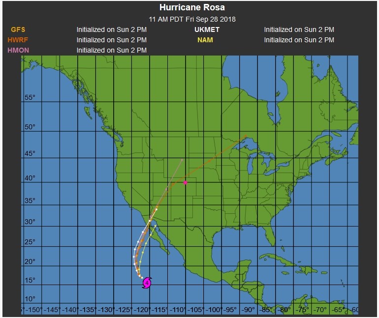
The National Hurricane Center's 5 day forecast brings Rosa up to near Yuma early Tuesday AM. Moisture will be pulled out ahead of the center of circulation (Figure 5). Figure 6 is the longer range track from various models - they are trending more to the northwest corner of our state than yesterday's runs. Still, Figure 6, the GFS, gives us a bit more water (this is through next Monday). The next 10 days, with Rosa and later storms, water seems to add up to almost an inch. Here's hoping!

Figure 3: The 500mb forecast upper air analysis for Monday PM. Pink dot is Longmont. Red lines are troughs, blue lines are ridges.

Figure 4: The 500mb forecast surface analysis for Monday PM. Pink dot is Longmont.

Figure 5: The 5 day forecast track and intensity map for Hurricane Rosa from the NHC and weatherunderground.com

Figure 6: The 5 day ensemble model comparison map for Hurricane Rosa from the NHC and weatherunderground.com

Figure 7: The total precipitation between Friday PM and early morning Monday 10/8 from the GFS and weather5280.com

Current Weather

Partly cloudy

Partly cloudy

45°F

UV Index
0 Low
Pressure
29.62 Steady
Visibility
8 miles
Dewpoint
23 °F
Humidity
41%
Wind
WSW 5.3 mph
Gust
13 mph
Wind Chill
42 °F

Hourly Forecast

Today
5 AM
43°F
Intermittent clouds
Today
6 AM
42°F
Mostly cloudy
Today
7 AM
43°F
Cloudy
Today
8 AM
47°F
Partly sunny w/ showers
Today
9 AM
51°F
Partly sunny
Today
10 AM
54°F
Intermittent clouds
Today
11 AM
56°F
Intermittent clouds
Today
12 PM
58°F
Mostly cloudy
Today
1 PM
59°F
Showers
Today
2 PM
61°F
Intermittent clouds
Today
3 PM
60°F
Intermittent clouds
Today
4 PM
59°F
Intermittent clouds

7 Day Forecast

Partly sunny w/ showers

Tuesday

61 °F

Very windy; a couple of showers this morning; otherwise, times of clouds and sun


Partly cloudy

Tuesday Night

34 °F

Partly cloudy


Intermittent clouds

Wednesday

57 °F

Cool with times of clouds and sun


Mostly cloudy

Wednesday Night

39 °F

Increasing clouds


Partly sunny w/ showers

Thursday

56 °F

Times of clouds and sun with a couple of showers; cool


Cloudy

Thursday Night

40 °F

Cloudy


Mostly cloudy

Friday

66 °F

Mostly cloudy and warmer


Mostly clear

Friday Night

40 °F

Mainly clear


Intermittent clouds

Saturday

74 °F

Pleasant and warmer with periods of clouds and sun


Mostly clear

Saturday Night

43 °F

Mainly clear


Sunrise and Sunset

Sunrise
5:52 AM
Sunset
8:02 PM

Based on AccuWeather data