Skip to content

The Next Storm/Next Snow Forecast Discussion from the Cherrywood Observatory – September 20th, 2018

This content was originally published by the Longmont Observer and is licensed under a Creative Commons license.

Forecast Discussion:

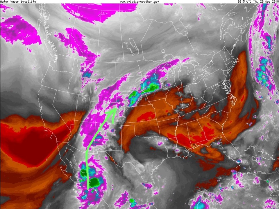
The moisture is here (Figure 1)! For Loveland, Ft. Collins, and Denver - it came in with a bang (thunderstorms). Longmont saw light showers.

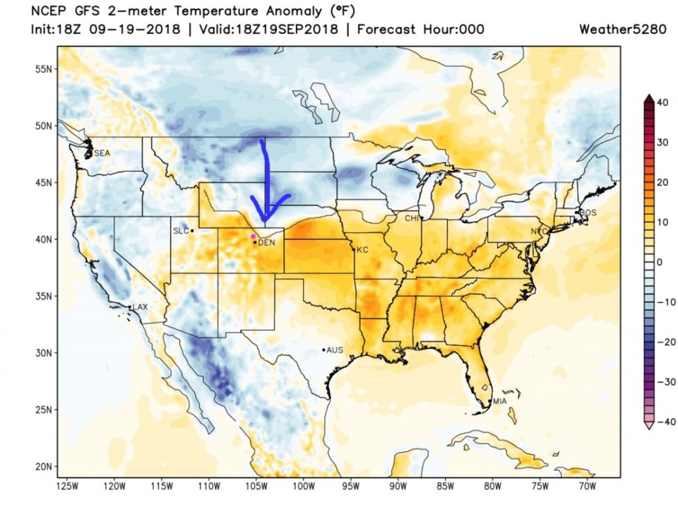
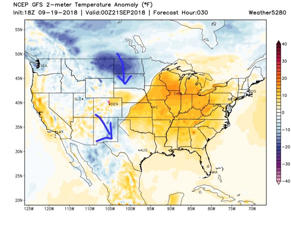
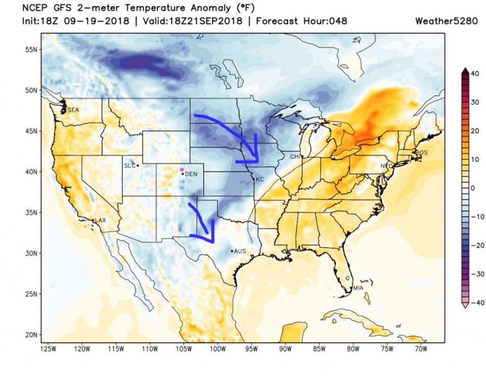
We can track the waves of arriving cold air by looking at my outline of the advancing cold air (thin black lines between blue and orange regions) in Figures 2 to 4. At noon on Wednesday, the cold air was just nosing down towards Ft. Morgan (Figure 2). By tonight the first blob of cool is sinking into Mexico while the next hit is on its way for Friday (Figure 3). For noon on Friday the next wave of colder air is past and things are pretty windy (Figure 4).

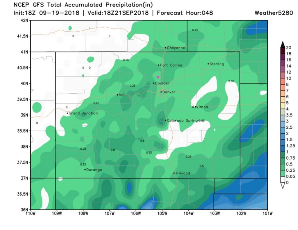
The total rainfall through Friday noon still is only a few hundredths of an inch of rain to maybe a one or two tenths (Figure 5).

Figure 1: the water vapor satellite image from Wednesday afternoon. Reds/Oranges are dry air, greys/whites are moist air regions.

Figure 2: The surface temperature anomaly (departure from normal) for Wednesday noon (yesterday).

Figure 3: The surface temperature anomaly (departure from normal) for Thursday PM.

Figure 4: The surface temperature anomaly (departure from normal) for Friday noon.

Figure 5: The total precipitation between Wednesday PM and Friday midday from the GFS and weather5280.com

The longer range forecast:

That cool air slides out for the weekend and we briefly return to upper 80's F for your time by the pool. Next week we drop to 70's F and eventually 60's F later in the week. There are some rain chances next week. We should see lows drop to the upper 30's F later in the week. More on that later!

Current Weather

Cloudy

Cloudy

34°F

UV Index
0 Low
Pressure
30.25 Steady
Visibility
5 miles
Dewpoint
32 °F
Humidity
90%
Wind
ENE 0.5 mph
Gust
2.3 mph
Wind Chill
34 °F

Hourly Forecast

Today
2 AM
34°F
Showers
Today
3 AM
34°F
Cloudy
Today
4 AM
34°F
Mostly cloudy
Today
5 AM
34°F
Mostly cloudy
Today
6 AM
34°F
Cloudy
Today
7 AM
35°F
Cloudy
Today
8 AM
36°F
Intermittent clouds
Today
9 AM
37°F
Intermittent clouds
Today
10 AM
40°F
Intermittent clouds
Today
11 AM
43°F
Intermittent clouds
Today
12 PM
46°F
Intermittent clouds
Today
1 PM
46°F
Intermittent clouds

7 Day Forecast

Rain and snow

Thursday

37 °F

Cloudy and much colder; snow showers this morning, accumulating a coating to an inch followed by brief showers this afternoon


Showers

Thursday Night

34 °F

Mostly cloudy with a couple of brief showers beginning late evening


Mostly cloudy w/ showers

Friday

47 °F

Chilly with some sun, then turning cloudy; a little rain in the afternoon


Rain and snow

Friday Night

33 °F

Periods of snow; rain mixed in early, accumulating an inch or two


Flurries

Saturday

43 °F

A bit of morning snow with little or no accumulation; otherwise, cloudy and chilly; storm total snowfall an inch or two


Intermittent clouds

Saturday Night

31 °F

Partly cloudy


Partly sunny

Sunday

69 °F

Pleasant and warmer with partial sunshine


Partly cloudy

Sunday Night

44 °F

Partly cloudy


Intermittent clouds

Monday

79 °F

Very warm with a blend of sun and clouds


Intermittent clouds

Monday Night

36 °F

Increasing clouds


Sunrise and Sunset

Sunrise
6:17 AM
Sunset
7:43 PM

Based on AccuWeather data