Skip to content

The Next Storm/Next Snow Forecast Discussion from the Cherrywood Observatory – October 22nd, 2018

This content was originally published by the Longmont Observer and is licensed under a Creative Commons license.

Forecast Discussion:

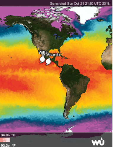
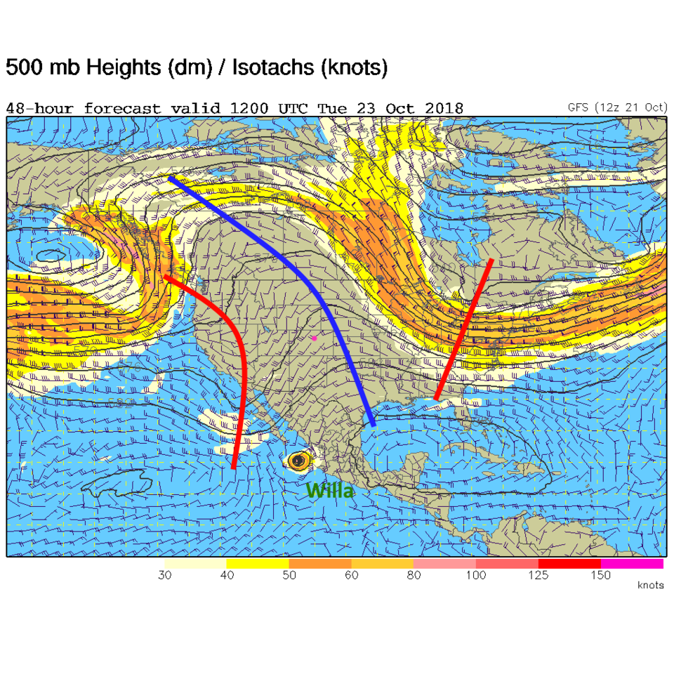
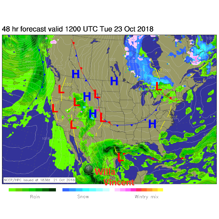
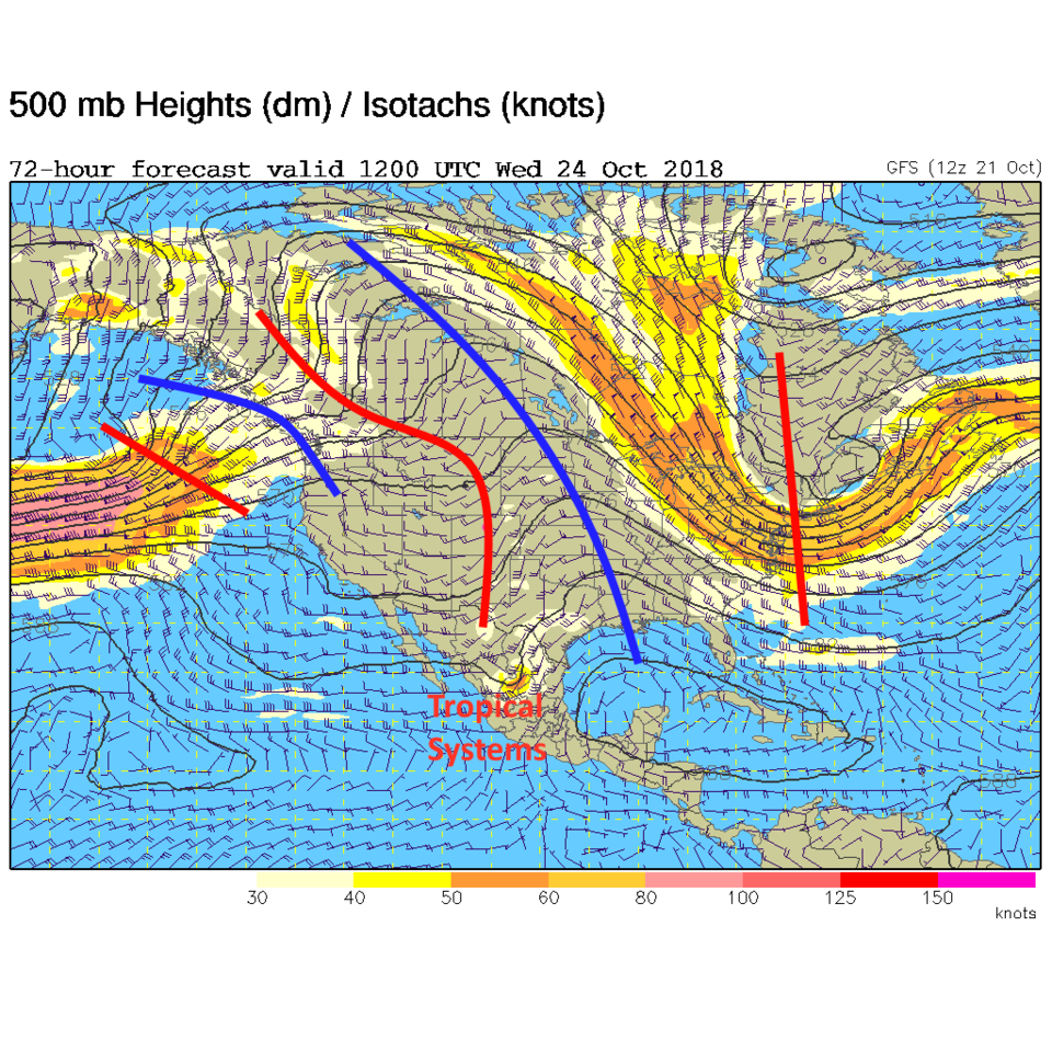
With an extreme-gorgeous-weather-warning being issued (not a real thing), one always must look ahead at the flies that may come. There are two tropical systems off the Mexican coast (Willa and Vicente (not Vincent as I typed in the graphic below)) that will feed moisture into the trough that is approaching (Figure 1). Tuesday AM we are still under the ridge with the tropical systems and trough just starting to interact (Figure 2). The surface map at this time shows Willa and Vicente down south and some moisture making it up to the four corners and western slopes (Figure 3).

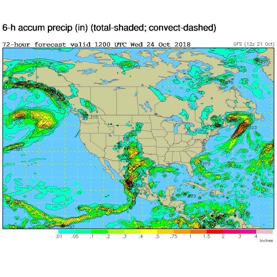
For Wednesday, the trough is here and the weakness in the upper-air pattern is in central Mexico (Figure 4). This same model shows heavy rains in Mexico, Texas (they don't need it), and New Mexico. We have some moisture making it up a bit into Wyoming; east of the Rockies (Figure 5).

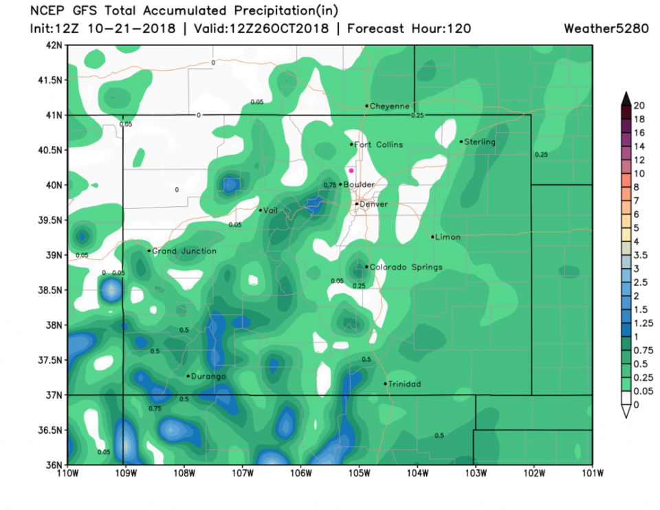
The total rainfall for Longmont is still really small. The GFS (Figure 6) gives us nearly nothing. The weatherunderground model shows 0.01 inch. Snow levels will remain up in the mid to higher mountains.

Figure 1: The tropical overview map for the Western hemisphere from weatherunderground.com

Figure 3: The 500mb forecast upper air analysis for Tuesday AM. Pink dot is Longmont. Red lines are troughs, blue lines are ridges.

Figure 3: The forecast surface map for Tuesday AM. From NCEP.

Figure 4: The 500mb forecast upper air analysis for Wednesday AM. Pink dot is Longmont. Red lines are troughs, blue lines are ridges.

Figure 5: The surface forecast map for Wednesday AM. Pink dot is Longmont. Red lines are troughs, blue lines are ridges.

Figure 6: The forecast accumulated precipitation map from the GFS and weather5280.com for the next 5 days (through Friday morning).

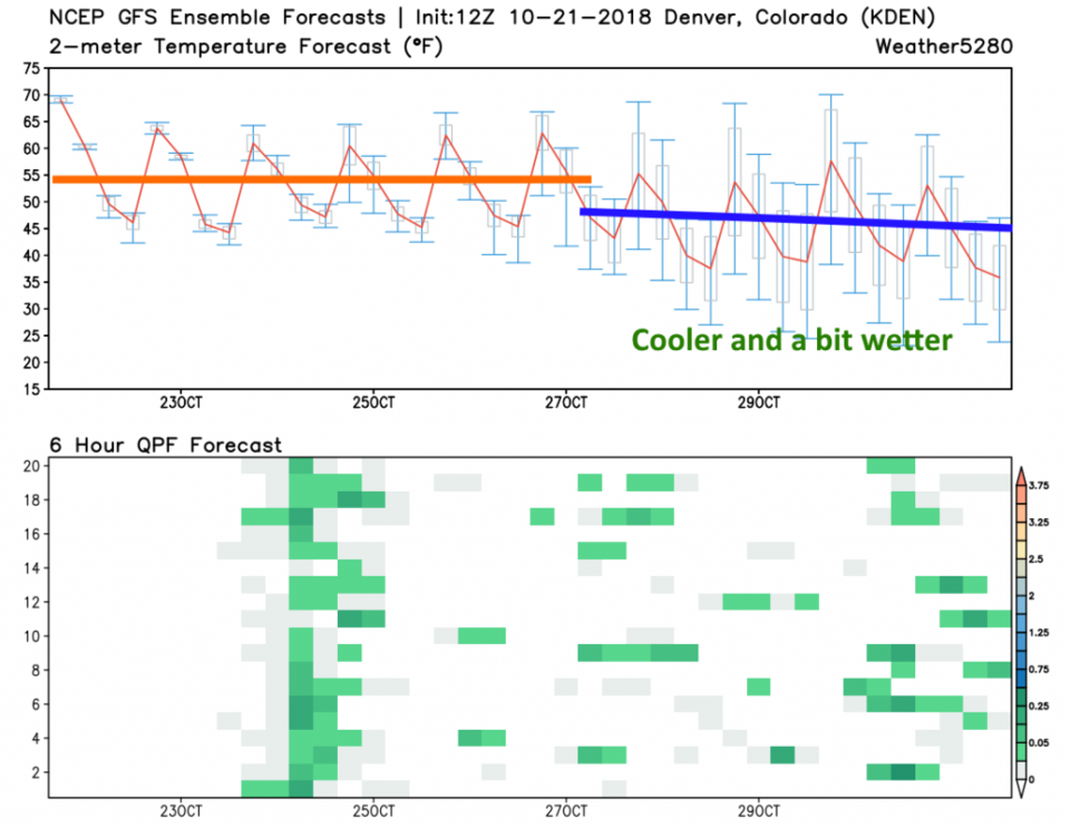
The longer range forecast:

Temperatures don't change much through Saturday next weekend, then the upper-air pattern sinks southward and we get more troughy, cooler and a touch wetter. Nothing notable, but it is a change from the near perfection of this weekend.

Figure7: 10 day meteogram from weather5280.com for DIA.

Current Weather

Cloudy

Cloudy

65°F

UV Index
1 Low
Pressure
29.6 Steady
Visibility
8 miles
Dewpoint
36 °F
Humidity
33%
Wind
NE 5.7 mph
Gust
11.6 mph
Wind Chill
65 °F

Hourly Forecast

Today
4 PM
67°F
Cloudy
Today
5 PM
65°F
Mostly cloudy
Today
6 PM
61°F
Thunderstorms
Today
7 PM
58°F
Thunderstorms
Today
8 PM
55°F
Cloudy
Today
9 PM
52°F
Cloudy
Today
10 PM
50°F
Thunderstorms
Today
11 PM
48°F
Thunderstorms
Tomorrow
12 AM
46°F
Cloudy
Tomorrow
1 AM
46°F
Cloudy
Tomorrow
2 AM
45°F
Cloudy
Tomorrow
3 AM
44°F
Rain

7 Day Forecast

Mostly cloudy w/ t-storms

Friday

69 °F

Variable cloudiness with a couple of thundershowers this afternoon; gusty winds and small hail can accompany any downpour


Thunderstorms

Friday Night

41 °F

Cloudy; a couple of showers and a thunderstorm this evening followed by periods of rain late; gusty winds and small hail can accompany any downpour


Rain

Saturday

44 °F

Chilly with periods of rain and a thunderstorm; travel in the foothills and mountains will be slippery due to snow


Rain and snow

Saturday Night

36 °F

Cloudy with rain, mixed with a little snow late; travel in the foothills and mountains will be slippery due to snow


Mostly cloudy

Sunday

61 °F

Mostly cloudy and warmer


Intermittent clouds

Sunday Night

36 °F

A thunderstorm in spots in the evening; otherwise, partly cloudy


Partly sunny

Monday

71 °F

Partly sunny, pleasant and warmer


Partly cloudy

Monday Night

45 °F

Partly cloudy


Mostly sunny

Tuesday

73 °F

Pleasant with sunshine and patchy clouds


Partly cloudy

Tuesday Night

40 °F

Partly cloudy


Sunrise and Sunset

Sunrise
6:06 AM
Sunset
7:51 PM

Based on AccuWeather data