Skip to content

The Next Storm/Next Snow Forecast Discussion from the Cherrywood Observatory – October 20th, 2018

This content was originally published by the Longmont Observer and is licensed under a Creative Commons license.

The Forecast Discussion:

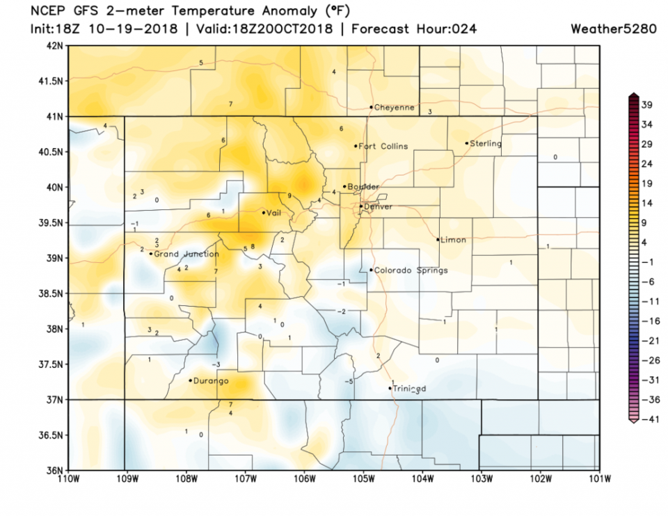
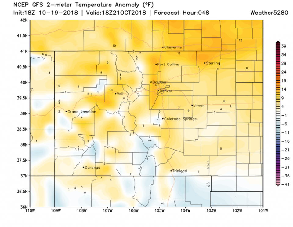
There really isn't much to report - this is a VERY NICE stretch of weather. The temperature departures from normal (Figure 1) today are just a little above or a little below normal depending on where you are. For Sunday, things are a touch warmer, but not extreme (Figure 2) - maybe about 72°F. We have a ridge over the west, so it is dry.

More below in the extended forecast...

Note: I'll be on a big family vacation at the end of the month. There will be no updates to this column for the period October 26-Nov 4. I'll probably create a page of links to my favorite forecast pages in my absence.

Figure 1: forecast surface temperature anomaly for Colorado (departure from normal) for Saturday noon from weather5280.com

Figure 2: forecast surface temperature anomaly for Colorado (departure from normal) for Sunday noon from weather5280.com

The longer range forecast:

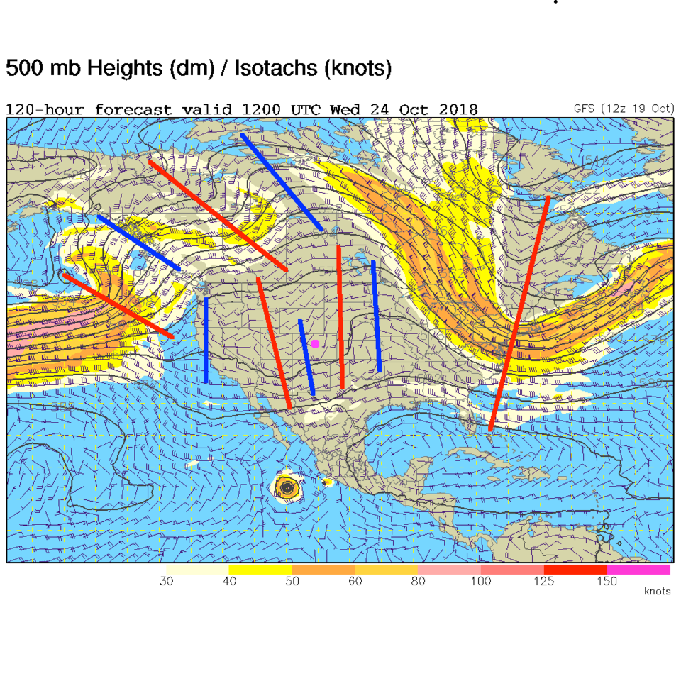
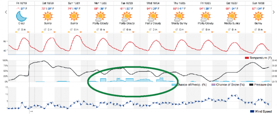
We do get a complex split flow with a couple short wave troughs traveling under the big ridge by mid-week next week (Figure 3). There isn't much moisture around, or instability expected with this set-up, so rain chances (Figure 4- green circle) remain low. We just cool to below normal as the short waves travel through (normal is about 65°F this week).

Enjoy the extreme niceness.

Figure 3: The 500mb forecast upper air analysis for Wednesday AM. Pink dot is Longmont. Red lines are troughs, blue lines are ridges.

Figure 4: the next 10 days of the graphical forecast for Longmont, CO from weatherunderground.com

Current Weather

Mostly cloudy

Mostly cloudy

46°F

UV Index
0 Low
Pressure
29.58 Steady
Visibility
8 miles
Dewpoint
42 °F
Humidity
87%
Wind
W 2.2 mph
Gust
5.8 mph
Wind Chill
46 °F

Hourly Forecast

Today
8 AM
50°F
Cloudy
Today
9 AM
54°F
Cloudy
Today
10 AM
58°F
Cloudy
Today
11 AM
63°F
Cloudy
Today
12 PM
68°F
Cloudy
Today
1 PM
67°F
Mostly cloudy
Today
2 PM
70°F
Mostly cloudy
Today
3 PM
68°F
Mostly cloudy
Today
4 PM
67°F
Mostly cloudy
Today
5 PM
65°F
Cloudy
Today
6 PM
58°F
Thunderstorms
Today
7 PM
56°F
Thunderstorms

7 Day Forecast

Thunderstorms

Friday

70 °F

Mostly cloudy with a couple of thundershowers this afternoon; gusty winds and small hail can accompany any downpour


Thunderstorms

Friday Night

45 °F

Cloudy; a couple of showers and a thunderstorm this evening followed by periods of rain late; gusty winds and small hail can accompany any downpour


Rain

Saturday

48 °F

Chilly with periods of rain and a thunderstorm; travel in the foothills and mountains will be slippery due to snow


Rain and snow

Saturday Night

39 °F

Cloudy with rain, mixed with a little snow late; travel in the foothills and mountains will be slippery due to snow


Mostly cloudy

Sunday

59 °F

Mostly cloudy and warmer


Partly cloudy

Sunday Night

36 °F

Partly cloudy


Partly sunny

Monday

71 °F

Partly sunny, pleasant and warmer


Partly cloudy

Monday Night

45 °F

Partly cloudy


Mostly sunny

Tuesday

73 °F

Mostly sunny, breezy and pleasant


Partly cloudy

Tuesday Night

43 °F

Partly cloudy


Sunrise and Sunset

Sunrise
6:06 AM
Sunset
7:51 PM

Based on AccuWeather data