This content was originally published by the Longmont Observer and is licensed under a Creative Commons license.
Forecast Discussion:
Snow has fallen most of the day Wednesday with some accumulation on cold surfaces before sunrise and again in the afternoon when snow rates increased. We had enough moisture to create puddles! (Take that GFS, you were wrong.)
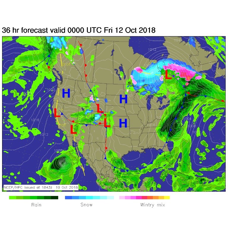
The surface map shows one front passing back to the east while a cool air mass is still pushed down to the south. When there is a front over the state, we can see up-slope flow and showers from passing upper level short waves. Rain chances don't vanish today even though things warm up and dry out a bit (Figure 1).
We approach 60°F tomorrow/Friday, then the next system sets up...
The longer range forecast:
Our next cold front enters the state Saturday afternoon after about 3 p.m. Before that, we'll have a high up at about 60°F again. Temperatures keep dropping through the night to drop below freezing before midnight. Temperatures won't go above freezing again until about 11 a.m. Monday. With that front, very cold air (a high of 30°F on Sunday!!), we are expecting more snow.
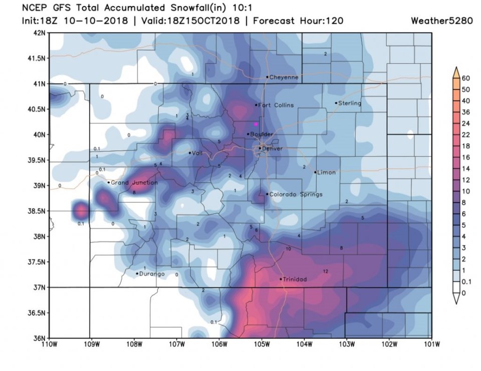
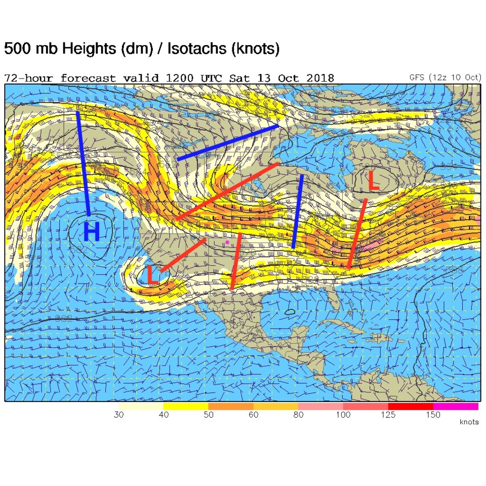
The GFS (Figure 3) gives us about 4-5 inches.
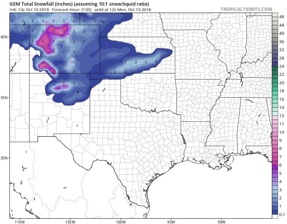
The GEM (Figure 4) gives us 4-5 inches.
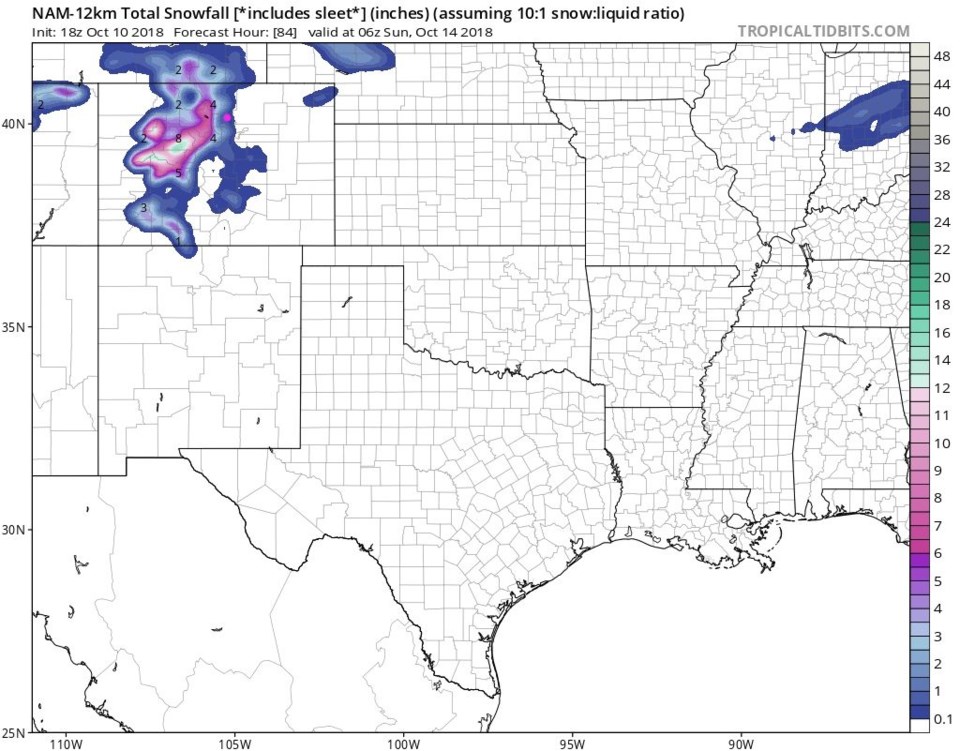
The NAM (Figure 5) gives us 1-3 inches (up through midnight Sat-Sun, so not the whole storm).
The weatherunderground model gives us 2-6 inches. It seems like a consensus!
Prepare for a Saturday p.m. to Sunday snow.