This content was originally published by the Longmont Observer and is licensed under a Creative Commons license.
Forecast Discussion:
Update 2PM:
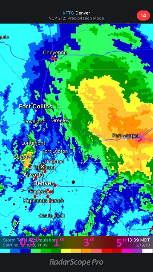
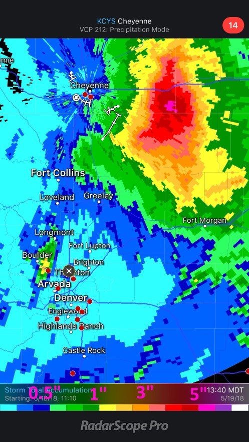
While Longmont hasn't received epic amounts of water (as of 2PM I've had just over 1/2 inch of rain in my backyard), but there was a bullseye of precipitation (or a few) similar to the model runs. Radar does its best to estimate how much rainfall has hit a location during a storm. Colors in Figure 1 and 2 are approximate rainfall amounts. Some rainfall initiates lower in the clouds so a radar, which must point up a few degrees and has the world curve down away from the beam, misses more distant precipitation. Figure 1 is NE Colorado from the point of view of DIA's radar. Figure 2 is the view that the Cheyenne, WY radar had.
Figure 1 shows the 2+ inches of rainfall around Boulder almost to just south Longmont. There is also a wide range of 2 to even 5 inches of rainfall around Fort Morgan. Cheyenne's view in Figure 2 has that region extending up into Wyoming and Nebraska with a maximum of 8" of rainfall between Pine Bluffs and Grover.
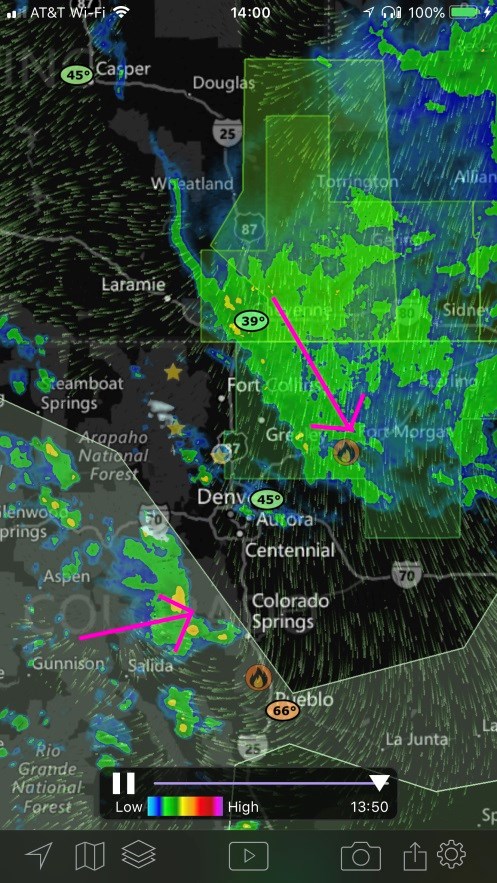
A short wave is entering the state from the west kicking off weak thunderstorms in the mountains that are heading towards the east along a line from Steamboat Springs down to Colorado Springs (pink arrow in Figure 3). Meanwhile the circulation around the low is keeping rainfall falling from Cheyenne to Fort Morgan at 2pm.
End Update 2PM.
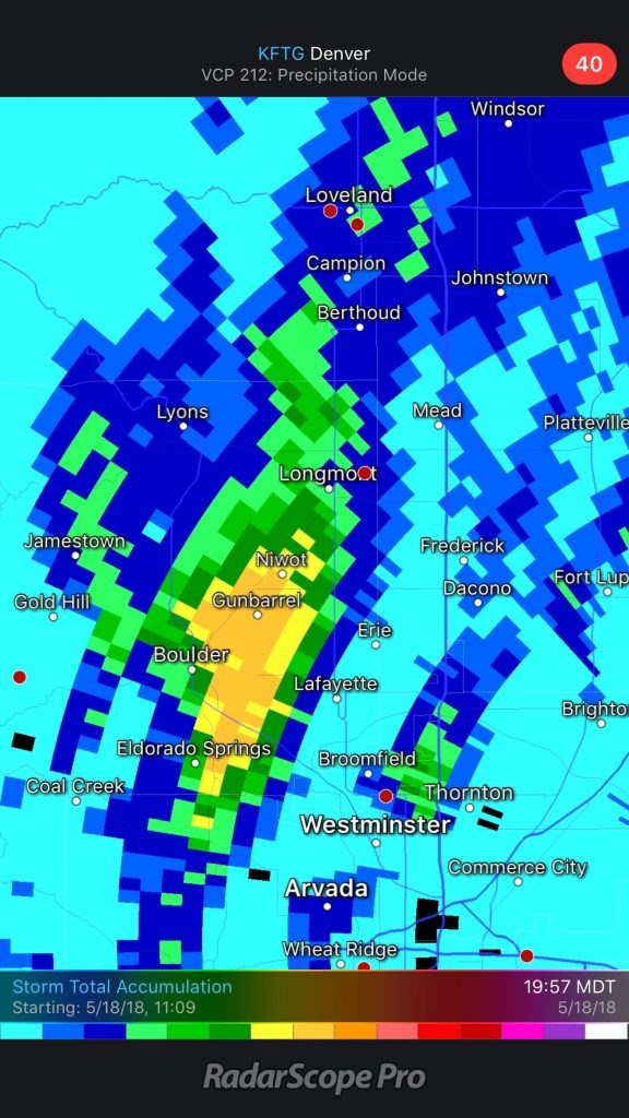
We're in the midst of the storm with the first round under our belt. I'll probably update this post Saturday afternoon to cover overnight rainfall and a look at what will happen as this system continues to evolve. Figure 1 shows the first local rainfall amounts from radar estimation. A swath from Eldorado Springs to Boulder and Niwot and almost to Longmont received up to 2 inches of water. Longmont seems to have received an inch on the SW side of town and 1/2 inch of water on the NE side of town.
The severe weather threat is gone today with the cool air from the cold front pushing down over the state overnight (Figure 2).
The models HAVE calmed down on the extreme high end precipitation amounts (and are more believable). I thought most would see around 2 inches with some spots seeing a lot more. It may end up being a bit under even that conservative take.
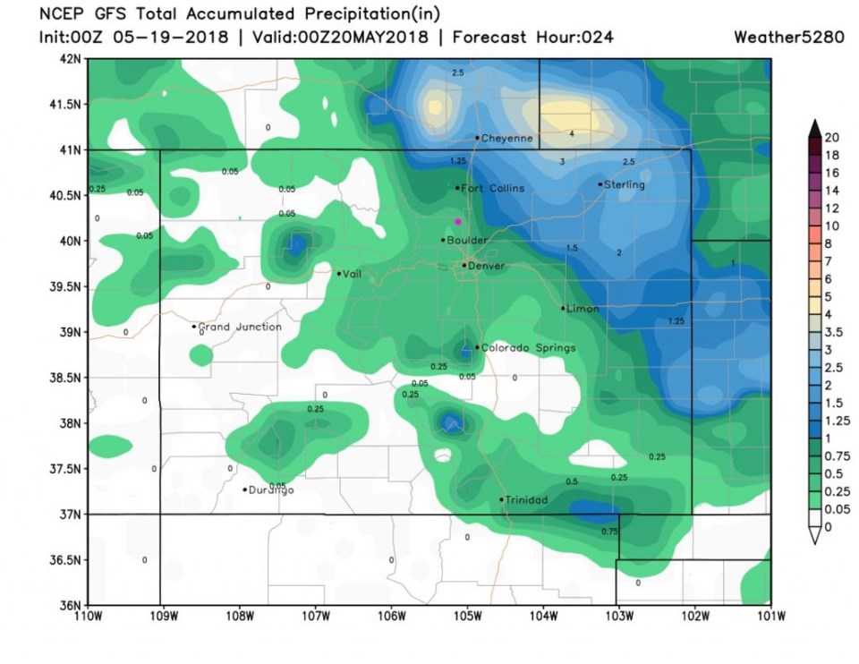
Figure 3 is the GFS through Saturday PM (as far as the run was complete when I wrote this). Longmont gets another 1/2 inch or so.
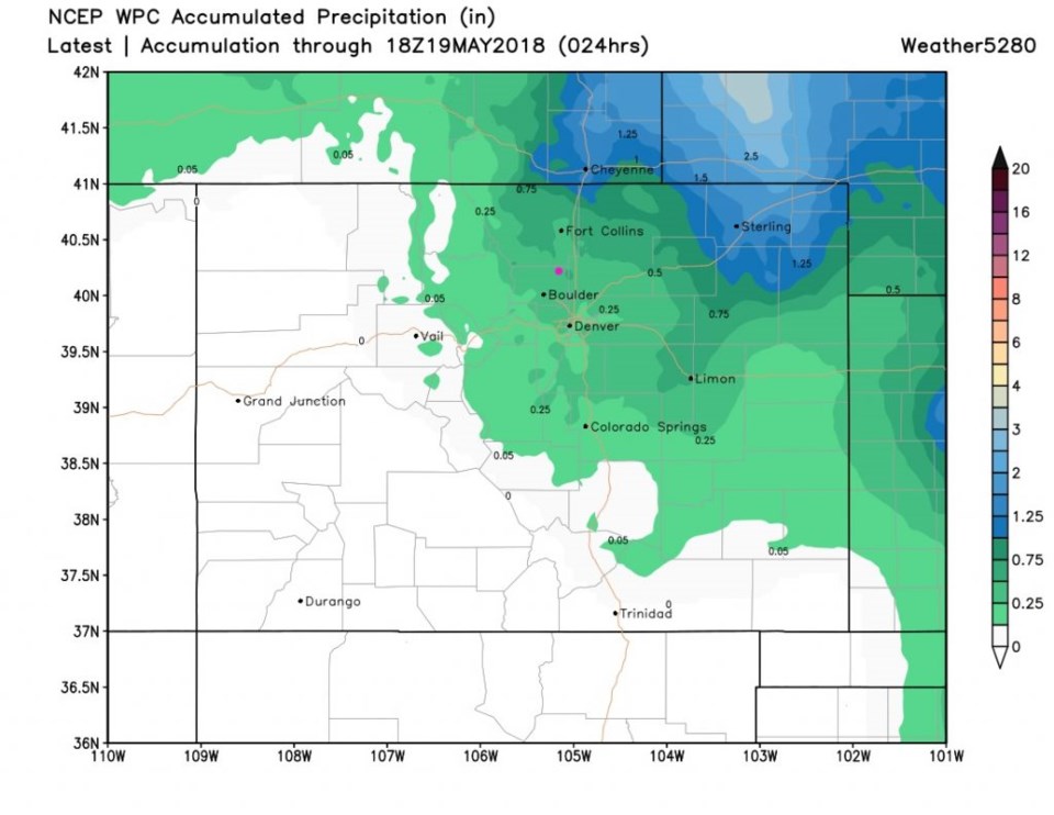
The WPC (Figure 4) up through noon today gives us about 1/3rd inch more rain.
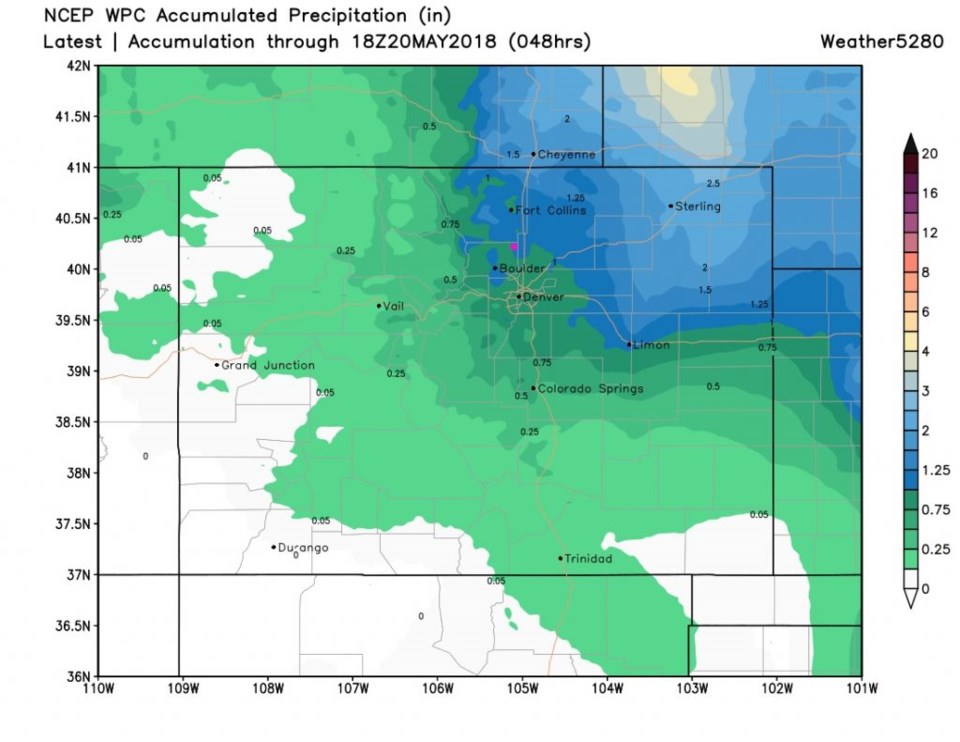
When we look at the WPC out further (Figure 5) to noon Sunday, we are up at an inch of additional rainfall.
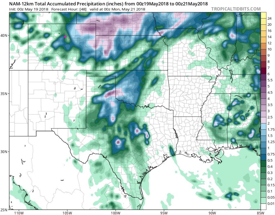
Finally, Figure 6 is the NAM which gives us another 1/2 to 3/4ths inch by Sunday PM.
It's a bit anticlimactic, but more believable.

The longer range forecast:
Rain chances are still about 50/50 for Sunday afternoon and night and there are chances of afternoon thunderstorms almost every day of the week. More later!


