This content was originally published by the Longmont Observer and is licensed under a Creative Commons license.
Forecast Discussion:
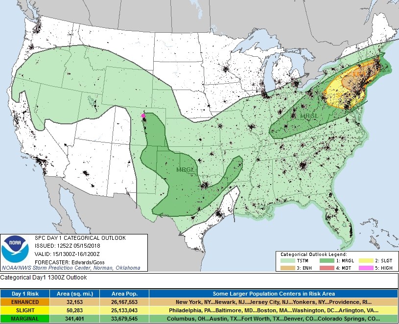
Update Tuesday 11:30am: The Storm Prediction Center in Norman, OK looked at the clearing and warming of the atmosphere, the available moisture, and the wind field over the Front Range today and expanded the Marginal Risk of severe weather up into Colorado. This region extends northward to almost Windsor, down to eastern Longmont, areas east of Boulder and down into Denver and out onto the eastern Plains. The primary threat will be large hail and damaging winds as storms move to the east southeast or to the southeast off the Foothills after around 2pm today.
End update 11:30am.
We had a break in the fog/drizzle and afternoon thunderstorms in Longmont, but other places north and south of us got hit today with both. The big storms Sunday PM gave many locations a lot of water. Since Thursday, my back yard rain gauge has received over 1 2/3rds inch of water.
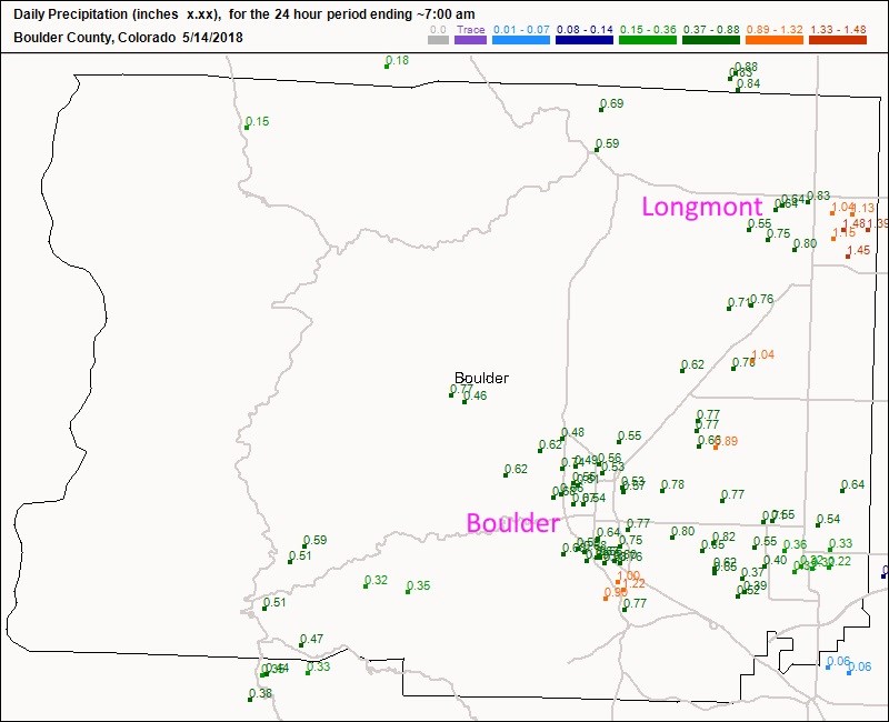
Figure 1 is the last 24 hours (up to 7am) precipitation reports for Boulder County. Longmont saw 1/2-3/4th inch west of Main St. and an inch to almost 1 1/2 inches east of the Downtown. Boulder saw 1/2 to almost 1 1/4th inch of rain.
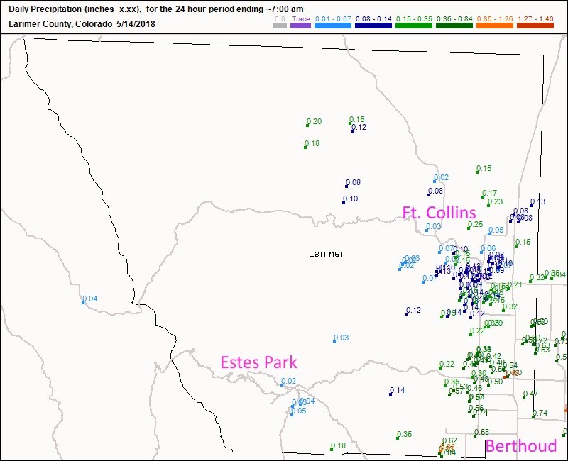
Figure 2 is Larimer County - Ft. Collins saw just a light sprinkle in places while other places got 1/3rd of an inch. Berthoud saw 1/4th to 1 inch of rain. Estes Park really missed out with just another light shower.
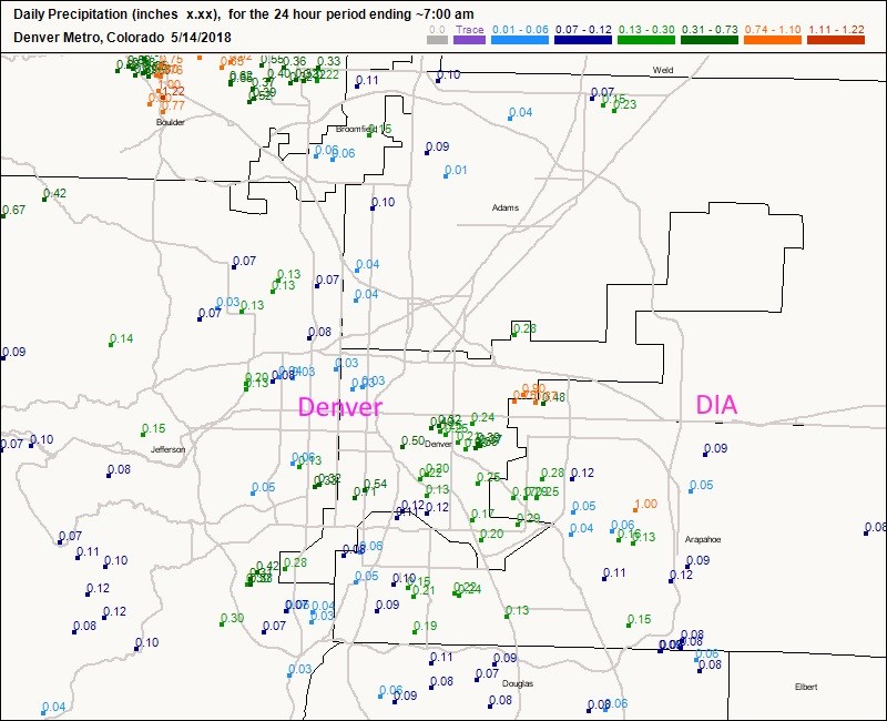
Figure 3 shows that in Denver, numbers were all over the place from a wide spread light rain to a few small locations over an inch. That changed on Monday as Denver won the thunderstorm lottery (with hail in places too).
Figure 4 is the thunderstorm and severe weather chances from the SPC for today. They have us pegged for just a general chance of thunderstorms. Severe (Marginal risk) weather is limited to New Mexico and places off to the southeast.
We dry out for Wednesday and Thursday and climb to around 80F for highs. The severe weather chances are out on our eastern Plains with the dry line location. We are the dry side of the dry line - again.
The longer range forecast:
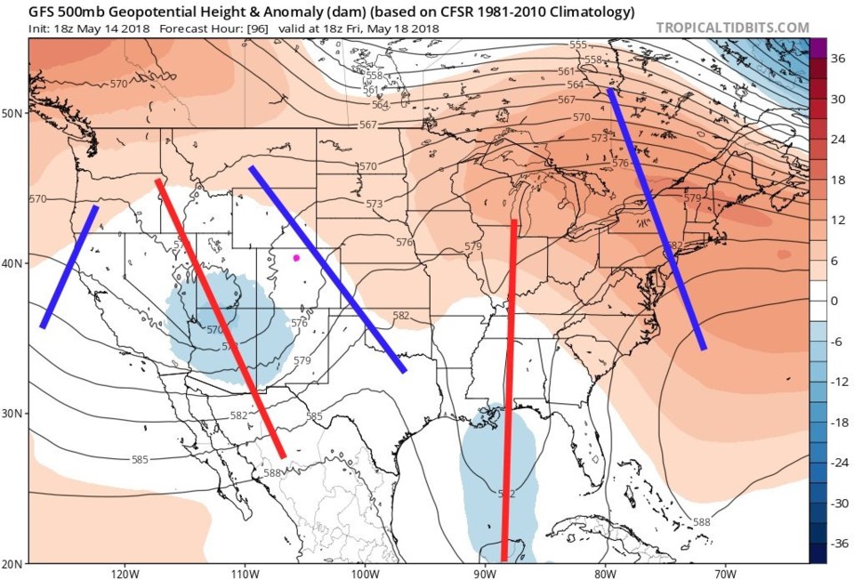
After warm and dry (lawn and garden growing) weather Wednesday and Thursday, we do have a trough / cutoff low roll in again from the Pacific. This negatively tilted trough (red line) will have some strong lift ahead of it. Expect severe thunderstorms for Friday afternoon and evening (Figure 6).
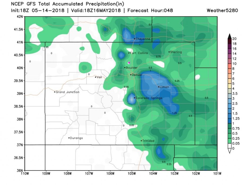
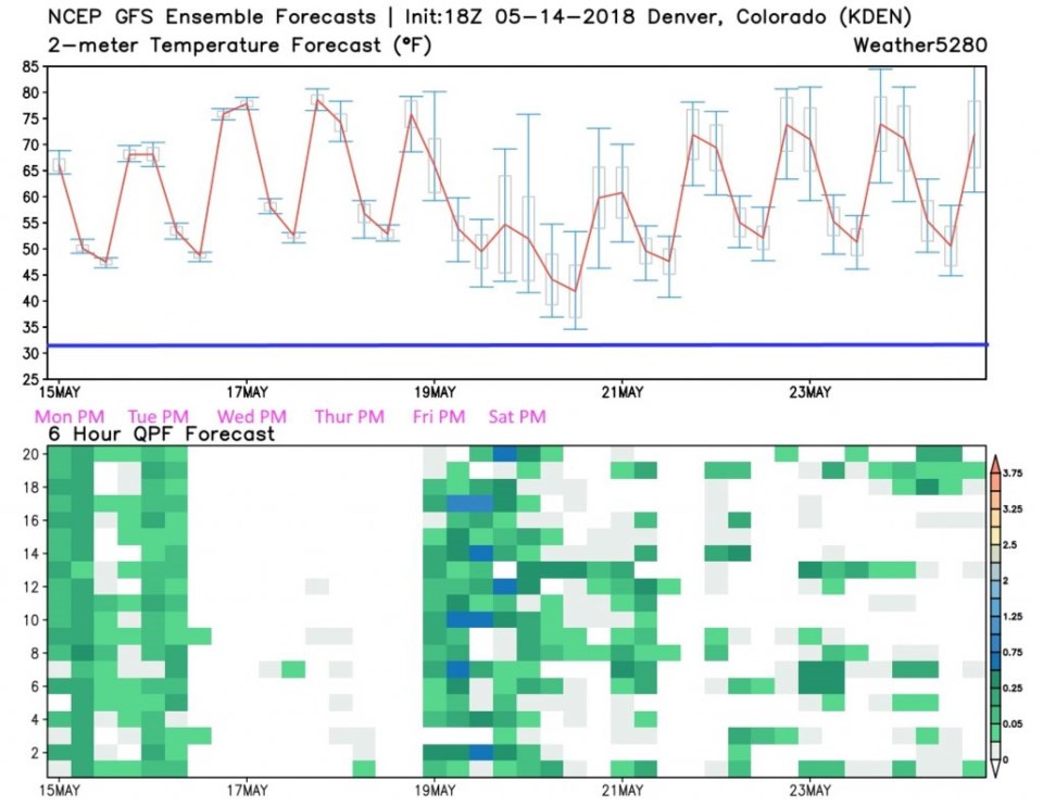
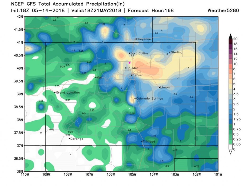
Where we have only a few tenth's of an inch of rain expected today (Tuesday - Figure 7) the next system this weekend looks well represented in the ensemble models (Figure 8) on Friday and Saturday. You can see temperatures are not threatening the freezing line (added) even at the end of the weekend. You need to mentally subtract the few tenths of an inch we may see before our dry period this week when looking at Figure 9 - the GFS puts a colossal 4-7 inches of RAIN around our neck of the woods by the end of next weekend. We'll see...that seems really over the top.
It has been a while since we looked at the ENSO forecast and what it might mean to Colorado precipitation amounts. It had us near normal north of Ft. Collins and quite below normal in the southern parts of the state for this season. We are seeing that dryness down south, but northeast Colorado is getting much wetter than normal. Great news for crops and fire concerns. Let's get some water in the mountains and down south next.