This content was originally published by the Longmont Observer and is licensed under a Creative Commons license.
Forecast Discussion:
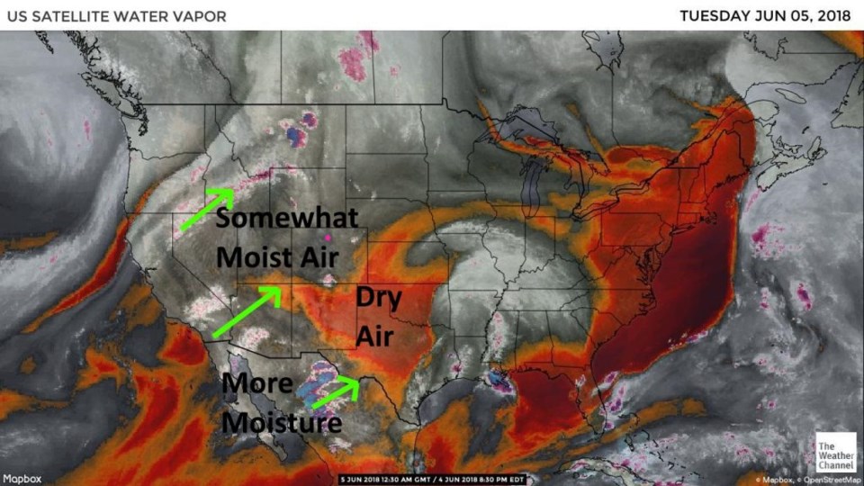
The heat goes on. Figure 1 shows the available moisture, and things were mostly dry on Monday. As the day wore on, more moisture filtered in (and a few thunderstorms formed in south Denver and down around Colorado City). We'll see just a bit more moisture flow in from the southwest (light green lines) for the middle of the week that will increase thunderstorm chances (by a bit) in the late afternoons.
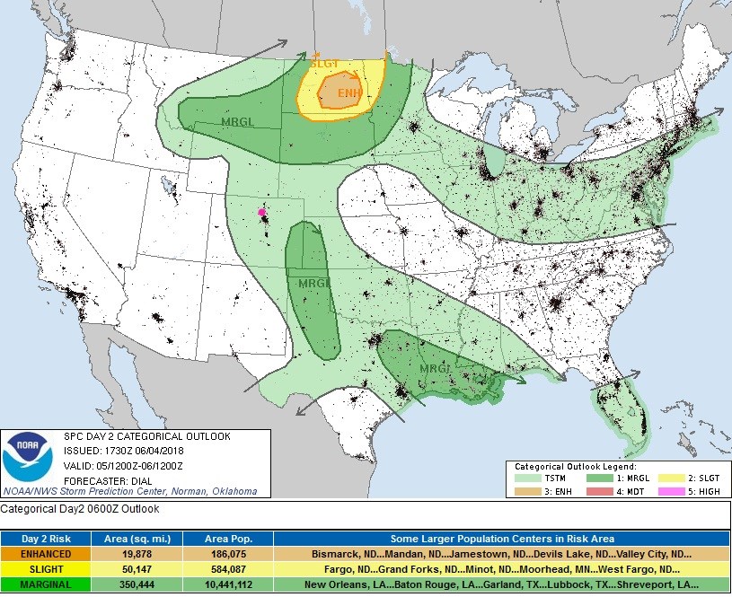
Figure 2 shows the big strong ridge sitting almost overhead today (the blue line). The red line out west is supplying the flow that is bringing a bit of tropical moisture. Accordingly, Figure 3 has a chance of normal thunderstorms over most of Colorado late today and a chance of severe weather (a marginal risk, 1 on a scale of 1-5) way down in southeast Colorado.

The longer range forecast:
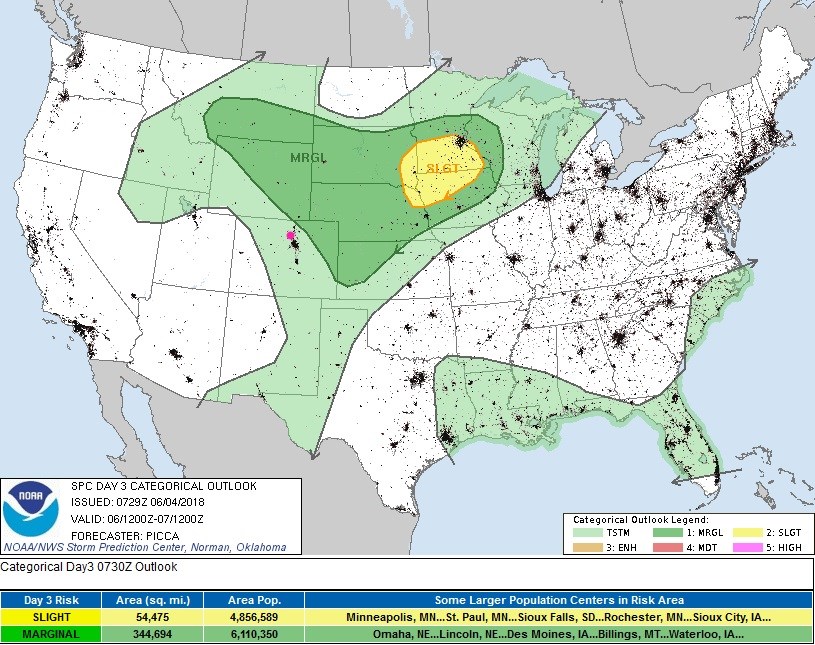
For Wednesday, the marginal risk almost includes Ft. Collins, but resides out in northeast Colorado (Figure 4).
Little changes in the overall pattern all week. By Friday morning, the ridge remains (Figure 5) as does the trough out west. We might see our first eastern Pacific tropical system (Aletta would be its name) forming southwest of Mexico. Those can, sometimes, pump moisture our way (later this month).