This content was originally published by the Longmont Observer and is licensed under a Creative Commons license.
Forecast Discussion:
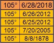
We did it - well DIA, at least, tied the all time high temperature record of 105F (Figure 1). Afternoon clouds building up (with virga - rain that evaporates as it falls creating strong down draft winds) cut off our chance to break the record. But it was close.
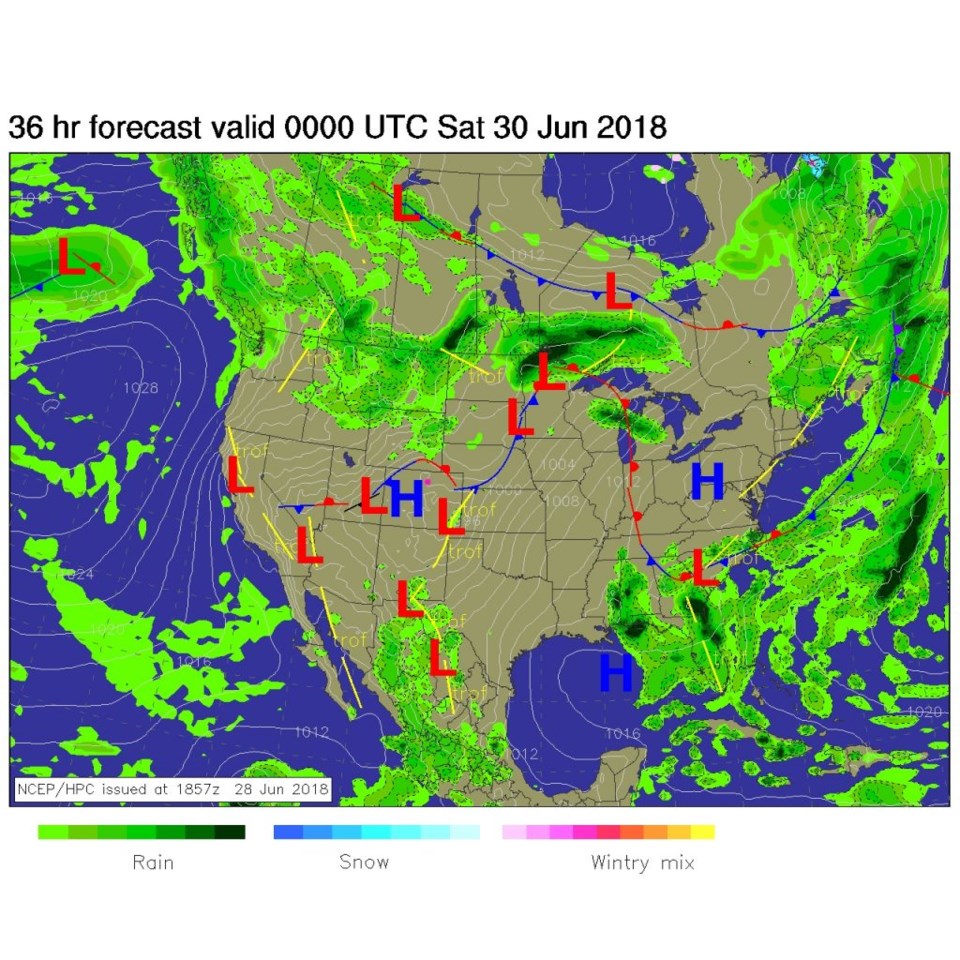
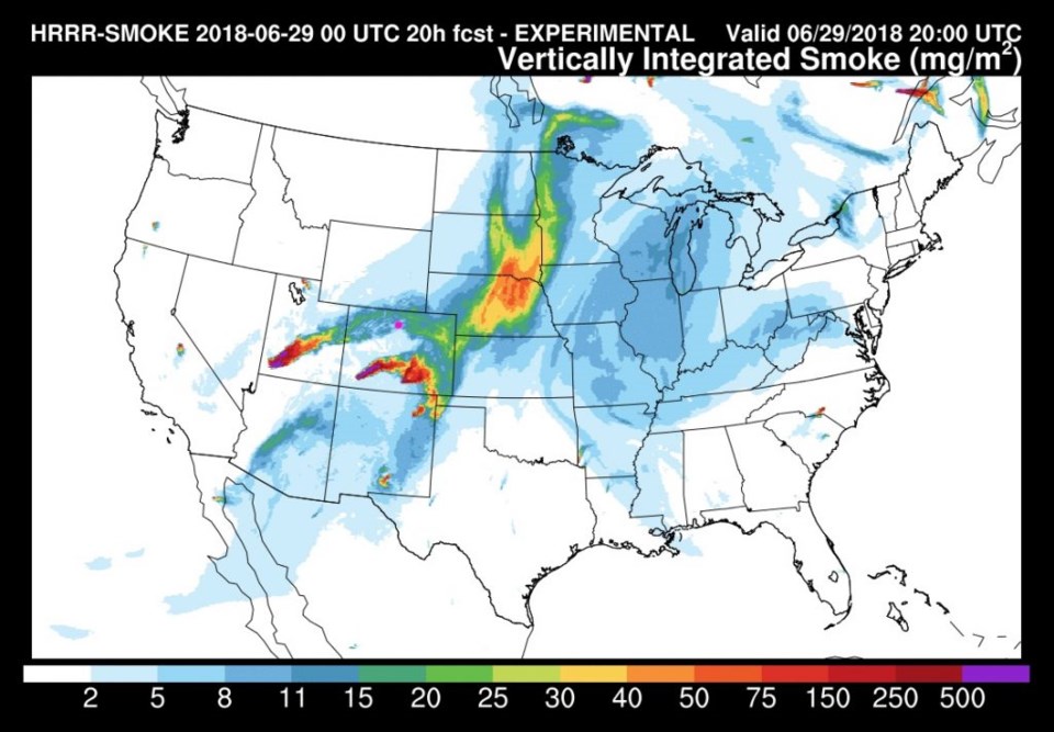
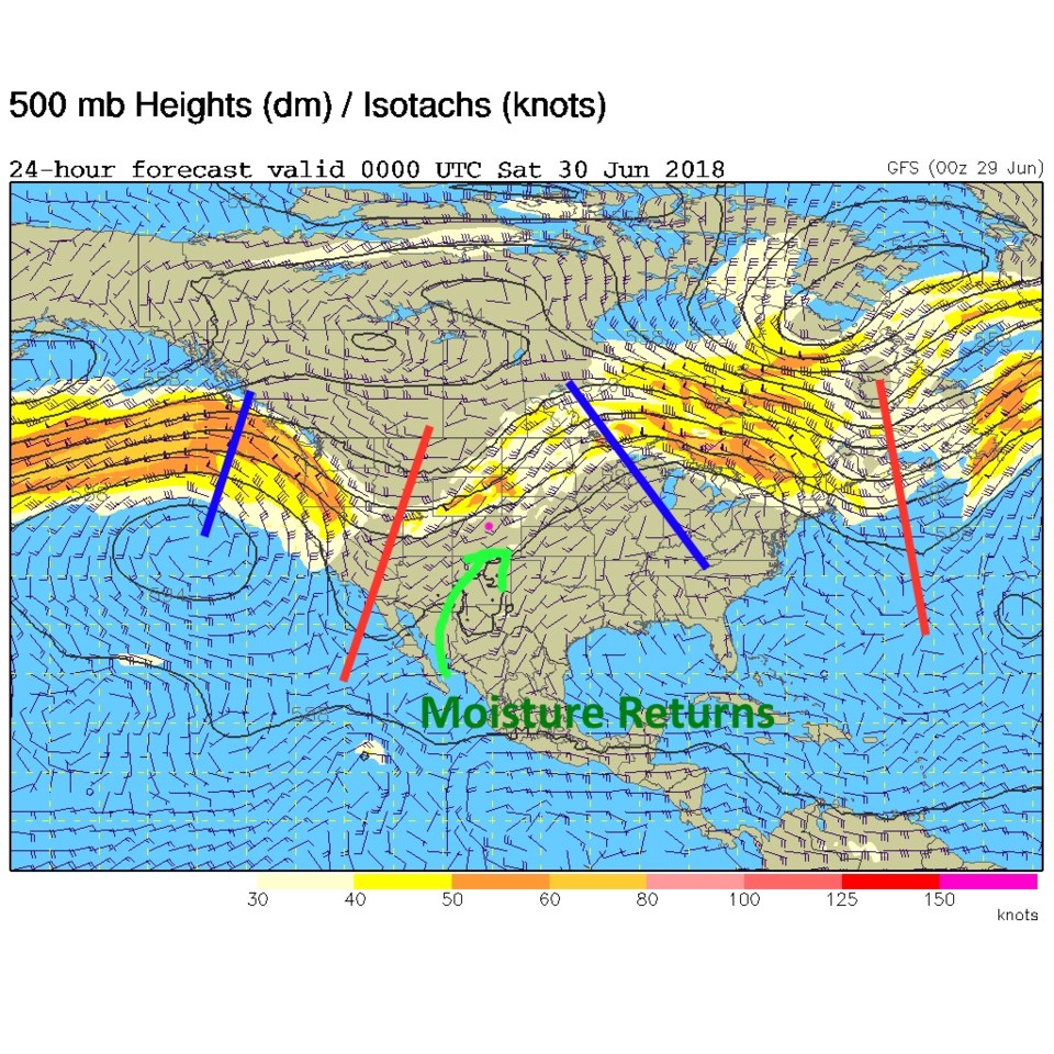
Today we have a front draped over the northern tier of counties and another afternoon chance of just a few normally strong thunderstorms (Figure 2). Smoke from Utah and local fires will make the skies milky (Figure 3) as the next trough moves in to cool us down and create a better chance of storms this weekend (Figure 4).
The longer range forecast:
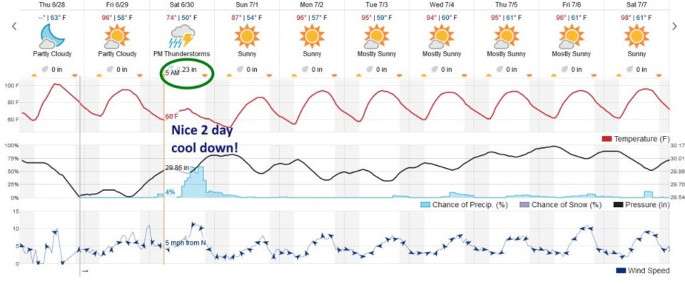
Amazingly this next front and trough will drop us to the lower 70'sF on Saturday with a midday to evening chance of rain (mainly up slope fueled showers and thunderstorms). This model gives us a whopping 1/4th of an inch. We'll look at other models tomorrow. Unfortunately, by Monday, we're back to the lower 90'sF for the Independence Day week.
Note- I will be camping the first two weeks of July. Due to the need of a vacation, and limited bandwidth, these forecast discussions will be more text based and, maybe, not quite as comprehensive. (This column has been going for more than a year now!!).