This content was originally published by the Longmont Observer and is licensed under a Creative Commons license.
Forecast Discussion:
Update 6/21 10:30am.
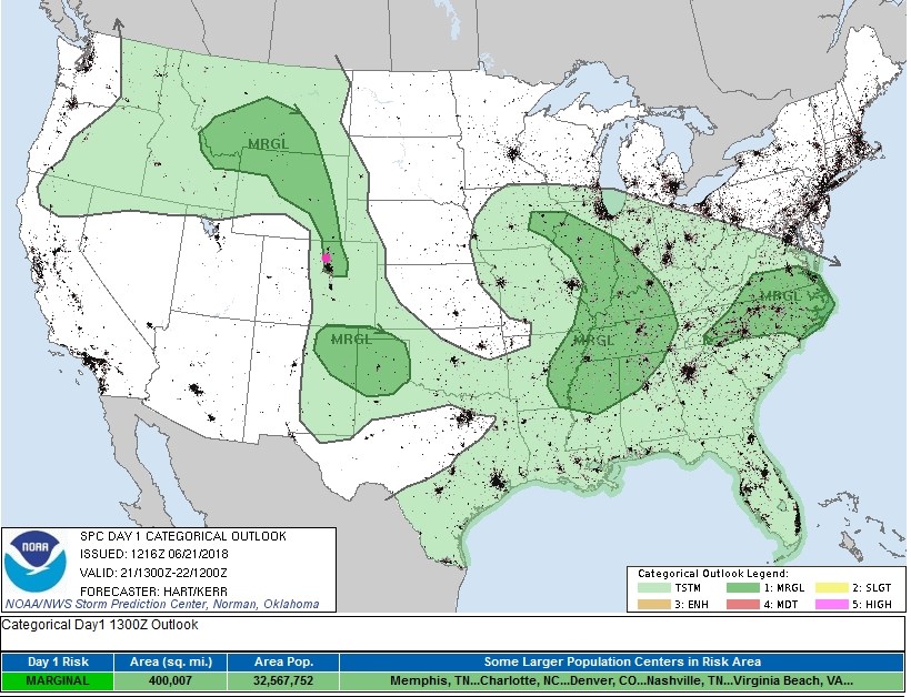
Sometimes it takes the morning data to see small scale features in the weather. A small but strong short wave will be moving down the flow creating lots of thunderstorms in Montana, Idaho and Wyoming - then down along I-25 to the Palmer Divide. The peak time for severe weather will be about 3pm - 8pm today. The main risk is for large hail and strong straight line winds. (Figure 1 update).
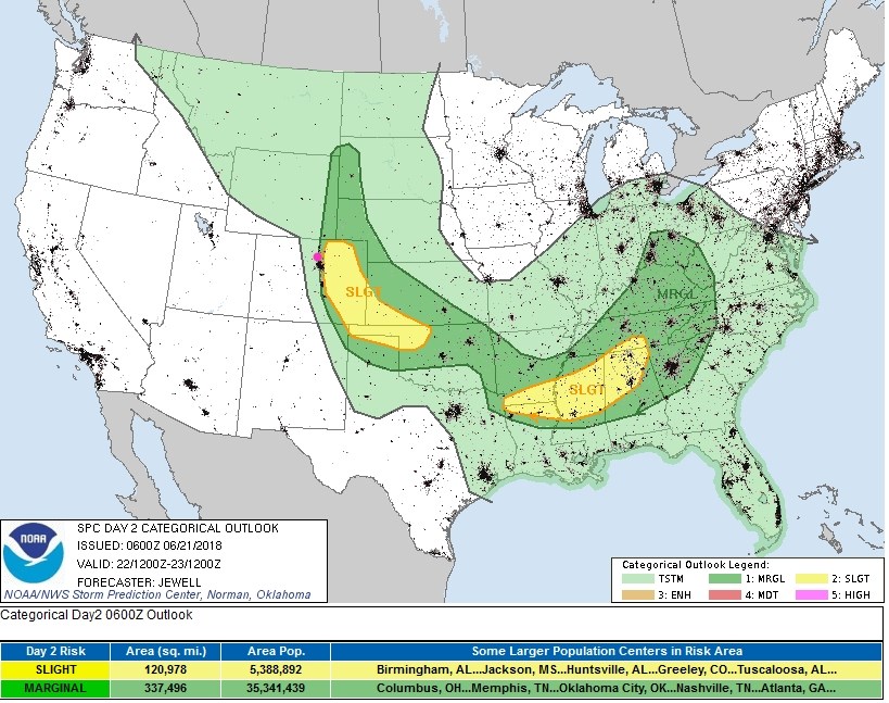
A low to our east, tomorrow, will pump more moisture back up to the Front Range and, with more heating, will create a marginal (1 on a scale of 1-5) to slight (2 on a scale of 1-5) risk of severe weather; hail and wind again, almost Longmont. This might be updated to cover areas further west before tomorrow. I'll update it in the morning!
End update 10:30am.
Summer begins today! It starts at 4:07AM Mountain Time. This is the point when the sun is at its highest altitude in the sky for the year at local noon. The days start getting shorter again, beginning tomorrow, and the nights start getting longer.
To recap our last 3 days of storms, my rain-gauge picked up 0.76 inches of water. Not bad, and that is a nice way to keep the drought away.
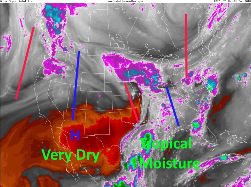
Things are quiet today except for some moisture remaining in the state (the dark grey colors in the water vapor satellite image Figure 1). The ridge (blue line) is inching this way, but little ripples in the flow may trigger a thunderstorm or two over the state. The SPC map (not shown) gives a chance of normal (non-severe) thunderstorms from, basically, Longmont north into Wyoming. Also in Figure 1, note how far away the deep tropical moisture is to our southeast.
The longer range forecast:
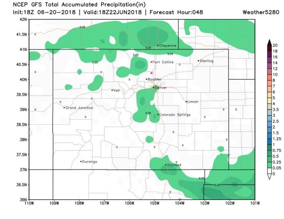
We'll have a bit better chance of afternoon thunderstorm action on Friday as moisture (that wasn't previously showing up in the models) will flow in from the west. Figure 2 shows, it will still be very spotty over the next 48 hours.
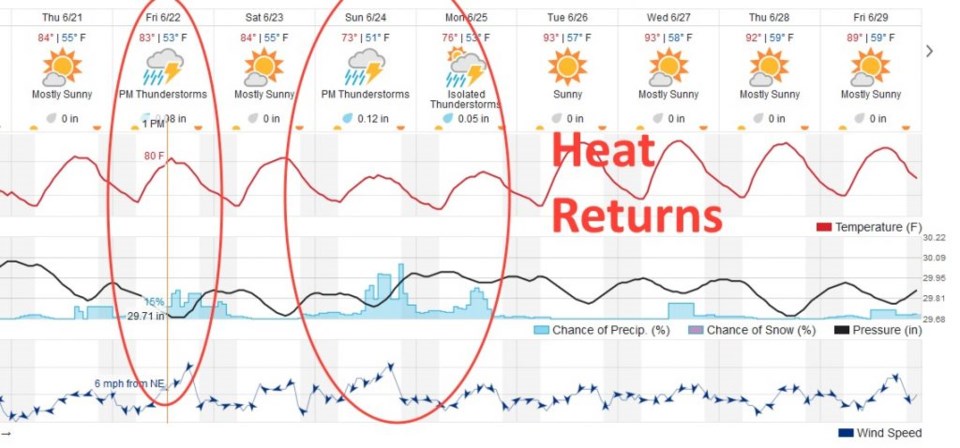
With figure 3, we'll gaze into the distant next-10-days. We have our chance of Friday thunderstorms, a dry spell for Saturday, then a better chance of thunderstorms Sunday and Monday (red circles). We might see severe storms return for a couple of days as well. After that, a big ridge reestablishes itself in the West, and we dry out and begin to bake with 90'sF again.
Enjoy the cool(er)/moist(er) weather while we've got it!