This content was originally published by the Longmont Observer and is licensed under a Creative Commons license.
Forecast Discussion:
The models remain somewhat excited about rainfall amounts, while Longmont (my backyard at least), has only received 0.03 inches. (As Marge Simpson would say - MMMmmmmmm!).
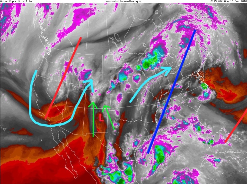
Figure 1 is the water vapor satellite image from Sunday night. There is a trough (red line) out in the west (with a cutoff low over Nevada) and a ridge in the east (blue line). The light blue lines are approximate air flow patterns. The green lines are the moisture flow from the Pacific and Gulf of Mexico (that will continue in one fashion or another most of the week).
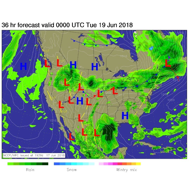
Today, we have a front sagging down to around Longmont and/or Boulder with weak up- slope flow. We'll be moist with showers and afternoon thunderstorms possible, and much cooler than the last few weeks (Figure 2).
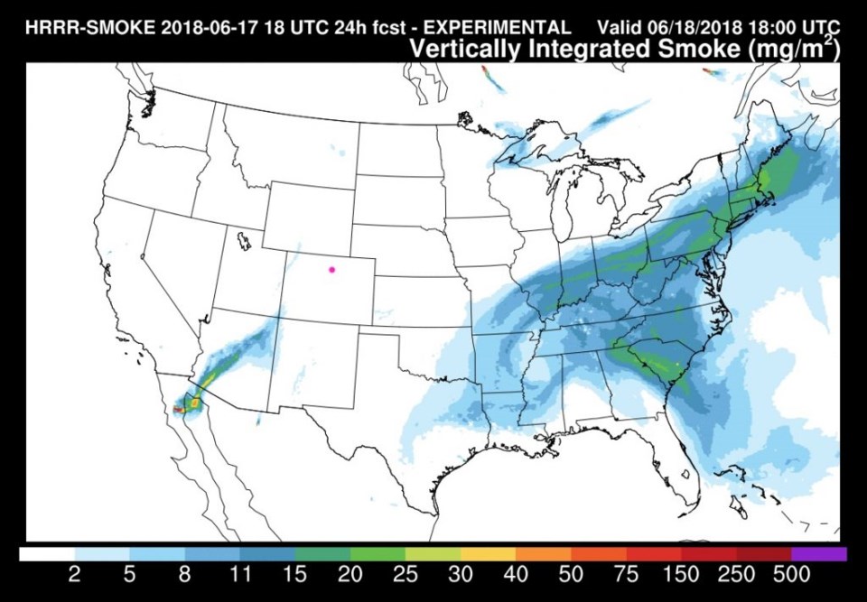
Conditions have changed greatly with the cool moist air (and a few showers) over the state. The fires have not been doused by rain, but the change in conditions has allowed the 416 fire near Durango to reach 25% containment (as of Sunday PM). Smoke is expected to be non-existent in Colorado today (Figure 3).
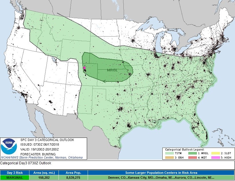
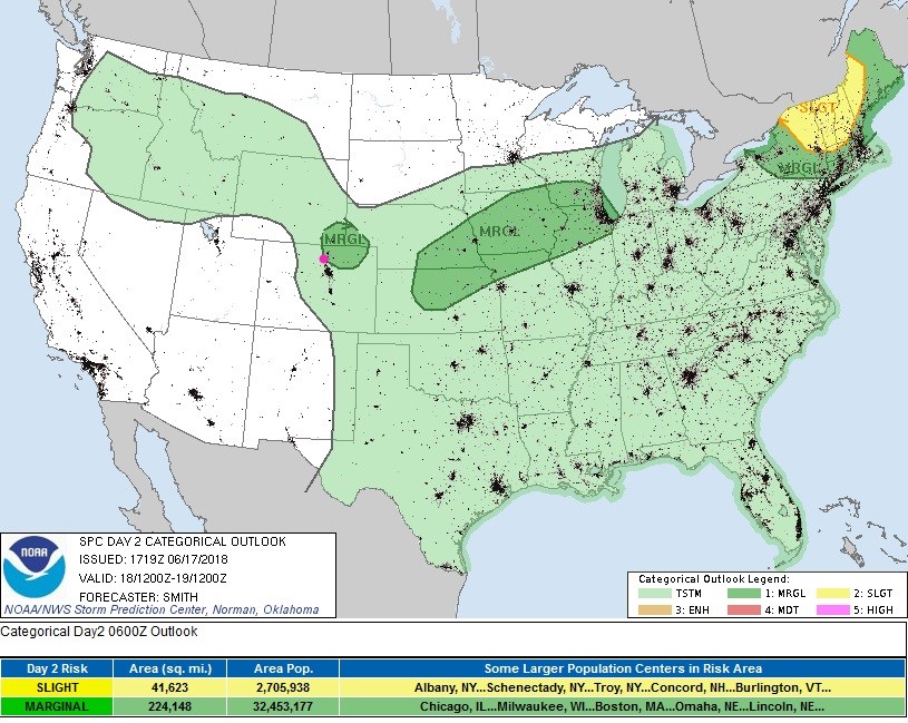
With the strong trough out west, ample moisture in easterly up-slope flow, and some warming today, severe weather chances return along and north of the front (near, over, or just south of Longmont) - Figure 4. Isolated supercells, that can create large hail, are possible in this region through early evening.
The longer range forecast:
The front sags further south tomorrow. With everything else still in place, plus a bit more warming, we'll see severe weather chances again down to the Palmer Divide (Figure 5).
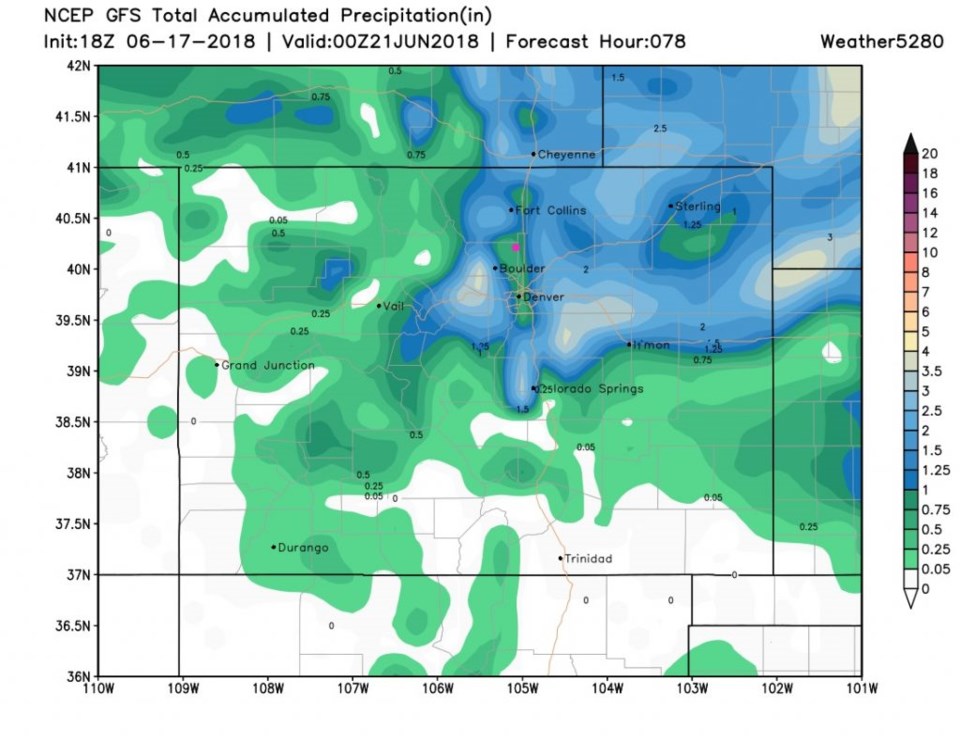
The GFS is becoming more realistic (and drier) with its rainfall predictions. We are expected, now, to only get about 1/2 to 3/4th inch more rainfall by Wednesday PM. Areas nearby may approach 3+ inches with thunderstorms and up slope flow.
We warm to the 80's F later in the week and cool a bit next weekend. Afternoon thunderstorms remain possible (but diminish in coverage) as the week progresses.