This content was originally published by the Longmont Observer and is licensed under a Creative Commons license.
Forecast Discussion:
Oh boy, there is so much to talk about... here we go:
First, clouds have increased even as temperatures increased on Thursday. Longmont hit 96F while DIA hit 97F. Those temperatures missed 100F probably due to the clouds that formed and maybe even the increased smoke.
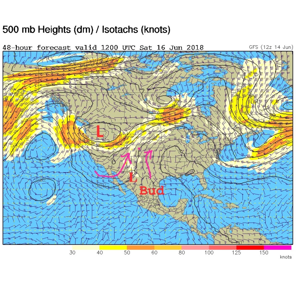
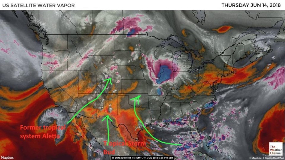
Those clouds were from mid-level moisture that largely came from the remains of our first eastern Pacific tropical storm of this season - Aletta. I kept my eye on it and its center of circulation rolled off to the west then got caught by this big western trough and was brought back. I added a green line from it to Colorado in Figure 1. The moisture from Bud is just entering the United States (another green line). The Gulf moisture is largely being shunted off to the east.
Figure 2 is the smoke. A LOT of smoke is originating from a large fire in the Baja (as well as Utah, now to a lesser extent).
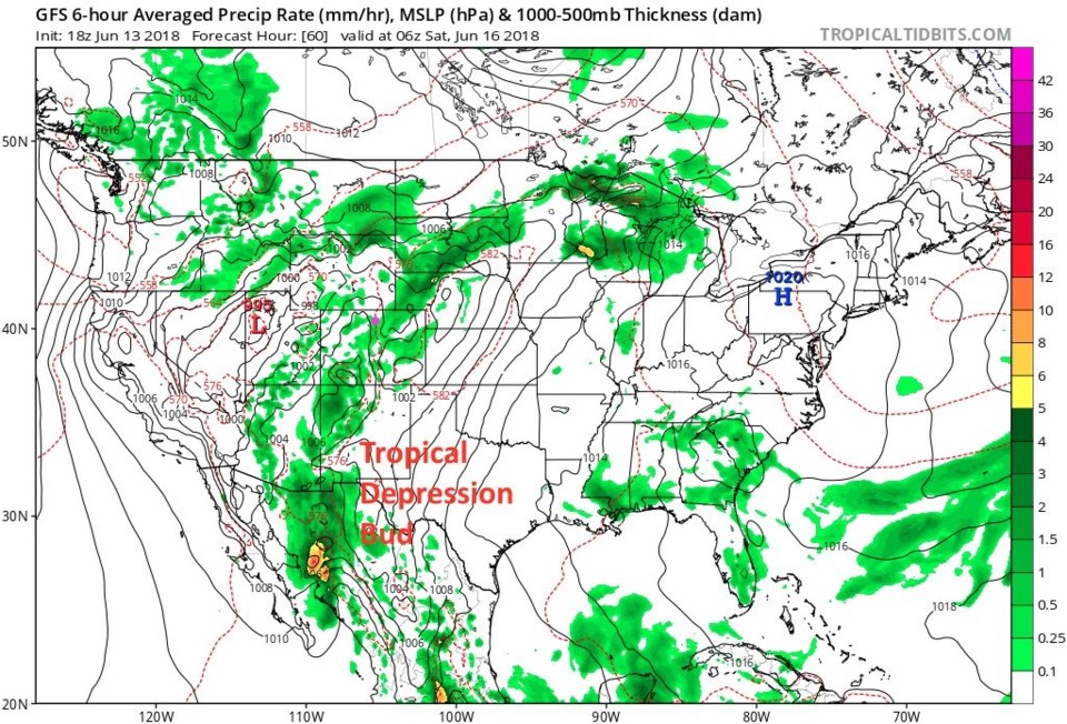
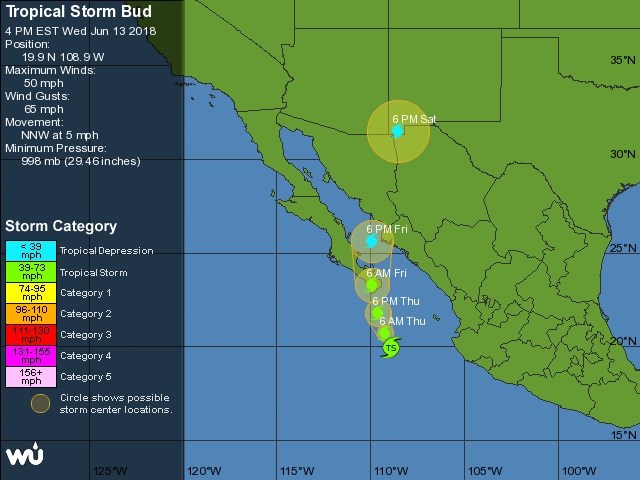
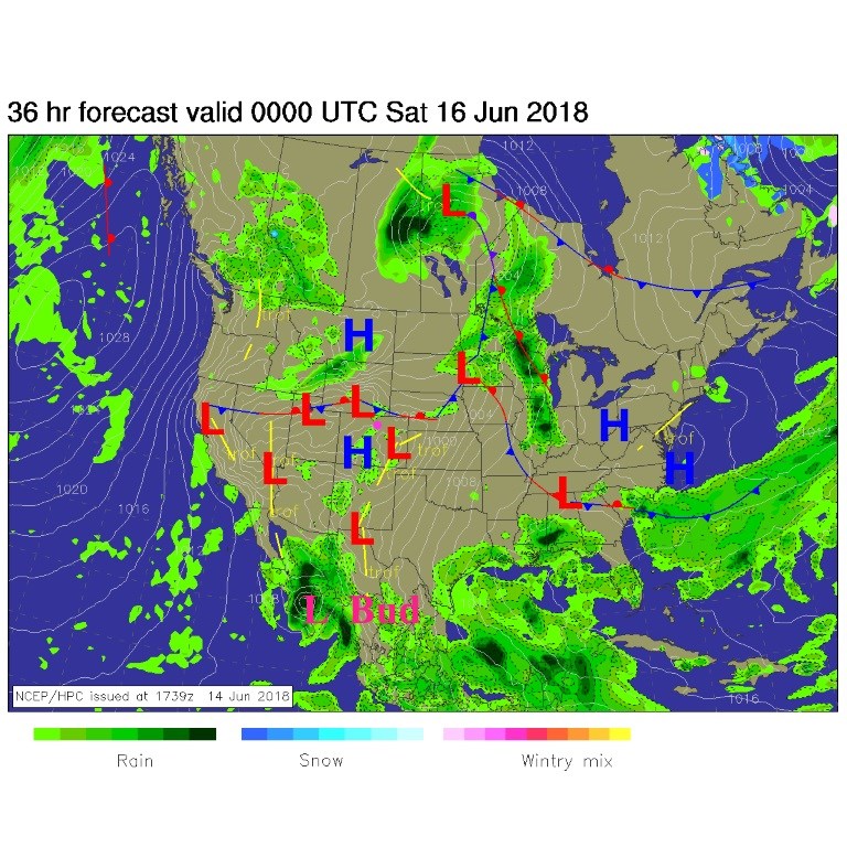
Figure 3 is the future of Bud. Today it is going to make final land fall on the Mexico mainland. It is expected to become non-tropical about the time it enters New Mexico. Because of that, it isn't being plotted beyond Saturday. We'll follow the moisture below.
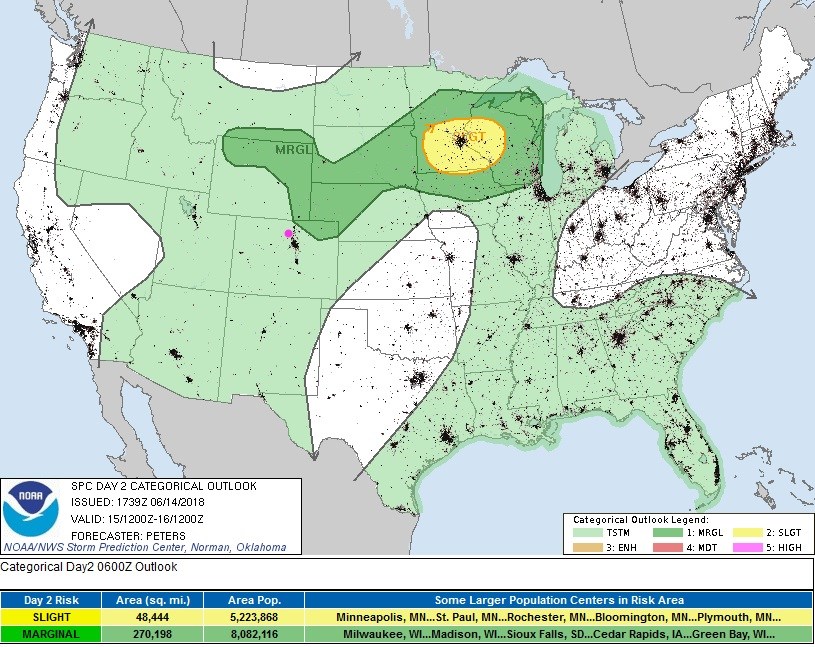
By tonight (Figure 4), a front pushes a bit into Colorado from the north. Figure 5 shows the entire state may get thunderstorms today, but the severe chances are restricted to near the frontal boundary.

The longer range forecast:
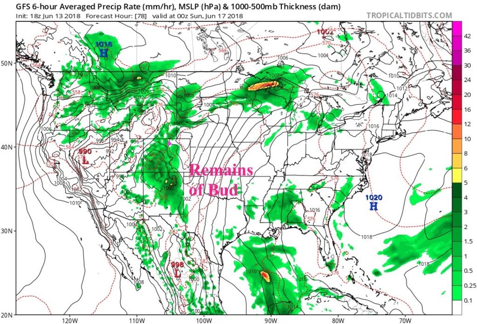
The trough in the west is moving inland and cutting off (the red L). Moisture from Bud is now getting pulled into Colorado (Saturday AM Figure 6).
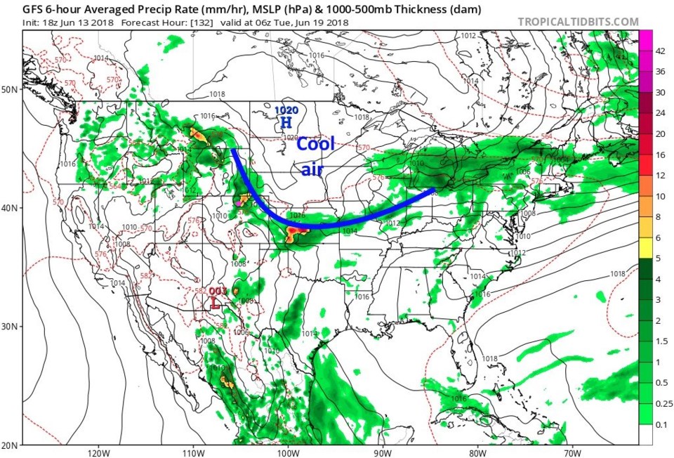
What I see now are three basic surges of rainfall for the state. One occurs early Saturday morning as moisture ahead of Bud is pulled into Colorado (Figure 7). The NWS points out that a front, that would help create up-slope flow and more rainfall/thunderstorms, is not likely Saturday. The main surge of Bud moisture arrives later on Saturday with more widespread rain (Figure 8). Rain continues Sunday morning (as it looks now). Another chance of rain/thunderstorms returns Monday night as a front does push down into the state (Figure 9/blue line).
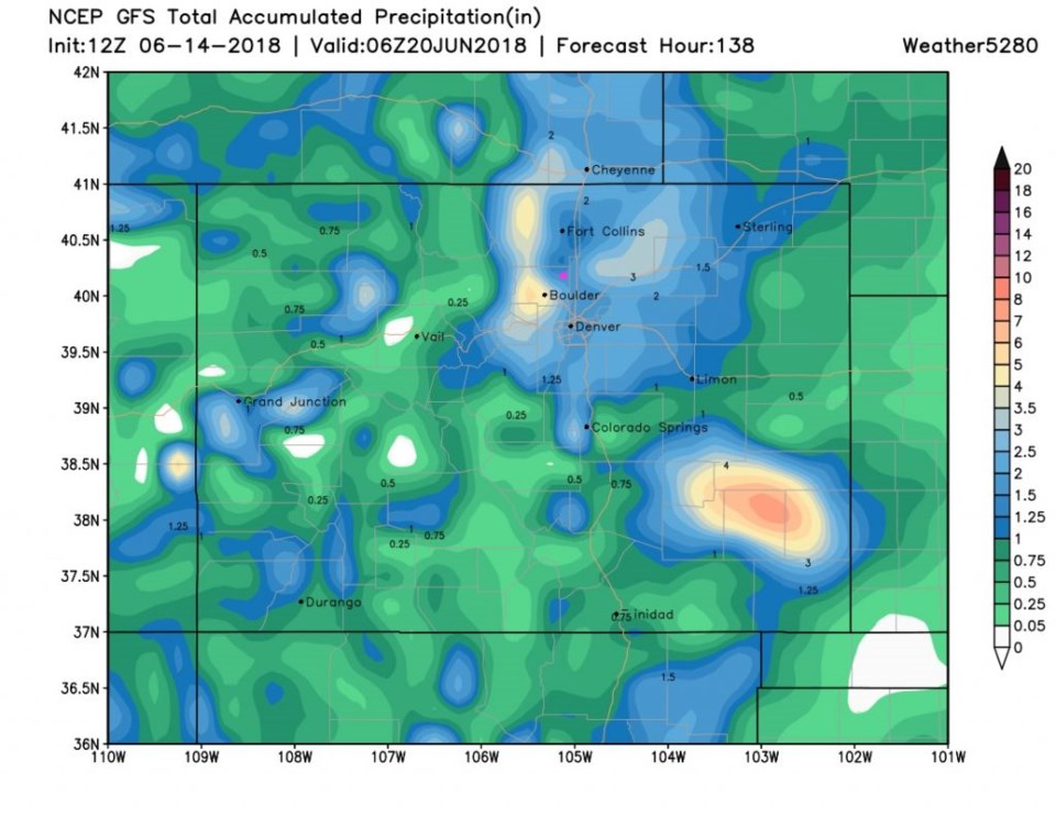
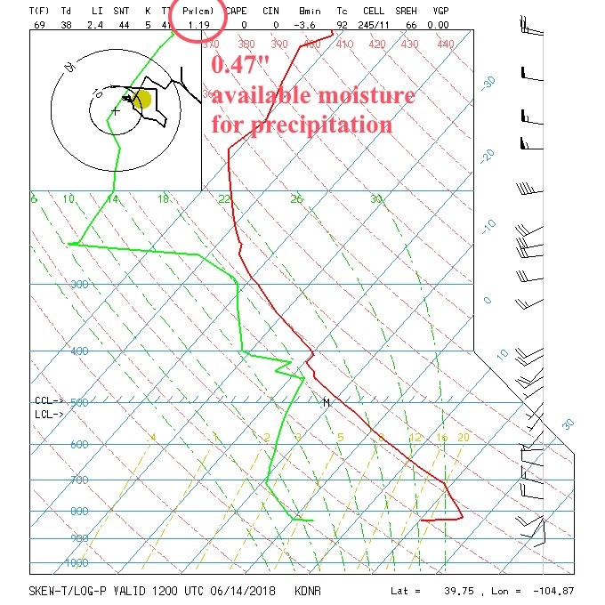
Rainfall totals still top the 1 inch area in many spots around Colorado. We are in the 1 1/4th to 1 1/2 inch zone on this run (Figure 10) by Tuesday PM, according to the GFS.
For fun, the precipitatable water (the amount of water in the atmospheric column over a location that can rain in an ideal convective situation) is highlighted in figure 11. That amount is fairly low, but we'll see how high it gets at max (probably Sunday AM). It was 1.19cm Thursday AM (which is 0.47 inches of water). The Thursday PM precipitatable water value had already risen to 1.69cm / 0.67 inches. Here comes the water we need to help with the fires!