Skip to content

The Next Storm/Next Snow Forecast Discussion from the Cherrywood Observatory – June 12, 2018

This content was originally published by the Longmont Observer and is licensed under a Creative Commons license.

Forecast Discussion:

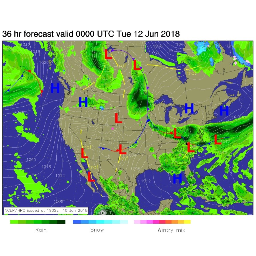
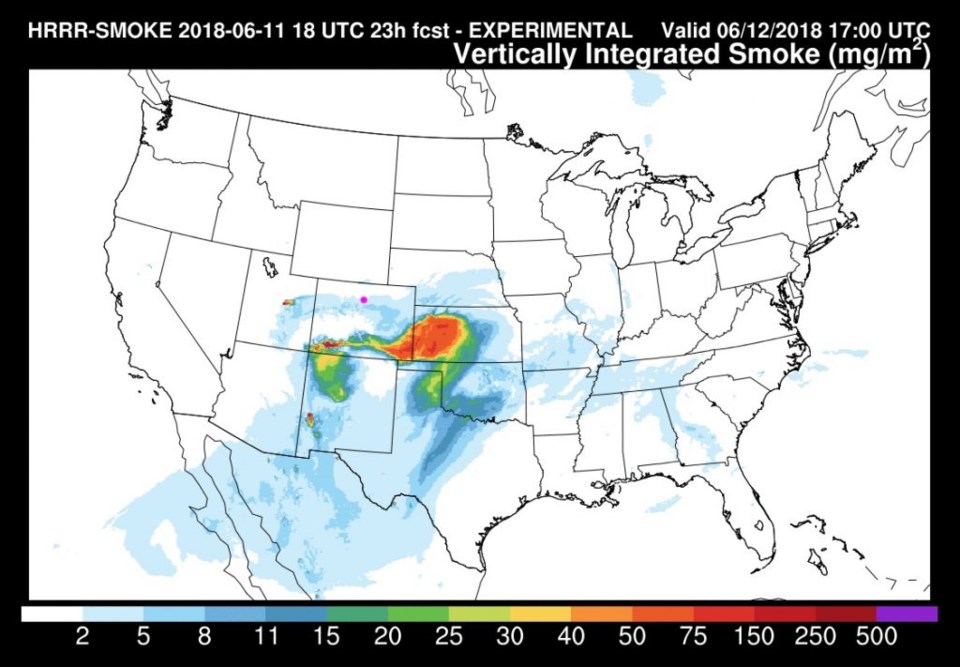
Dry and cooler continues today. Figure 1 shows the departed cold front Monday PM.  Other than smoke, the skies are Colorado-clear. Speaking of smoke, the large fires in the south are pouring out copious amounts of smoke, but the haze around here Monday and today is actually coming from new fires in central Utah (Figure 2).

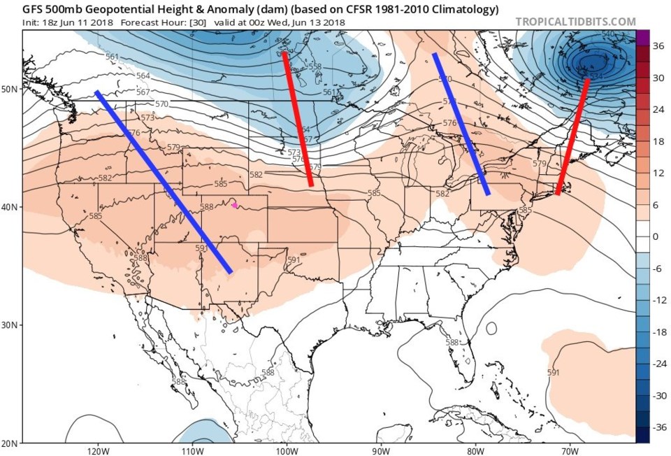
The upper air pattern for tonight shows the big ridge sitting to our west keeping us high and dry.

Figure 1: The forecast surface map for this afternoon. From NCEP.

Figure 2: The HRRR model forecast for smoke at all levels for midday Tuesday. From NOAA.gov

Figure 3: The 500mb upper air forecast map for Tuesday PM from the GFS and tropicaltidbits.com. Ridges are blue lines, troughs are red lines.

The longer range forecast:

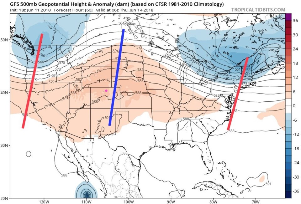
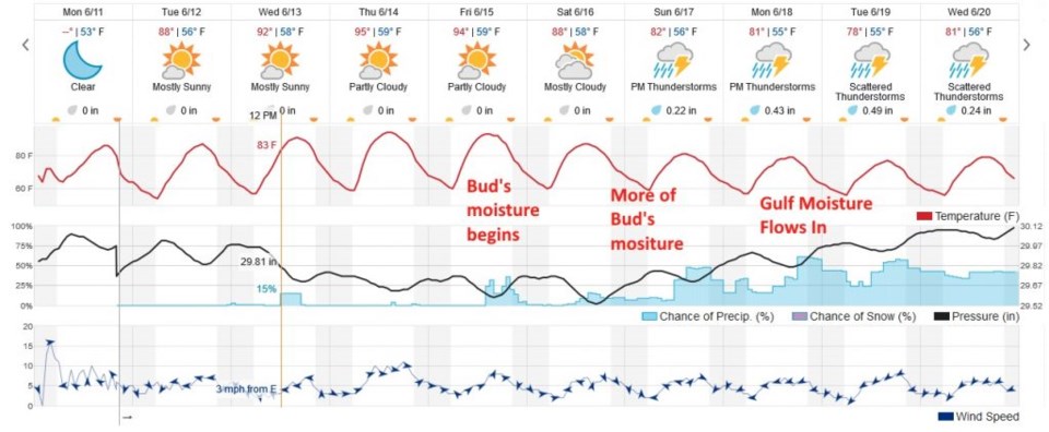
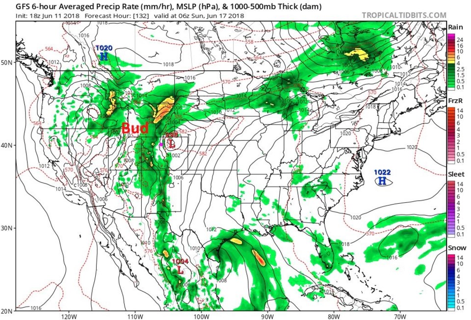
The ridge is still in place tomorrow, but has slid across the state with its central axis just barely to our east (Figure 4).  From this , we see very little weather but rapidly warming temperatures through Thursday (Figure 5). Down in the bottom of figure 4 is an interesting feature - hurricane Bud (oh what a terrifying name).

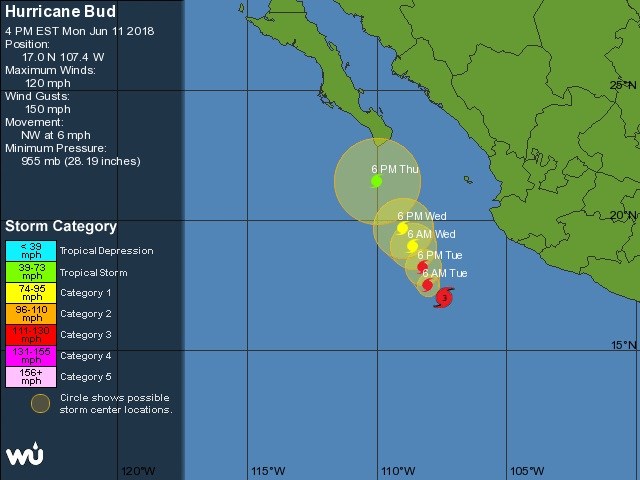
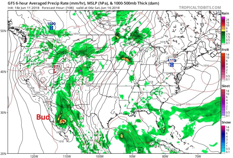
Figure 5 is the NHC's forecast of storm intensity and direction.  It currently has winds at 120mph making it a category 3 storm headed north-ish (Figure 6).  Figure 7 is the weather map for Friday PM and Bud is coming inland in northern Mexico.  Moisture is already streaming ahead of it into Colorado.  Figure 8 has a lee trough in NE Colorado and a lot of moisture from Bud nearby.  This could be interesting! Going back to Figure 5, afternoon heating will combine with Bud's moisture for Friday afternoon storms.  Saturday and Sunday will see more moisture around.  After that, a stream of Gulf of Mexico moisture seems to get drawn into Colorado with rain showers for the beginning of next week.  Relief *may* be in sight!

Figure 4: The 500mb upper air forecast map for Wednesday PM from the GFS and tropicaltidbits.com. Ridges are blue lines, troughs are red lines.

Figure 5: the total 10 days of the graphical forecast for Longmont, CO from weatherunderground.com

Figure 6: The National Hurricane center prediction for the future position and strength of hurricane Bud. From weatherunderground.com

Figure 7: The future weather map from the GFS and tropicaltidbits.com valid Friday PM.

Figure 8 The future weather map from the GFS and tropicaltidbits.com valid Saturday PM.

Current Weather

Partly cloudy

Partly cloudy

59°F

UV Index
0 Low
Pressure
29.9 Steady
Visibility
8 miles
Dewpoint
42 °F
Humidity
53%
Wind
NW 3.5 mph
Gust
8.2 mph
Wind Chill
59 °F

Hourly Forecast

Tomorrow
12 AM
55°F
Partly cloudy
Tomorrow
1 AM
52°F
Partly cloudy
Tomorrow
2 AM
50°F
Mostly clear
Tomorrow
3 AM
47°F
Mostly clear
Tomorrow
4 AM
45°F
Clear
Tomorrow
5 AM
43°F
Mostly clear
Tomorrow
6 AM
41°F
Mostly clear
Tomorrow
7 AM
45°F
Partly sunny
Tomorrow
8 AM
50°F
Partly sunny
Tomorrow
9 AM
55°F
Partly sunny
Tomorrow
10 AM
62°F
Intermittent clouds
Tomorrow
11 AM
66°F
Intermittent clouds

7 Day Forecast

Mostly sunny

Wednesday

75 °F

Mostly sunny, pleasant and warmer


Partly cloudy

Wednesday Night

41 °F

Patchy clouds


Mostly cloudy w/ t-storms

Thursday

75 °F

Turning cloudy, warm; breezy, a thunderstorm around in the afternoon


Thunderstorms

Thursday Night

49 °F

A thunderstorm in spots in the evening; otherwise, considerable cloudiness


Thunderstorms

Friday

70 °F

Mostly cloudy with a couple of thundershowers


Thunderstorms

Friday Night

46 °F

Cloudy with a couple of thundershowers


Rain

Saturday

50 °F

Chilly with periods of rain and a thunderstorm


Rain and snow

Saturday Night

39 °F

Cloudy with rain, mixed with a little snow late


Mostly cloudy

Sunday

59 °F

Mostly cloudy with a stray thundershower in the afternoon


Partly cloudy

Sunday Night

36 °F

Partly cloudy


Sunrise and Sunset

Sunrise
6:08 AM
Sunset
7:49 PM

Based on AccuWeather data