This content was originally published by the Longmont Observer and is licensed under a Creative Commons license.
Forecast Discussion:
With a cool front that pushed across the state Sunday PM, we are very quiet and dry today. Temperatures are down about 12 F from Sunday (Sunday hit 99F in Longmont and 97F in Denver).
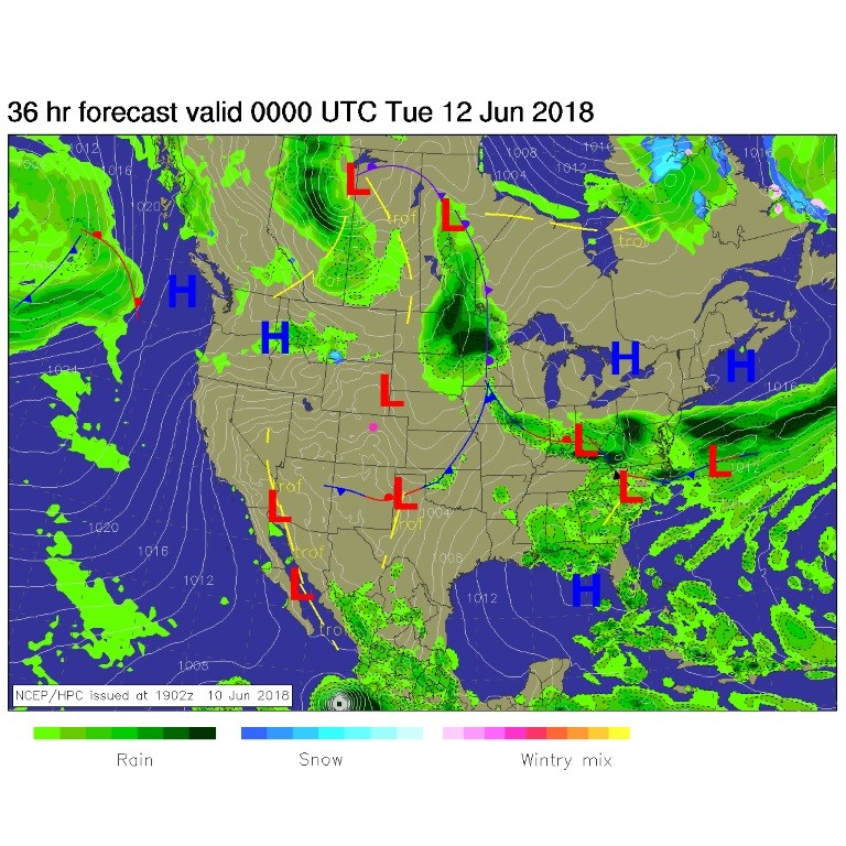
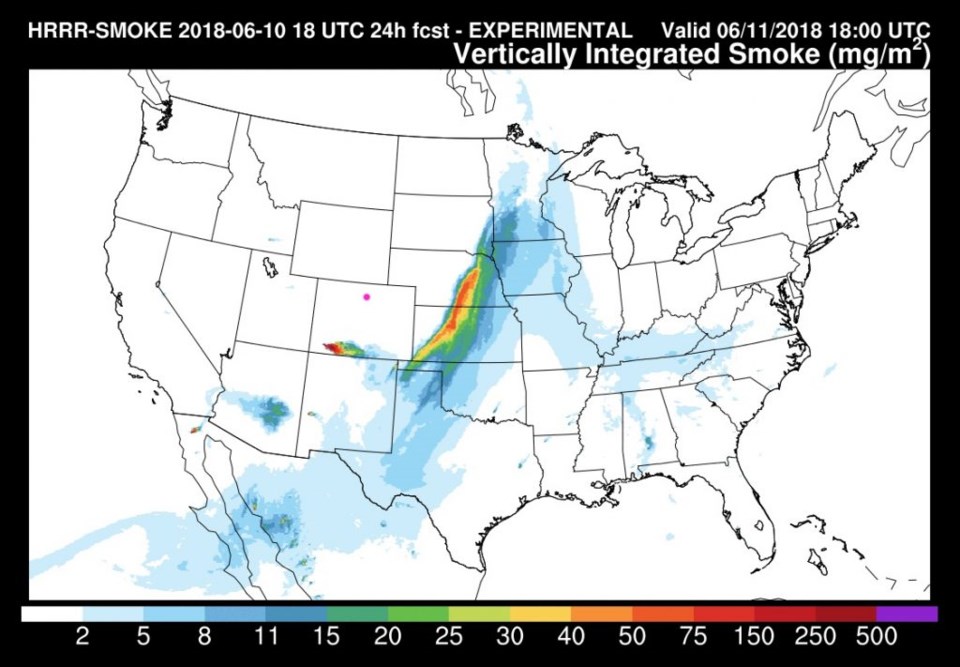
Figure 1 shows the bone dry, post-frontal state with no notable weather occurring as it scours moisture out of Colorado and cools the lower atmosphere (more stable). There was A LOT of smoke aloft over Longmont Sunday morning, but Figure 2 shows the front has pushed all the smoke way off into Kansas an deep south Colorado where the closest major fire is still burning.
The longer range forecast:
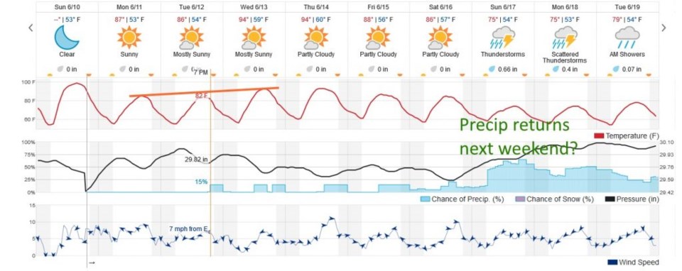
We drop to the lower 80'sF (no matter what Figure 3 says) then warm back up the the 90'sF over the next couple of days. A VERY low chance of afternoon thunderstorms return, when a bit of monsoon-like moisture returns, and heat helps trigger them starting Tuesday PM. Real cooling and rain chances seem to return come next weekend. More later!