This content was originally published by the Longmont Observer and is licensed under a Creative Commons license.
Forecast Discussion:
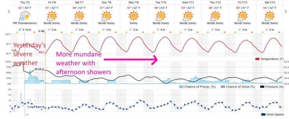
This post brings us to the 1/2 mark of my camping trip the northern Colorado. We are under a flash flood watch as I type today. Thursday PM (yesterday) promised to be very stormy along I-25 with a marginal risk. But that hasn't happened yet as I type.
After the "fun" of Thursday, the upper level ridge will move/expand westward. It dominates the eastern 2/3rds of the nation and will really heat things up again. Often moisture gets trapped under a ridge and is available for thunderstorm formation in the afternoons when heating hits a maximum.
Figure 1 shows the first three days of the forecast period as reaching near peak heat again with afternoon thunderstorms possible. With moisture around, the heat index (temperature + moisture levels) will be very high. We get very dry early in the week as the ridge moves a bit further west giving us northwest flow. Southwest flow returns midweek and a cool front might enter the state to bring back showers (and severe chances out on the plains?).
More in a couple of days!