Skip to content

The Next Storm/Next Snow Forecast Discussion from the Cherrywood Observatory – July 18th, 2018

This content was originally published by the Longmont Observer and is licensed under a Creative Commons license.

Forecast Discussion:

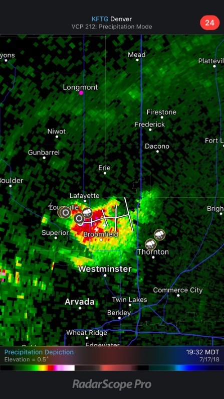
We had some BIG storms out on the eastern plains and one that fired just before sunset near Lafayette and Broomfield (Figure 1). That one put down some good hail.

The moisture plume that has wetted parts of the state over the last few days is still here Tuesday but will push to the east tomorrow (green and yellow arrows Figure 2).

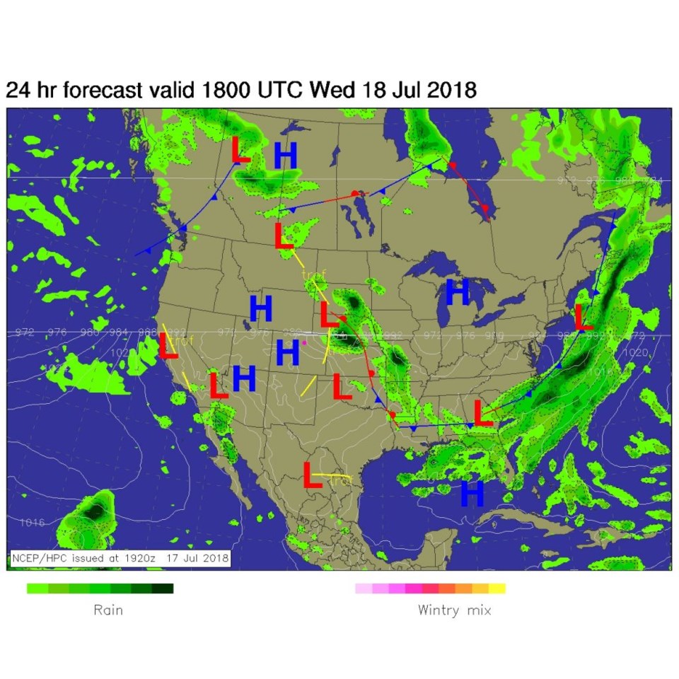
Figure 3 is the forecast surface map for today - the surface high pressure is settling in.  The SPC has "no" chance of convection over the Front Range and I-25 areas north of Denver. Wow.

Figure 1: 7:30pm Radar Scope Pro app image.

Figure 2: the water vapor satellite image from Tuesday PM. Reds/Oranges are dry air, greys/whites are moist air regions.

Figure 3: The forecast surface map for Wednesday midday. From NCEP.

The longer range forecast:

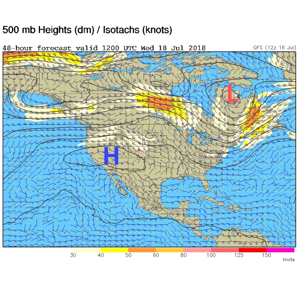
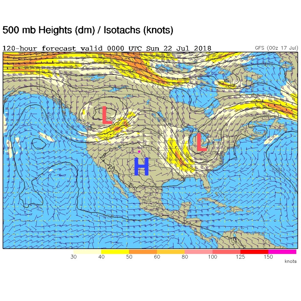
The upper level map (figure 4) has a big height ridge to our west feeding us heat and dryness. That ridge still rules the roost come Saturday night (Figure 5). (We'll watch for 'some' moisture that will eventually leak into the ridge later in the work week.)

That ridge and the departure of much of the moisture means hot and dry is back. Figure 6 shows temperatures near 100° F for the next 3-5 days. Moisture and cooler weather doesn't return until the end of the weekend. More as the week goes by!

Figure 4: The 500mb upper air analysis for Wednesday AM. Pink dot is Longmont. Red L is a low pressure trough bottom, blue H is a ridge top.

Figure 5: The 500mb upper air analysis for Saturday PM. Pink dot is Longmont. Red L's are low pressure troughs bottom, blue H is a ridge top.

Figure 6: the next 10 days of the graphical forecast for Longmont, CO from weatherunderground.com

Current Weather

Mostly cloudy

Mostly cloudy

50°F

UV Index
0 Low
Pressure
30.14 Falling
Visibility
7 miles
Dewpoint
45 °F
Humidity
83%
Wind
NNW 1.1 mph
Gust
2.3 mph
Wind Chill
50 °F

Hourly Forecast

Today
12 AM
48°F
Mostly cloudy
Today
1 AM
46°F
Intermittent clouds
Today
2 AM
45°F
Intermittent clouds
Today
3 AM
43°F
Intermittent clouds
Today
4 AM
42°F
Intermittent clouds
Today
5 AM
41°F
Intermittent clouds
Today
6 AM
40°F
Intermittent clouds
Today
7 AM
42°F
Intermittent clouds
Today
8 AM
47°F
Mostly sunny
Today
9 AM
52°F
Mostly sunny
Today
10 AM
57°F
Mostly sunny
Today
11 AM
63°F
Mostly sunny

7 Day Forecast

Mostly cloudy w/ showers

Tuesday

63 °F

Turning cloudy and cooler; a passing afternoon shower or two


Mostly cloudy w/ t-storms

Tuesday Night

40 °F

Considerable clouds this evening; partly cloudy late


Mostly sunny

Wednesday

76 °F

Pleasant and warmer with sunshine and patchy clouds


Partly cloudy

Wednesday Night

42 °F

Patchy clouds


Mostly cloudy w/ t-storms

Thursday

73 °F

Becoming cloudy; breezy in the afternoon with a thunderstorm in spots


Cloudy

Thursday Night

48 °F

A thunderstorm in spots in the evening; otherwise, considerable cloudiness


Showers

Friday

69 °F

Mostly cloudy with a couple of showers


Cloudy

Friday Night

46 °F

Cloudy


Showers

Saturday

53 °F

Cloudy and cooler with a couple of showers


Showers

Saturday Night

39 °F

Cloudy with occasional rain and drizzle late


Sunrise and Sunset

Sunrise
6:10 AM
Sunset
7:48 PM

Based on AccuWeather data