This content was originally published by the Longmont Observer and is licensed under a Creative Commons license.
Forecast Discussion:
Update 9:30am:
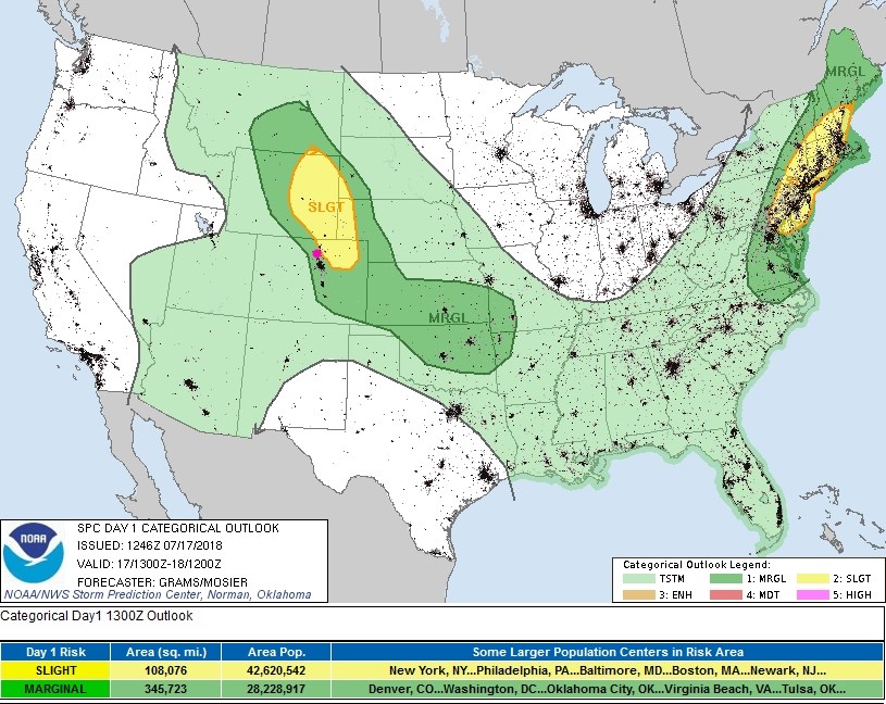
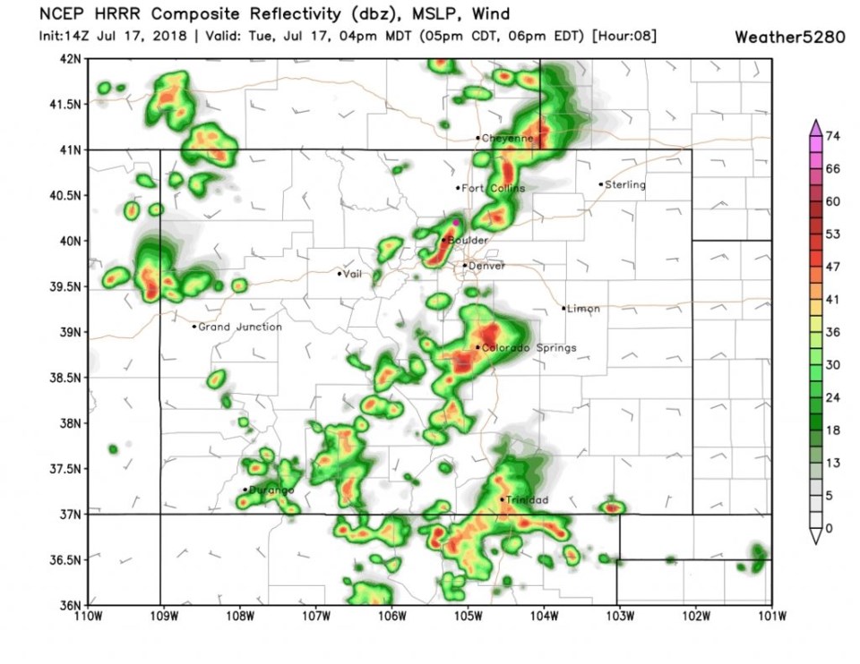
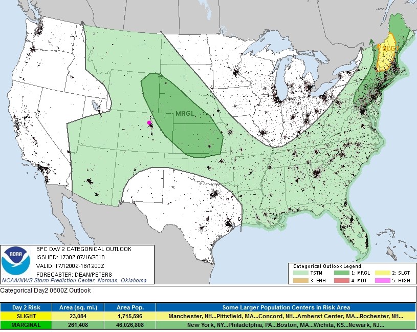
The forecasted threat of sever weather has been expanded significantly westward with a marginal risk of severe weather into the higher foothills (1 on a scale of 1-5) and a slight risk (2 on a scale of 1-5) just down to a line between Loveland and Platteville at the closest to Longmont (Figure 1 update). The storms will be fairly widely scattered as can be seen in the HRRR model run for 4pm today (Figure 2 update). Don't take storm placement literally in that graphic... it is better at showing density of storm coverage than exact location.
Storms should initiate around 1-2pm in the high country and roll across I-25 from 3-5pm with some lingering storms down south until around 7pm.
There is a 2% chance of a tornado within 25 miles of a location from north Denver to Boulder and up I-25 on the low lands. There is a 5% chance of winds >50mph and a 5% chance of hail >2 inches in diameter in the marginal risk zone (higher in the slight risk).
End 9:30am update.
As I write this, the evening chances of severe weather haven't yet manifested (see yesterday's update). Two days ago, there was a marginal risk of severe weather today as the heat and humidity returns. But is that still true?
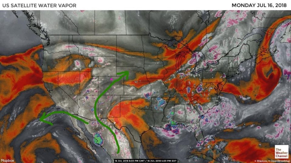
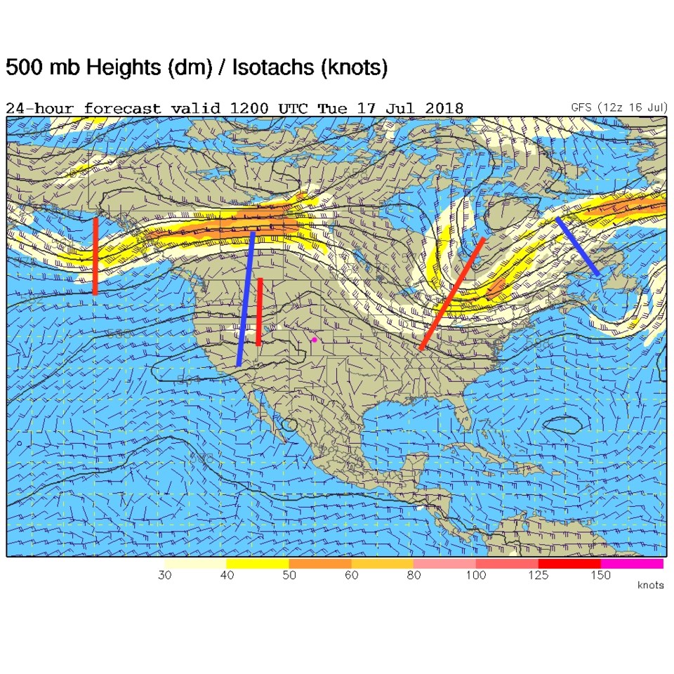
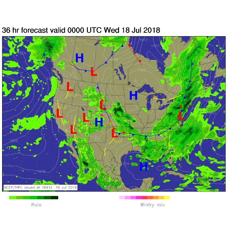
First, the water vapor is still here! (Figure 1) That might change after today as the ridge begins to dominate again. Figure 2 shows the short wave traveling under the ridge (the short red line next to the longer blue line). The front that was south of us Sunday and Monday is now pushing off to the east. There are many mountain storms around this afternoon (Figure 3). The SPC is placing a Marginal risk of severe weather (hail and strong winds, and lightning always) east of the I-25 corridor at this time. If this changes in the morning, I'll issue an update.
The longer range forecast:
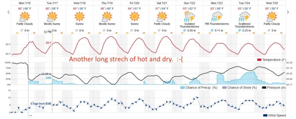
We rocket back to nearly 100F and get really dry until next weekend. Sorry, if I could keep it cool and rainy, I would.