This content was originally published by the Longmont Observer and is licensed under a Creative Commons license.
Forecast Discussion: (I'm posting this Saturday PM for the BIG change coming. And I'm rested, and excited to be back.)
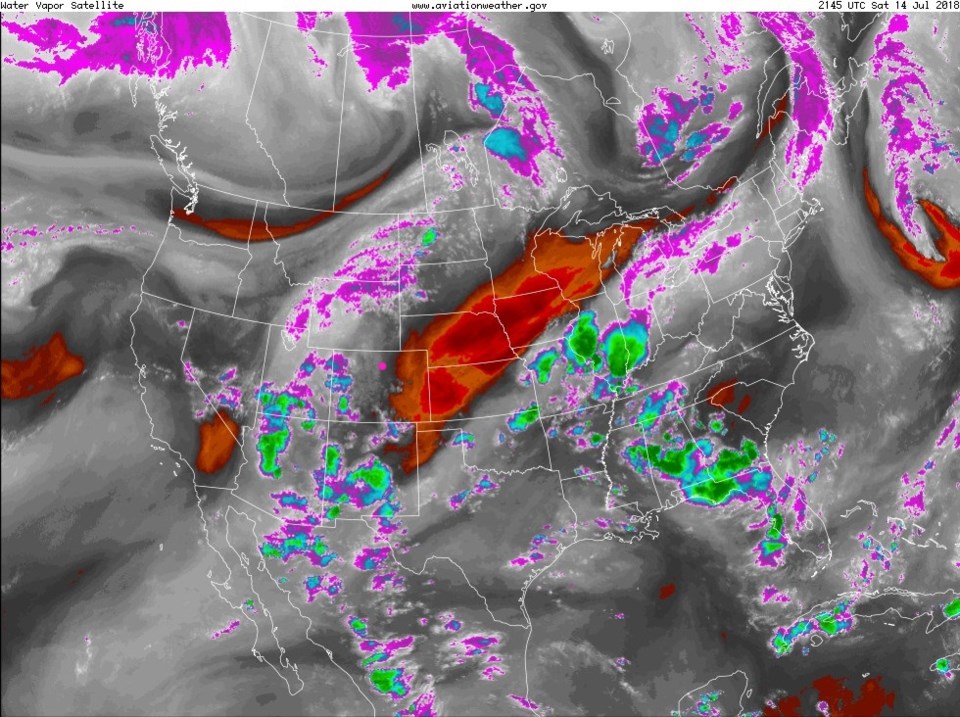
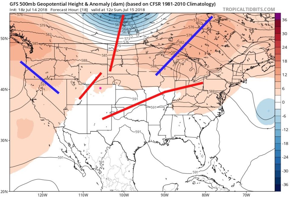
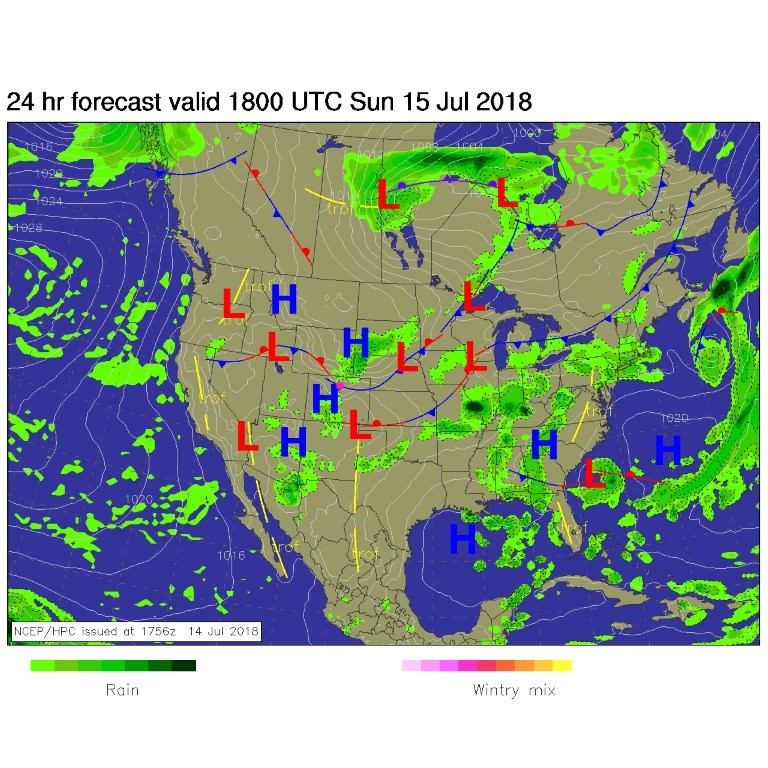
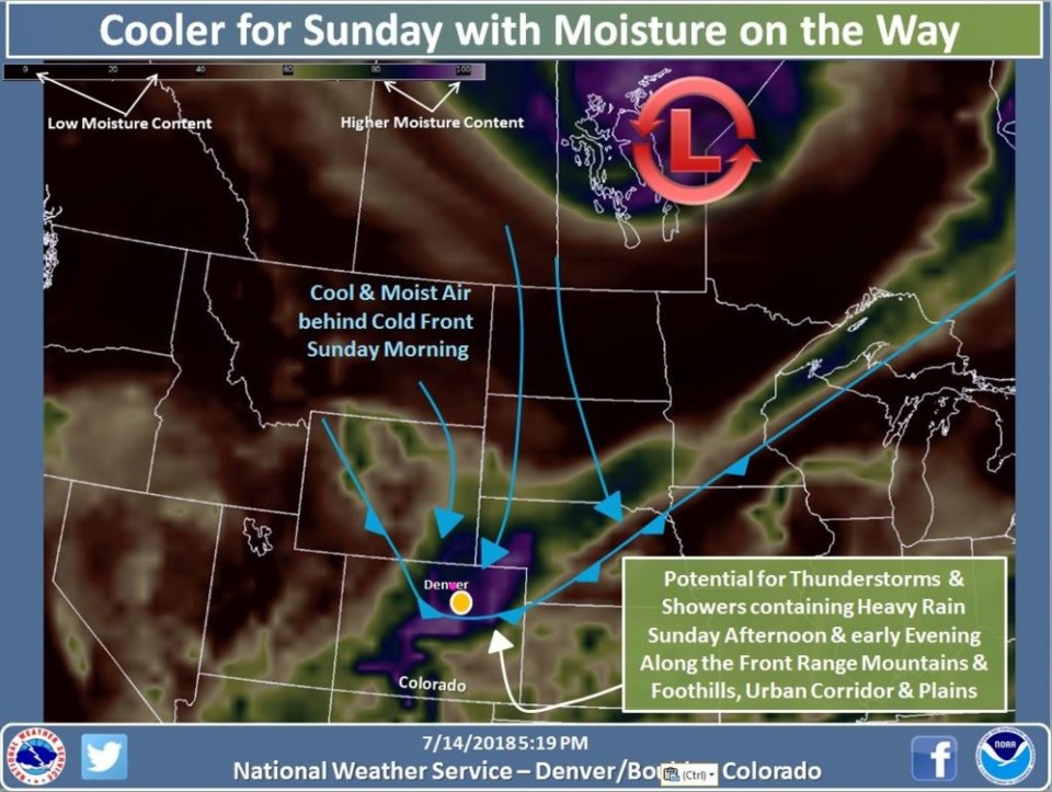
It is roasting in the upper 90's F on Sunday (it looks like we hit 99°F) - but change is coming our way! The giant moisture plume out west is making a return as a trough passes to the north. You can see all of Saturday's thunderstorms (green blobs) in Figure 1. The trough approaching is visible if one draws enough isolines- as is done on the 500mb map (red lines) in Figure 2. By mid-morning, the cold front will slide south and a low cloud layer will cover the sky as some up-slope flow begins (Figure 3). This big change is so notable that the NWS created a special graphic showing the cold front with atmospheric moisture in greens and purples (dark colors though) in Figure 4.
Highs today will drop by almost 20°F to around 80°F. Rain will start in the mountains just before noon and showers will invade the I-25 corridor around noon to 1pm. Precipitatible water in the atmosphere is around 0.80 inch on Saturday. It is predicted to jump to 1 1/3rd to 1 1/2 inch by Sunday afternoon (a record amount of moisture in the atmosphere according to the NWS).
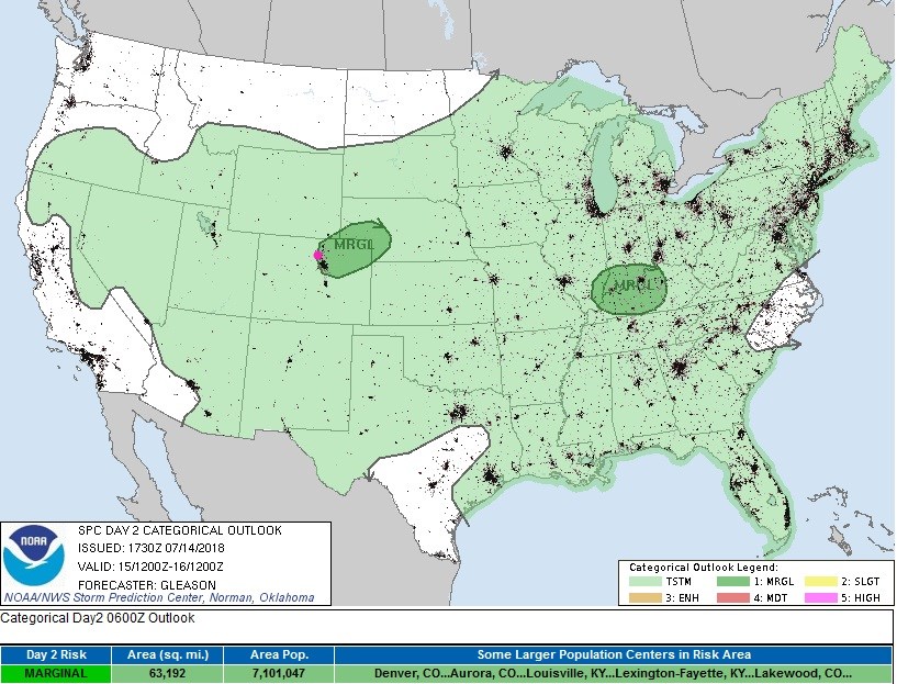
Some storms (especially if the sun can break through the stratus mid-afternoon as the upper-level trough approaches to destabilize the atmosphere) may produce local flooding rainfall (especially on burn scars) and some large hail. The SPC has painted us with a marginal risk of severe weather (1 on a scale of 1-5; Figure 5).
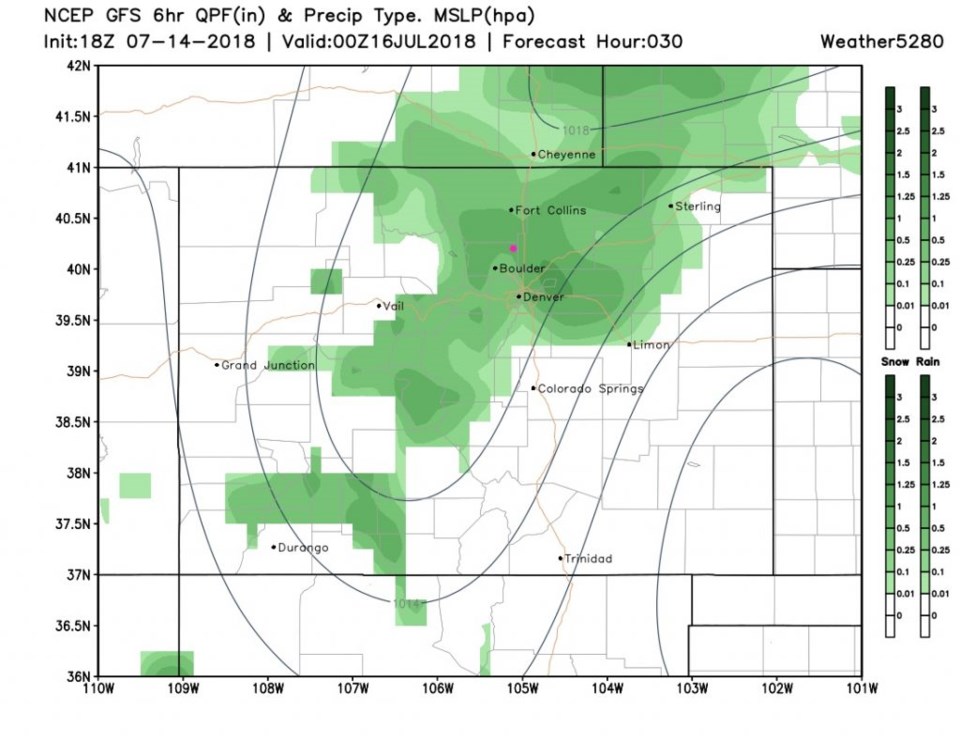
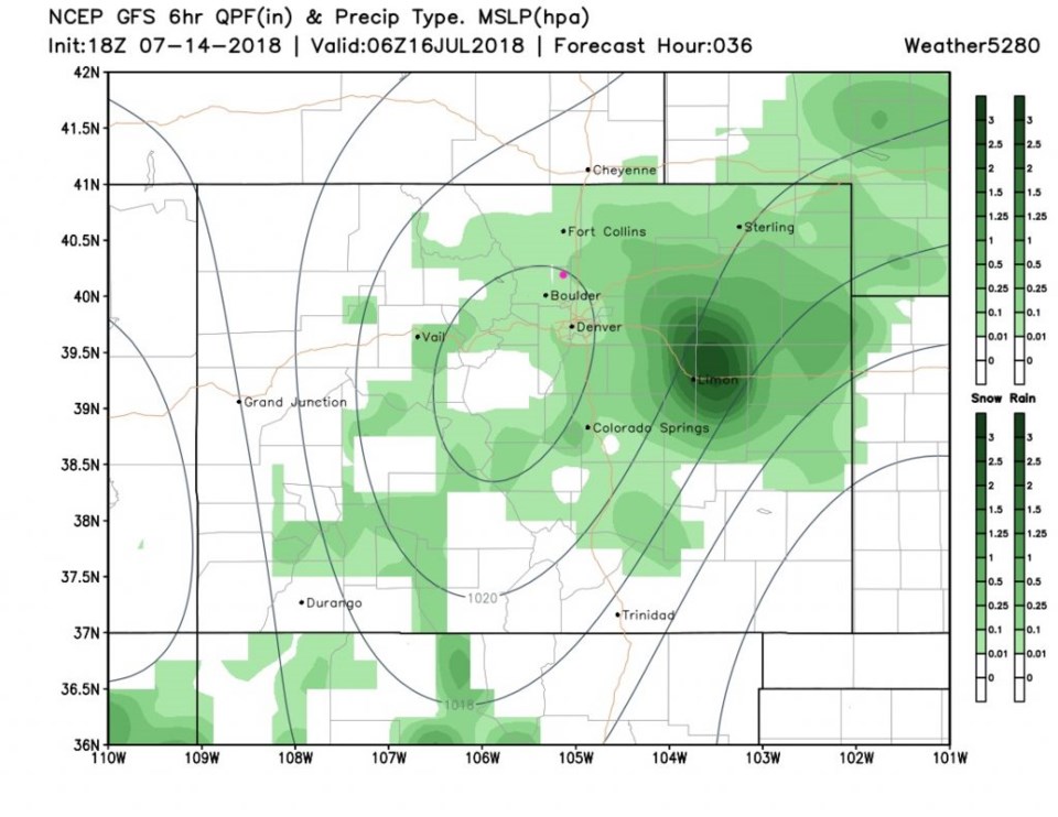
The rain coverage looks pretty extensive from Sunday afternoon to after midnight Sunday night (Figures 6 and 7). The GFS gives us 1/2 to 3/4 inch of water. Weather underground's model is just above 1/2 inch. The NAM gives us just about 1/3rd inch. (The GFS does paint over 3 1/2 inches of rainfall out near Limon in a recent run, so some storms will really douse people.)
The longer range forecast:
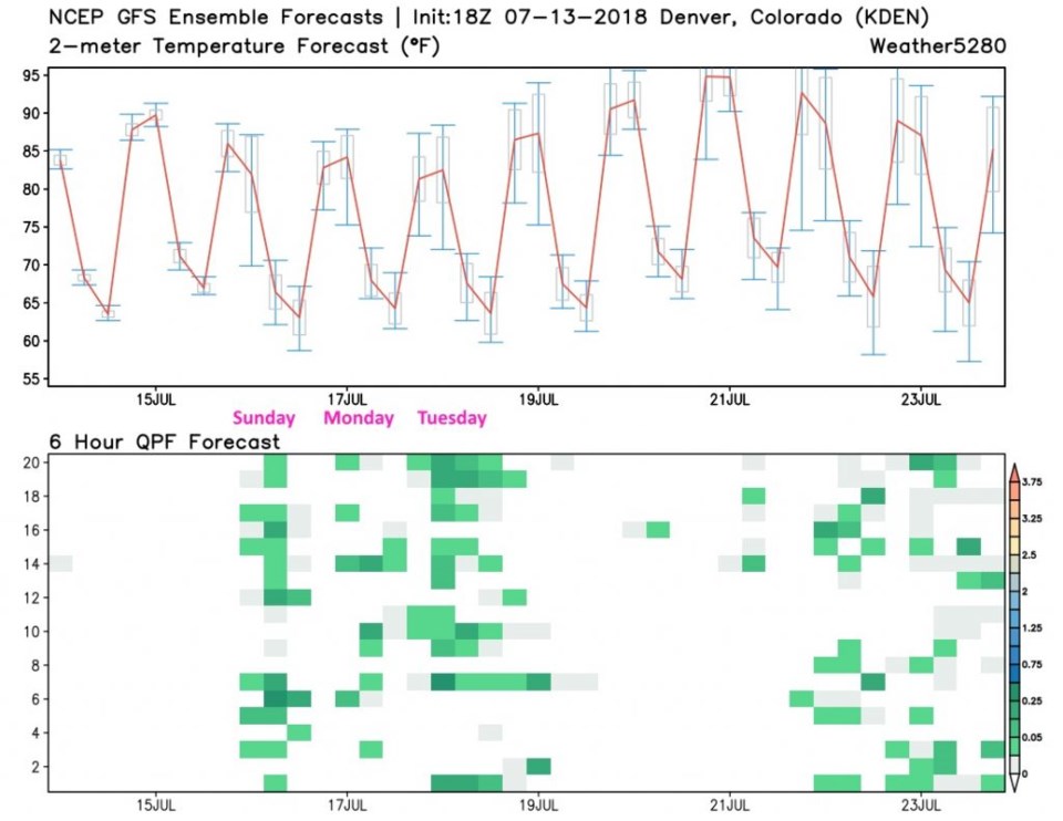
We still have moisture around the next couple of days with afternoon chances of thunderstorms Monday and Tuesday (Figure 8). After that we heat up AGAIN and dry out for a few days. More later! (It's good to be back on Longmont fiber. Oh so good.)