Skip to content

The Next Storm/Next Snow Forecast Discussion from the Cherrywood Observatory – August 22st, 2018

This content was originally published by the Longmont Observer and is licensed under a Creative Commons license.

Forecast Discussion:

The upper level feature bringing some rain and a lot cooler air (and eventually cleaner air) has slowed down a bit. We'll have another cool, cloudy, showery day today.

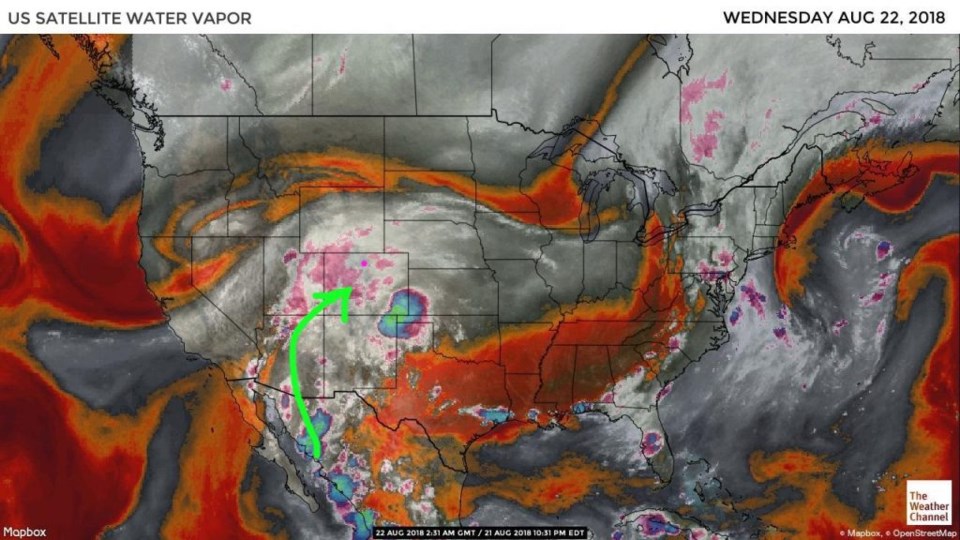
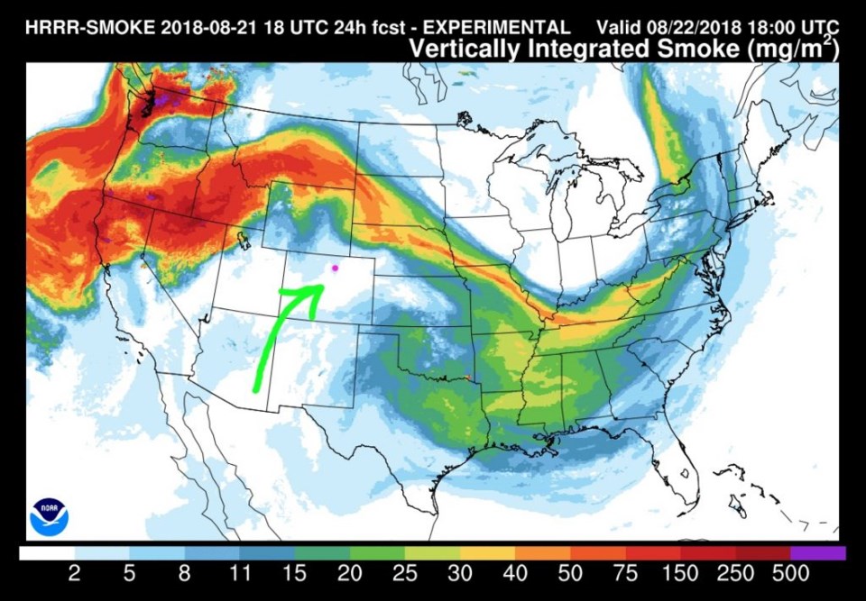
Figure 1 shows the ample moisture flowing up into the state (green arrow here and in following graphics). That flow is pushing the thickest smoke up into Montana, the Dakotas, and Nebraska (Figure 2).

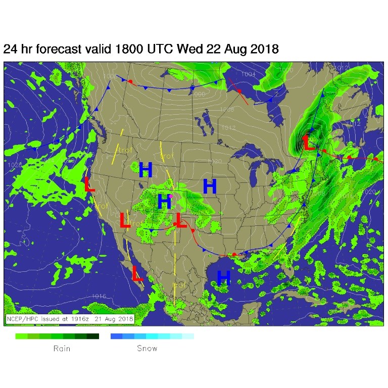
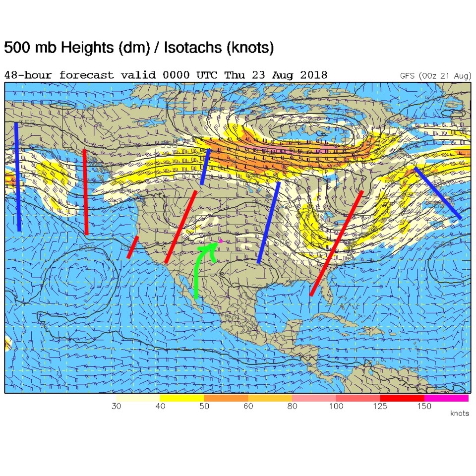
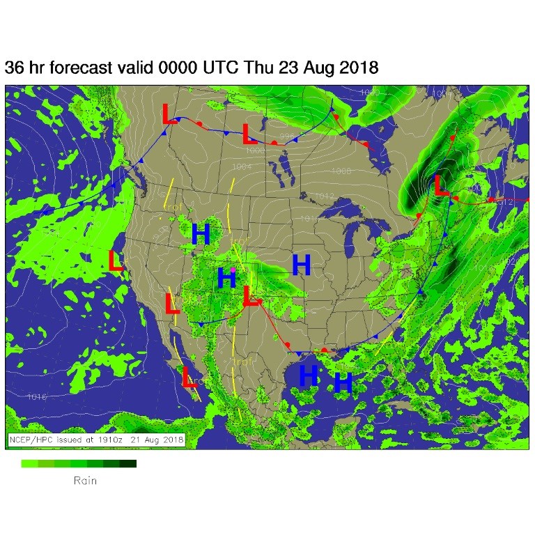
Figure 3 is the midday surface map for today. A front has passed and pushed down into Arizona and New Mexico. A low sits in the Oklahoma and Texas panhandle and will pump surface moisture uphill into Colorado. That slower trough has opened (is no longer cut off/closed) but is still to our west by this evening (Figure 4).

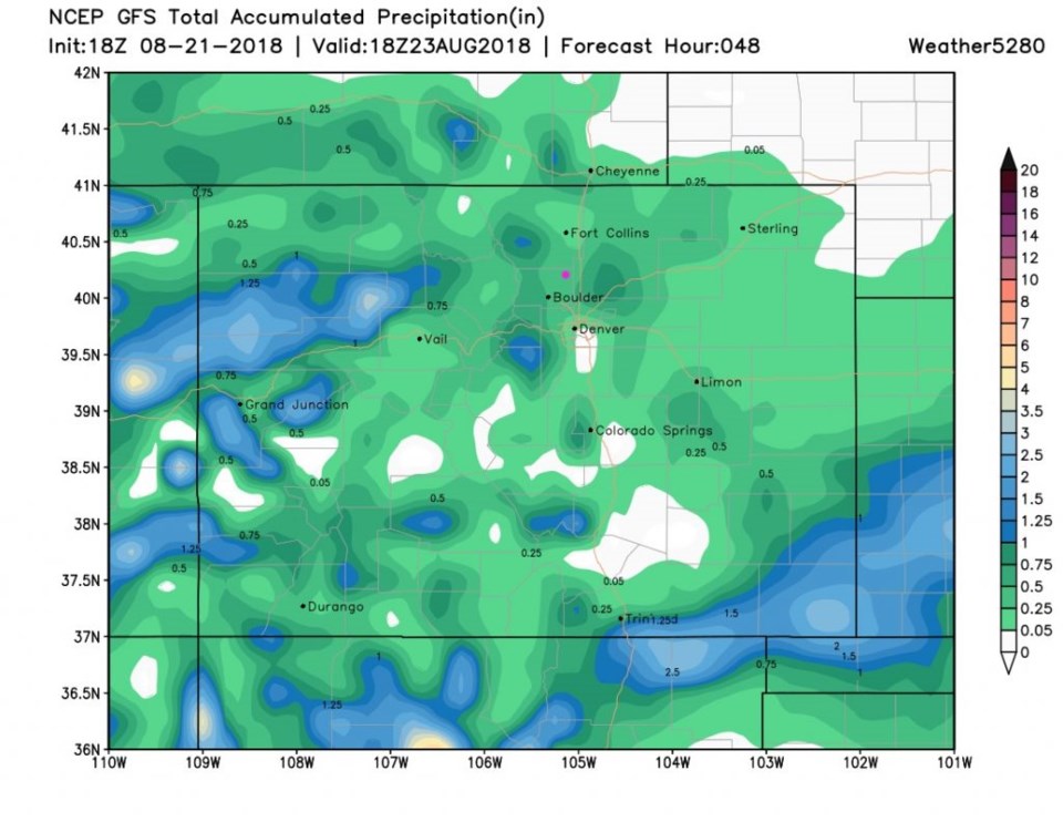
For this evening, the next forecast surface map has much of the state sitting under a good chance of rain (Figure 5). Rainfall totals for the next 48 hours (Figure 6) paint us in the 1/4th to 1/2 inch area. Wet, but not flooding except under the rare heavy thunderstorm.

Figure 1: the water vapor satellite image from Tuesday PM. Reds/Oranges are dry air, greys/whites are moist air regions. Green arrow is approx. moisture flow.

Figure 2: The HRRR (high resolution rapid refresh) model forecast of smoke at all levels for Wednesday noon.

Figure 3: The forecast surface map for Wednesday noon. From NCEP.

Figure 4: The 500mb forecast upper air analysis for Wednesday PM. Pink dot is Longmont. Red lines are troughs, blue lines are ridges.

Figure 5: The forecast surface map for Wednesday PM. From NCEP.

Figure 6: The total accumulated precipitation predicted between Tuesday PM and Thursday noon from the GFS and weather5280.com

The longer range forecast:

There is still some moisture around Thursday a.m. but things are drying out and warming. We still get to around 90° F for the end of the week and weekend. And there is still a hint of another period of cool storminess early next week. See you here tomorrow!

Current Weather

Cloudy

Cloudy

49°F

UV Index
0 Low
Pressure
29.62 Falling
Visibility
8 miles
Dewpoint
43 °F
Humidity
80%
Wind
SW 2.2 mph
Gust
4.9 mph
Wind Chill
49 °F

Hourly Forecast

Today
5 AM
51°F
Cloudy
Today
6 AM
51°F
Cloudy
Today
7 AM
52°F
Cloudy
Today
8 AM
55°F
Cloudy
Today
9 AM
60°F
Cloudy
Today
10 AM
62°F
Thunderstorms
Today
11 AM
65°F
Cloudy
Today
12 PM
68°F
Cloudy
Today
1 PM
67°F
Thunderstorms
Today
2 PM
70°F
Mostly cloudy
Today
3 PM
68°F
Mostly cloudy
Today
4 PM
67°F
Mostly cloudy

7 Day Forecast

Thunderstorms

Friday

70 °F

Mostly cloudy with a couple of thundershowers


Thunderstorms

Friday Night

45 °F

Cloudy with a couple of thundershowers


Rain

Saturday

48 °F

Chilly with periods of rain and a thunderstorm; travel in the foothills and mountains will be slippery due to snow


Rain and snow

Saturday Night

39 °F

Cloudy with rain, mixed with a little snow late; travel in the foothills and mountains will be slippery due to snow


Mostly cloudy

Sunday

59 °F

Mostly cloudy and warmer


Partly cloudy

Sunday Night

36 °F

Partly cloudy


Partly sunny

Monday

71 °F

Partly sunny, pleasant and warmer


Partly cloudy

Monday Night

45 °F

Partly cloudy


Mostly sunny

Tuesday

73 °F

Mostly sunny, breezy and pleasant


Partly cloudy

Tuesday Night

43 °F

Partly cloudy


Sunrise and Sunset

Sunrise
6:06 AM
Sunset
7:51 PM

Based on AccuWeather data