This content was originally published by the Longmont Observer and is licensed under a Creative Commons license.
Forecast Discussion:
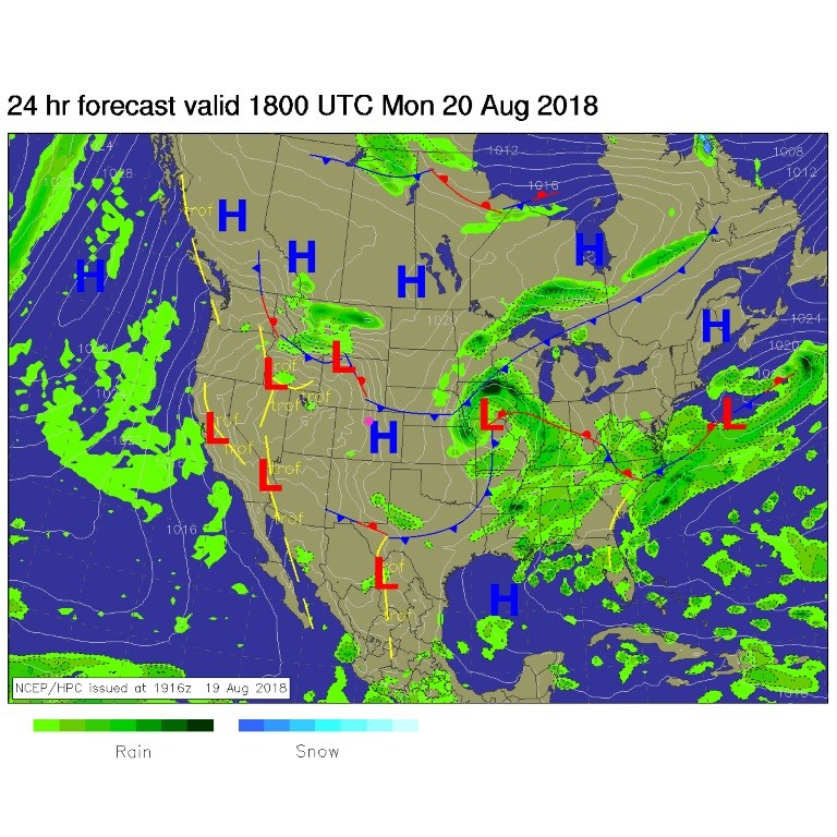
Quiet and cool dominate the beginning of the week. It will be SO nice for the next three day. Figure 1 shows the first cold front way down to Mexico and Texas with another shot of cool air coming in from the north today.
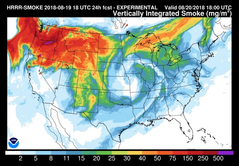
Figure 2 show that, unfortunately, smoke from the west is being brought down with this northern fetch of air. Yuck.
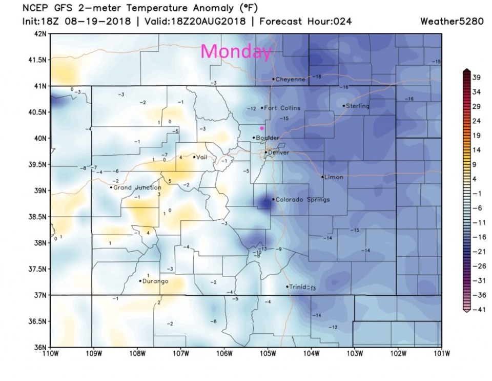
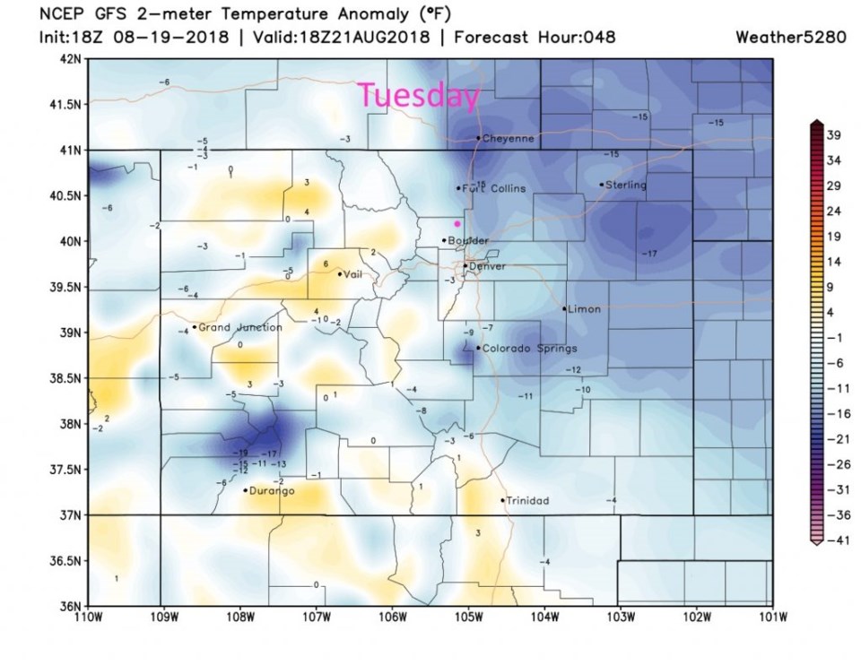
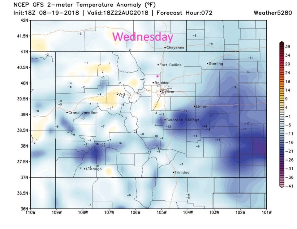
Again, the headlines is cold front after cold front... Figure 3 is the temperature anomaly (how far below (blue) or above (yellow) normal the surface temperatures will be) for Monday. Figure 4 is the Tuesday map and Figure 5 is the Wednesday map. It will be nice and refreshing out there.
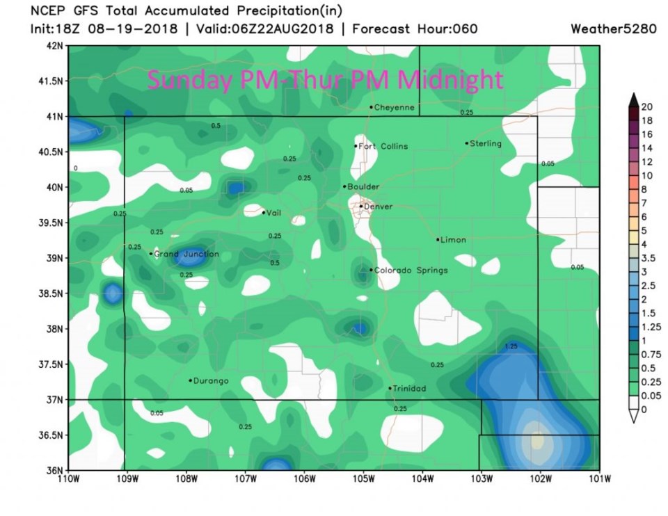
Showers may travel off the mountains at times (primary in the afternoons) but up to the midnight going into Wednesday, Longmont may only see up to 1/4th of an inch. That's not much water.
The longer range forecast:
The ridge comes back at the end the week and we climb to nearly 90F each day. We remain quite dry into next weekend. Not much more I can say about that!


