This content was originally published by the Longmont Observer and is licensed under a Creative Commons license.
Forecast Discussion:
The forecast is on track. Small cool fronts will cool us down over the weekend and give us a chance of (slightly severe) thunderstorm-type weather. Today, we will warm to almost 90F before the next upper level trough sends a wind shift back over the state (Figure 1). As shown in this figure, there will be more storms over southern Colorado and the mountains than us today. (But a wandering storm is NOT out of the question.)
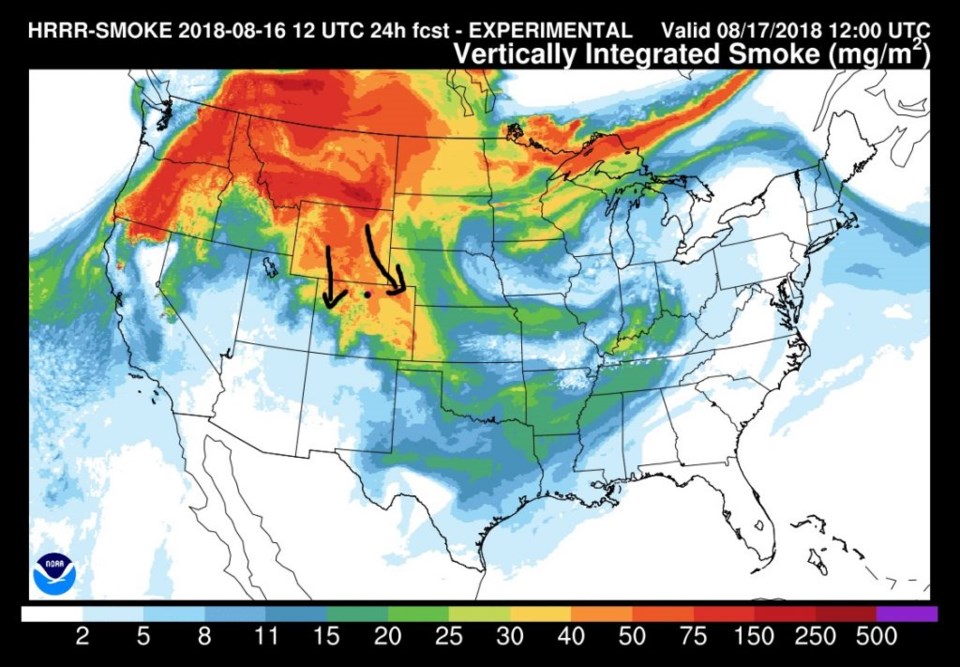
A LOT of smoke is now pouring into the state. You might not see the thunderstorms that form except that the skies get dark-ish in the northwest (Figure 2).
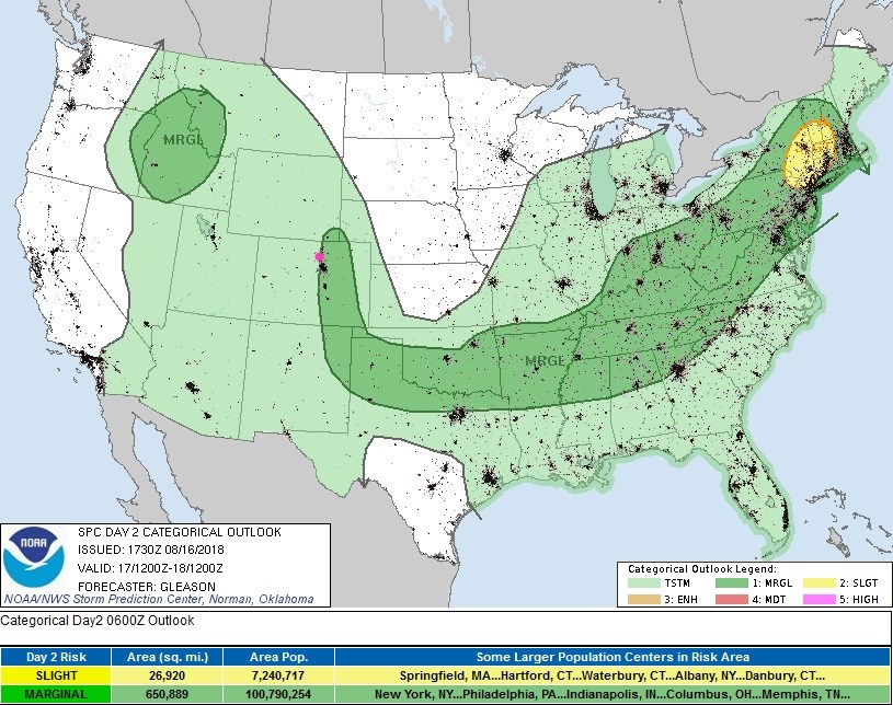
For the storms that do form around Longmont, they could be marginally severe - with hail and heavy, locally flooding rains possible (due to slow storm movement) - Figure 3.
The longer range forecast:
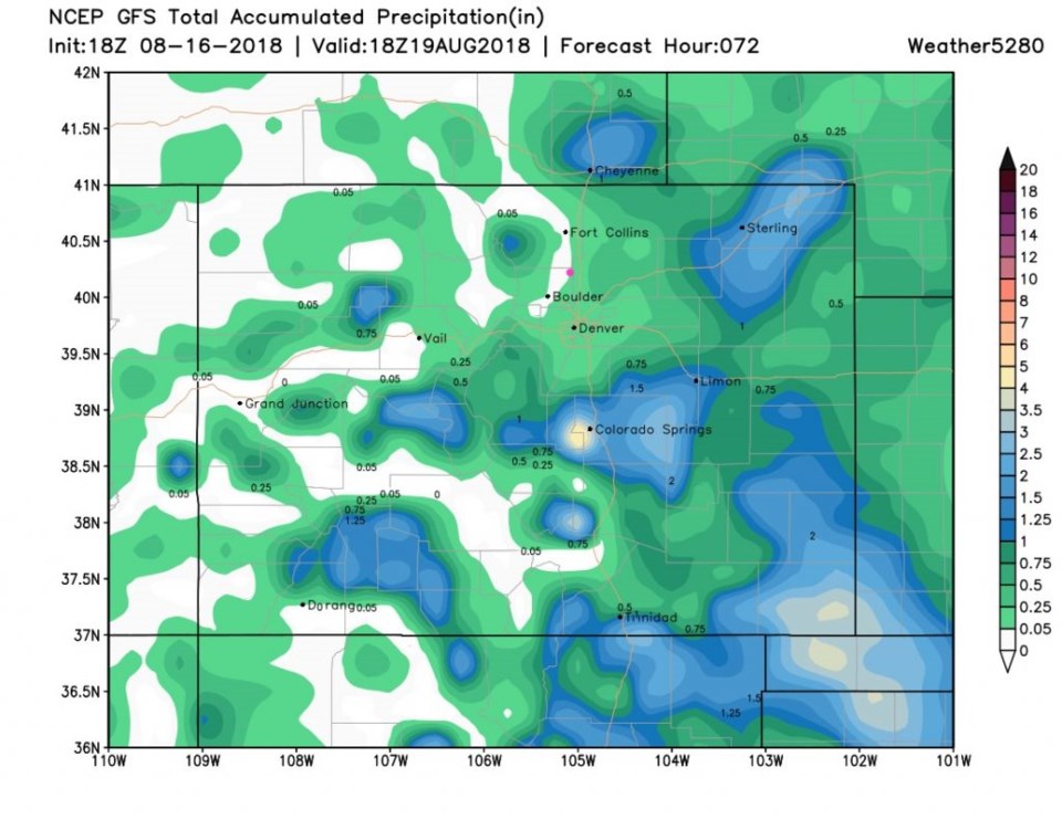
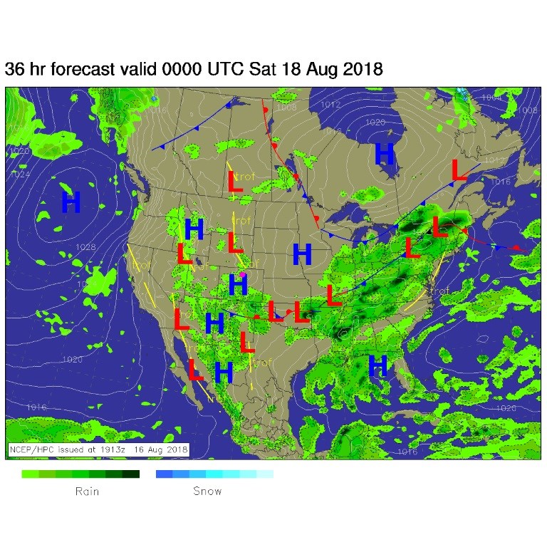
For tomorrow (Saturday) we'll get a good cool down from a front and an approaching upper level trough. This will give us another round of afternoon storms that may become severe just on the other side of I-25 (Figure 4). The next 3 days of accumulated precipitation look really spotty (Figure 5) with some spots getting 1 to 3 inches while the rest of the state pulls only a trace to a quarter inch or so. Remember, this is not a direct indication of who will get the big rains, just an idea of what parts of the state will see the heaver storms close together and what parts will see them spread further apart. More cool air will drop temperatures to the 70'sF for a high on Sunday. That will feel nice!