Skip to content

The Next Storm/Next Snow Forecast Discussion from the Cherrywood Observatory – August 15th, 2018

This content was originally published by the Longmont Observer and is licensed under a Creative Commons license.

Forecast Discussion:

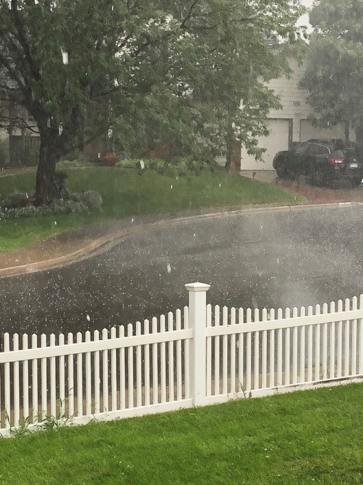
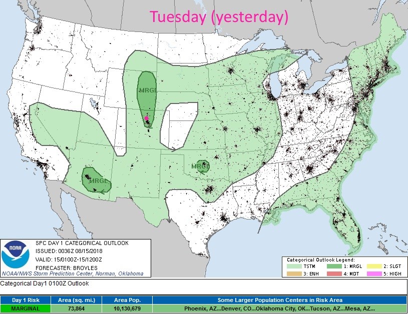
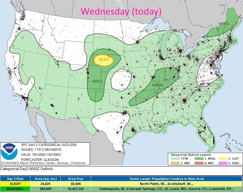
The moisture and upper level support returned. We had, quite suddenly, a storm on Tuesday. I took this picture in front of the Cherrywood Observatory Tuesday afternoon (Figure 1). At the last second, the SPC drew a marginal risk down the I-25 corridor as these storms began to form. (A bit late in my opinion - Figure 2). My rain gauge is showing somewhere over 3/4th of an inch of rain (and some hail melt). The hail at my house ranged from pea to dime sized.

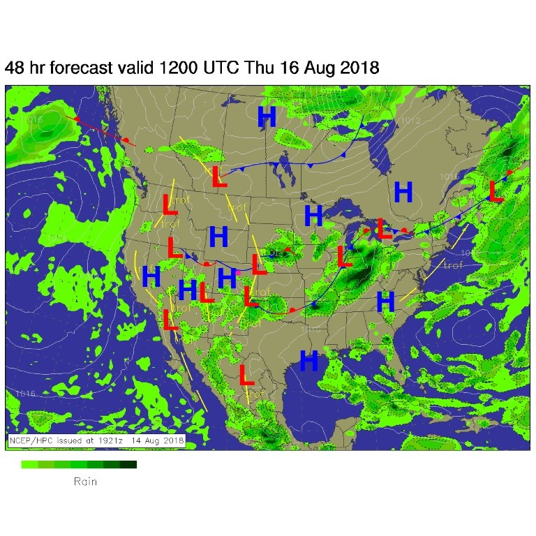
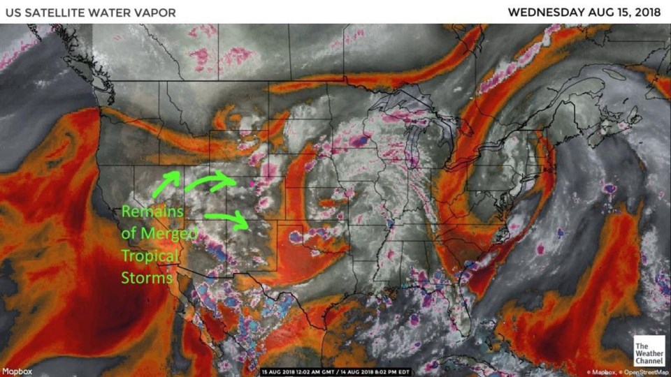
For today, a cool front sags down into northern Colorado (maybe making it to Longmont Figure 3) and a good amount of moisture is still in place for storms (Figure 4) as tropical left-overs from tropical system John et al. flow into the southwestern U.S.

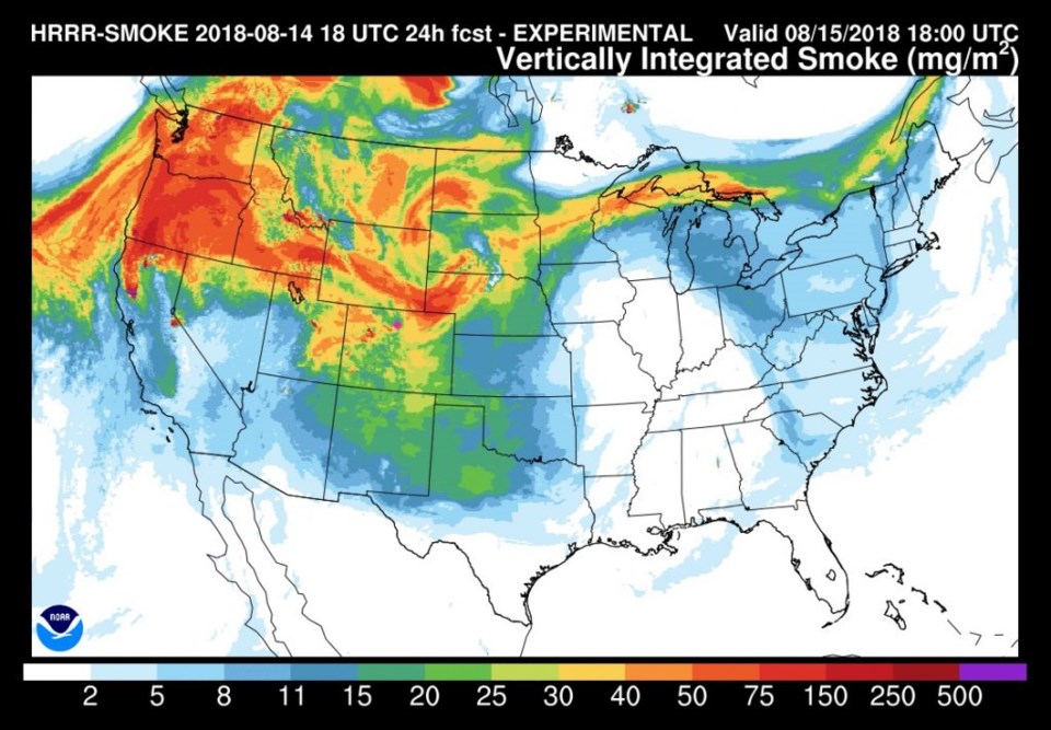
This upper-air flow is still bringing in a lot of western fires and local fire smoke (Figure 5).  With moisture, clouds, and smoke, the sky will be murky today.

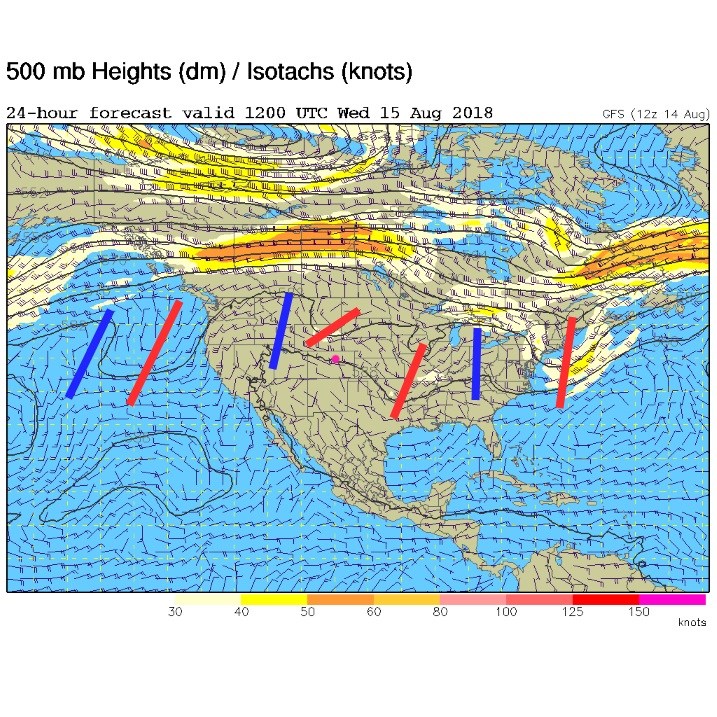
The upper-level forecast for today shows another upper-level wave approaching as the big western ridge collapses and shrinks south (Figure 6). All that will come together for another round of severe weather today along I-25 (primarily hail and high winds - Figure 7).

Figure 1: Storm image rain and hail in front of the Cherrywood Observatory - (c) 2018 John Ensworth

Figure 2: the day 1 SPC thunderstorm and severe weather forecast made Tuesday (valid Tuesday).

Figure 3: The forecast surface map for Wednesday PM. From NCEP.

Figure 4: the water vapor satellite image from Tuesday PM. Reds/Oranges are dry air, greys/whites are moist air regions.

Figure 5: The HRRR (high resolution rapid refresh) model forecast of smoke at all levels for Wednesday noon.

Figure 6: The 500mb forecast upper air analysis for Wednesday AM. Pink dot is Longmont. Red lines are troughs, blue lines are ridges.

Figure 7: the day 2 SPC thunderstorm and severe weather forecast made Tuesday (valid Wednesday).

The longer range forecast:

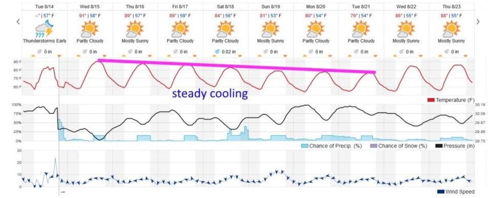
We keep getting shots of moisture through the beginning of next week (Figure 8) and the ridge keeps fading, so we have steady cooling to the 70's F by next Tuesday. This will be nice, even if it is smoky. More tomorrow!

Figure 8: the next 10 days of the graphical forecast for Longmont, CO from weatherunderground.com

Current Weather

Cloudy

Cloudy

69°F

UV Index
3 Moderate
Pressure
29.59 Steady
Visibility
8 miles
Dewpoint
32 °F
Humidity
25%
Wind
WNW 5.5 mph
Gust
11.2 mph
Wind Chill
69 °F

Hourly Forecast

Today
2 PM
69°F
Thunderstorms
Today
3 PM
70°F
Intermittent clouds
Today
4 PM
68°F
Intermittent clouds
Today
5 PM
66°F
Mostly cloudy
Today
6 PM
61°F
Thunderstorms
Today
7 PM
58°F
Thunderstorms
Today
8 PM
56°F
Cloudy
Today
9 PM
53°F
Cloudy
Today
10 PM
51°F
Thunderstorms
Today
11 PM
49°F
Thunderstorms
Tomorrow
12 AM
48°F
Cloudy
Tomorrow
1 AM
48°F
Cloudy

7 Day Forecast

Mostly cloudy w/ t-storms

Friday

70 °F

A shower in spots late this morning followed by a couple of thundershowers this afternoon; gusty winds and small hail can accompany any downpour


Thunderstorms

Friday Night

44 °F

Cloudy; a couple of showers and a thunderstorm this evening followed by periods of rain late; gusty winds and small hail can accompany any downpour


Rain

Saturday

47 °F

Chilly with periods of rain and a thunderstorm; travel in the foothills and mountains will be slippery due to snow


Rain and snow

Saturday Night

36 °F

Cloudy with rain, mixed with a little snow late; travel in the foothills and mountains will be slippery due to snow


Mostly cloudy

Sunday

61 °F

Mostly cloudy and warmer


Intermittent clouds

Sunday Night

36 °F

A thunderstorm in spots in the evening; otherwise, partly cloudy


Partly sunny

Monday

71 °F

Partly sunny, pleasant and warmer


Partly cloudy

Monday Night

45 °F

Partly cloudy


Mostly sunny

Tuesday

73 °F

Pleasant with sunshine and patchy clouds


Partly cloudy

Tuesday Night

43 °F

Partly cloudy


Sunrise and Sunset

Sunrise
6:06 AM
Sunset
7:51 PM

Based on AccuWeather data