Skip to content

The Next Storm/Next Snow Forecast Discussion from the Cherrywood Observatory – August 13th, 2018

This content was originally published by the Longmont Observer and is licensed under a Creative Commons license.

Forecast Discussion:

Extremely dry with no precipitation and warmer than normal. That is the weather forecast for today. Done.

But change is in the air. Literally.

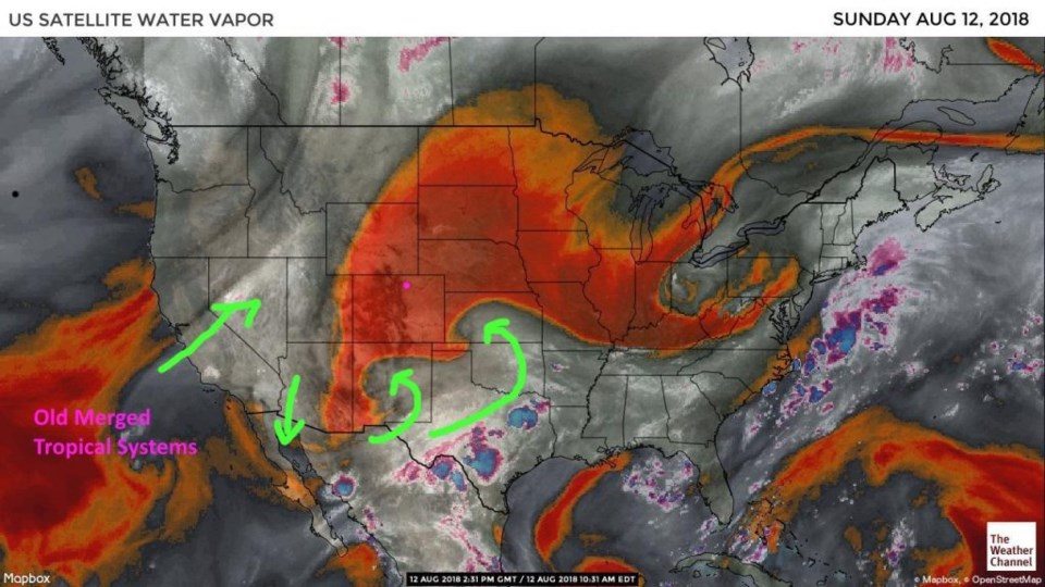
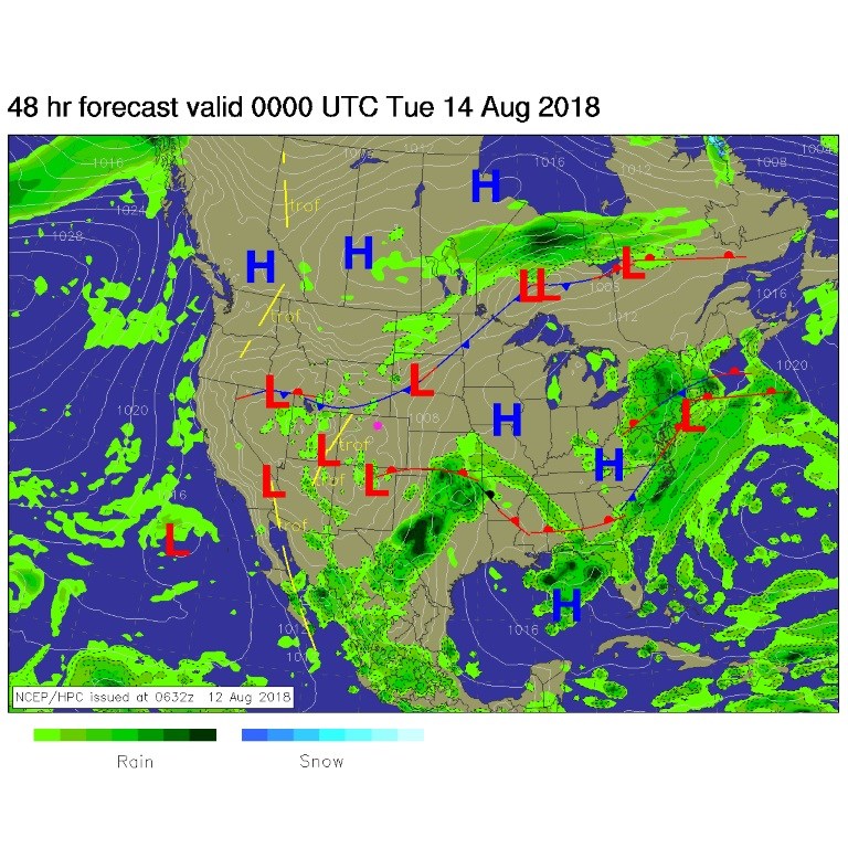
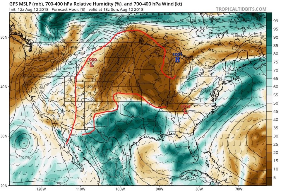
Figure 1 is the water vapor satellite image. There are surges of moisture coming up from the southeast and the moisture from the merged tropical systems last week getting pulled up into the western states. The surface map for this afternoon still has us high and dry, but there is a cold front up north and scattered showers in Arizona and Utah up to Wyoming (Figure 2).

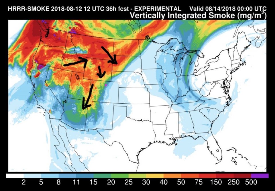
Some smoke leaked into northeast Colorado on Sunday - more is coming in today (Figure 3). It is thick again on the western slopes and will be very noticeable (white sky, limited visibility) around Longmont today.

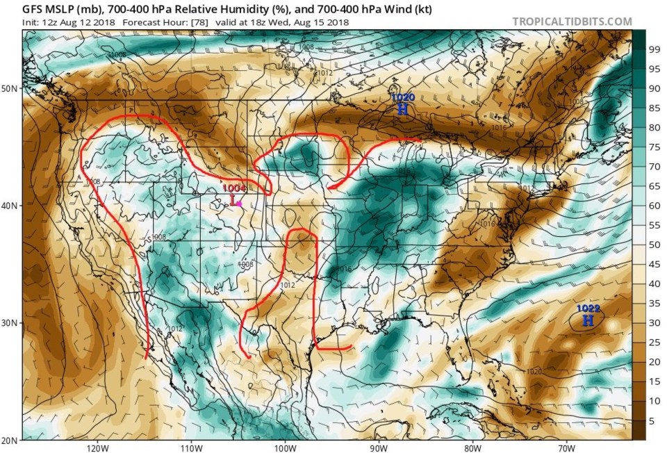
For the longer range forecast (down below) - let me introduce a new model output for this column. It is the upper air moisture (between roughly 700mb and 400mb) seen in Figure 4. I created a rough outline of the 'red and yellow' or dry areas in Figure 1 and overlaid it on this map. It is not a perfect match, but it is pretty good. The deepest reds in Figure 1 match the darkest browns in Figure 4). With that, let's go into the future!

Figure 1: the water vapor satellite image from Sunday PM. Reds/Oranges are dry air, greys/whites are moist air regions.

Figure 2: The forecast surface map for Monday PM. From NCEP.

Figure 2: The HRRR (high resolution rapid refresh) model forecast of smoke at all levels for Monday PM.

Figure 4: A model output from the GFS that quantifies and predicts moisture amounts in the upper atmosphere (details in the header). Red outline is medium browns (usually) corresponding to the outline of the dry air on the water vapor satellite. For Sunday midday from tropicaltidbits.com

The longer range forecast:

In Figure 5, I've tried to outline the same areas that would exist as the boundary between moist and dry in the water vapor satellite image of the future. This forecast map is for midday Wednesday. If this outline matches then, we are in much deeper moisture over all of Colorado. Storms and rainfall will increase after Tuesday. You can also see the winds aloft (the little black arrows). One long barb on the arrow means the wind speeds will be 10 knots (close to 10mph). Storms that do start to dump rain will move very slowly later in the week. Locally flooding rains will occur in spots.

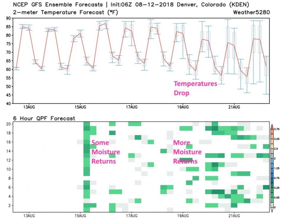
Figure 6 is the 10 day forecast. We get good rain chances on Wednesday, but not enough moisture to really affect the temperatures yet. The deeper surge of moisture (and another cold front) moves in at the end of this week. Rain chances increase again and temperatures noticeably drop 10° to 15° F over this last week's temperatures. A good taste of late summer approaching? We'll see...

Figure 5: A model output from the GFS that quantifies and predicts moisture amounts in the upper atmosphere (details in the header). Red outline is medium browns (usually) corresponding to the outline of the dry air on the water vapor satellite. For Wednesday AMfrom tropicaltidbits.com

Figure 6: the GFS temperature and ensemble precipitation meteogram forecast for the next 10 days from tropicaltidbits.com

Current Weather

Cloudy

Cloudy

41°F

UV Index
0 Low
Pressure
30.19 Rising
Visibility
8 miles
Dewpoint
32 °F
Humidity
71%
Wind
NE 4.9 mph
Gust
9.2 mph
Wind Chill
38 °F

Hourly Forecast

Today
1 AM
40°F
Showers
Today
2 AM
39°F
Rain and snow
Today
3 AM
39°F
Cloudy
Today
4 AM
38°F
Cloudy
Today
5 AM
38°F
Cloudy
Today
6 AM
37°F
Cloudy
Today
7 AM
37°F
Cloudy
Today
8 AM
37°F
Cloudy
Today
9 AM
38°F
Flurries
Today
10 AM
39°F
Flurries
Today
11 AM
40°F
Flurries
Today
12 PM
40°F
Cloudy

7 Day Forecast

Intermittent clouds

Wednesday

74 °F

Times of clouds and sun


Rain and snow

Wednesday Night

37 °F

Cloudy; a couple of brief showers late this evening followed by a rain or snow shower in spots late


Rain and snow

Thursday

47 °F

Cloudy and chilly with a couple of showers of rain or snow


Mostly cloudy

Thursday Night

34 °F

Mostly cloudy


Mostly cloudy w/ showers

Friday

52 °F

Breezy in the morning; otherwise, cool with some sun, then turning cloudy with a little rain in the afternoon


Rain and snow

Friday Night

32 °F

Snow at times, accumulating an inch or two; rain mixed in early


Flurries

Saturday

49 °F

A bit of morning snow with little or no accumulation; otherwise, cloudy and chilly; storm total snowfall an inch or two


Intermittent clouds

Saturday Night

31 °F

Partly cloudy


Partly sunny

Sunday

72 °F

Partly sunny and warmer


Partly cloudy

Sunday Night

44 °F

Partly cloudy


Sunrise and Sunset

Sunrise
6:18 AM
Sunset
7:42 PM

Based on AccuWeather data