Skip to content

The Next Storm/Next Snow Forecast Discussion from the Cherrywood Observatory - April 6, 2018

This content was originally published by the Longmont Observer and is licensed under a Creative Commons license.

Forecast Discussion:

Buckle up.  This is not a big snow storm, but there is a lot to cover with it.

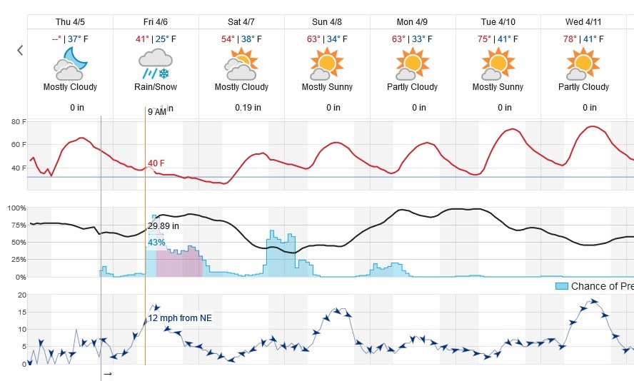
Figure 1 is the whole story at a glance. There were chances of showers now and then with the initial front starting about 8pm Thursday.  The next, stronger, frontal push pours down the Front Range mid-morning increasing the chance of rain, that quickly changes to snow around midday. Snow chances continue until midnight then precipitation tapers off.

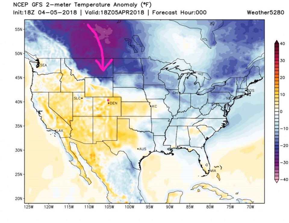
Figure 2 shows the cold air Thursday PM pouring out of Canada coming our way. By about sunrise Friday - temperatures are still above normal, but the leading edge of the really cold air is visible in Wyoming and Nebraska and a bit into Kansas (Figure 3).

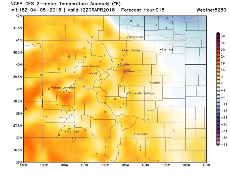
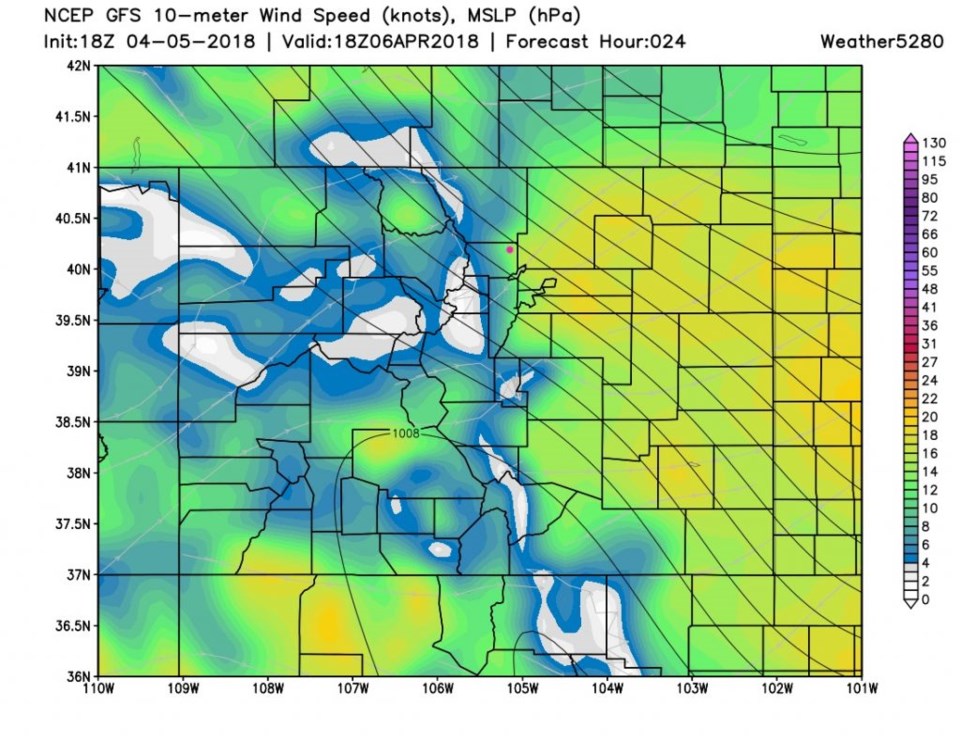
Six hours later, Figure 4, the cold air has made it all the way back through Boulder County and is filtering down into Denver (noon).  Winds at this time are pretty stiff at 20mph with gusts to 30mph as seen in Figure 5.  Remember, the closer the isobars, the stronger the wind.

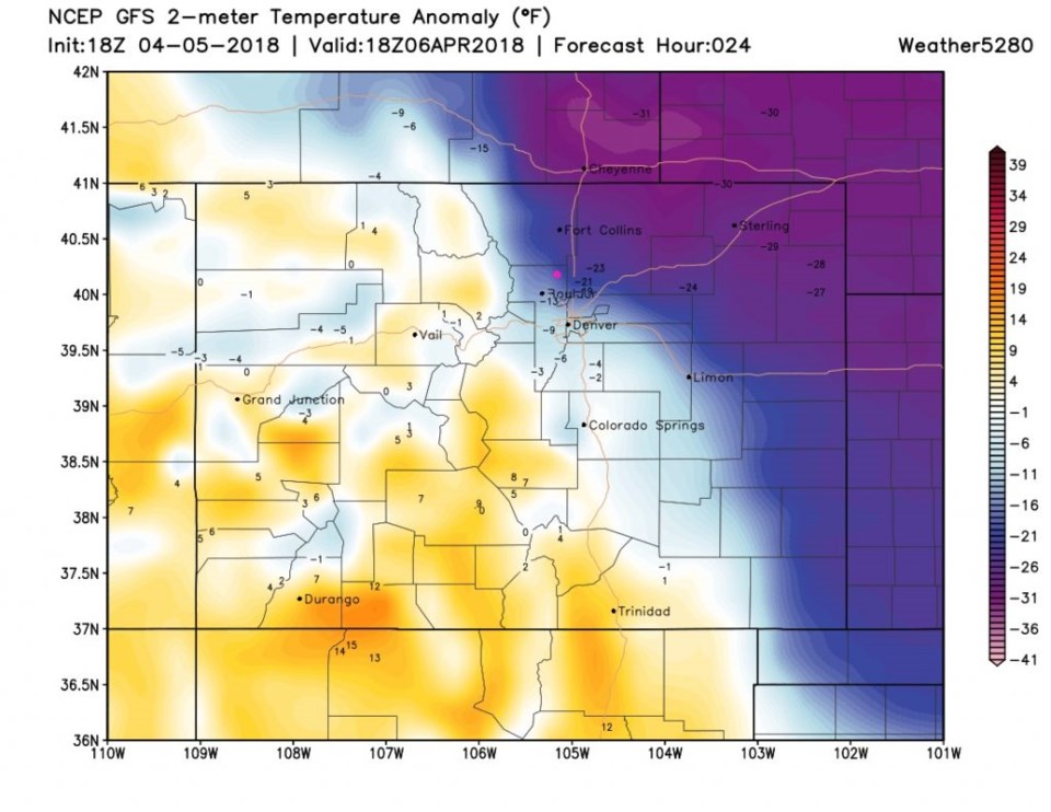
The coldest air is here around sunset (Figure 6). Temperatures on the plains go from 5-10 F above normal Thursday night to about 30 F below normal. Oh the cold.

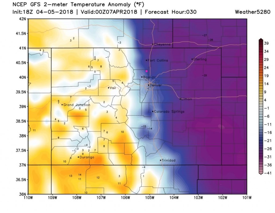
As quickly as it comes, it retreats to the east.  By Saturday morning (Figure 7) we are returning to normal and the extreme cold on the plains is fading out.

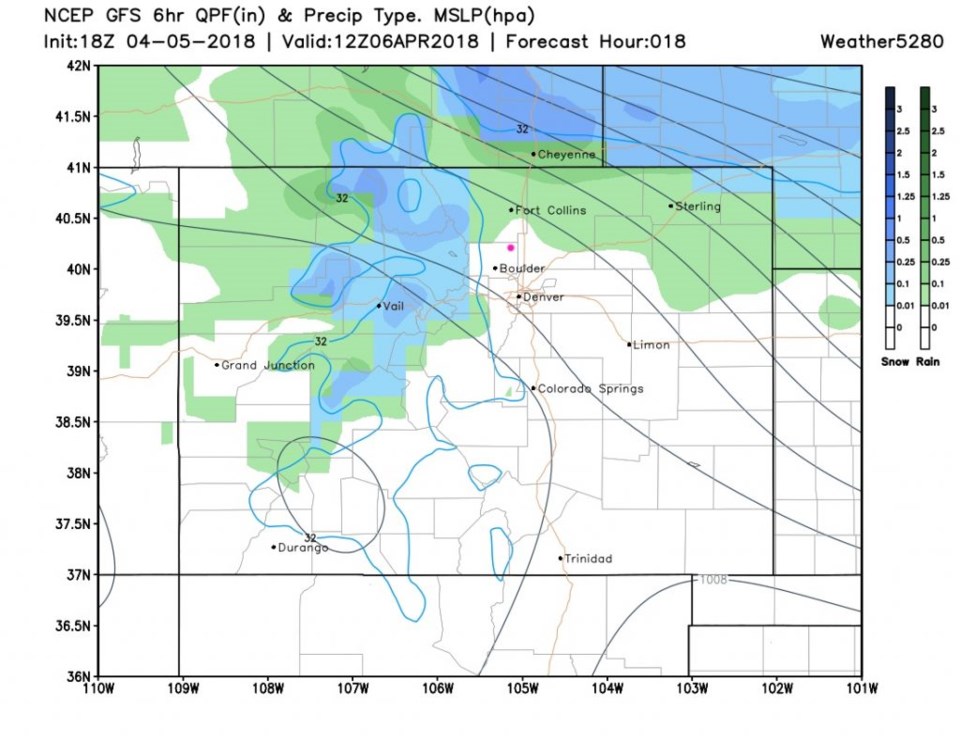
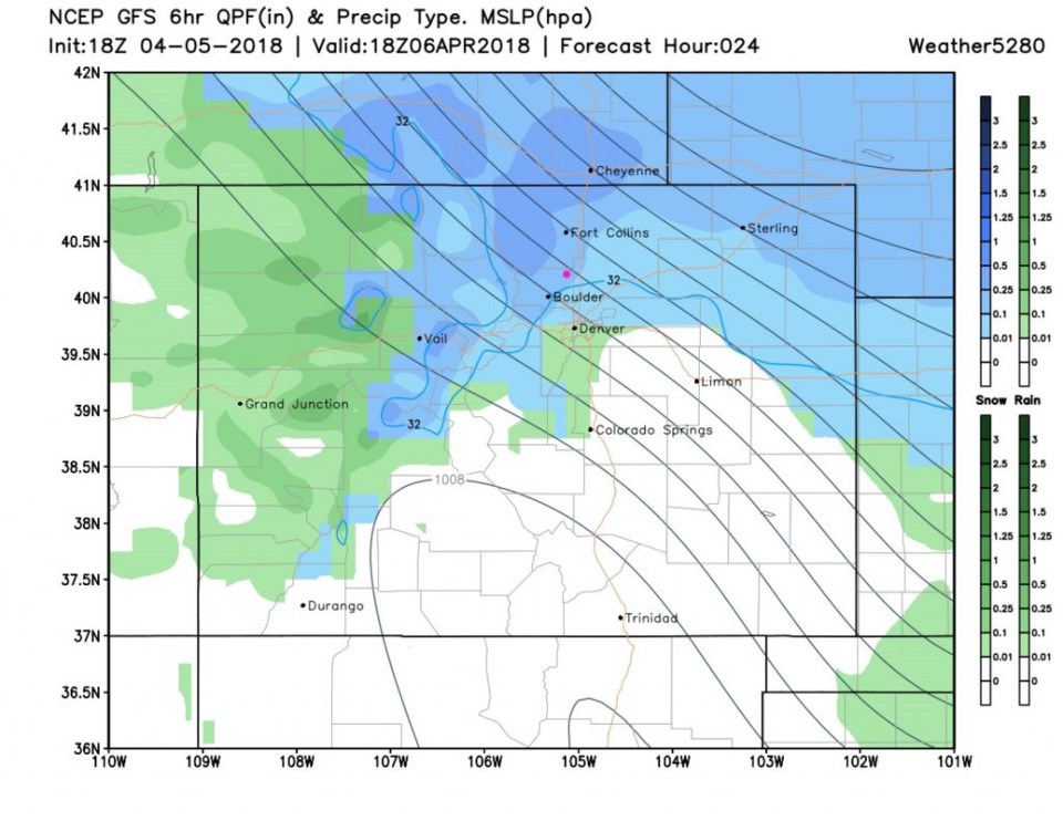
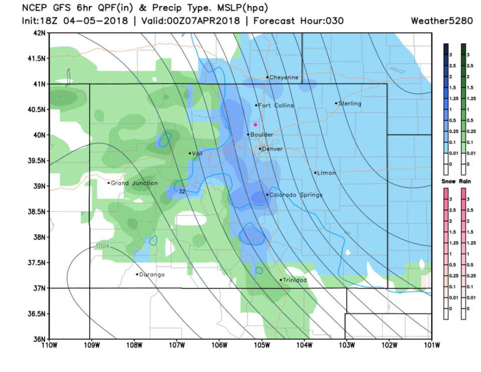
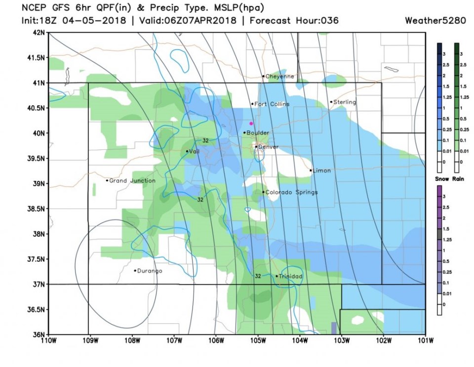
Lets now turn to the precipitation.  Though showers may occur all night Thursday into Friday AM - the real precipitation is impacting the mountains and coming down from Wyoming by sunrise today (Figure 8). By noon (Figure 9) fairly heavy snow is falling north of Denver. For the evening drive and the Rockies game (Figure 10) snow is falling from Wyoming almost to New Mexico.  It looks bad for driving and for sports. The storm is moving out with the back edge of the snow just south of Ft. Collins by midnight Friday into Saturday (Figure 11).

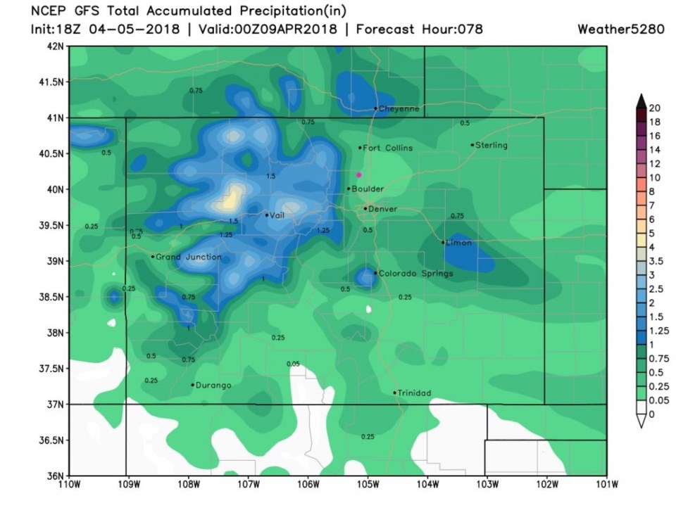
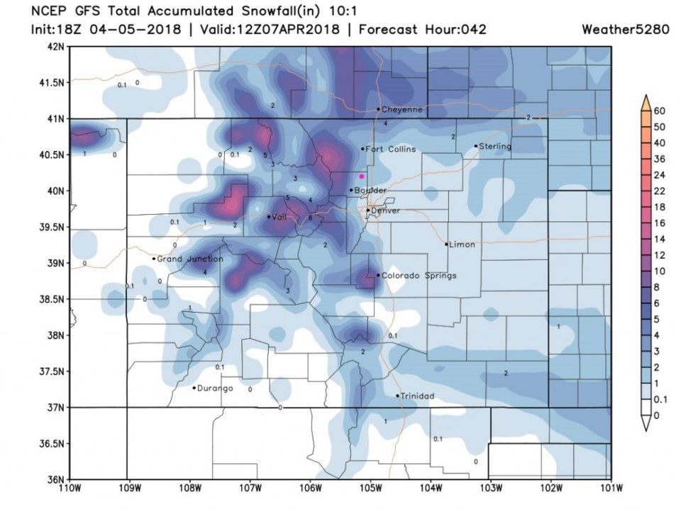
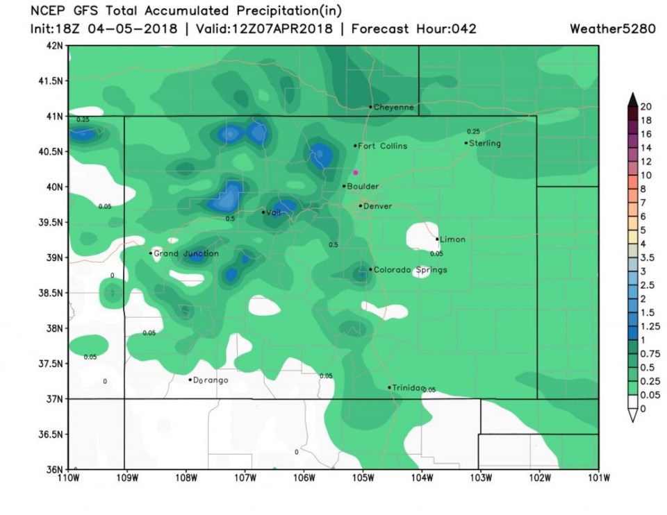
For totals: The GFS in Figure 12 shows Longmont in the 1-3 inch area. Ft. Collins in the 2-4" area. Estes Park 3-6".  Denver 1/2 to 2". Boulder 2-5".  The Palmer Divide communities will see 1-4". Initially warm, and wet, ground will limit snowfall totals initially.

For water total- Figure 13 gives us about 1/4th inch (locally 1/2 inch, especially west of town).

Figure 1: The first 5 days of the 10 day graphical forecast for Longmont from weatherunderground.com

Figure 2: The current temperature departure from normal from Thursday PM. The cold air up north is headed this way (purples/blues). From the GFS and weather5280.com.

Figure 3: The forecast temperature departure from normal for Friday AM. From the GFS and weather5280.com.

Figure 4: The forecast temperature departure from normal for Friday midday. From the GFS and weather5280.com.

Figure 5: The surface pressure contors (black lines) and wind speeds (color fields) for Friday midday. From the GFS and weather5280.com.

Figure 6: The forecast temperature departure from normal for Friday evening. From the GFS and weather5280.com.

Figure 7: The forecast temperature departure from normal for Saturday morning. From the GFS and weather5280.com.

Figure 8: Precipitation type and intensity for Friday morning. From the GFS and weather5280.com.

Figure 9: Precipitation type and intensity for Friday midday. From the GFS and weather5280.com.

Figure 10: Precipitation type and intensity for Friday evening. From the GFS and weather5280.com.

Figure 11: Precipitation type and intensity for Friday midnight/Saturday. From the GFS and weather5280.com.

Figure 12: Total snowfall between Thursday PM and Saturday AM from the GFS and weather5280.com

Figure 13: Total precipitation/water total between Thursday PM and Saturday AM from the GFS and weather5280.com

The longer range forecast:

Figure 1 shows another system coming in around 3pm Saturday with rain chances through Sunday pre-dawn.  Temperatures stay above freezing day and night.  Comparing figure 14 and 13 - the mountains pick up another 1/2+ invh of water while we get another couple of 10ths of an inch of water.  THEN by mid-week, we may see our first 80'sF. Wow, what a state!

Figure 14: Total precipitation/water total between Thursday PM and Sunday PM from the GFS and weather5280.com

Current Weather

Mostly clear

Mostly clear

58°F

UV Index
0 Low
Pressure
29.9 Rising
Visibility
7 miles
Dewpoint
41 °F
Humidity
54%
Wind
NNW 4 mph
Gust
7.6 mph
Wind Chill
58 °F

Hourly Forecast

Today
11 PM
55°F
Mostly cloudy
Tomorrow
12 AM
53°F
Intermittent clouds
Tomorrow
1 AM
51°F
Partly cloudy
Tomorrow
2 AM
49°F
Mostly clear
Tomorrow
3 AM
47°F
Mostly clear
Tomorrow
4 AM
45°F
Clear
Tomorrow
5 AM
43°F
Mostly clear
Tomorrow
6 AM
41°F
Mostly clear
Tomorrow
7 AM
45°F
Partly sunny
Tomorrow
8 AM
49°F
Partly sunny
Tomorrow
9 AM
55°F
Partly sunny
Tomorrow
10 AM
62°F
Intermittent clouds

7 Day Forecast

Mostly sunny

Wednesday

75 °F

Mostly sunny, pleasant and warmer


Partly cloudy

Wednesday Night

41 °F

Patchy clouds


Mostly cloudy w/ t-storms

Thursday

75 °F

Turning cloudy, warm; breezy, a thunderstorm around in the afternoon


Thunderstorms

Thursday Night

49 °F

A thunderstorm in spots in the evening; otherwise, considerable cloudiness


Thunderstorms

Friday

70 °F

Mostly cloudy with a couple of thundershowers


Thunderstorms

Friday Night

46 °F

Cloudy with a couple of thundershowers


Rain

Saturday

50 °F

Chilly with periods of rain


Rain and snow

Saturday Night

39 °F

Cloudy with rain, mixed with a little snow late


Mostly cloudy

Sunday

59 °F

Mostly cloudy with a stray thundershower in the afternoon


Partly cloudy

Sunday Night

36 °F

Partly cloudy


Sunrise and Sunset

Sunrise
6:08 AM
Sunset
7:49 PM

Based on AccuWeather data