Skip to content

The Next Storm/Next Snow Forecast Discussion from the Cherrywood Observatory – April 23, 2018

This content was originally published by the Longmont Observer and is licensed under a Creative Commons license.

Forecast Discussion:

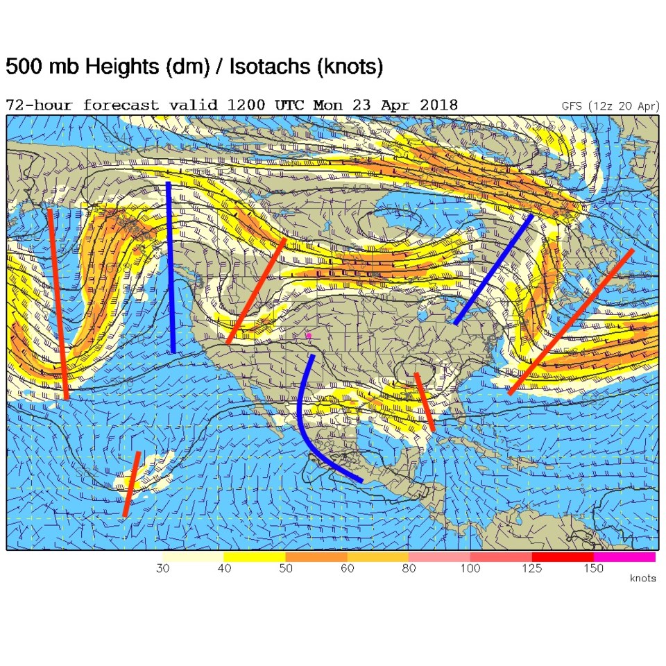
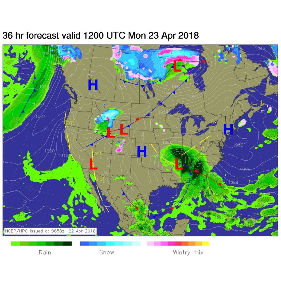
Today, a ridge is passing overhead and we have, generally, sinking air and beautiful temperatures. A trough is headed this way (it is over Nevada and Montana earlier today) and will push a cold front down over Colorado tonight.  You can see this front to the northwest of the state at sunrise today (Figure 2). By this evening/ 6pm - the front is passing south of Denver.  Expect our wind shift, temperature drop and chance of rain coming in after 4pm (figure 3).

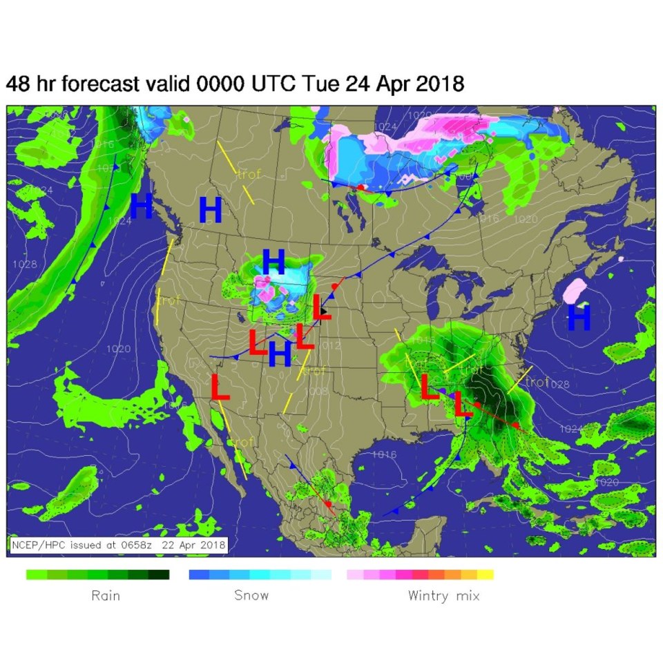
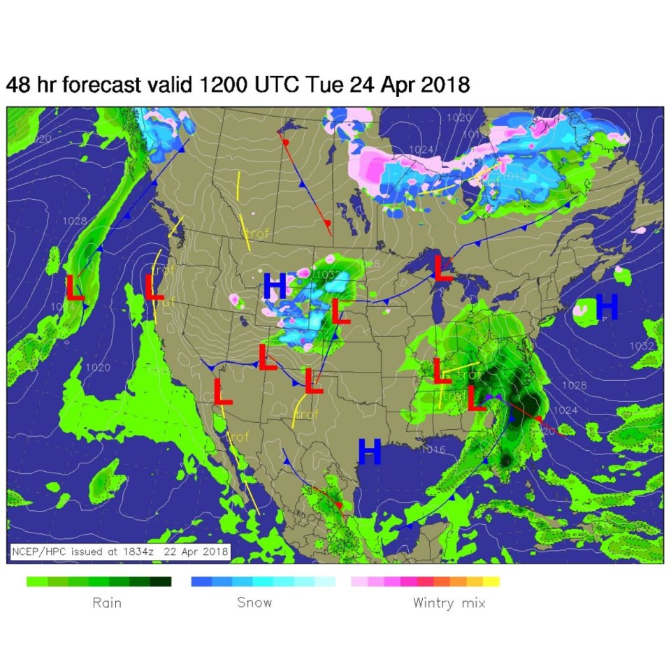
By midnight tonight (figure 4) the front has cleared south of Colorado, but rain and snow chances continue into the early morning Tuesday. Precipitation chances finally really drop off around 7 to 9am Tuesday.

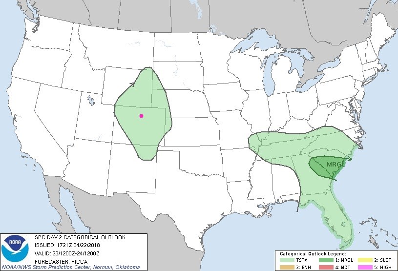
There is no chance of severe weather, but general thunderstorms are possible today, as the front passes, over most of Colorado (Figure 5).

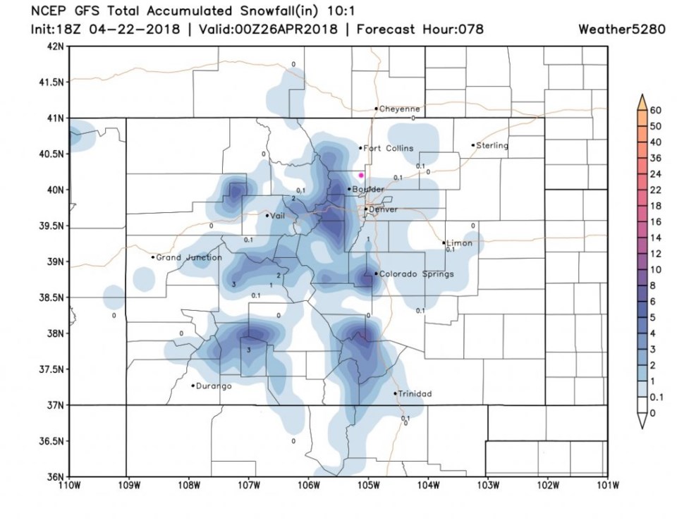
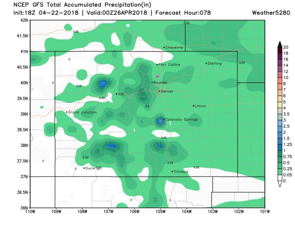
The GFS gives Longmont a minimal (to maybe a coating) of snow through this storm (Figure 6). For water, though, we seem to have under a 1/4th inch (Figure 7).

Figure 1: The 500mb forecast map for Monday 6am. Red lines are troughs, blue lines are ridges. Pink dot is Longmont in all images.

Figure 2: The forecast surface analysis map for Monday AM from NCEP.

Figure 3: The forecast surface analysis map for Monday PM from NCEP.

Figure 4: The forecast surface analysis map for Tuesday AM from NCEP.

Figure 5: the forecast thunderstorm outlook for the US from the SPC in Normal OK for Monday.

Figure 6: the forecast total snowfall for Colorado from the GFS and weather5280.com between Sunday PM and Thursday PM (just to capture everything) from weather5280.com

Figure 7: the forecast total precipitation for Colorado from the GFS and weather5280.com between Sunday PM and Thursday PM (just to capture everything) from weather5280.com

The longer range forecast:

Once this minor storm clears, we warm up to the upper 70'sF with just a chance of rain now and then in the near future.  Nothing to show graphically!

Current Weather

Sunny

Sunny

59°F

UV Index
8 Very High
Pressure
30.16 Falling
Visibility
7 miles
Dewpoint
28 °F
Humidity
30%
Wind
ESE 3.2 mph
Gust
6.9 mph
Wind Chill
59 °F

Hourly Forecast

Today
12 PM
59°F
Partly sunny
Today
1 PM
60°F
Intermittent clouds
Today
2 PM
61°F
Mostly cloudy
Today
3 PM
62°F
Cloudy
Today
4 PM
60°F
Showers
Today
5 PM
59°F
Cloudy
Today
6 PM
57°F
Cloudy
Today
7 PM
54°F
Cloudy
Today
8 PM
52°F
Intermittent clouds
Today
9 PM
50°F
Mostly cloudy w/ t-storms
Today
10 PM
47°F
Intermittent clouds
Today
11 PM
46°F
Intermittent clouds

7 Day Forecast

Mostly cloudy w/ showers

Tuesday

62 °F

Cooler with some sun, then turning cloudy; a couple of afternoon showers


Partly cloudy w/ t-storms

Tuesday Night

39 °F

An evening thundershower; otherwise, partly cloudy


Mostly sunny

Wednesday

76 °F

Pleasant and warmer with sunshine and patchy clouds


Partly cloudy

Wednesday Night

41 °F

Patchy clouds


Mostly cloudy

Thursday

75 °F

Turning cloudy, warm; breezy, a thunderstorm around in the afternoon


Cloudy

Thursday Night

48 °F

Considerable cloudiness


Showers

Friday

69 °F

Mostly cloudy with a couple of showers


Thunderstorms

Friday Night

46 °F

Cloudy; thundershowers in the evening followed by periods of rain late


Showers

Saturday

53 °F

Cloudy and cooler with a couple of showers


Showers

Saturday Night

39 °F

Cloudy with occasional rain and drizzle late


Sunrise and Sunset

Sunrise
6:10 AM
Sunset
7:48 PM

Based on AccuWeather data