This content was originally published by the Longmont Observer and is licensed under a Creative Commons license.
Forecast Discussion:
Extreme nice weather for today. Calm winds, sunshine, and temperatures near 70F. No need for a map on that... let's watch this next storm.
The longer range forecast:
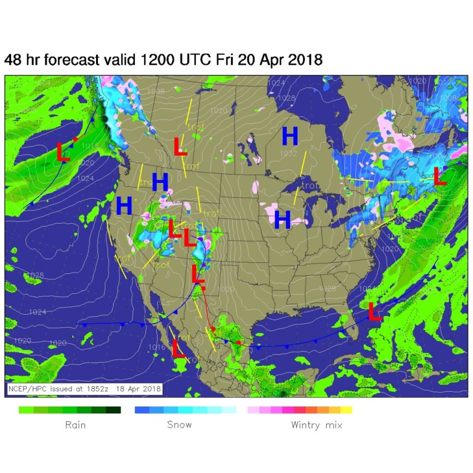
Figure 1 shows the low gathering itself in southern Utah with a front down into AZ. This is a touch further north, still, over previous forecasts. That means warmer mid-storm temperatures. Figure 2 shows one low up in NW Colorado and a secondary low down in New Mexico. We'll have a storm, but it won't be as wet or cold as it looked five days ago.
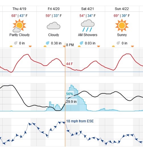
Figure 3 is the graphical forecast for Thursday through Sunday. Rain chances begin around 8am Friday but the more persistent rainfall doesn't start until after 6pm. Rain chances drop off late morning to around noon Saturday. You can see that temperatures don't drop below freezing during this storm, at all.
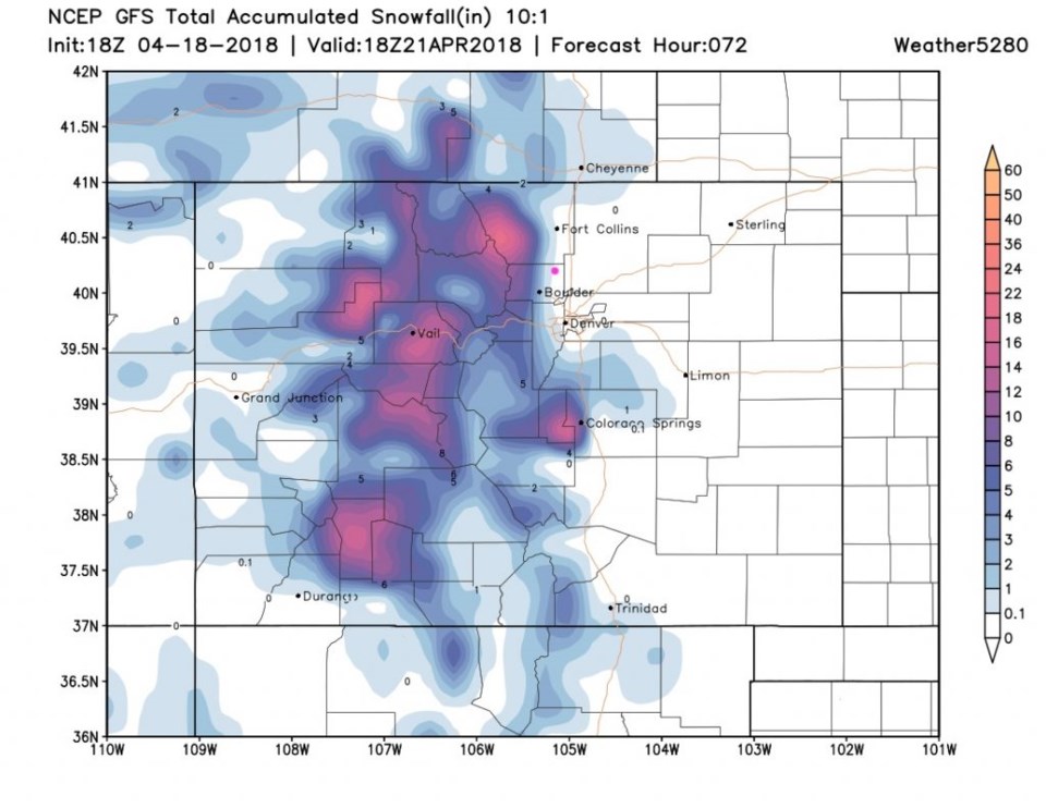
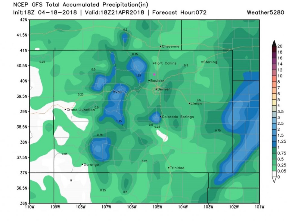
Figure 4 is the latest snowfall forecast. Longmont may see a coating on the west side, but most of town won't get any measurable snow according to this. Estes Park may still see 8-12 inches of snow though. For rainfall (Figure 5) we are up a bit over the forecast for yesterday at 0.25 to 0.5 inches of water.
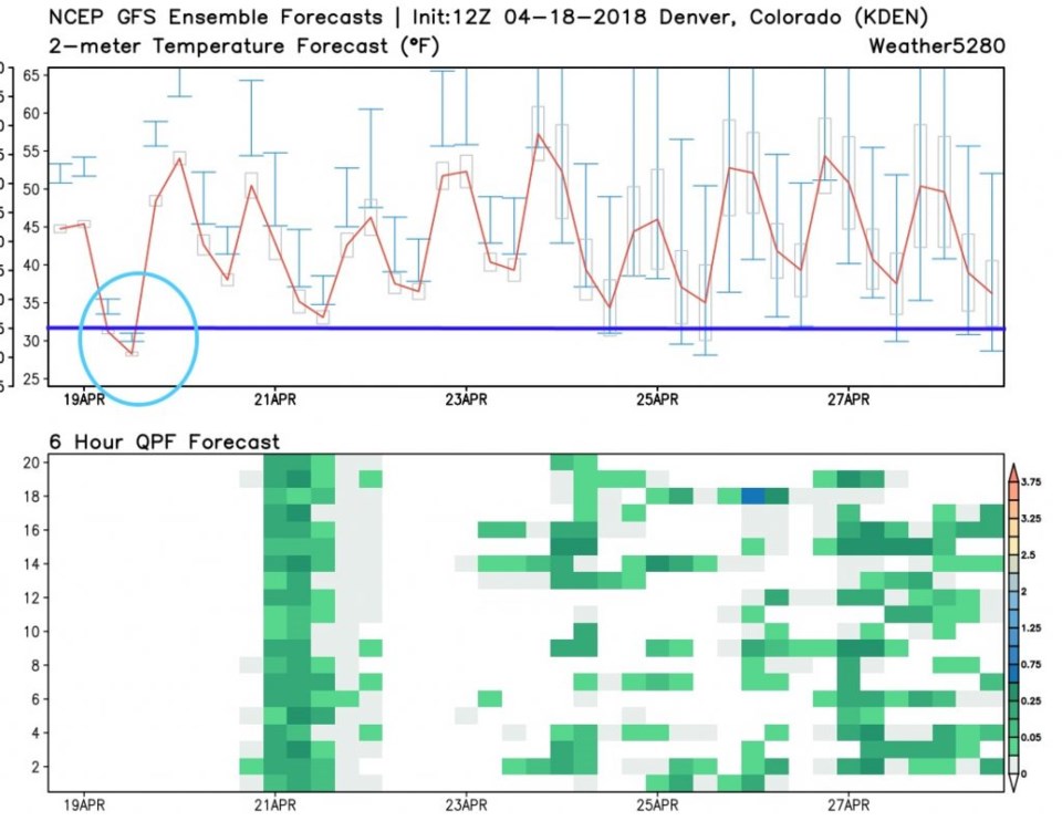
Looking further out, we remain above freezing for the next 10 days (except for this morning). All model runs in the ensemble put precipitation down for the Fri/Sat storm. Next week April 24-28 we see unsettled weather giving us chances of rain now and then. Fertilize your law today if your sprinklers are still off.