This content was originally published by the Longmont Observer and is licensed under a Creative Commons license.
Forecast Discussion:
Tuesday Update: the high wind watch has been upgraded to a high wind warning.
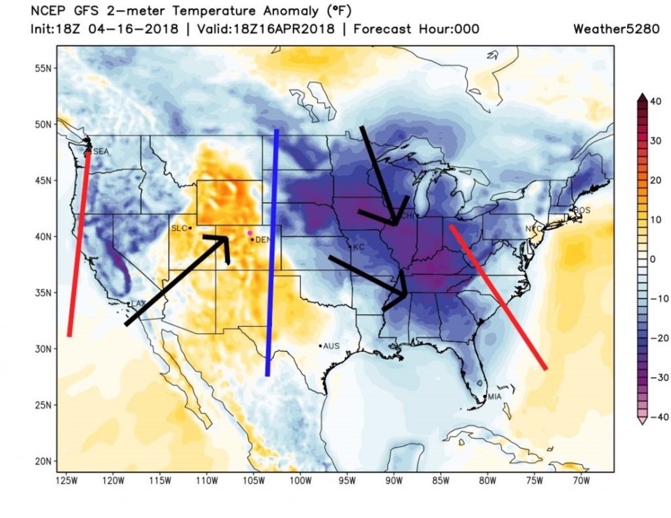
We have today's mini-storm and the weekend BIG storm to cover today, but first, there is a great illustration of surface temperature patterns and the 500mb pattern. Figure 1 is the 'current' surface temperature anomaly (departure from normal) showing big U-shapes of cold air coming down in the west and east and an upside-down-U shape of warm over us and off the east coast. The blue and red lines are the ridge and trough axes, respectively, that match the 500mb pattern in Figure 2. The black arrows show the overall air flow explaining what is moving this warm and cold air around. Pretty neat! (Note: the added lines are matched geographically, but the base maps are a slightly different scale.)
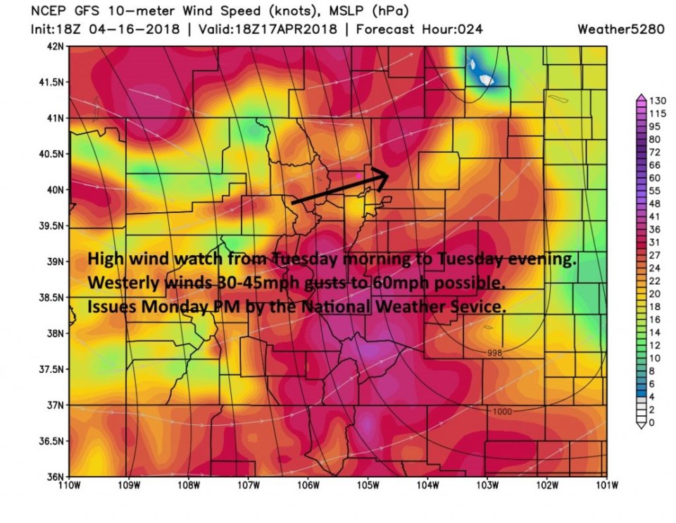
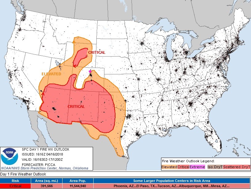
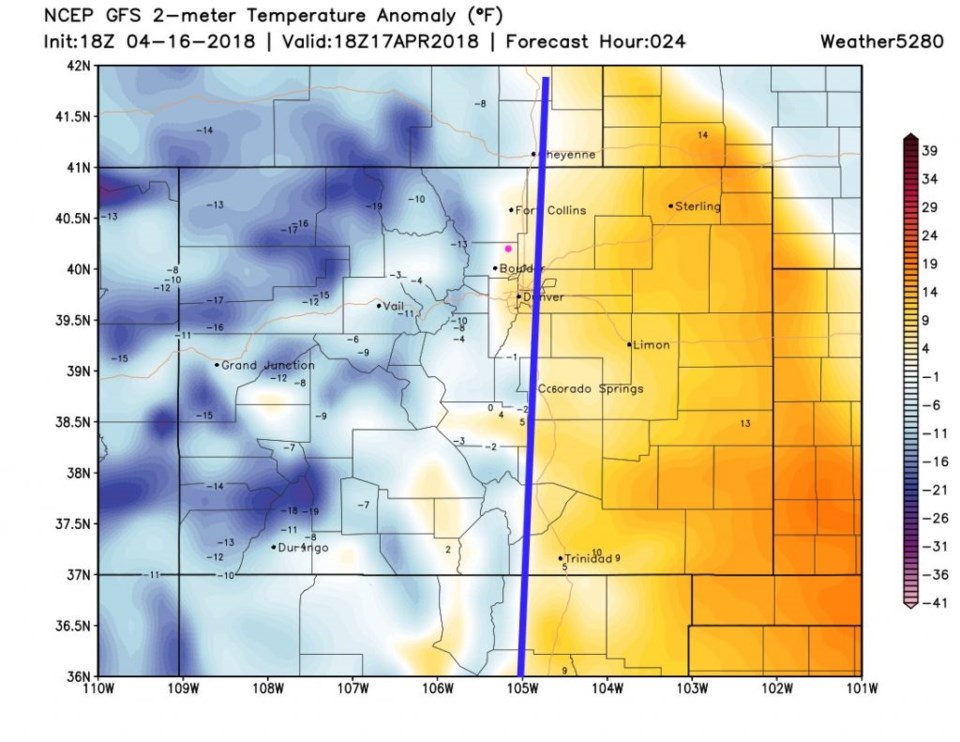
That colder air out over Nevada is moving east as the ridges and troughs move east today. That will create a trough of surface low pressure east of the Rockies and generate stiff and gusty winds today. The National Weather Service (NWS) has issued a high wind watch for Longmont all day today (Tuesday - Figure 3). The fire danger is elevated here tomorrow as well, but not critical (Figure 4).
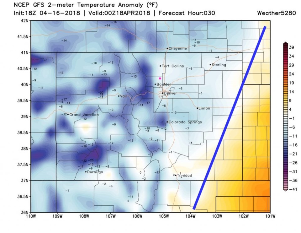
The cooler air is spilling out of the mountains behind my hand-drawn cold front by noon today (Figure 5). By 6pm (Figure 6) the front is about to clear Colorado as it heads into Kansas and Oklahoma. There will be a bit of snow in the mountains with this, but only a very small chance of a passing shower down along I-25. This is not a wet storm, at all.

The longer range forecast:
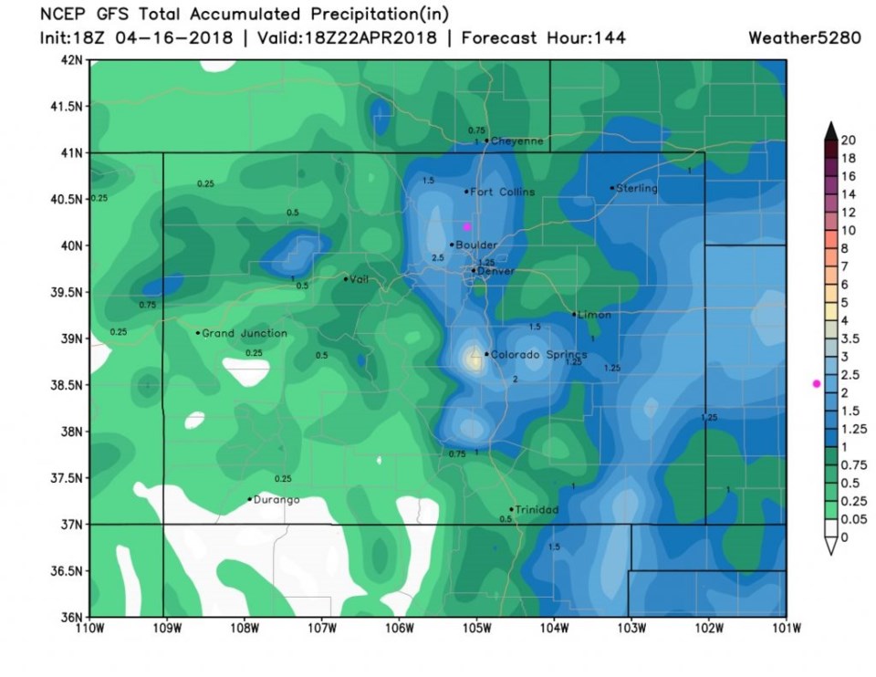
For now, the Friday/Saturday storm is on track to pump a maximum amount of water into Boulder and Larimer counties (and southward). This can still change a lot in the four days we have left before this storm, but, overall, the models have not varied much on how wet this storm will be. It could give us as much rainfall in a couple of days as we have seen over many many months.
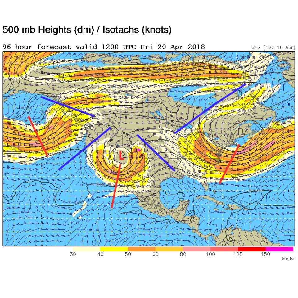
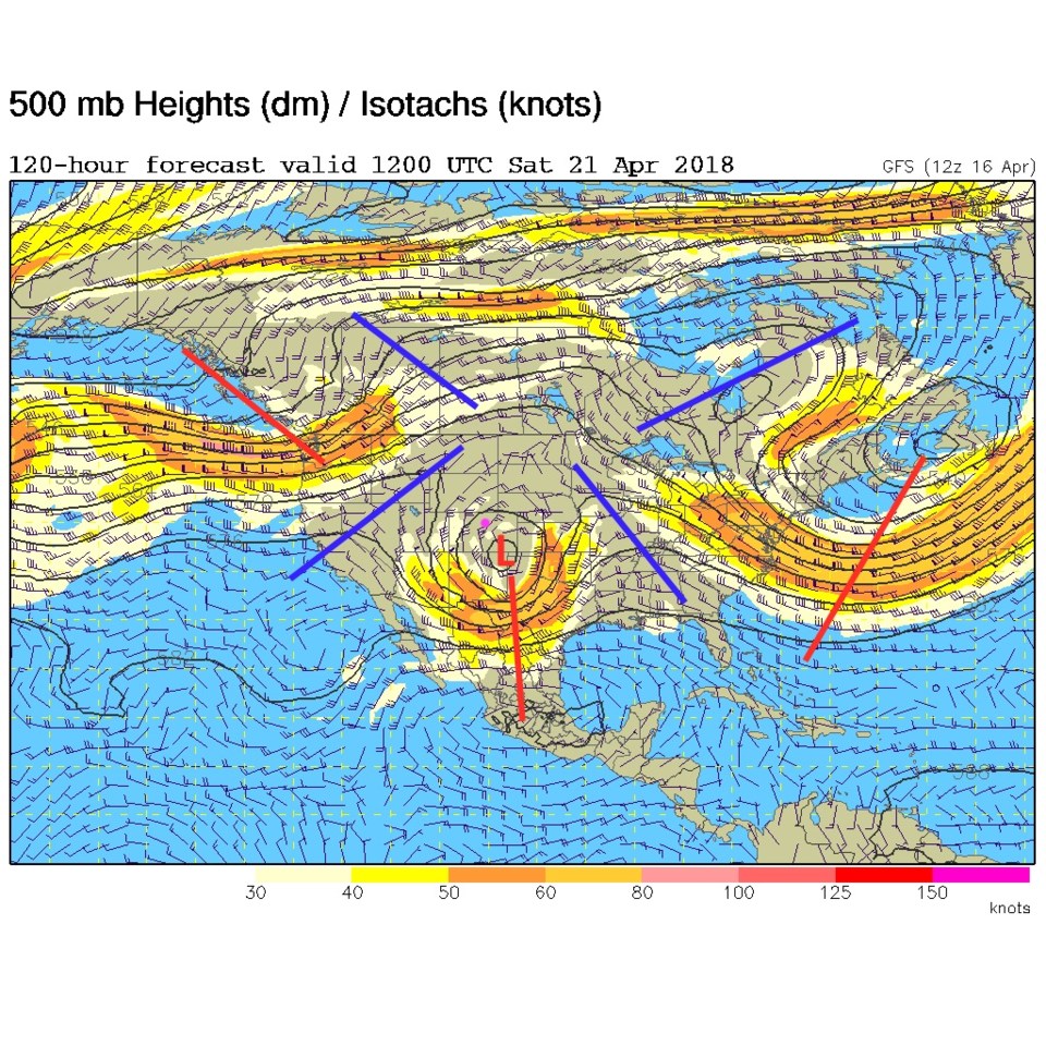
Figure 7 shows the upper level low heading right for the four corners area by Friday morning. For Saturday morning (Figure 8) the Low is moving into the SE corner of the state. That is a good/favorably, fairly slow, track for up slope rainfall around home.
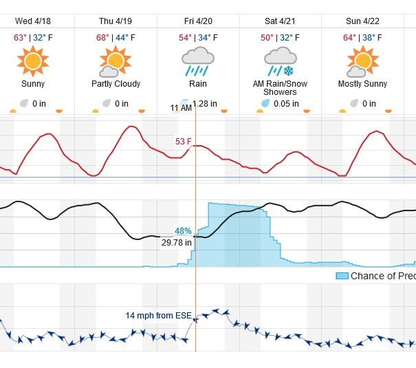
Figure 9 is a portion of the graphical forecast centered on this storm. Beforehand, we remain above freezing and approach 70F for a high on Thursday. Rain starts here mid to late morning Friday and "may" change to a rain/snow mix or snow Saturday morning for a while. Ground temperatures are warm and the low temperature really doesn't go below freezing during the storm either. The weatherunderground.com model is giving us about 1 and 1/3rd inches of rainfall. Wow!
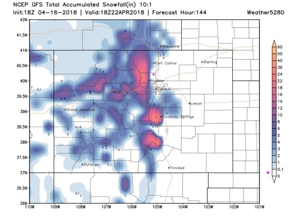
For snowfall through Sunday (post storm - Figure 10) - I-25 stays snow-free except down in western Denver and up in western Fort Collins. Boulder might see 2-5 inches of snow while Longmont won't probably see any accumulation. Places like Ward, CO and Estes Park, CO might see 8-12 inches of snow or more. That is quite a gradient in a very short distance/elevation change.
For water (Figure 11) the GFS paints an incredible 2 to 2.5 inches of water/rainfall/melt for us. Just west of Colorado Springs- this run puts 4 to 5 inches of water there. This seems overdone, but if true, there might be some runoff/flooding problems in some canyons in the mountains - especially if the snow melts quickly.
Nail your lawn chairs down today and we'll continue to watch this weekend storm tomorrow.