This content was originally published by the Longmont Observer and is licensed under a Creative Commons license.
Forecast Discussion:
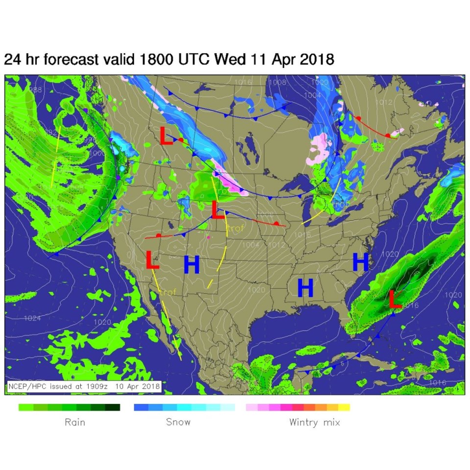
We are about to live in interesting times (meteorologically). Temperatures on Tuesday began to climb, and there were stiffer breezes. Not much changes today, except winds build as does the heat/warmth. The next big storm is visible crashing into the west coast (Figure 1). The record for DIA today is 80F which is not officially forecasted to be broken, but the weather service is speculating that the record is in danger.
The longer range forecast:
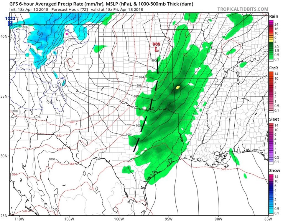
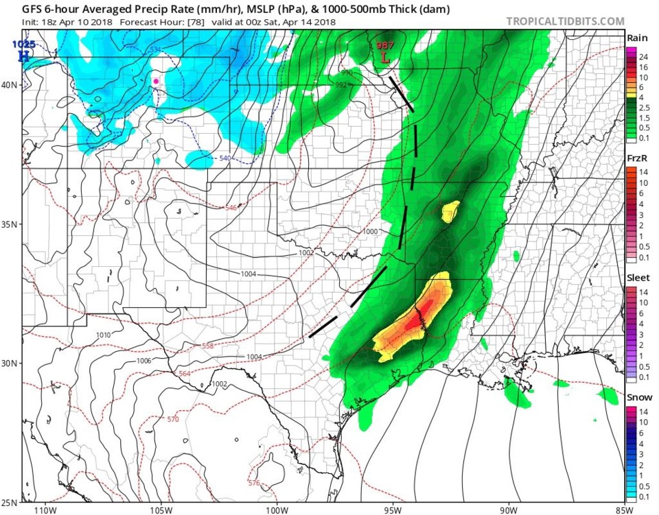
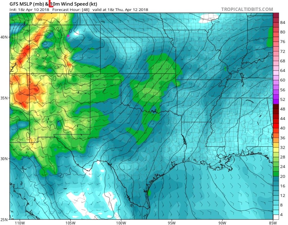
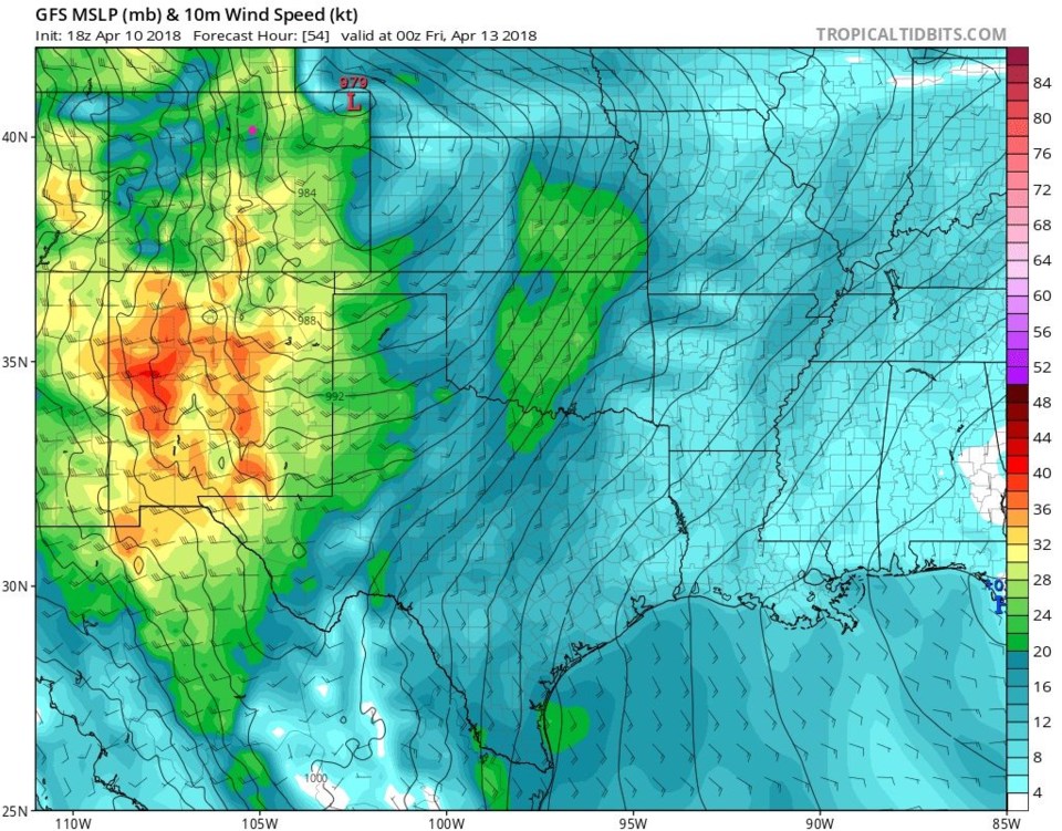
Figures 2-7 are a 6 hour, frame by frame of the upcoming weather situation. Figures 8-12 illustrate the serious fire danger we face for the next few days.
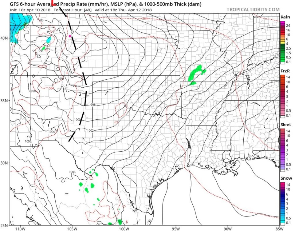
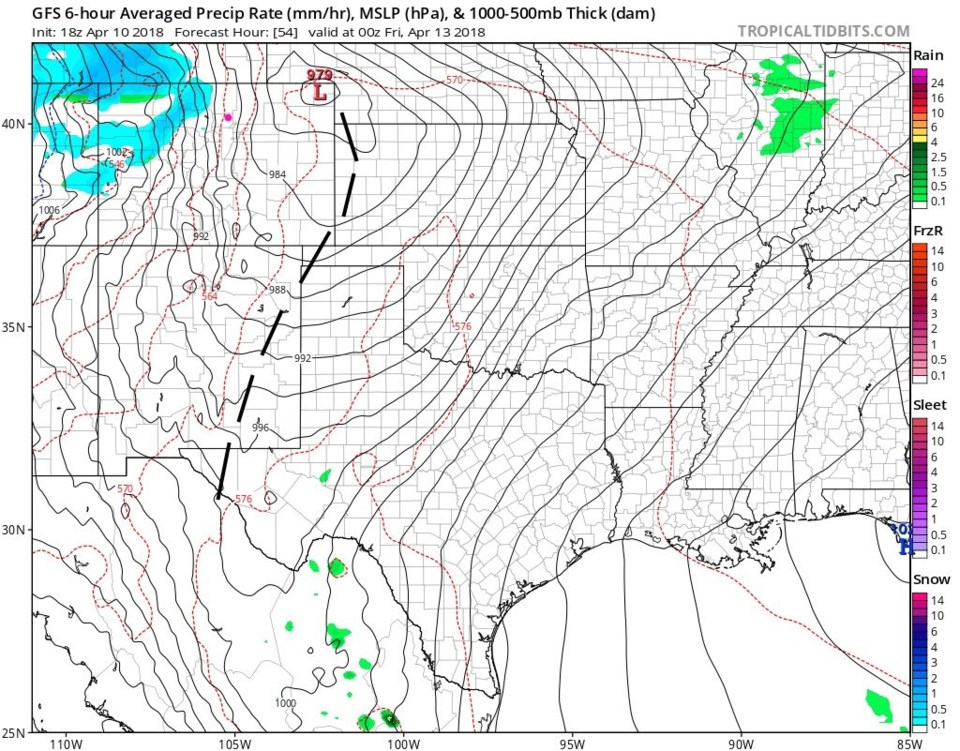
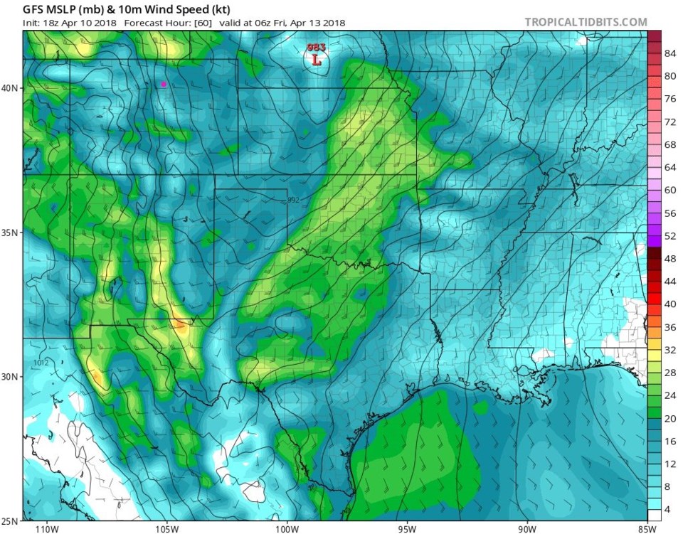
Figure 2 has the main low forming in Wyoming with a dry line like feature forming down the Front Range Thursday midday. To the west of a dry line, dry warm/hot air is usually moving eastward (in the daytime hours) displacing moist warm air to the east. This can be a focus of severe weather in the spring time on the Plains. By Thursday night (figure 3) the low has moved southeast into the northeast corner of our state. Snow is beginning in the mountains on the backside of the Low. The isobars are close (black lines) and winds are strong (see figure 9 too).
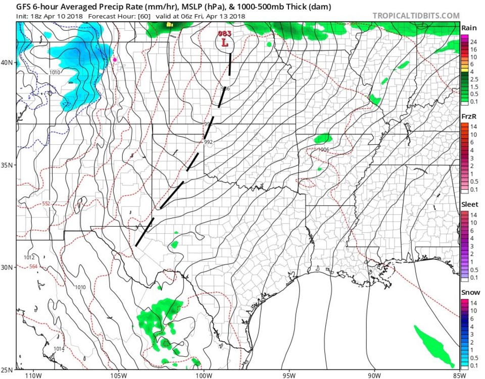
Figure 4, midnight Thur into Fri, the low has advanced with the dry line moving out into Nebraska to Kansas, Oklahoma and West Texas. Snow is still falling in the mountains.
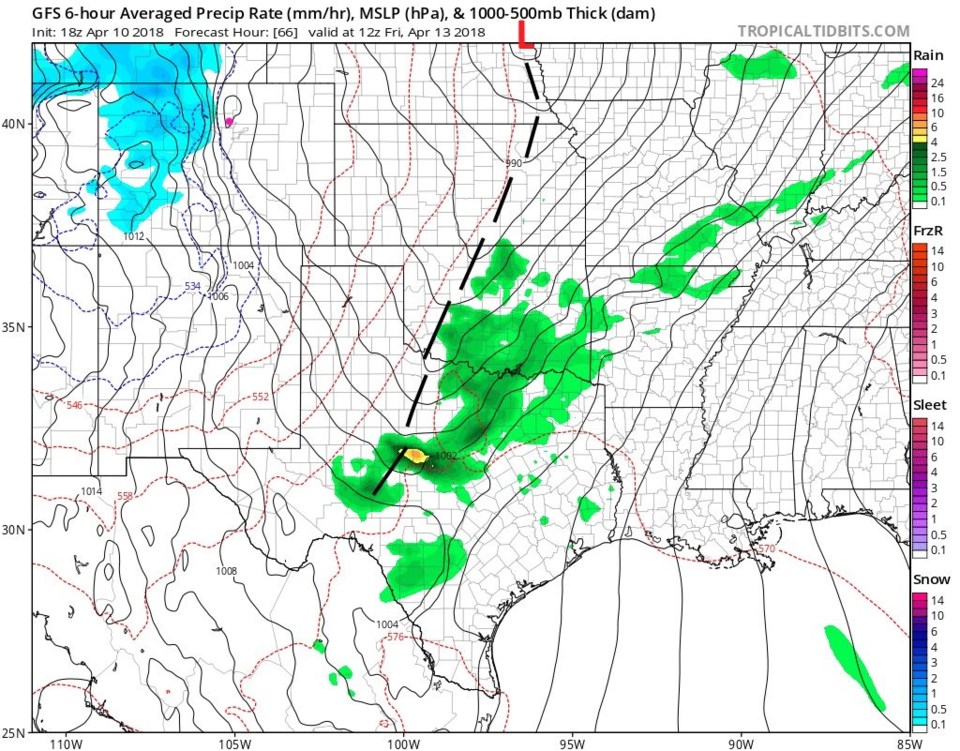
Figure 5, midday Friday, takes the low further east, drops more snow on the mountains, and thunderstorms are firing in Texas and Oklahoma. Figures 6 and 7 for Friday midday and evening, the snow spreads out onto the Colorado plains (but seems to skip us due to ongoing down slope winds). Severe weather is moving through eastern Oklahoma and Texas.
Figure 8 is the same surface map but now with winds on Thursday midday. Very strong winds (sustained 20-30mph; gusts to 40mph) are expected in Longmont and the mountains are being buffeted by winds up into the sustained 40mph area (gusts beyond 50mph?!).
Figure 9 are the winds Thursday evening... the stronger winds have spread out onto the Plains. Figure 10, midnight Thur/Fri, the stronger winds diminish as the low pulls eastward.
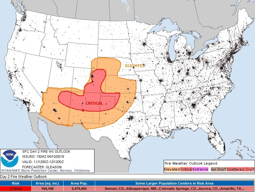
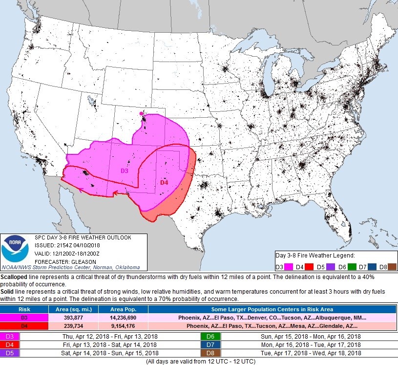
Figure 11 shows the resultant elevated and critical fire danger for Wed/Thur. High temperatures for this time of year, strong winds, low humidities (behind the dry line), and already dry fuel will make things dangerous. Figure 11 is the next day (Thur/Fri) in pink. The extreme fire conditions almost reach Longmont then too.
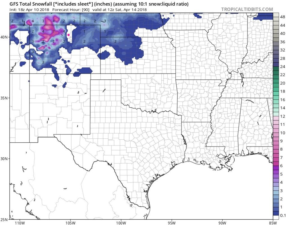
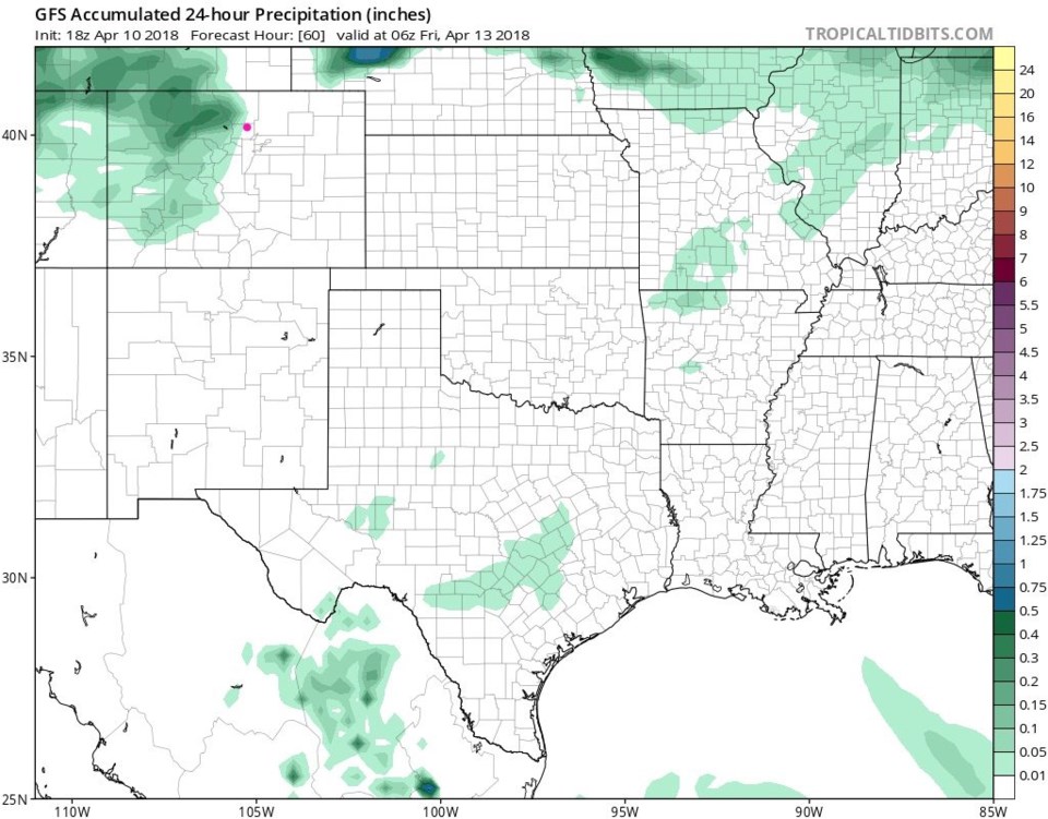
Figure 12 is snowfall total up to Saturday morning and it looks like Longmont suffers from down-slope-itis. We seem to get nothing (so maybe a coating to an inch is possible??). So do we get rain? Figure 13, also the GFS, says no, not really.
Watch the winds, warmth and fire danger and hope the storm tracks a bit differently to give us water. More later!