This content was originally published by the Longmont Observer and is licensed under a Creative Commons license.
In Brief:
We sail through the weekend mild and dry. Get out and soak up some sun! A shift in the upper air pattern will bring showers for the Front Range Monday and Tuesday. Another shift gives us a more spring/summer like pattern that will result in afternoon storm chances from Wednesday on. We don't get unusually hot or cold this week.
Update 5/10 12pm:
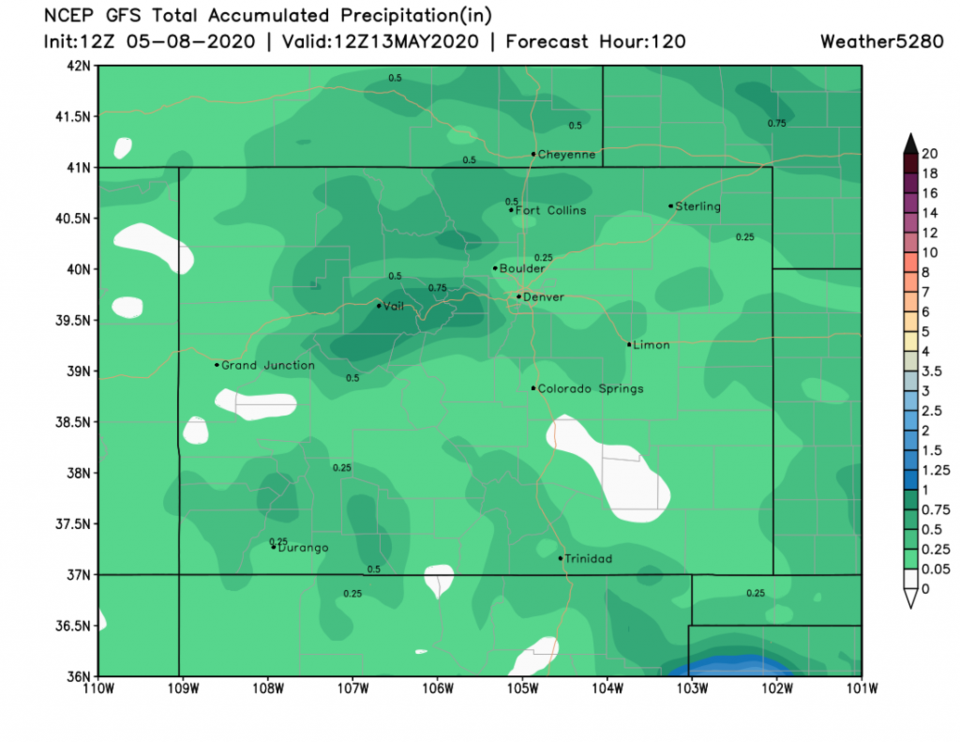
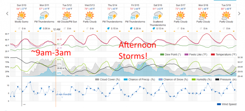
Our next cold front and period of upslope flow moves in for Monday. We have some rain chances for almost 24 hours with a midday peak in those chances (Figure 1). We should hear some thunder now and then (Figure 2). Thunderstorms are not expected to approach severe levels, but lightning is deadly (never forget!). We should see around 0.10 inch of water with some spots getting up to 0.25 inch (Figure 3 and Figure 1). Note the modest warm up later this week with afternoon and evening storm chances occurring every day Thursday to Saturday.
End 5/10 12pm update.
Forecast Discussion:
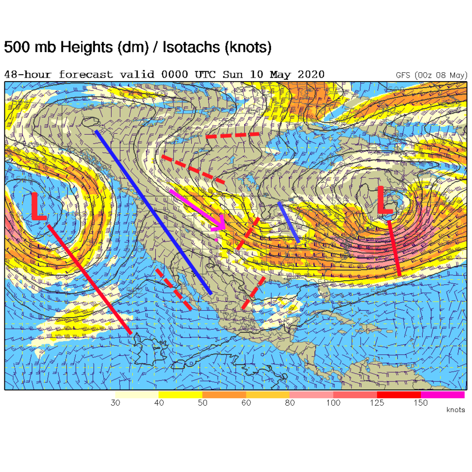
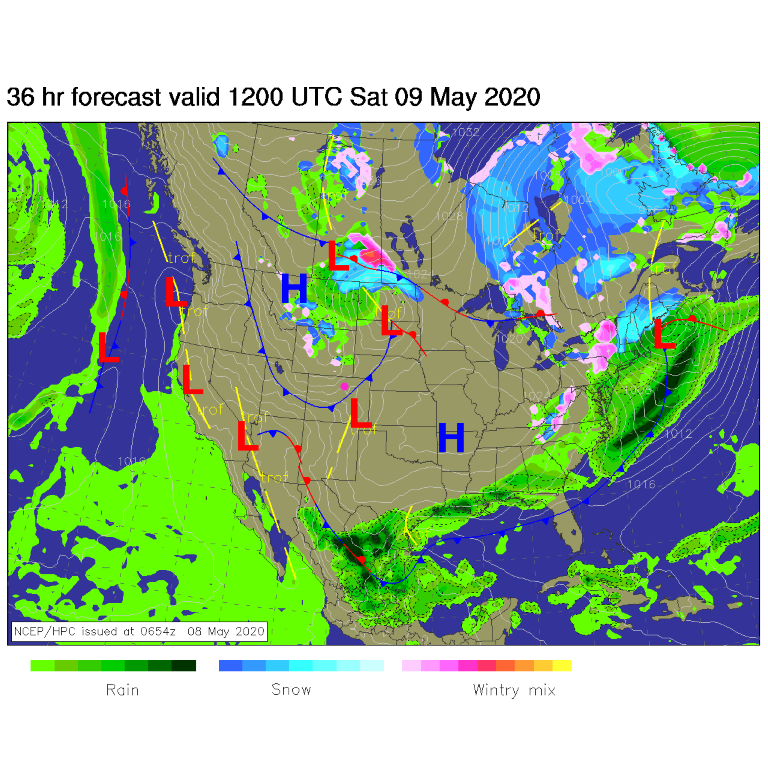
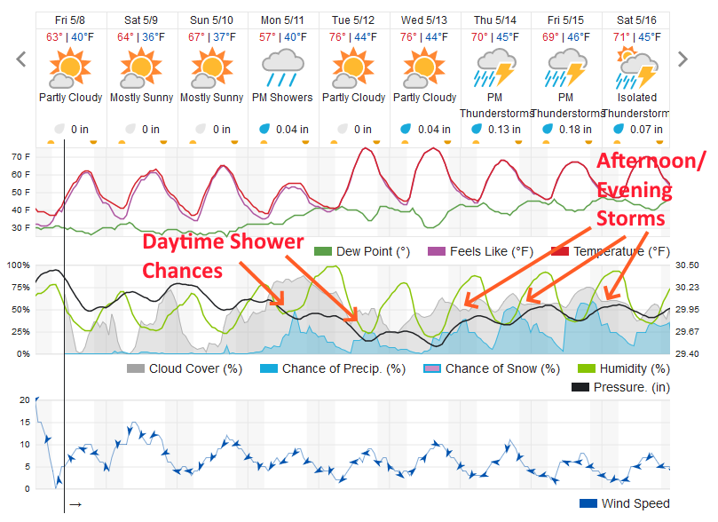
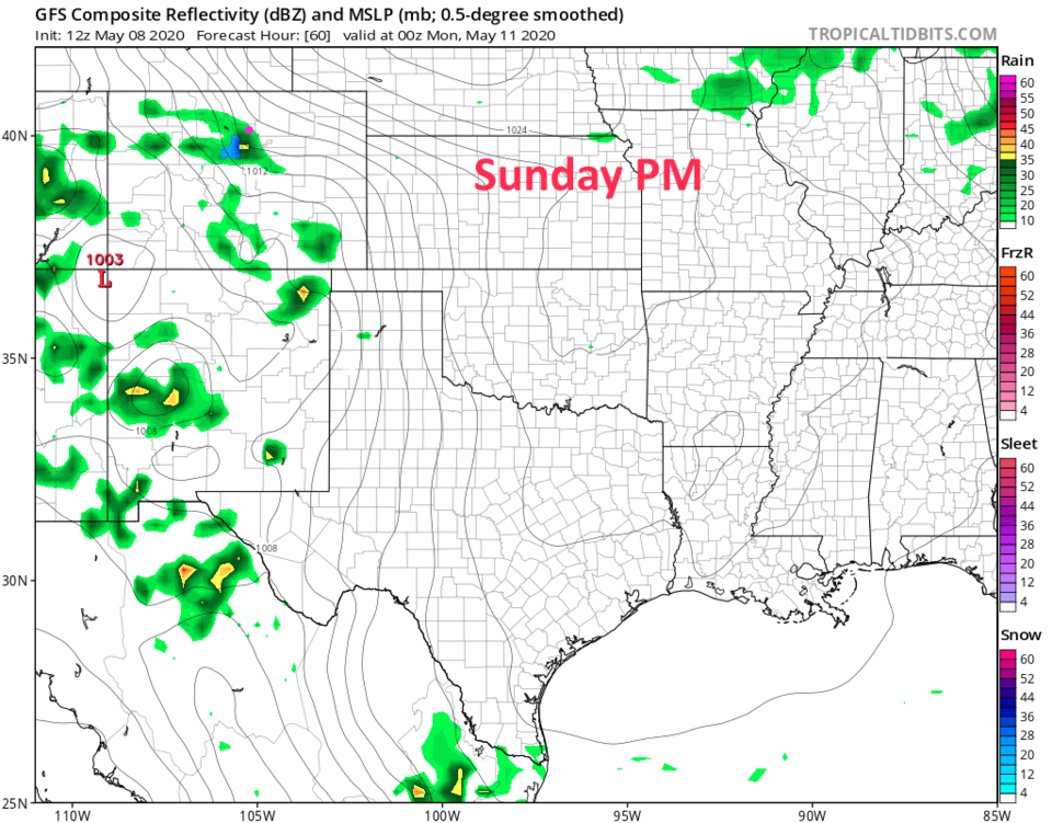
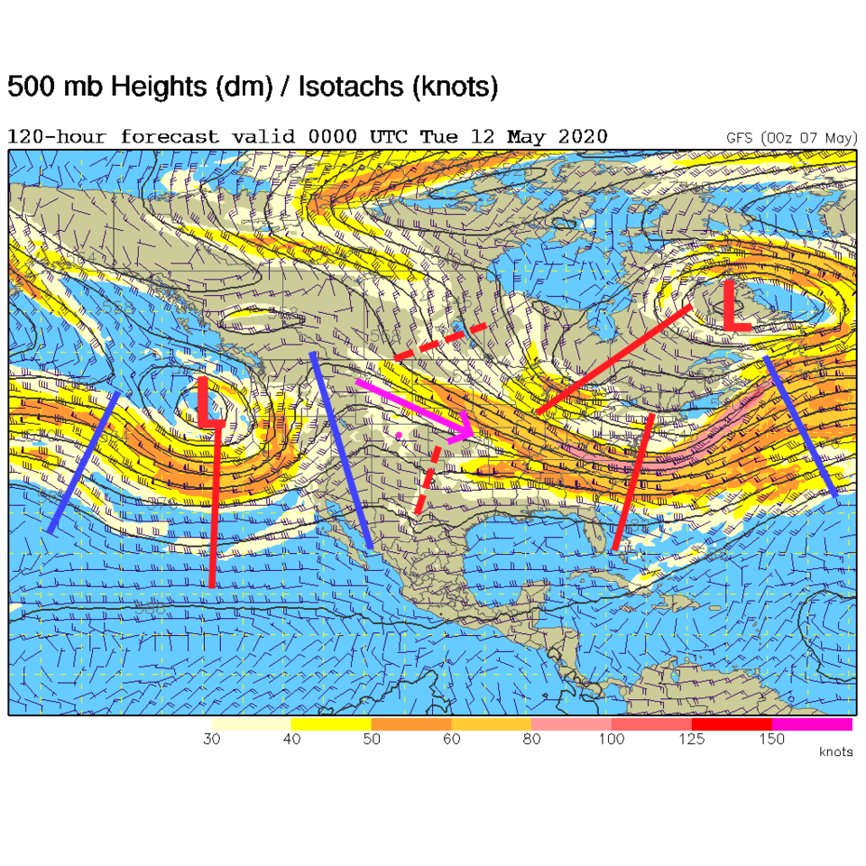
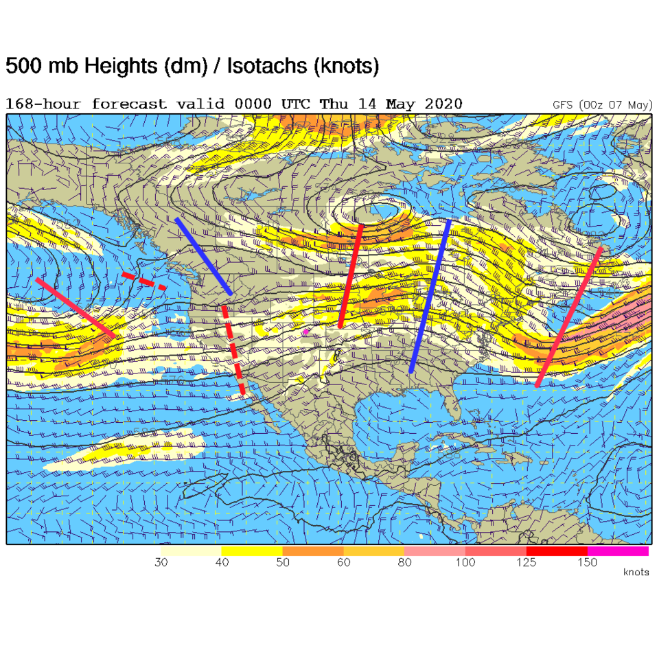
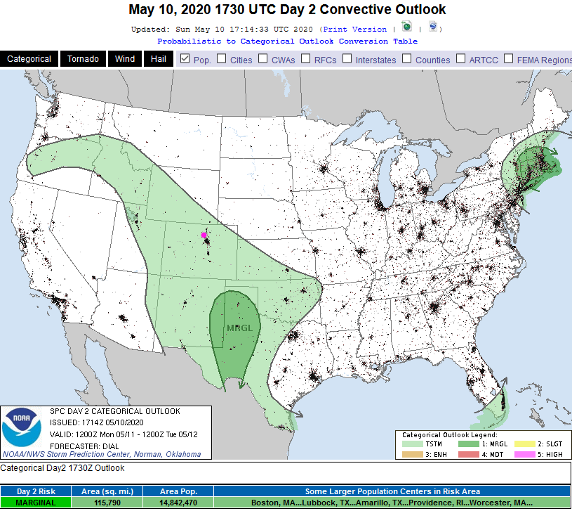
A 'gear shift' is about to occur this week in the upper air pattern. We start this weekend with a ridge just to our west and that famous northwest flow aloft (Figure 1 purple arrow). Little ripples (dotted red lines Figure 1) in the jet stream can kick a cold front down at any time, but there is little moisture around for clouds or storms. For example, a front will sweep the state Saturday with a few clouds and gusty winds (Figure 2). Because of that, temperatures stay in the 60'sF (or close to 60F - Figure 3). The mountains will see a few very widely scattered showers Sunday PM (I doubt we'll see actual rain in Longmont, but there is a tiny chance - Figure 4).
The Longer Range Forecast:
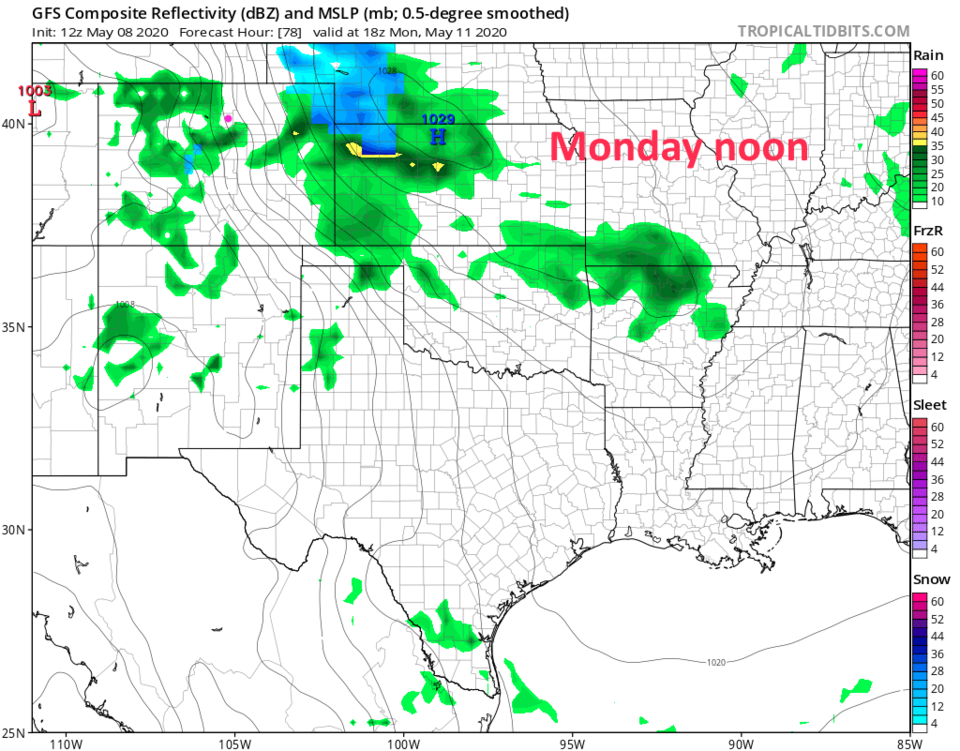
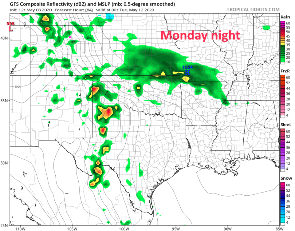
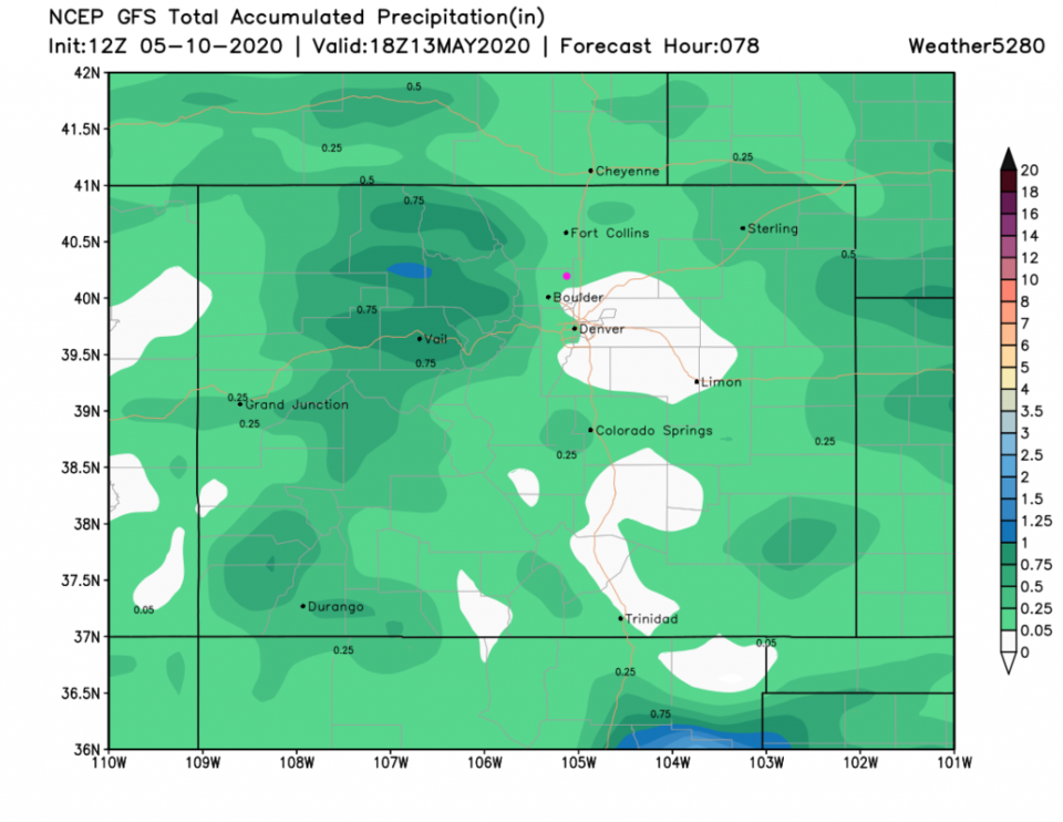
Moving into the new week, northwest flow (Figure 5) gets to act up for a couple days with cooler temperatures and a better chance of rain Monday and Tuesday (Figure 3). You can see the deeper moisture out east Monday (Figure 6). Later in the day, Tuesday, storms are still very widely spaced (Figure 7). Over the next 5 days, 0.10 to 0.25 inch of water should fall around here (Figure 8).
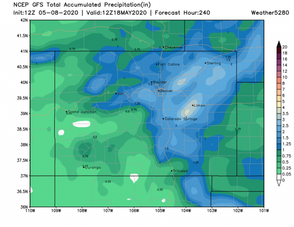
Later in the week, the ridge moves east and replaces the trough out there while a broad lowering of the heights (basically a big trough) forms in the west (Figure 9). That will give us southwest flow aloft and a more afternoon/evening timed round of storms as our source of water from the Great Plains picks up (Figure 3). Over the next 10 days, we might pick up over an inch of water (this pattern is still not helping southern Colorado much though - Figure 10).
The Month Ahead:
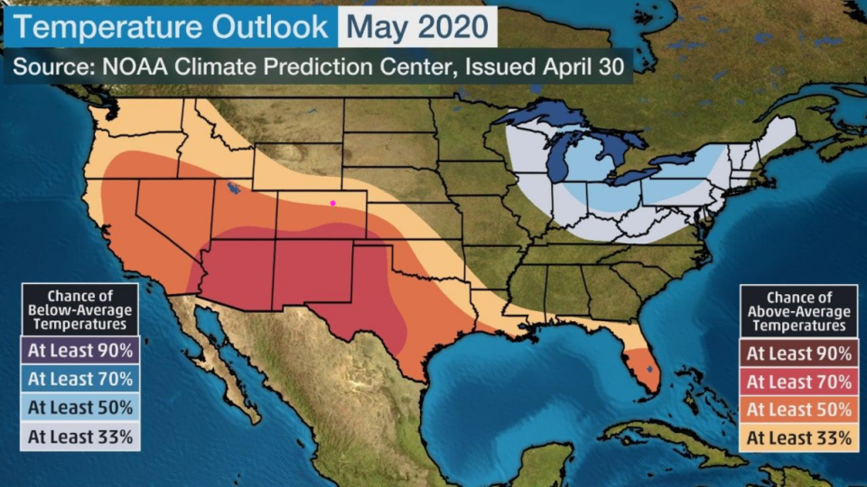
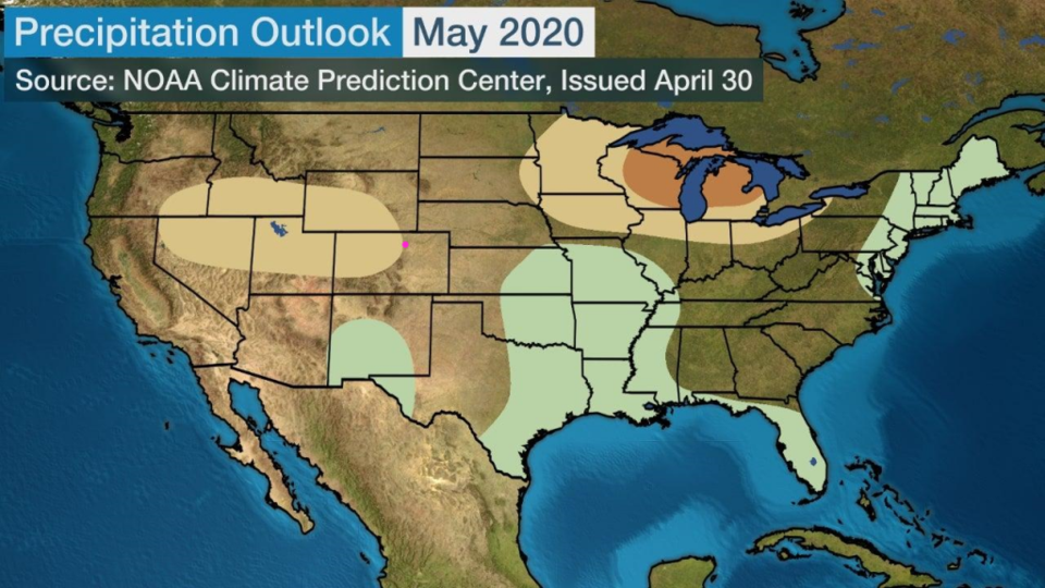
NOAA did publish the May outlooks. Their forecast for the averages are for above average temperatures (Figure 11) and normal to a bit drier than normal conditions (Figure 12).