This content was originally published by the Longmont Observer and is licensed under a Creative Commons license.
In Brief:
We have some 'somewhat' warm weather to end the week, then the jet-stream attacks! After enjoying 80F ish weather Fri/Sat a cold front Saturday night brings in a BIG change. A cutoff low rolls in overhead and pushes up slope moisture into the state giving us possibly as much as 1-2 inches of rain from Sunday afternoon to early Memorial Day morning. After that the pattern repeats with 80'sF mid-week, a Thursday cold front and rain Friday.
Update 5/23 11:30am:
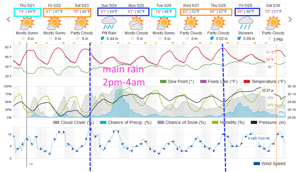
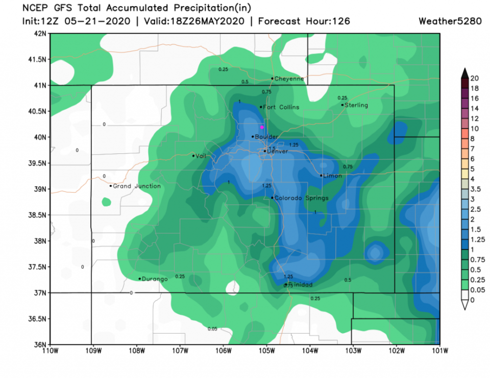
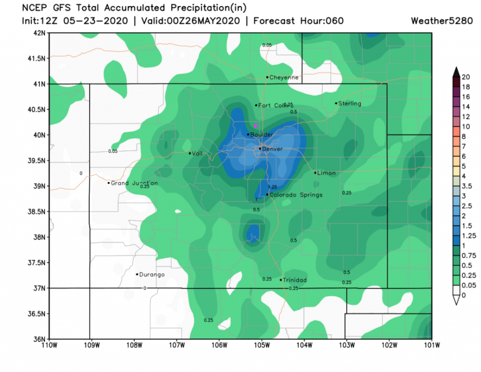
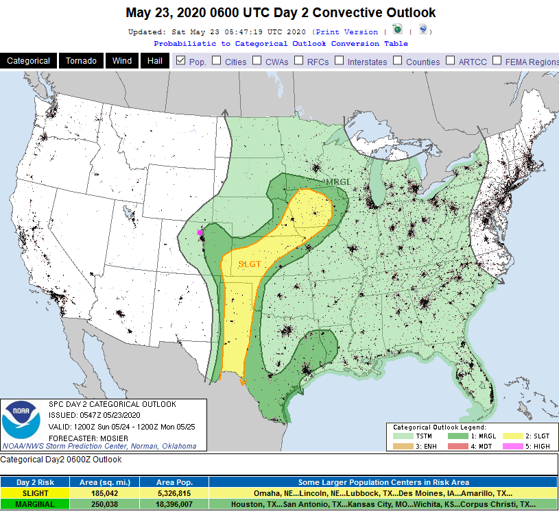
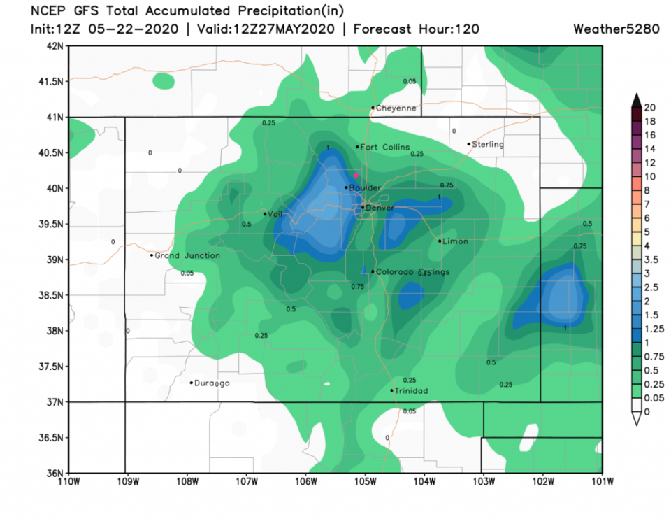
Not much is changing in the Sunday/Monday rain storm, but we have some refinements to watch for. First, the timing has backed up a bit with rain starting around noon Sunday and ending a bit earlier, around 7am on Memorial Day (Figure 4 update). The GFS brings a bit of a drying notch down I-25 nipping off some of our rain totals to around 0.5 to 0.75 inch of rain (Figure 5 update). The weatherunderground model only gives us 0.4 to 0.5 inch of rain (Figure 4 update). The GEM (not shown) remains wetter with 0.75 to 1 inch of rain. There is a chance of thunder, now and then, during this storm (Figure 6 update) with a marginal chance of severe weather (1 on a scale of 1-5) right up to but east of I-25. If that changes, I'll update it here. The main chance of severe weather would be for hail and high winds.
End 5/23 11:30am update.
Update 5/22 12pm Update:
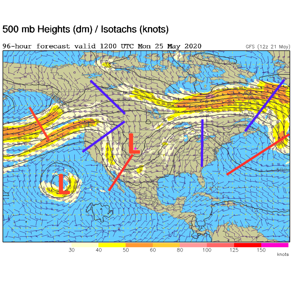
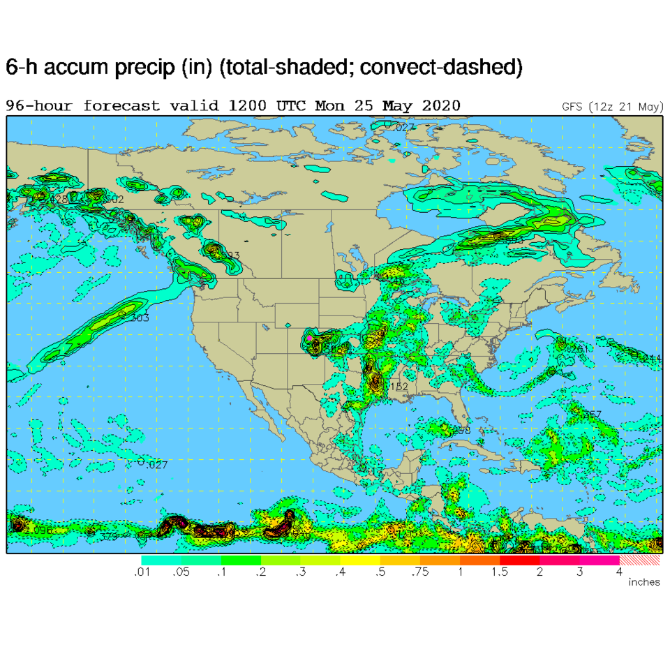
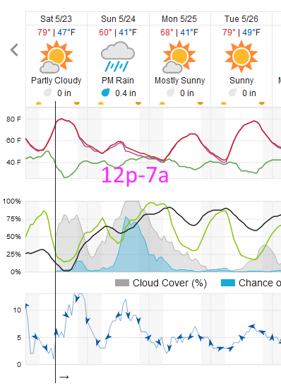
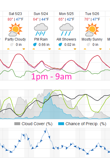
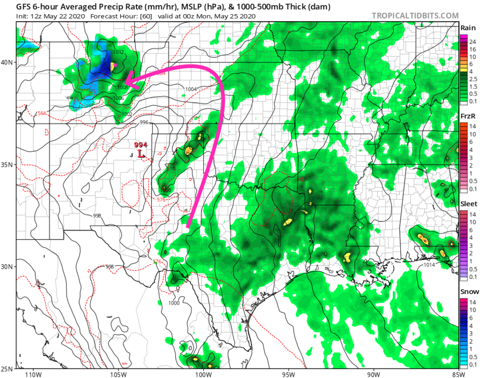
The weekend will still start out with beautiful, nearly perfect weather. Then our deep trough and surface low moves in on Sunday with a second cold front push. The period of time with the highest rainfall chances stretch from 1pm Sunday to 9am Monday (with lower chances after that- tapering off - Figure 1 udpate). At the peak, the low center is in northeast New Mexico creating a very moist flow out of the east, up slope into the mountains (Figure 2 update). Notice the mountain snow - mainly above 10,000 feet. Weather underground gives us about 3/4th inch of rain while the GFS gives us 3/4th to 1 inch of water (Figure 3 update). It will be cool and damp Monday, but things will get better later in the afternoon.
End 5/22 12pm Update.
Forecast Discussion:
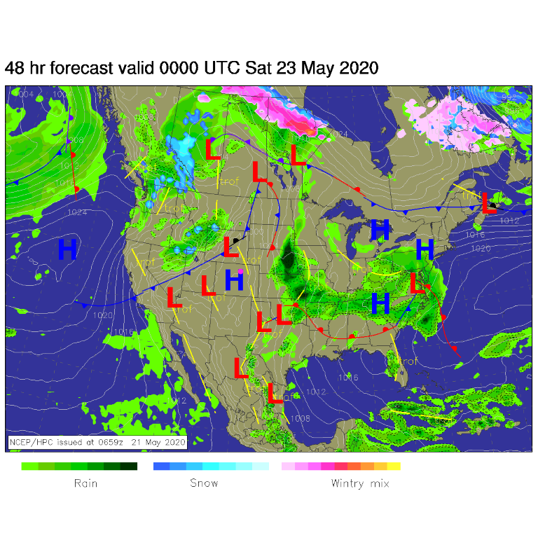
A cold front is poised to pounce on us from the northwest Saturday night. This front can be seen on the surface map for Friday night (Figure 1). That will end 80F highs and the dry weather for a bit. The cold front, with somewhat gusty winds, starts the temperature drop around 8pm Saturday (Figure 2).
The Longer Range Forecast:
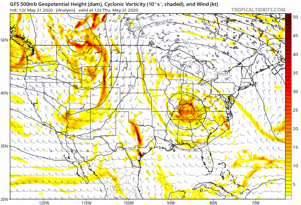
This front is being pushed across the state by the big trough and low rolling in seen in Figure 3. The shield of precipitation and moisture flowing in from the east is pretty impressive (Figure 4).
You can see the low roll in on the animation found in Figure 5. Into next week, it rolls south, spins and wobbles back to repeat the front passage (Thursday) and burst of rain and cool weather Friday (Figure 2).
For rainfall totals this weekend: the weatherunderrground model gives us just under 1/2 inch of rain (Figure 2). The GFS gives us an impressive 1.25 to 1.5 inch of rain (Figure 6). I'm camping in the front yard again - that might be an 'in the house' day for us.
Glancing at the ENSO:
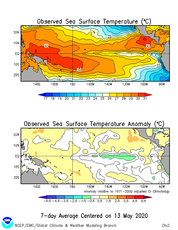
The El Nino Southern oscillation is always worth peeking at. We were in a prolonged El Nino event that brought good moisture to the state and snow in the winter. We were 100% drought free for a while last year. Even though spring forecasts of the ENSO indices are usually pretty shaky - there is a hint of the La Nina state (the opposite of El Nino) settling in (Figure 7). Will this mean dry conditions for the long term?? We'll see!