This content was originally published by the Longmont Observer and is licensed under a Creative Commons license.
In Brief:
The upper air pattern is switching from "northwest flow" on Monday to a passing ridge on Tuesday/Wednesday then to west and southwest flow for the rest of the week. We warm up a bit until a passing trough destabilizes the atmosphere enough to give us afternoon and evening thunderstorms Thursday and Friday. A big ridge returns next week. We get very dry and approach 90F again!
Update 5/14 9:30am:
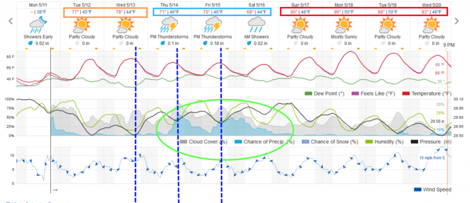
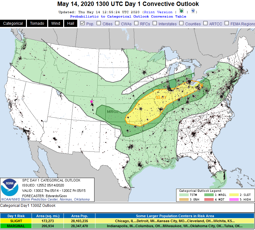
In the video below (for the week beginning May 14th) I speculated that severe weather chances (for hail and high winds) would inch closer to Longmont as Thursday and Friday afternoons approach. The Thursday SPC forecast has severe chances (marginal - 1 on a scale of 1-5) to the southeast of Denver still. But the I-25 corridor and east is under a marginal risk for Friday afternoon/evening (Figure 2 update). You can see the increase in low cumulus clouds out there and feel the moisture in the air. Spring excitement! Keep an eye out for storms with (always) dangerous lightning and some small hail and blasts of wind that will throw trash cans and lawn furniture around. The will be moving towards you from the west-northwest.
End 5/14 9:30am udpate.
Forecast Discussion:
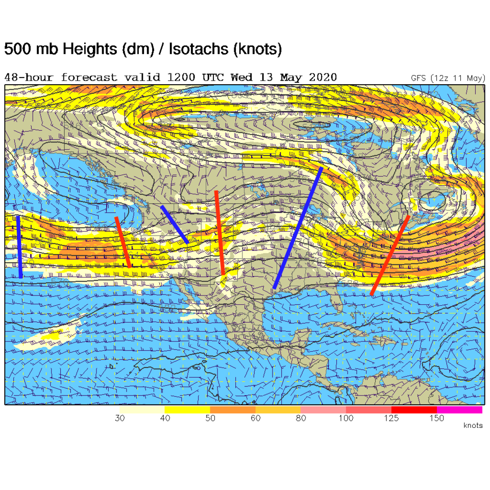
A ridge scoots across the state Tuesday and Wednesday. We don't get much warmer overall, but do dry out for a couple of days. Troughs moving through the westerly flow after the ridge will begin to interact with deepening moisture flowing into the state from the Great Plains (Figure 1).
The Longer Range Forecast:
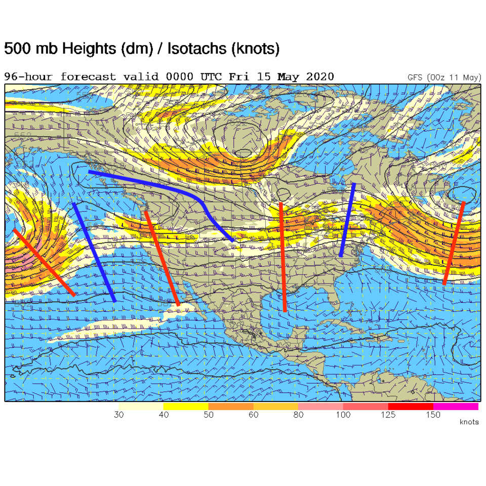
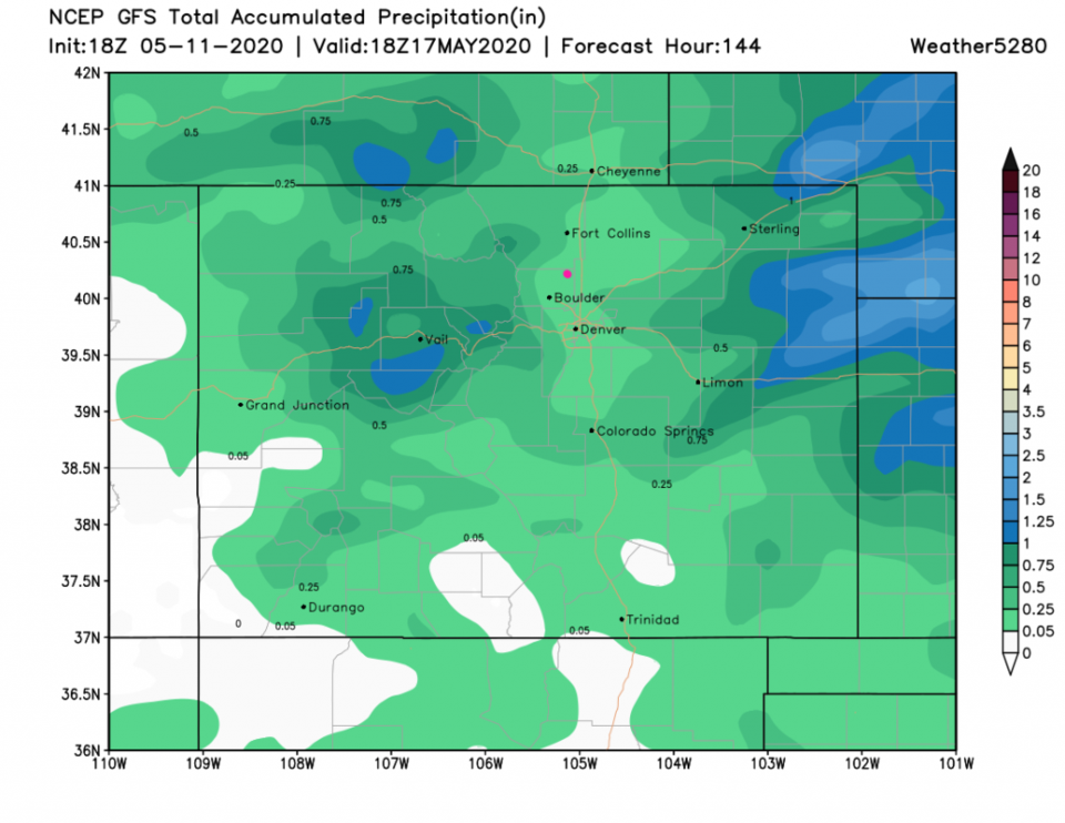
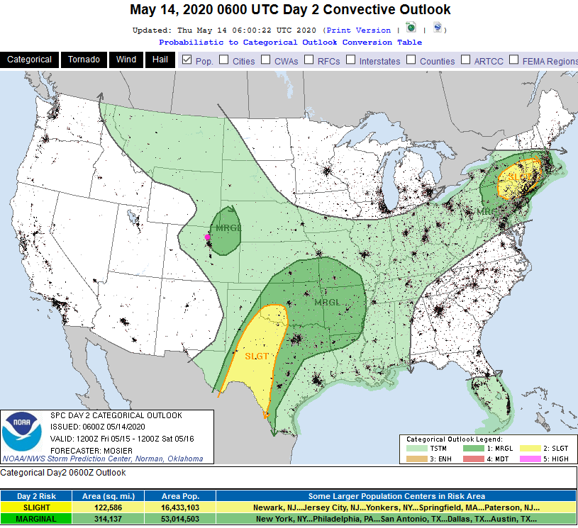
Our best chances of afternoon storms arrive for the end of the week. We'll need to watch Thursday and Friday afternoon for chances of severe weather. It is too far away at this time to make that call. (Figure 2). We have zonal - straight west to east - flow during this stormy time (Figure 3). The short wave troughs, if they time well with daytime heating will create these severe chances - if they line up. The GFS still doesn't give us much water through the weekend. Longmont gets 0.10 to 0.25 inches of water on average (a single thunderstorm could drop a lot more) - Figure 4.
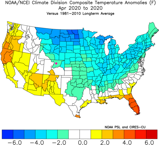
A look back at April:
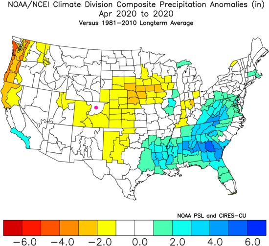
I don't see a look forward set of graphics for April to reproduce for comparison, but the actual numbers are in. Figure 5 shows that we were a bit below average for that month. We had normal precipitation here but the rest of the state was a bit drier than normal (Figure 6).