This content was originally published by the Longmont Observer and is licensed under a Creative Commons license.
In Brief:
Thursday started cloudy and cool with one last shot of relative warmth in the afternoon. An evening cold front slides down the state bringing a chance in the weather. Rain chances start low in the evening and increase through the the night into the morning Friday. Rain is likely late morning through early evening. Temperatures will slowly drop later Friday allowing rainfall to change to snow for a while later in the evening Friday. Longmont should see a coating to maybe 1 inch. Things clear out and warm for the weekend. Another chance of showers returns Monday followed by real spring like warmth.
Update 3/28 10am:
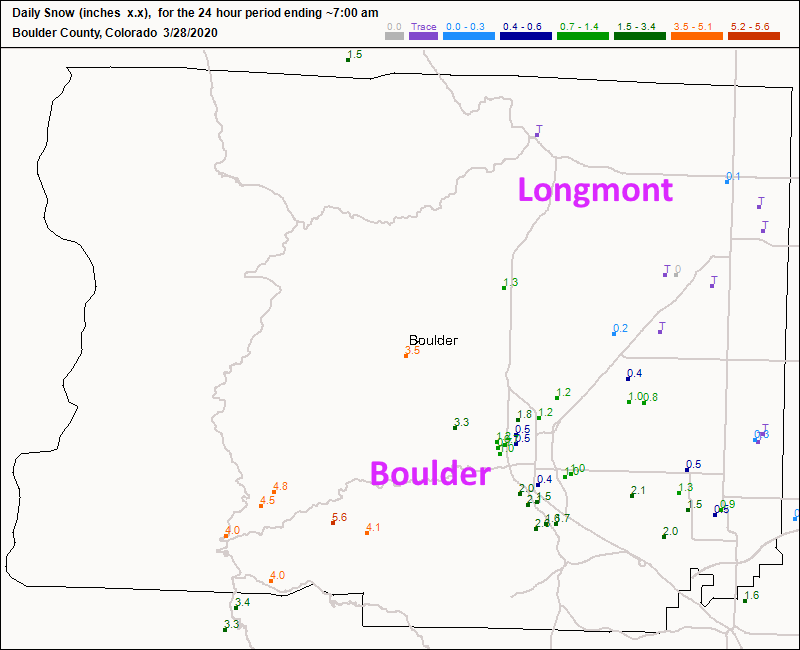
Snowfall happened, but not much in town (as expected). Figure 4 update. Boulder did better with 1-almost 3 inches. Enjoy the rapid warm up!
End 3/28 10am.
Update 3/27 3pm:
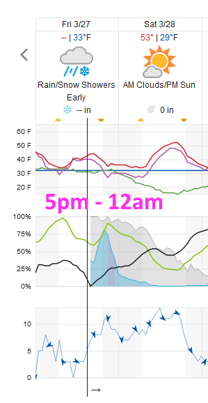
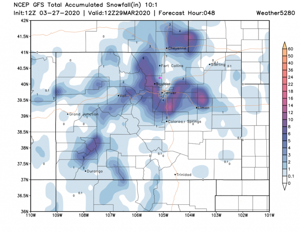
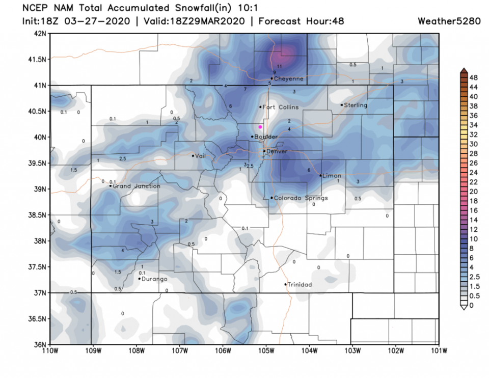
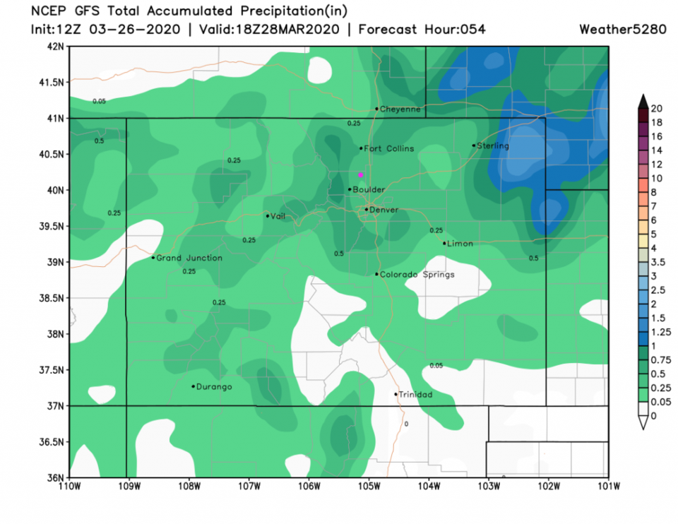
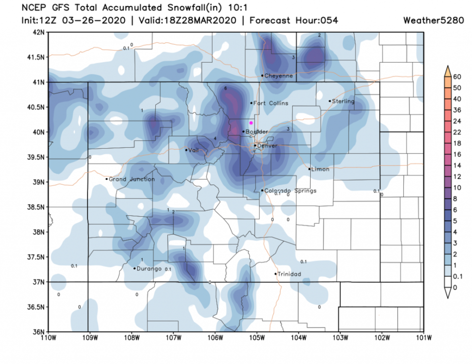
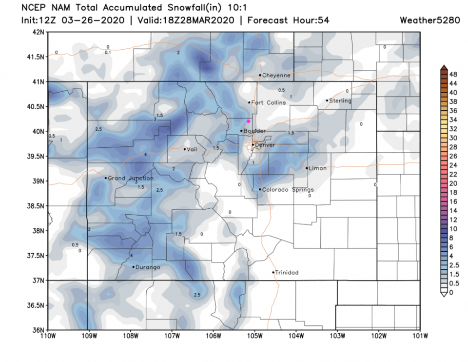
The forecast is largely still on track. Rainfall has been slow to develop along I-25 and has not yet begun in Longmont as of 3pm. The lingering showers may also last somewhat past sunrise Saturday. The timing of the best chances for precipitation stretch from 5pm to midnight Friday (Figure 1 update). The GFS gives us a coating to 2 inches now (a bit more snow than yesterday - Figure 2 update). The NAM backed off with only a coating to 1 inch building up (Figure 3 update). Enjoy a movie and a warm take-out meal this weekend!
End 3/27 3pm update.
Forecast Discussion:
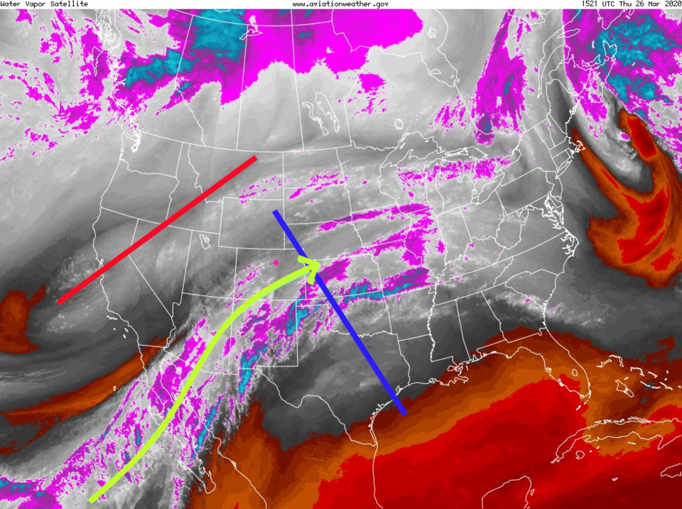
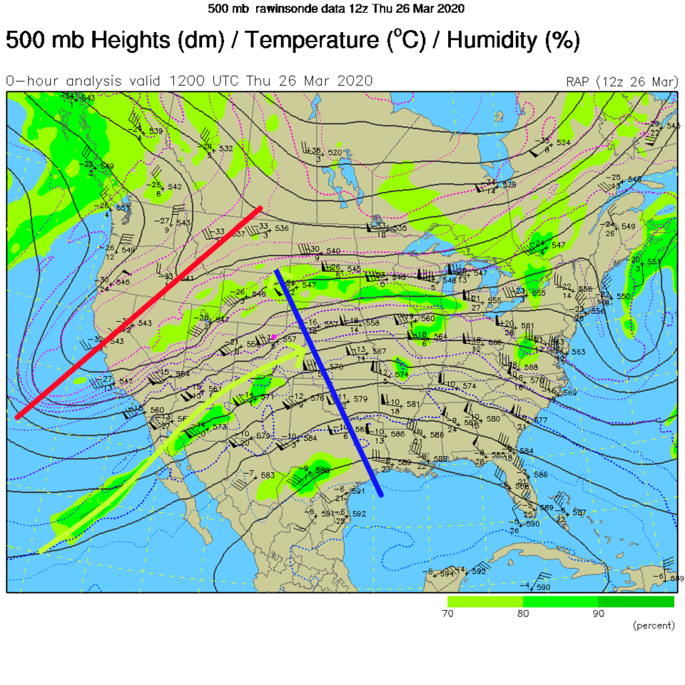
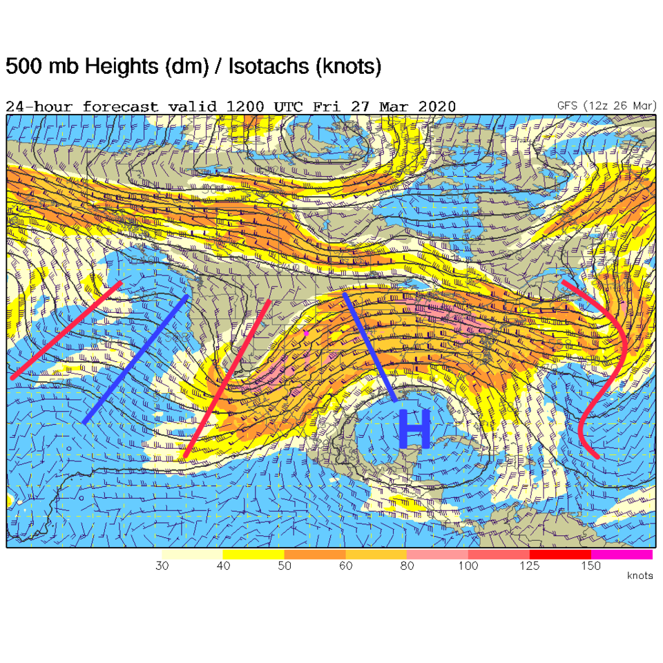
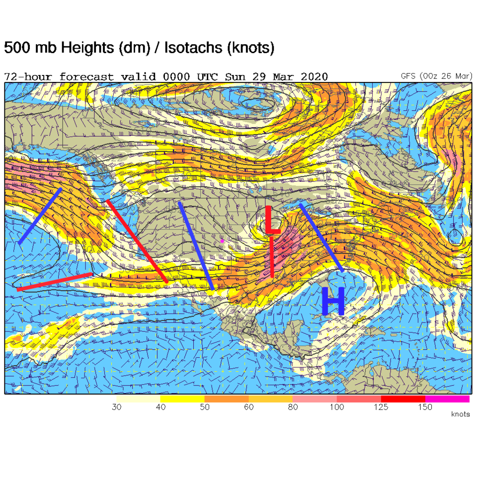
A trough tilting off the West Coast of the U.S. (red line in Figure 1) is beginning to pump moisture into the middle of the country - right over Colorado (green arrow). We still have a ridge over our state on Thursday (Figure 2) but that trough is headed for us Friday (Figure 3). We are on the "uphill" side of the trough meaning that there will be lifting of the atmosphere. This matched with the moisture flow means rain.
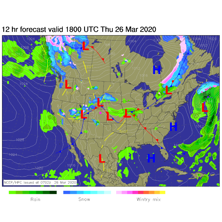
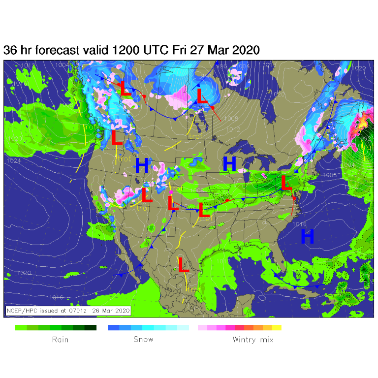
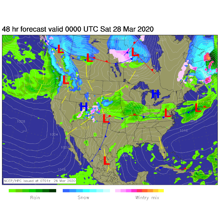
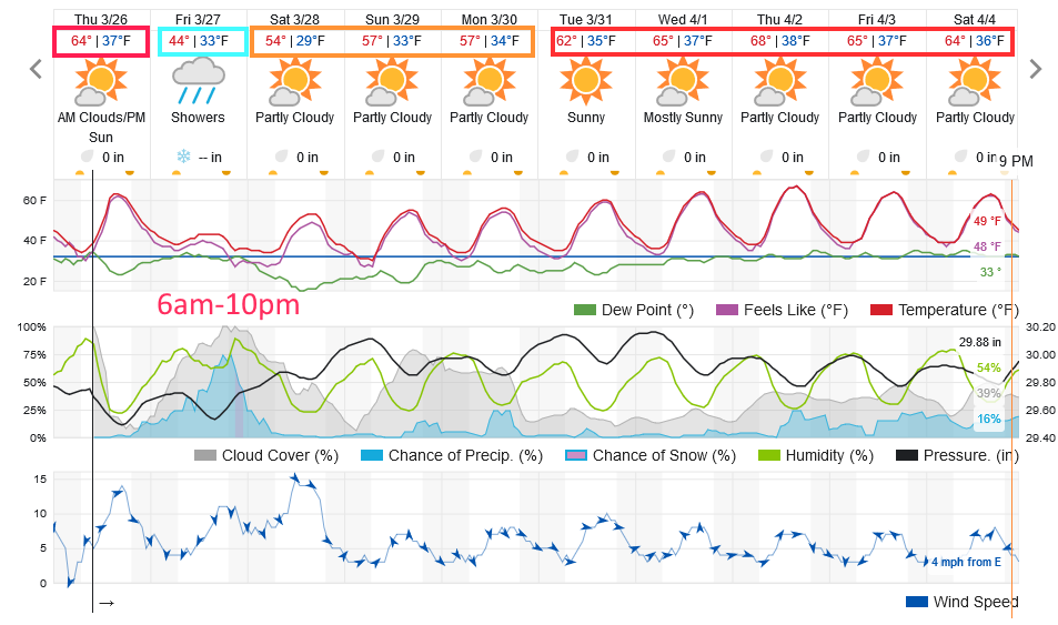
Thursday noon, a cold front, pushed by this trough, is approaching the Four Corners region and pushing in from the northwest (Figure 4). By Friday morning, the front is past us with a deepening low in southeast Colorado (Figure 5). The deeper up-slope flow of moisture may hold off until Friday afternoon as is shown in this figure. The rain and mountain snow finally arrives Friday afternoon and evening with temperatures dropping low enough for some snow (Figure 6) in town. The better rain (later snow) chances run from 6am to 10pm Friday (Figure 8). We also cool to the 40'sF for a high temperature Friday and drop to the upper 20'sF by Saturday morning.
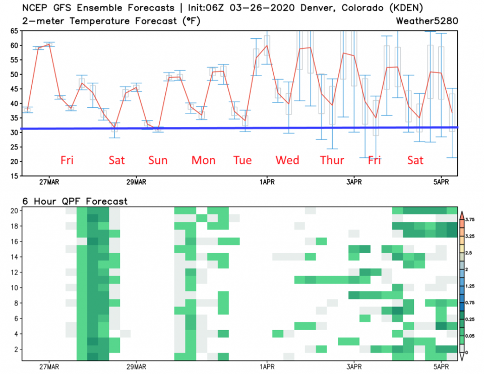
For rainfall amounts - the GFS is painting us with 0.25 to 0.5 inch of liquid. The weatherunderground (not in this run) has given us about 0.15 to 0.2 inches of water (Figure 10). For Friday nights snow, the GFS gives us a dusting to an inch (more on the west side of Longmont). Boulder might see 2-4 inches. Snow won't be too far away (Figure 11). The NAM is a bit more excited about snow and gives us 1-1.5 inches (Figure 12). I'd like to err on the side of the trace to 1 inch region.
The Longer Range Forecast:
For the weekend, that trough is passing through the Midwestern states with a small ridge over our state warming us up quickly to the 50'sF (Figure 7). Another trough is right behind this ridge and will slide over the state Monday (Figure 7). The weatherunderground model gives us just a small chance of rain Monday afternoon (Figure 8) but the GFS ensemble is a bit more bullish on rain showers Sunday PM and Monday afternoon (Figure 9).
The long range, Tuesday and on, we get temperatures in the 60'sF with "mostly" dry conditions for a while. Enjoy when you go out!