Skip to content

The Forecast Discussion from the Cherrywood Observatory –March 23-25, 2020

This content was originally published by the Longmont Observer and is licensed under a Creative Commons license.

In Brief:

Very spring-like weather is here. A ripple in the upper level flow will bring in a chance of rain showers Monday afternoon. We warm up to the 60'sF until a deeper trough passes Thursday/Friday giving us a better chance of rain (and maybe a brief shot of overnight snow). Warmness and niceness settles in right after that. Is winter gone for good!? (Probably not.)

Forecast Discussion:

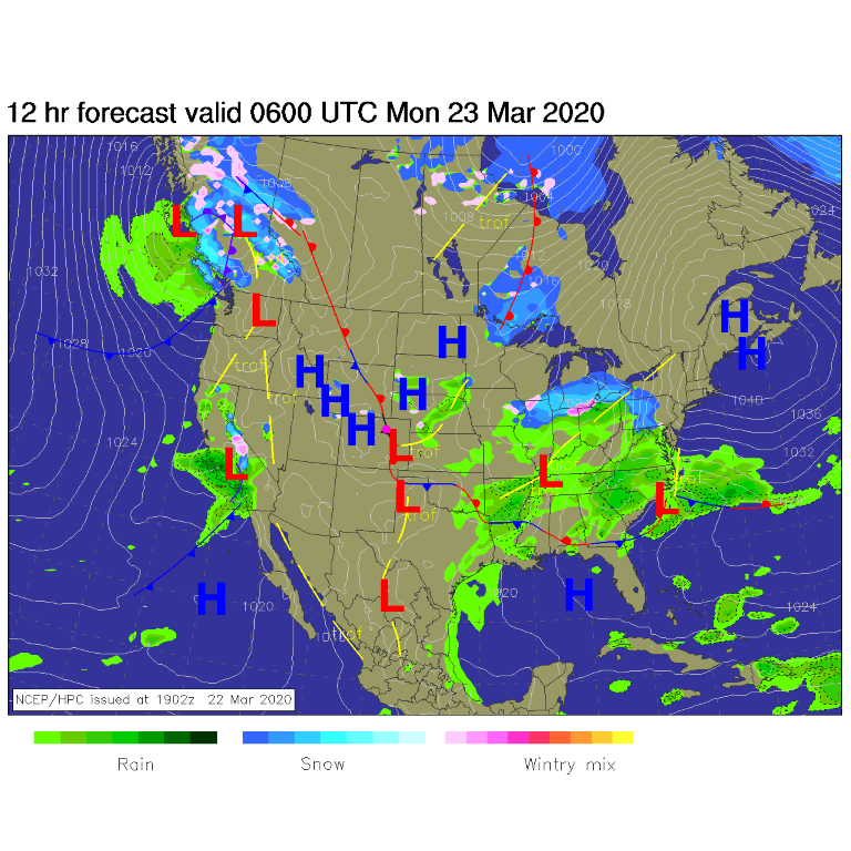
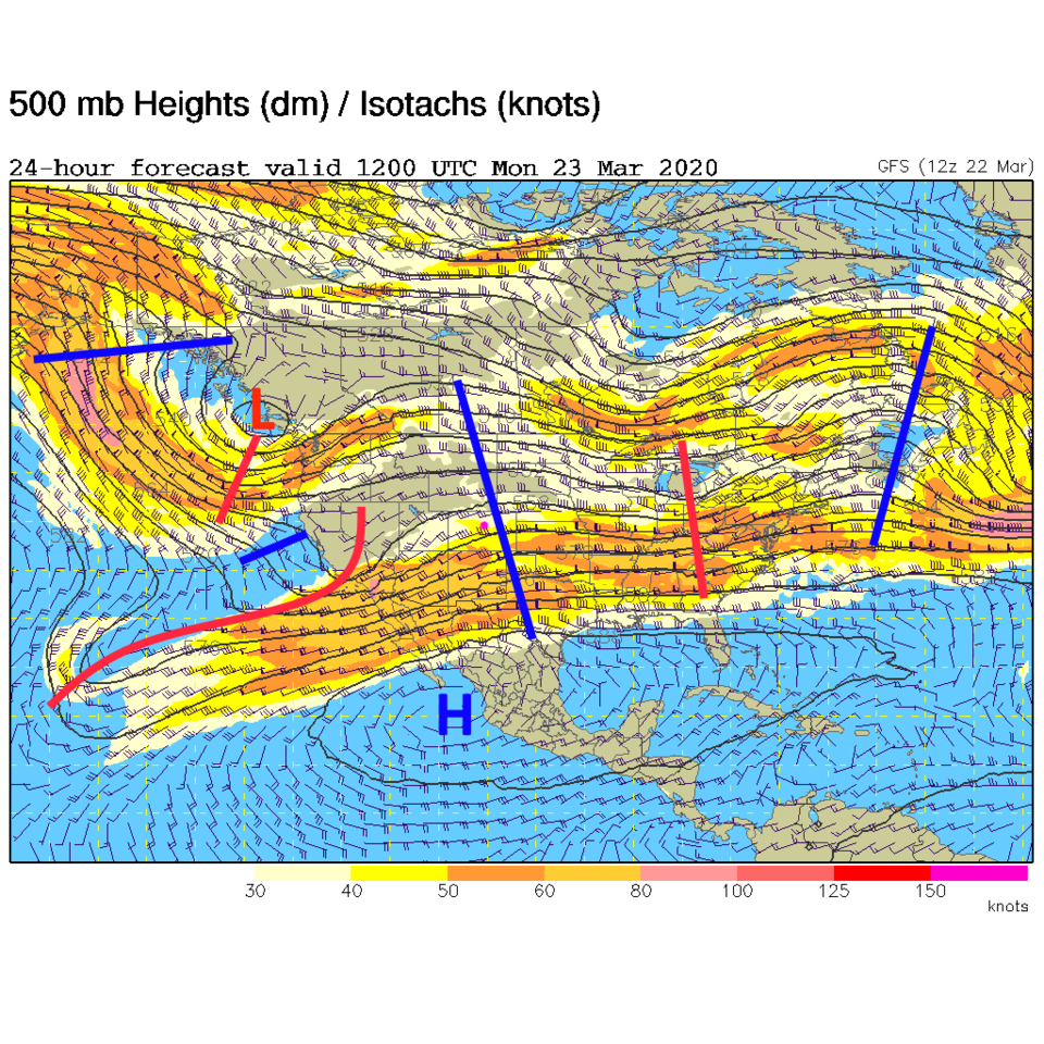
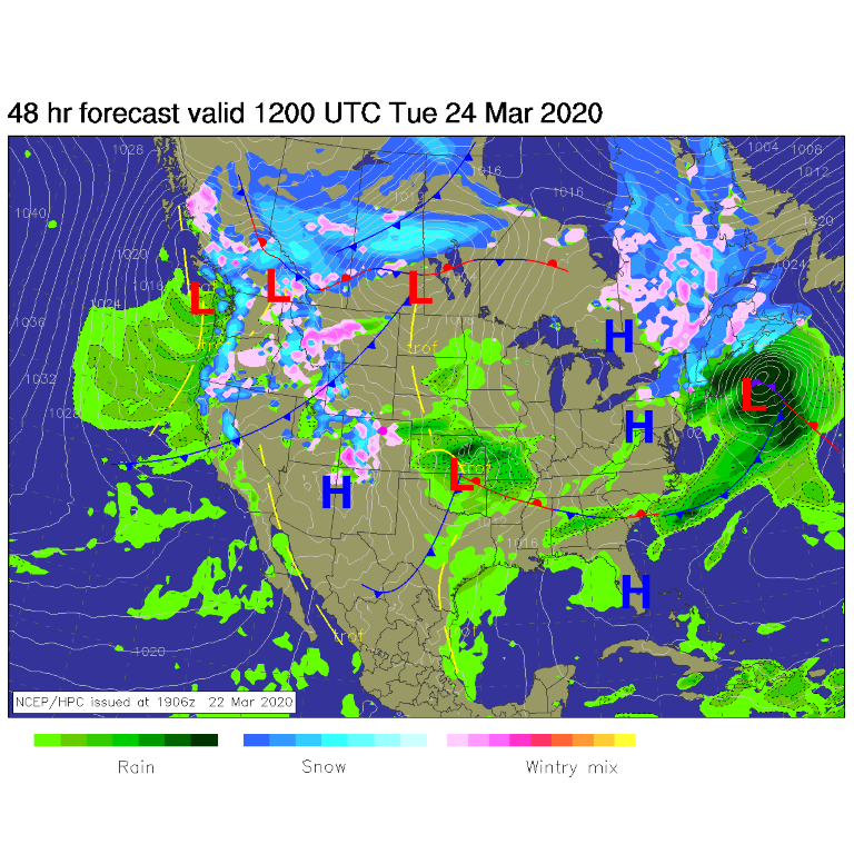
High pressure dominates Sunday into Monday (Figure 1) with a small storm system moving through southern California. Our next storm (Monday PM) will be kicked off by the upper portion of the trough over Nevada passing our state (Figure 2). A weaker and quick moving low will form east of Denver again and race into Oklahoma/Kansas (Figure 3). The chance of rain showers stretches from 10am - 10pm Monday. With ridging never very far away, we stay warm.

The Longer Range Forecast:

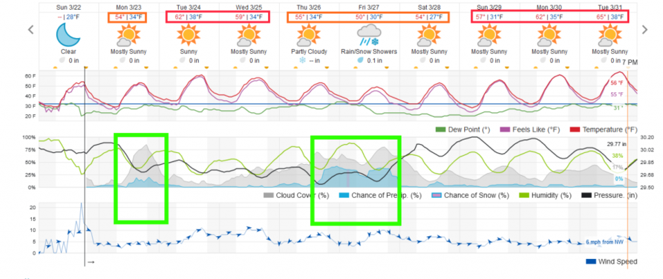
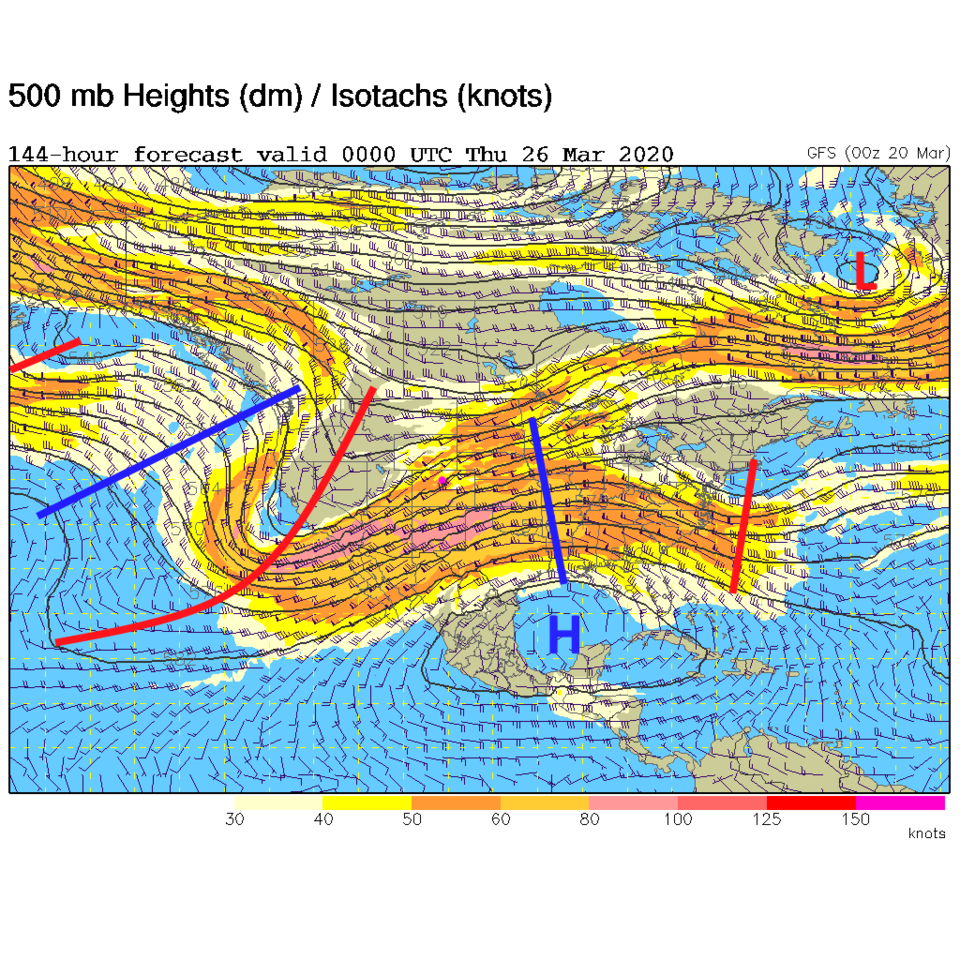
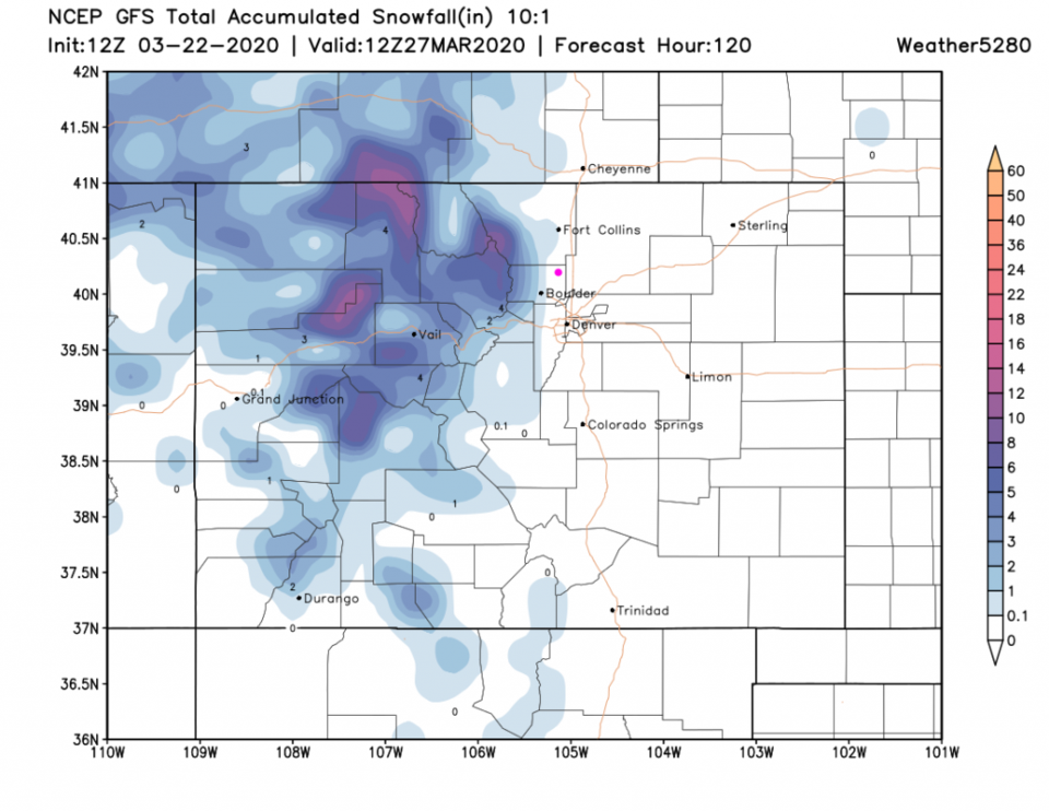
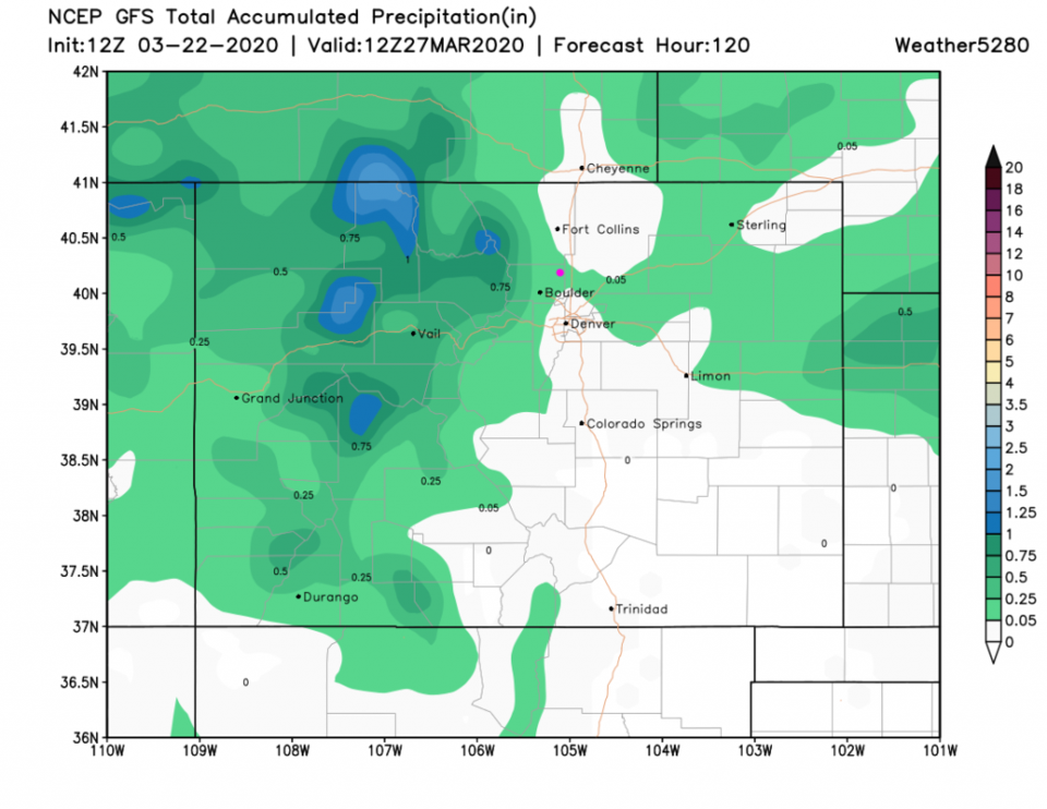
We'll see 60F Tuesday and Wednesday then rain (and a brief snow moment) returns Thursday into Friday (Figure 4). The main trough begins to migrate (more slowly) our way for that rainy period later in the week allowing us to cool a bit too (Figure 5). Snow chances remain up in the northern mountains and foothills over the next 5 days (Figure 6). A dusting is possible down to the western side of town. Rain amounts over the next 5 days are still pretty skimpy sitting between 0.05 and 0.10 inch (Figure 7).

Figure 1: The forecast surface map for Monday AM from NCEP.
Figure 2: The 500mb forecast upper air analysis for Monday AM. Pink dot is Longmont. Red lines are troughs, blue lines are ridges.
Figure 3: The forecast surface map for Tuesday AM from NCEP.
Figure 4: the graphical forecast for the next 10 days for Longmont, CO from weatherunderground.com
Figure 5: The 500mb forecast upper air analysis for Wednesday PM. Pink dot is Longmont. Red lines are troughs, blue lines are ridges.
Figure 6: 10:1 (snow to liquid) snowfall totals through the next 5 days from the GFS and weather5280com for Colorado made Sunday PM.
Figure 7: precipitation totals through the next 5 days from the GFS and weather5280com for Colorado made Sunday PM.

Current Weather

Clear

Clear

44°F

UV Index
0 Low
Pressure
30.12 Falling
Visibility
7 miles
Dewpoint
41 °F
Humidity
89%
Wind
NW 2.3 mph
Gust
3.3 mph
Wind Chill
44 °F

Hourly Forecast

Today
4 AM
42°F
Intermittent clouds
Today
5 AM
41°F
Intermittent clouds
Today
6 AM
40°F
Intermittent clouds
Today
7 AM
43°F
Intermittent clouds
Today
8 AM
45°F
Mostly sunny
Today
9 AM
51°F
Mostly sunny
Today
10 AM
57°F
Mostly sunny
Today
11 AM
62°F
Mostly sunny
Today
12 PM
66°F
Mostly sunny
Today
1 PM
70°F
Mostly sunny
Today
2 PM
73°F
Mostly sunny
Today
3 PM
74°F
Mostly sunny

7 Day Forecast

Mostly cloudy w/ showers

Tuesday

63 °F

Turning cloudy and cooler; a passing afternoon shower or two


Partly cloudy w/ t-storms

Tuesday Night

40 °F

Partly cloudy


Mostly sunny

Wednesday

76 °F

Pleasant and warmer with sunshine and patchy clouds


Partly cloudy

Wednesday Night

42 °F

Patchy clouds


Mostly cloudy w/ t-storms

Thursday

76 °F

Becoming cloudy; breezy in the afternoon with a thunderstorm in spots


Thunderstorms

Thursday Night

47 °F

A thunderstorm in spots in the evening; otherwise, considerable cloudiness


Showers

Friday

71 °F

Mostly cloudy with a couple of showers


Cloudy

Friday Night

46 °F

Cloudy


Showers

Saturday

53 °F

Cloudy and cooler with a couple of showers


Rain

Saturday Night

39 °F

Cloudy with steady rain becoming intermittent


Sunrise and Sunset

Sunrise
6:10 AM
Sunset
7:48 PM

Based on AccuWeather data