This content was originally published by the Longmont Observer and is licensed under a Creative Commons license.
In Brief:
The snow departs and we enter an extended mild period of quiet weather. There is a chance of some rain/snow Wednesday PM into Thursday. That's all I have to say about that.
Forecast Discussion:
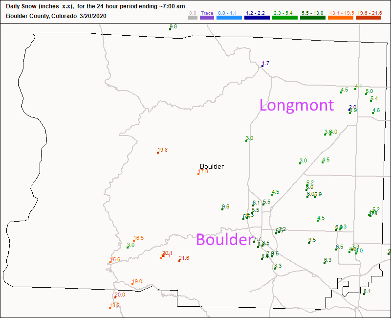
Let's start with the main storm snow totals. Figure 1 shows Longmont received about 4-5.5 inches. Boudler received an impressive 5-10 inches and the mountains above pushed 20 inches. I forecasted 3-5 here and 4-8 later over on Next Door. This was a healthy hit of snow (with almost 1.5 inches of moisture!).
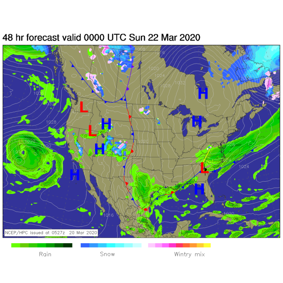
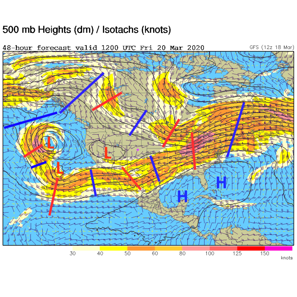
A slow moving frontal boundary will now drift east as warmer air returns Saturday (Figure 2). We have a local bit of ridging in the upper air pattern while the complex troughiness remains way out west off the coast (Figure 3). There is a lot less energy in that setup currently.
The Longer Range forecast:
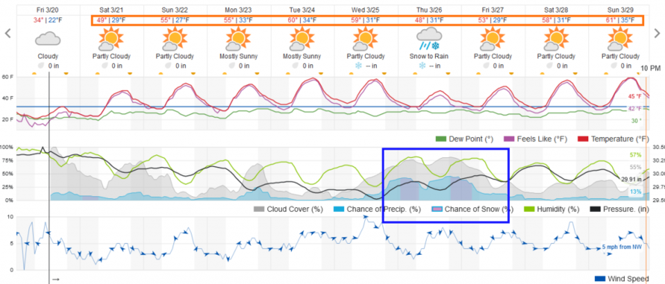
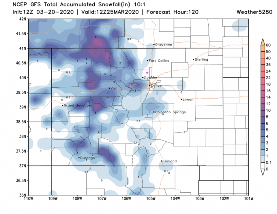
We hover between about 50F and 60F for the next 10 days. A somewhat organized low ejects Wednesday night across the state bringing us some rain/snow chances mid-week (Figure 4). Snowfall is confined to the mountains and higher elevations over the next 5 days (Figure 5).