This content was originally published by the Longmont Observer and is licensed under a Creative Commons license.
By John Ensworth
Discussion:
The slow change from a northwest flow regime to a westerly (zonal) flow and, later, a southwest flow is underway. Our frontal boundary is washing out and moving east as seen as a black dotted line in eastern Colorado in Figure 1.
Figure 1: Surface frontal analysis, pressure centers and radar from the Weather Channel.
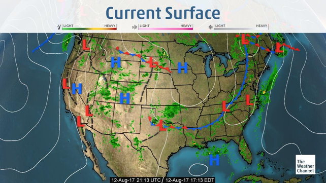
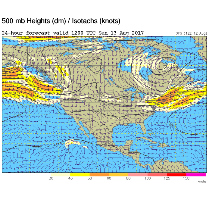
Figure 2 shows how ‘flat’ the jet stream is becoming (really the upper air flow in general). As illustrated yesterday, there is moisture in place under the upper air ridge overhead and some monsoon moisture is slipping in as well.
Figure 2: The 500mb map forecast for Sunday morning from the GFS model.
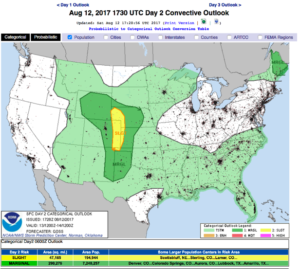
With the shortwaves still traveling down the flow, and more surface heating as the ridge dries things out a bit, severe weather is still expected for Longmont and the Front Range Sunday. It is again a Marginal Risk – a 1 on a scale of 1-5 issued by the Storm Prediction Center in Norman, Oklahoma (the SPC) – again mainly for large hail and damaging winds. Soils are quite wet many places, so always be aware that local flooding may occur under the bigger storms – Figure 3.
Figure 3: The SPC forecast Day 2 for Sunday issued on Saturday.

In a look at the longer range:
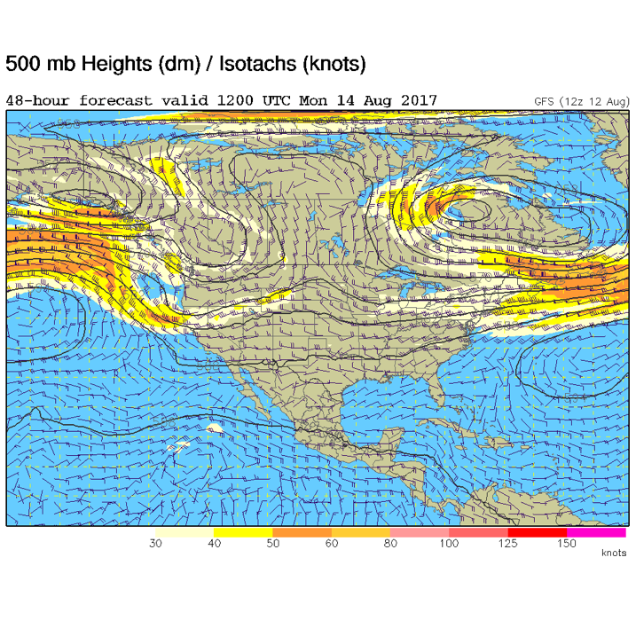
By Monday morning (Figure 4) the ridge axis is just past us, but there is enough upper air energy for afternoon thunderstorms in places.
Figure 4: The Monday morning upper air pattern, 500mb GFS forecast.
*** This feature will run as close to daily as possible in this location on the Longmont Observer. ***
This article will provide a brief discussion concerning the ‘why’ behind the weather with a focus on severe weather, unusual weather, and snow (especially trying to predict snow depth and its human impact in Longmont).
Bio:
John Ensworth works from Longmont as the Principle Investigator for the NASA Science Mission Directorate Earth and space science education product review through the IGES (The Institute for Global Environmental Strategies – www.strategies.org) . He is in his 14th year running this review. He is an astronomer (from the 2nd grade onward) and became a meteorologist (in the 5th grade) when a thunderstorm in Arizona rained on his telescope when the weather service had only forecasted a 10% chance of rain. He has college degrees in physics and astronomy and climatology and a graduate degree in meteorology and earth science. He lectures at the Little Thompson Observatory in Berthoud, the Estes Park Memorial Observatory in Estes Park, and for a number of online universities. He built and runs a backyard observatory near Pace and 17th in northeast Longmont where he has lived for 8 years with his wife, daughter, son, and two cats. Invitations to open house nights at this observatory, LTO, and EPMO will be posted with future discussions when they are scheduled.
Forecasting severe weather and snow amounts via text lead to this column. He began texting friends about the weather right after the September 2013 flood. The readers of this column will, hopefully, keep him honest in what he ‘thought’ he had forecasted for ‘the most recent’ storm.


