This content was originally published by the Longmont Observer and is licensed under a Creative Commons license.
Forecast Discussion:
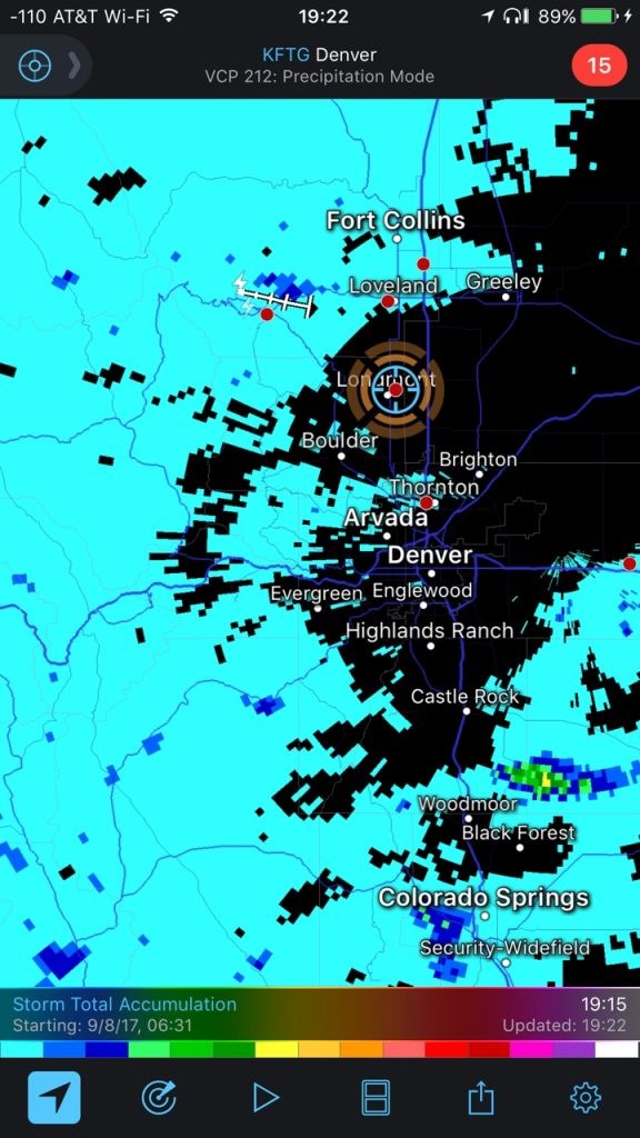
A little more moisture and smoke moved into Colorado on Friday. Figure 1 shows the water vapor satellite image with a scattering of showers over the West. Figure 2 is the radar estimated rainfall, though, for Friday. There was barely enough to add up over the mountains and northern I-25 corridor and down around Colorado Springs. By tonight, Figure 3, that moisture will create a few more mountain showers in Colorado, but more significant rain in Arizona, Utah and southern Nevada. This just isn't a wet time for us.
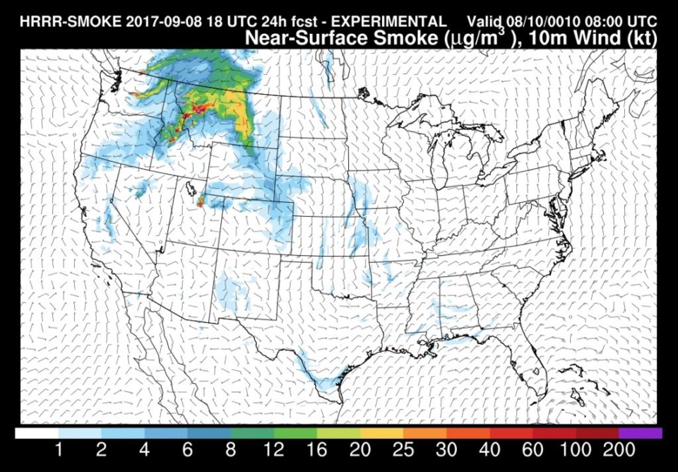
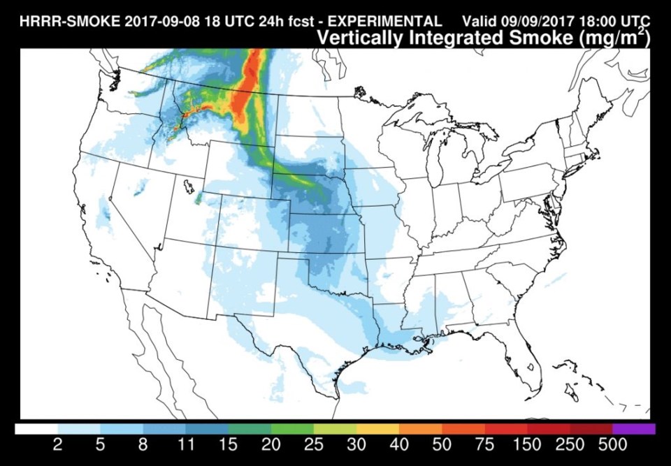
On the smoke front, the skies were white and the air a bit nasty along I-25 on Friday. Figure 4 shows the HRRR smoke forecast for Saturday at the surface. Most of the smoke is off to the east... yea! Figure 5 shows the upper level smoke off to the east as well. We should breath easier and see bluer skies Saturday. Peeking into the model output on Sunday, there is even less smoke around (barring any new fires!).
In the longer range:
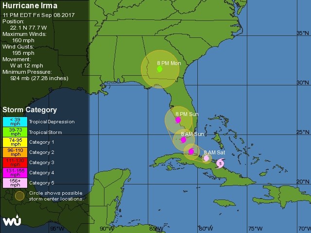
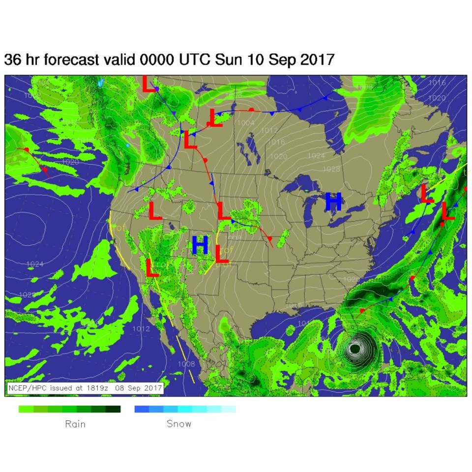
Nothing changes much around Colorado. We'll watch for a front to cool us down around Monday afternoon (see yesterday's post) but still little rain. Meteorologically and in every other way, the big news is Hurricane Irma that has been upgraded to a category 5 storm again. The forecast track has clearly snapped to the other side of the south end of Florida with a hit likely on the Florida Keys (Figure 6).
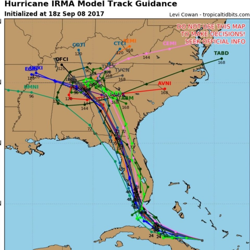
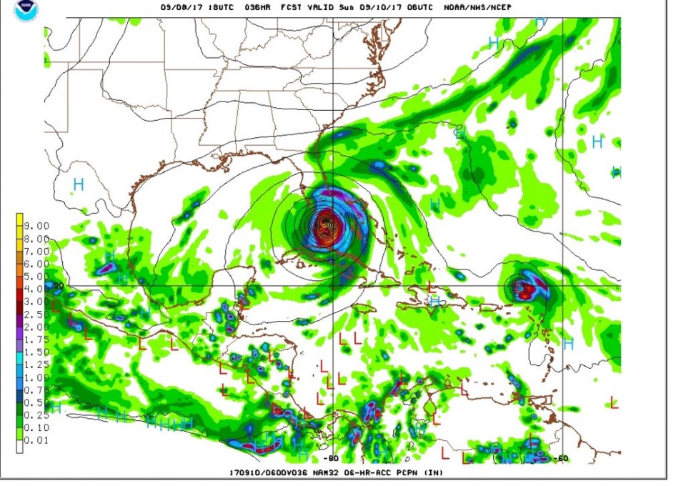
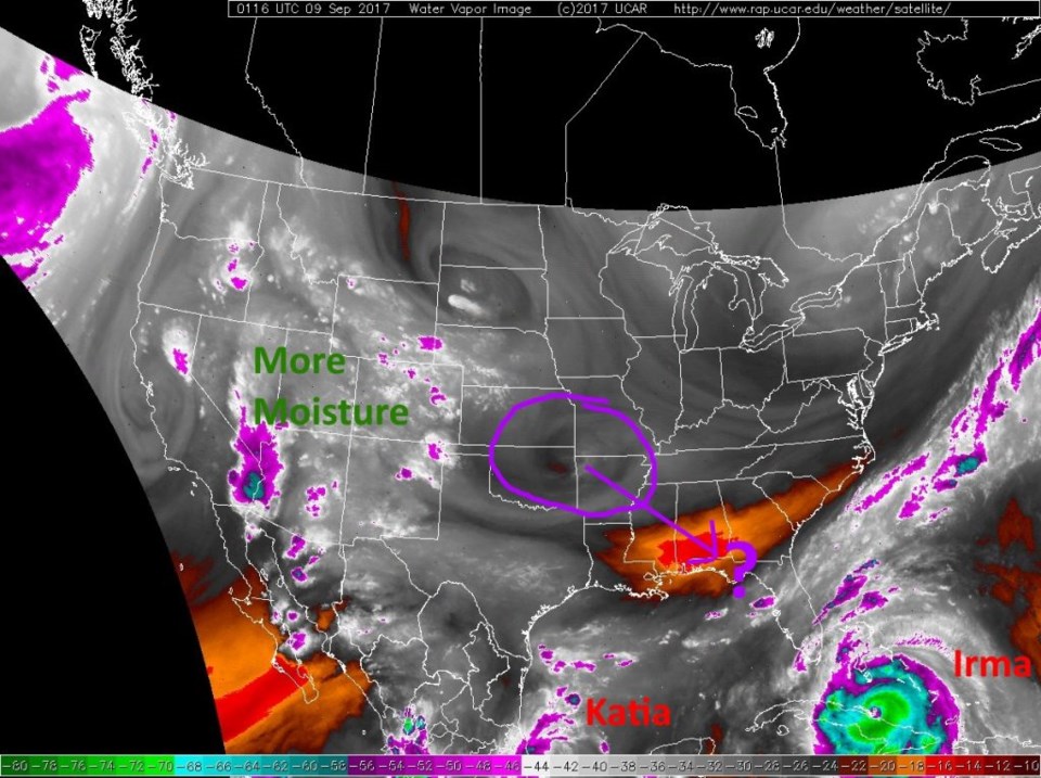
Figure 7 shows the latest (as of Friday PM) comparison of many many models... all trending to the west too. Figure 8 shows the landfall according to the high resolution NAM model run from Friday night. The secret to what is going on here is the ripple in the atmosphere that ran over us today and kicked off the slight showers seen in figure 2. I've circled this small feature in purple in Figure 1 and shown where it is traveling. It was thought this circulation would help push the hurricane to the east, but it is not as strong nor will the positioning be quite as well as it was to move the storm over... so Irma is heading a bit further west impacting, really, all of Florida with very high winds and torrential rainfall and lots of storm surge flooding.
Not pictured here, but Hurricane Jose - a significant Cat 3 storm by itself - may loop in the ocean next week and **could** threaten the east coast later next week. That is still fairly unlikely though. We'll watch that too.