This content was originally published by the Longmont Observer and is licensed under a Creative Commons license.
Forecast Discussion:
A bit more ridge, and a bit more northwest flow aloft equals more warmth and more smoke. The upper air analysis for Friday morning shows the overall large ridge in the western US with a deepening through off the coast, and a large trough over the Great Lakes. Also in Figure 1, you can see our three tropical systems (all three are hurricanes) down in the lower right. The interesting feature for us today is that shorter red marked trough heading over Montana and into Wyoming. That will bring a weak front down tonight and cooler air aloft that will interact with a brief return of tropical moisture to give us a chance of thunderstorms in the foothills that will move east later in the afternoon.
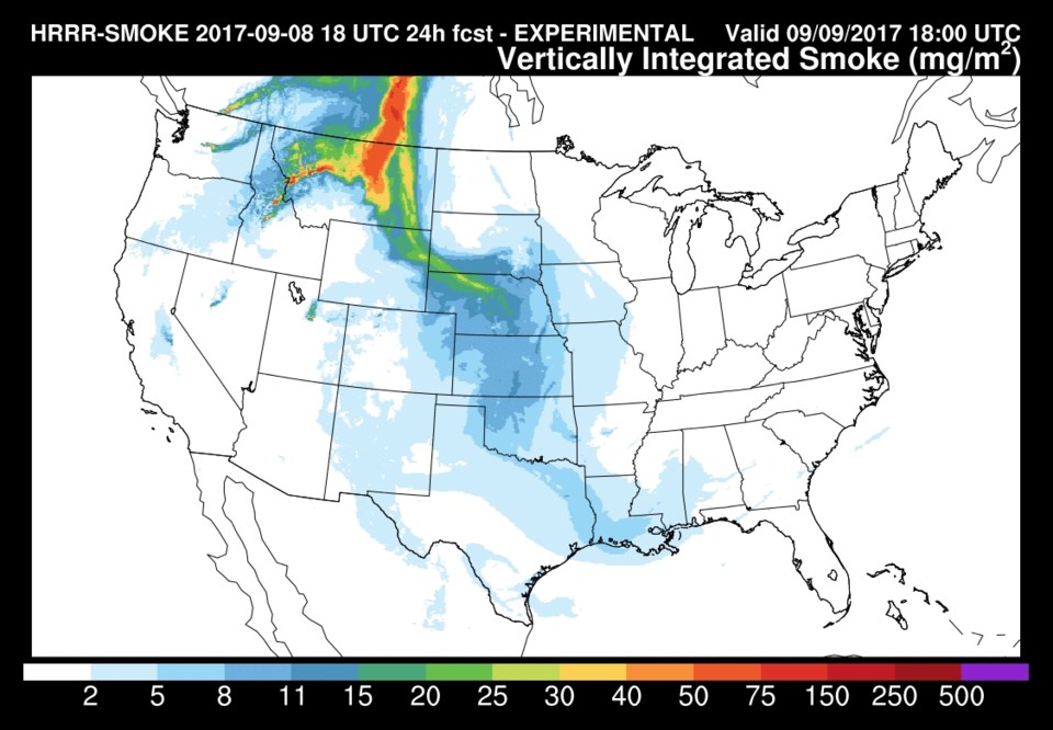
The northwest flow will bring smoke back though. Figure 2 shows the lower level smoke only, and it is definitely thicker, all day today, than it has been since Monday. Figure 3 shows smoke at all levels and it is pretty thick over central Colorado and down the Front Range. It will be a milky sky with lower visibility, burning eyes and noses and the all the rest again.
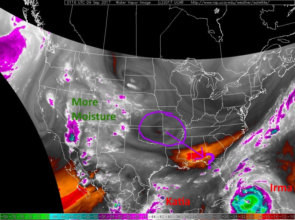
Then the moisture moving in may create our 20-30% chance of afternoon storms. You won't see them coming with the haze in place. Figure 4 is the water vapor satellite image for the nation from Thursday night. The moisture has invaded southern Colorado and northern New Mexico. Figure 5 is the radar image from Thursday night with widely scattered showers in the moist zone. The moisture (and probably a good amount of smoke) remain into the weekend with a small chance of afternoon storms.
The longer range forecast:
Our next real front is slated for Monday when (probably with circulation help from Irma) the ridge becomes deformed and centered back over Utah (Figure 6). Will we see some showers? It doesn't really look like it.
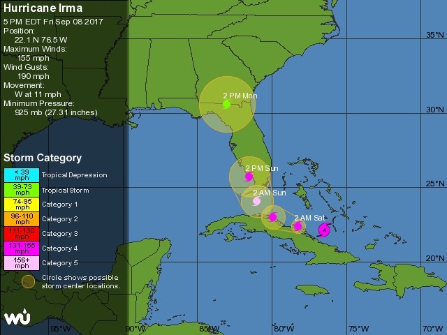
But then there are the hurricanes. The current forecast (Thursday PM) has this 170mph sustained wind speed storm (with gusts to 220mph) hitting Florida with a worst-case scenario for the state and for the Miami area in particular.
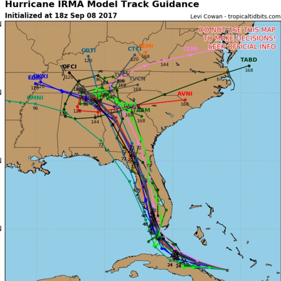
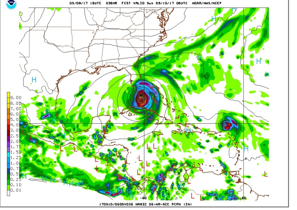
From weatherbell.com we can see just one particular run from the NAM-WRF high resolution model for 8pm Mountain Time Saturday showing the eye hitting the city with winds above 160mph. Run to run, the storm has gone just east of Florida sometimes and closer to the western coast of Florida in other runs. We do not know where it will make landfall. You'll have to watch the models and wait for data to come in just like the meteorologists. And say a prayer for Florida, Georgia, and Tennessee (if correct, the current forecast has a Cat 1 storm in south central Georgia and a tropical storm up into Tennessee. Bad bad bad.)
There is ALSO a small chance that Jose will bank left and head for the U.S. next week. A small chance - the storm curving east is much more likely at this point.