This content was originally published by the Longmont Observer and is licensed under a Creative Commons license.
Forecast Discussion:
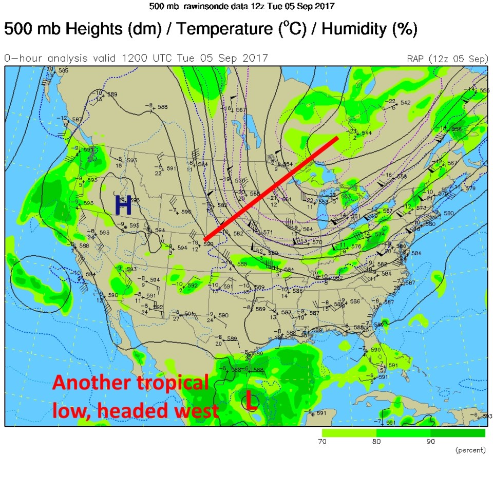
The front came through and brought us some relief from the smoke and real relief from the heat. Figure 1 shows the trough driving the front (all the way into Mexico now) and the ridge (blue H) pushed to the west, where they don't need more heat and dry conditions.
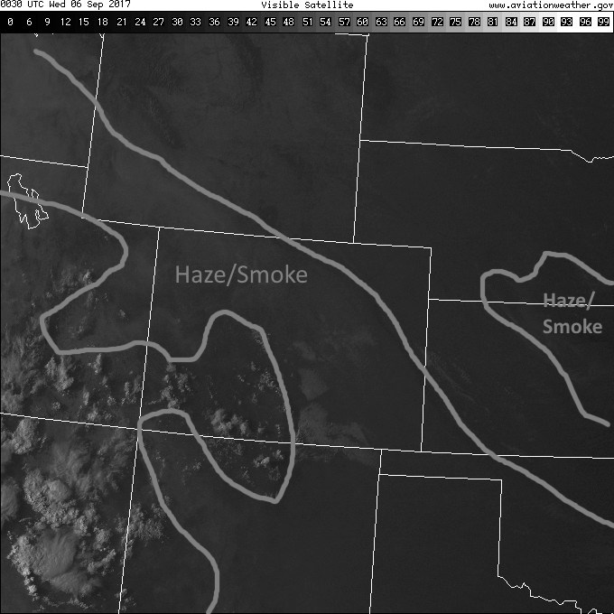
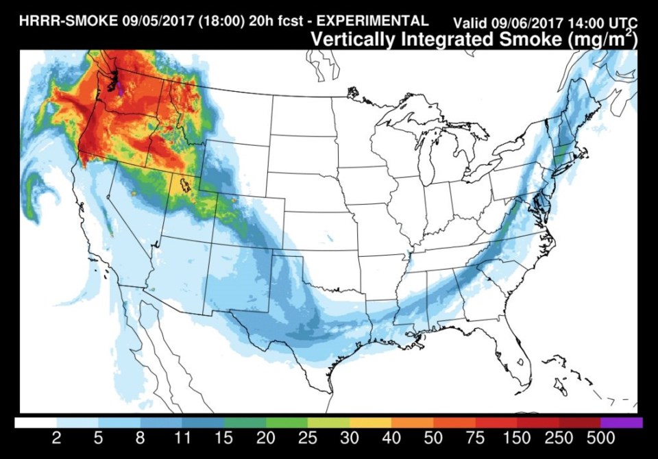
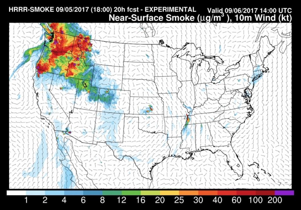
Figure 2 is a visible satellite image from Tuesday afternoon showing that the change in wind direction has helped move a lot of the smoke to the south of Longmont. A new product for this discussion is seen in Figure 3 and 4, smoke tracing forecast maps from the HRRR (the High Resolution Rapid Refresh model). Figure 3 shows all the smoke from the surface up to the top of the troposphere (the lowest, day-to-day weather layer of the atmosphere) while Figure 4 shows just the smoke at the surface. The northeast winds cleaned the air out down here for the most part (some smoke mixes down of course). The mountains still poke up into the smoke levels though.
We start a warm up now as the ridge starts to come back - and we remain dry.
Longer range forecast:
Figure 5 shows the fate of the ridge by the weekend (Saturday AM) - on top of us with a high center to the southeast. That high will block the westward movement of Irma though. The new trough on the west coast may start to cool us down from near 90F again and send some afternoon shower-type moisture our way later this week... maybe. One can see Irma, and newly formed Jose headed in from the southeast towards the U.S.
Hurricane Irma, Tuesday night, is an incredible Category 5 storm (Figure 6) with sustained winds at 185 mph and gusts to 225 mph. That is really hard to imagine. It is headed right along the north side of Puerto Rico, Haiti, The Dominican Republic and Cuba with massively damaging winds and colossal flooding expected.
Figure 7 shows a number of leading model tracks of Irma compared. The Florida Keys seem to get a direct hit followed by a massive hit to Florida. Figure 8 shows the ensemble runs from the European model (my favorite model right now). Florida is in the center of the cone-of-doom here too. And, not to be ignored, a new Tropical Storm - Jose - has formed and is expected to become a Category 1 hurricane just after midnight tonight into Thursday morning. That one 'should' curve out to sea and not threaten the U.S. directly. Fingers crossed.
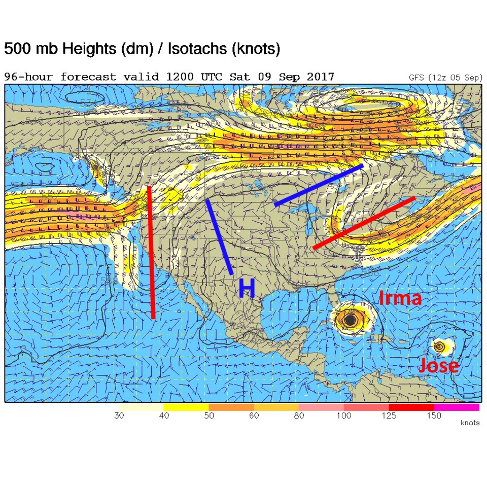 Figure 5: 500mb forecast map from the GFS for Saturday morning.
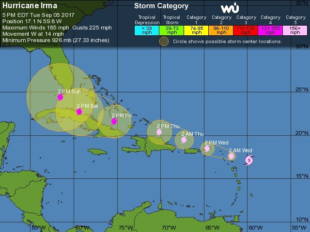
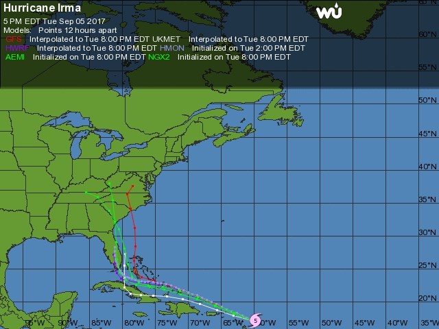

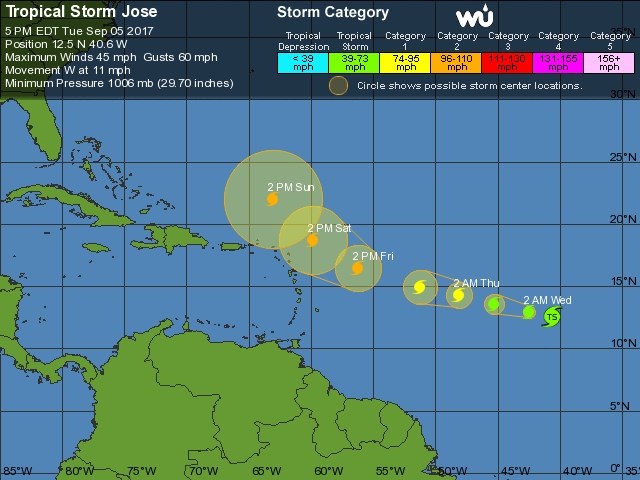 Figure 9: Weatherunderground forecast track for Hurricane Jose.


