This content was originally published by the Longmont Observer and is licensed under a Creative Commons license.
Forecast Discussion:
At the hour I'm drafting this discussion, 8pm Sunday night, it looks like DIA hit 97F which ties the all time September high temperature (which is a high record for the month set a number of times before) - but didn't we set a new monthly record. We did break the record for the date 9/3 of 95F though. I'll update this IF the NWS comes out with a special statement on that.
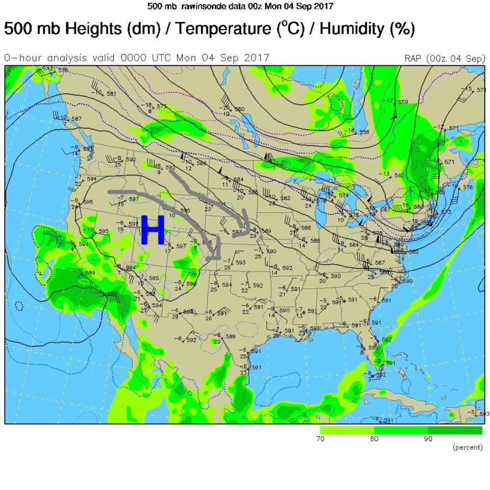
Figure 1 shows the big ridge doing its worst - both in bringing the heat (the purple colors outlined in Figure 2) and bringing the smoke down form the northern and northwestern fires. In Figure 2, you can also see the remains of Lidia and Harvey still 'on the map.' Figure 3 is a visible satellite image (our first I think!) with the next blob of smoke outlined. Quite thick smoke is forecasted to come down in a blob overnight before dawn Monday through mid-day Monday. Yuck. A hazy, unhealthy start to Labor Day.
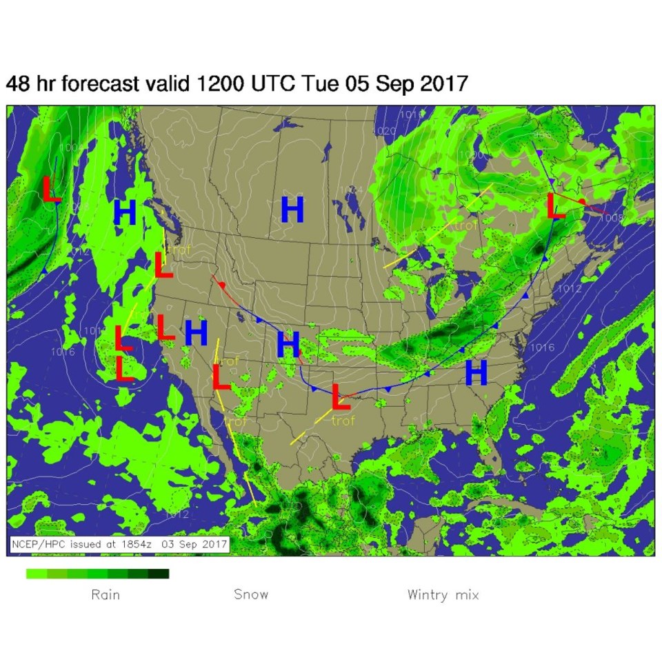
Our cold front pushes down the Front Range in the afternoon on Monday (Figure 4), hopefully bringing in clearer air with the drop in temperatures. Frontal passage for Longmont appears to be in the hour either side of 3pm. The temperatures drop to a high of 68F on Tuesday. Tuesday night may go as low as 48F.


The Longer Ranger Forecast:
The ridge reestablishes itself later in the week. Figure 5 shows this ridge mostly over Colorado with a west coast and an east coast trough. It looks like it remains below 90F into the next weekend. But you can see Hurricane Irma coming in to scare the east coast and/or Florida on Friday. Some of Caribbean has been damaged by this time.
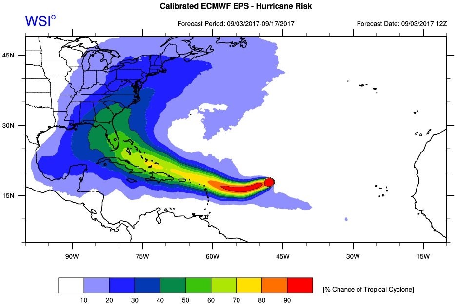
Figure 6 shows that Irma is already a Category 3 storm, as of Sunday PM, and is expected to intensify to a Category 4 storm in the next day and a half or so. Figure 7 and Figure 8 are two 'ensemble' runs where all the outcomes of the same models are run and plotted (with small variations to see how things change). The 'hotter' the color, the more likely it is that that spot in the ocean will see hurricane force winds. Figure 7 is the European model. It threatens Florida clearly. But there are very small chances it will make it into the western Gulf of Mexico or up to New York and Maine etc. Figure 8 is the GFS (we look at the output of the GFS a lot in these discussions) and the Gulf risk is mostly zero, but Florida up to the Carolina's are more 'under the gun' according to its plotted many possible outcomes. Special thanks to the WSI "The Weather Company" for those graphics. http://www.theweathercompany.com/brands/wsi