Skip to content

The Next Storm/Next Snow Forecast Discussion from the Cherrywood Observatory – September 3, 2017

This content was originally published by the Longmont Observer and is licensed under a Creative Commons license.

Forecast discussion:

The ridge is bearing down on us.  The record high at DIA for today is 95F.  Many forecasts have the high at or above this. Poking into records on my own, the highest September temperature ever for Denver was 97F - this has happened a few times with 1995 being the most recent. Smoke keeps coming down from Montana and the Pacific Northwest.  At times yesterday, the mountains were invisible from I-25.  (See Figure 1)

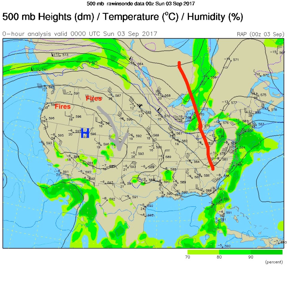
Figure 1: The 500mb upper level map from Saturday PM.

A look into the near future:

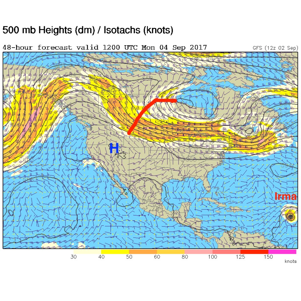
The next trough (red line in Figure 2) is very potent and will drive a strong cold front down the Front Range Monday afternoon and early evening.  The sad thing is... there is little precipitation associated with it.  Some may see a shower or brief storm (more up in the mountains) - but the chances of Longmont seeing significant rain are very low. By Tuesday PM, the trough has pushed further south bringing in much cooler air.  Highs on Tuesday may drop to as low as 68F; 30 degrees lower than Sunday.  Nice!

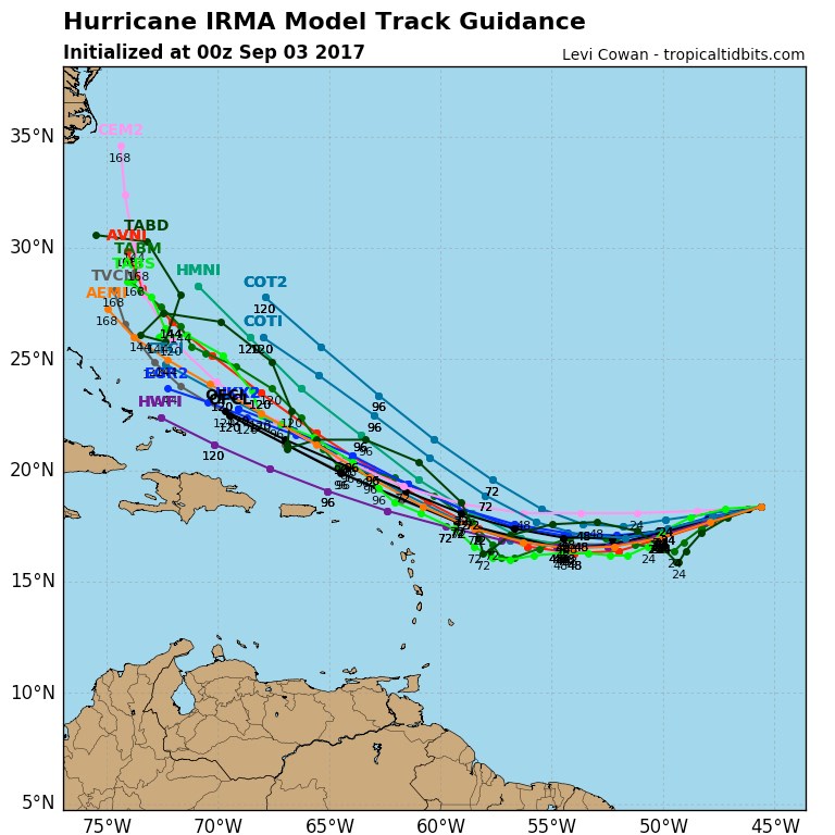
After Harvey heavily damaged south Texas, everyone is extra aware of the next - very potent already- hurricane Irma far out in the Atlantic. Irma is already a Category 2 storm and will soon be a Category 3 storm. Figure 4 shows a comparison of a ton of different hurricane forecast models all laid together for comparison.  Saturday night's GFS actually brings this storm into the DC to Baltimore region around next Sunday.  But a lot can happen this week as we watch. It will keep inching in on the far eastern edge of our maps all week.

Figure 2: 500mb upper level map Monday/Labor Day morning.

Figure 3: GFS 500mb forecast upper air map for Tuesday night.

Figure 4: The Tropicaltidbits.com multi-model comparison graphic.

Current Weather

Cloudy

Cloudy

35°F

UV Index
0 Low
Pressure
30.29 Rising
Visibility
6 miles
Dewpoint
32 °F
Humidity
89%
Wind
ENE 1.1 mph
Gust
3.4 mph
Wind Chill
35 °F

Hourly Forecast

Today
11 PM
34°F
Cloudy
Tomorrow
12 AM
34°F
Cloudy
Tomorrow
1 AM
34°F
Showers
Tomorrow
2 AM
34°F
Cloudy
Tomorrow
3 AM
34°F
Cloudy
Tomorrow
4 AM
34°F
Mostly cloudy
Tomorrow
5 AM
34°F
Mostly cloudy
Tomorrow
6 AM
34°F
Cloudy
Tomorrow
7 AM
35°F
Cloudy
Tomorrow
8 AM
36°F
Intermittent clouds
Tomorrow
9 AM
37°F
Intermittent clouds
Tomorrow
10 AM
40°F
Intermittent clouds

7 Day Forecast

Rain and snow

Thursday

37 °F

Cloudy and much colder; snow showers this morning, accumulating a coating to an inch followed by brief showers this afternoon


Mostly cloudy

Thursday Night

34 °F

An evening shower in spots; otherwise, mostly cloudy


Mostly cloudy w/ showers

Friday

47 °F

Chilly with some sun, then turning cloudy; a little rain in the afternoon


Rain and snow

Friday Night

33 °F

Periods of snow; rain mixed in early, accumulating an inch or two


Flurries

Saturday

43 °F

A bit of morning snow with little or no accumulation; otherwise, cloudy and chilly; storm total snowfall an inch or two


Intermittent clouds

Saturday Night

31 °F

Partly cloudy


Partly sunny

Sunday

69 °F

Pleasant and warmer with partial sunshine


Partly cloudy

Sunday Night

44 °F

Partly cloudy


Intermittent clouds

Monday

79 °F

Very warm with a blend of sun and clouds


Intermittent clouds

Monday Night

36 °F

Increasing clouds


Sunrise and Sunset

Sunrise
6:17 AM
Sunset
7:43 PM

Based on AccuWeather data