This content was originally published by the Longmont Observer and is licensed under a Creative Commons license.
Forecast Discussion:
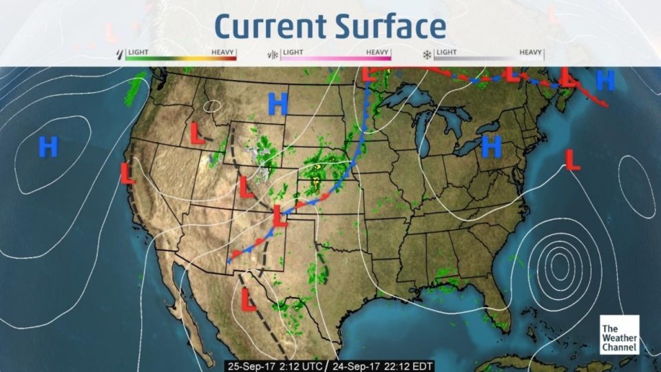
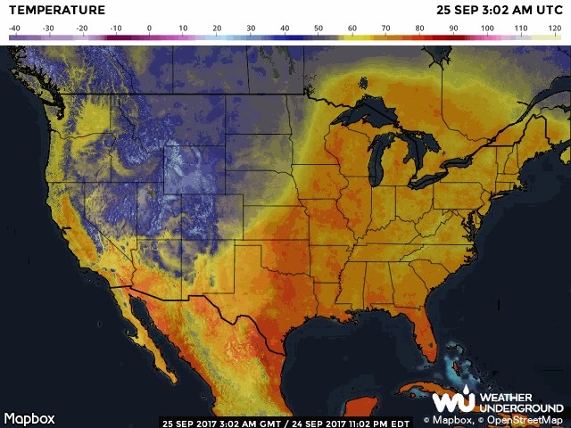
My backyard rain gauge in Longmont collected just about 0.90" of rain with the heavy period of showers Saturday night and additional overnight light rain. Very nice! Figure 1 shows that the front has passed through most of Colorado with another wave of showers moving through northern counties Sunday night. Figure 2 illustrates how far south and east the cold air (blues) has moved. Pretty impressive over the last 3 days.
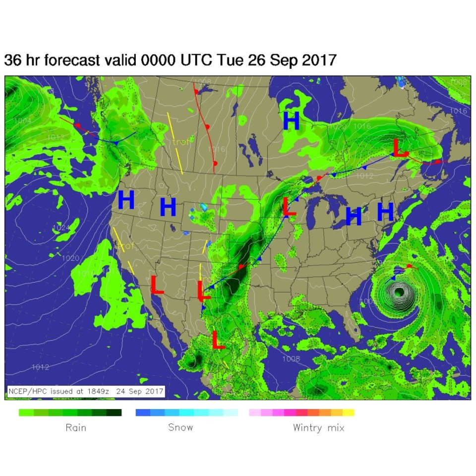
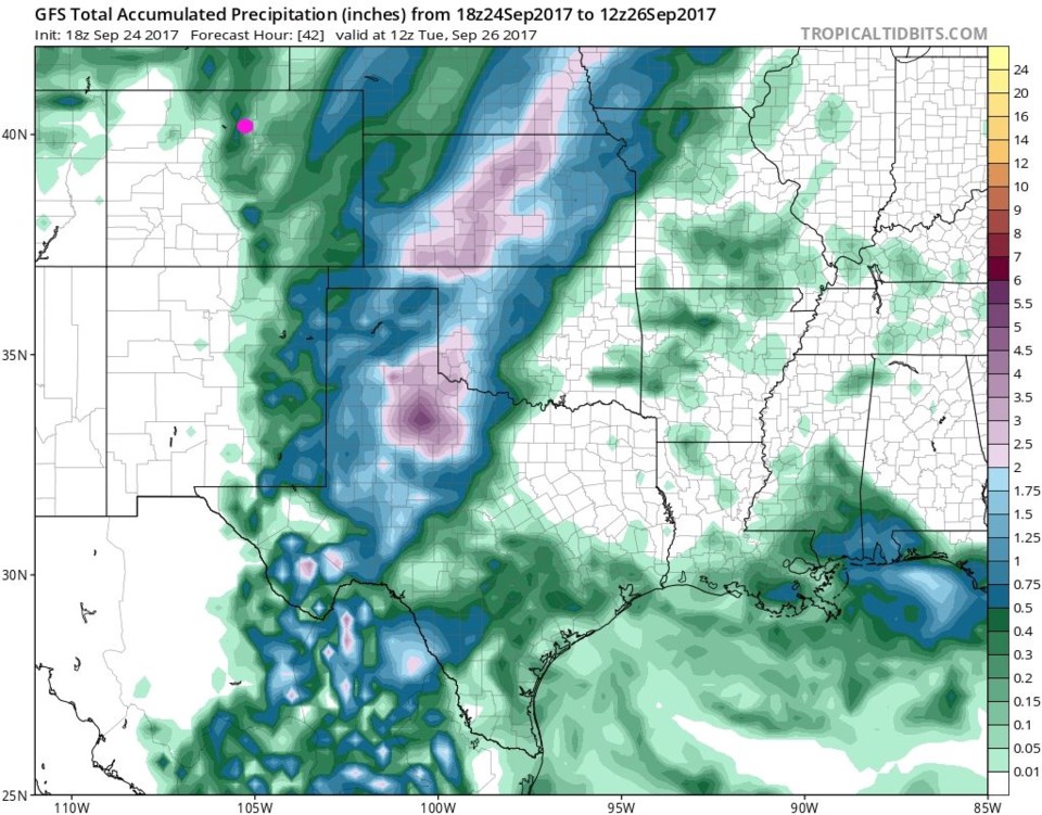
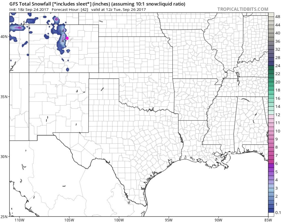
We'll have rain showers, with periods of heavier rain, all day Monday- decreasing to wandering showers through Tuesday morning. Figure 3 shows the front further to the southeast by Monday night, but rain still hanging on in eastern Colorado. Figure 4 is the GFS total rainfall through Tuesday morning. Longmont is the pink dot and seems to get about another 0.5" total from Sunday PM to Tuesday AM. Figure 5 is the same map with snowfall totals through that same period. Very high elevations along the Divide get up to 4-5" but it really is only on the high mountains that snows that build up significantly.
The Longer Range forecast:
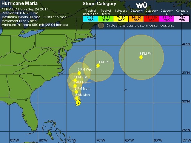
With the current storm not yet cleared in Colorado, I'll only glance at Hurricane Maria today. The National Hurricane Center shows it (Figure 6) as a Category 1 storm that will get close to the Outer banks Tuesday and Wednesday. Tropical storm force winds extend far from the storm center, but it is moving into cooler ocean water left behind by Jose, cooler water created by its own large wind field, and cooler water north of Gulf stream - it should not intensify. There is still a chance that some U.S. land will get a period of Cat 1 winds, but that is all.