Skip to content

The Next Storm/Next Snow Forecast Discussion from the Cherrywood Observatory – September 11, 2017

This content was originally published by the Longmont Observer and is licensed under a Creative Commons license.

Forecast Discussion:

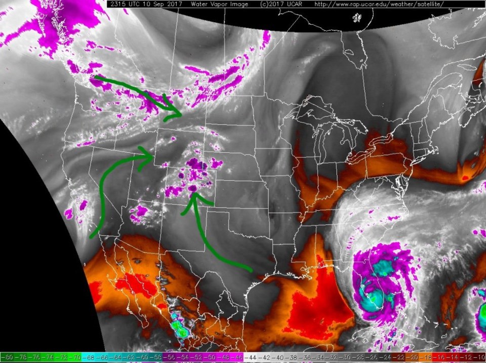
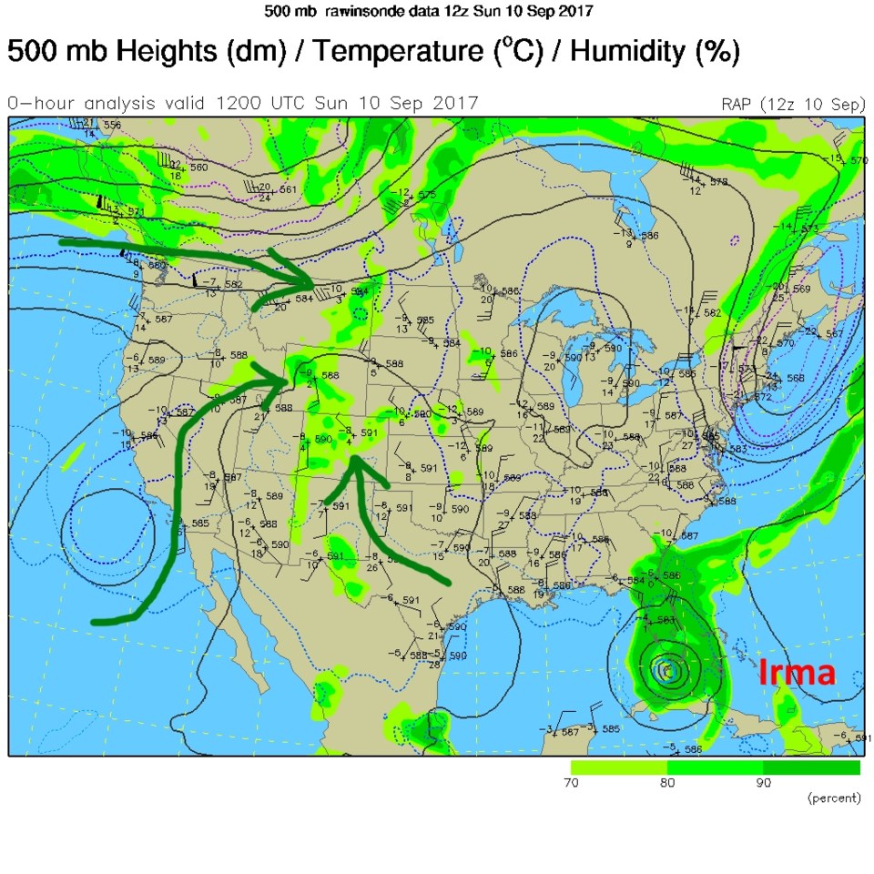
The smoke has cleared (so no HRRR maps today) and a bit more moisture has flowed into the West. Figure 1 shows there is some water vapor from all sorts of directions. It does appear that Hurricane Irma has some moisture in it as well. Figure 2 is the upper air map from Sunday PM showing those same moisture channels.  The ridge is sitting on Colorado keeping us above normal as far as daytime high temperatures go. Some chances of afternoon showers will continue as they fire in the foothills and a few wander east to *maybe* get to us.

Figure 1: Sunday PM Water Vapor satellite image with moisture flow in green.

Figure 2: Sunday PM 500mb upper air map with moisture flow in green.

The Longer Range Forecast:

We stay above normal and pretty dry until Wed/Thur when a cool front may come down and knock us down to the lower 80's and bring just a bit of a better chance of rain.  There isn't much to show graphically yet at this point.

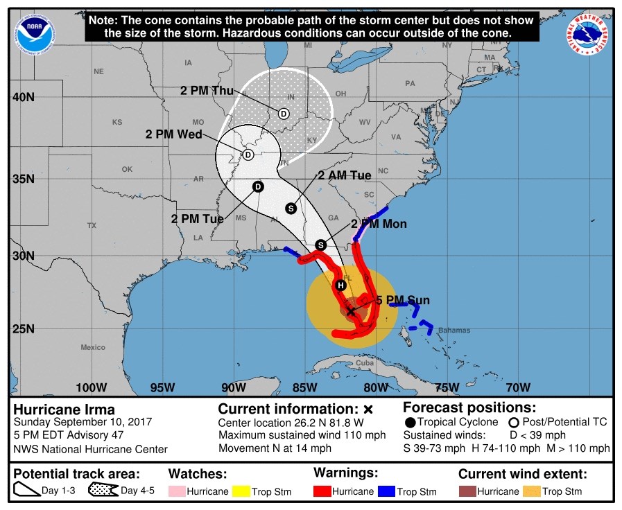
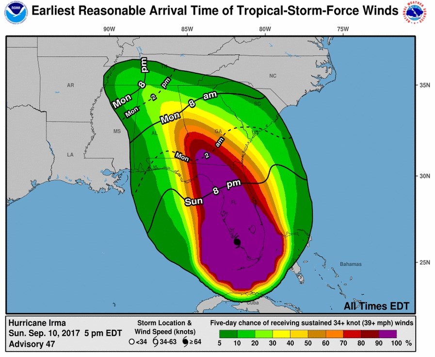
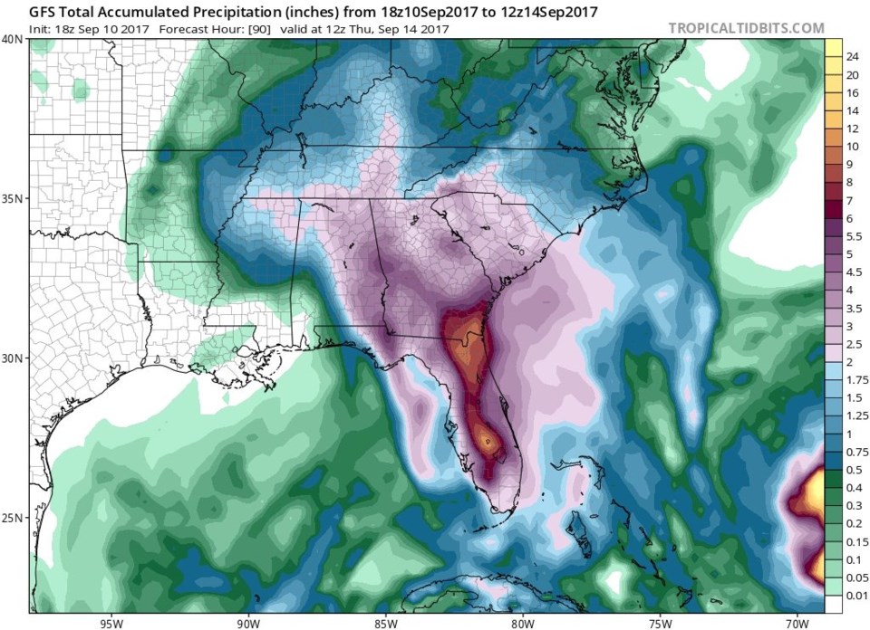
Figure 3 shows the current forecast for Irma and how it will be heading to the Mississippi River Valley and the Tennessee/Kentucky/ Indiana and Ohio area. Figure 4 shows the arrival time, over the next day, of tropical storm forced winds up into the SE US. Figure 5 shows 2+ inches of rain falling between now and Thursday AM for much of Alabama, Georgia, South Carolina, and parts of Tennessee and North Carolina.  And, of course, 6+ inches of rain over a lot of Florida.

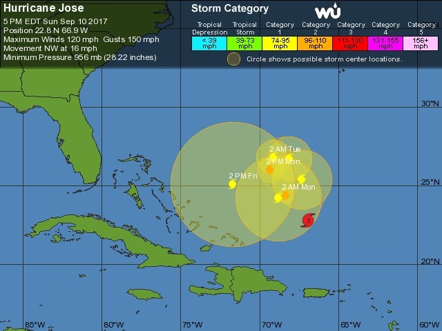
And lest we forget Hurricane Jose, it is projected to do loop-d-loops out in the ocean with the last position next Friday heading a bit back toward the U.S.  We'll keep one eye on it all week.

Figure 3: NOAA/NWS Hurricane Irma forecast from Sunday PM.

Figure 4: Arrival time of tropical storm forced winds (or greater) for Irma.

Figure 5: Total accumulated precipitation Sunday PM to Thursday Morning.

Figure 6: Forecast track of Hurricane Jose from the NWS/NHC from Weatherunderground.

Current Weather

Cloudy

Cloudy

34°F

UV Index
0 Low
Pressure
30.23 Steady
Visibility
4 miles
Dewpoint
31 °F
Humidity
91%
Wind
ENE 1.1 mph
Gust
2.7 mph
Wind Chill
34 °F

Hourly Forecast

Today
3 AM
34°F
Cloudy
Today
4 AM
34°F
Mostly cloudy
Today
5 AM
34°F
Mostly cloudy
Today
6 AM
34°F
Cloudy
Today
7 AM
35°F
Cloudy
Today
8 AM
34°F
Intermittent clouds
Today
9 AM
35°F
Intermittent clouds
Today
10 AM
36°F
Intermittent clouds
Today
11 AM
38°F
Intermittent clouds
Today
12 PM
40°F
Intermittent clouds
Today
1 PM
41°F
Intermittent clouds
Today
2 PM
42°F
Cloudy

7 Day Forecast

Rain and snow

Thursday

37 °F

Cloudy and much colder; snow showers in the morning, accumulating a coating to an inch followed by brief showers in the afternoon


Showers

Thursday Night

34 °F

Mostly cloudy with a brief shower or two late


Mostly cloudy w/ showers

Friday

43 °F

Chilly with some sun, then turning cloudy; a little rain this afternoon


Rain and snow

Friday Night

32 °F

Periods of snow; rain mixed in early, accumulating an inch or two


Flurries

Saturday

40 °F

A bit of morning snow with little or no accumulation; otherwise, cloudy and chilly; storm total snowfall an inch or two


Intermittent clouds

Saturday Night

31 °F

Partly cloudy


Partly sunny

Sunday

64 °F

Partly sunny, pleasant and warmer


Partly cloudy

Sunday Night

41 °F

Partly cloudy


Intermittent clouds

Monday

79 °F

Warmer with a blend of sun and clouds


Partly cloudy

Monday Night

36 °F

Partly cloudy


Sunrise and Sunset

Sunrise
6:17 AM
Sunset
7:43 PM

Based on AccuWeather data