Skip to content

The Next Storm/Next Snow Forecast Discussion from the Cherrywood Observatory – October 9, 2017

This content was originally published by the Longmont Observer and is licensed under a Creative Commons license.

Forecast Discussion:

As printed in the prior special post, we are under a Winter Storm Warning for most of today and a Freeze Warning through Tuesday morning.  I finished winterizing my camper at 5pm Sunday.  That might have been playing it too close.

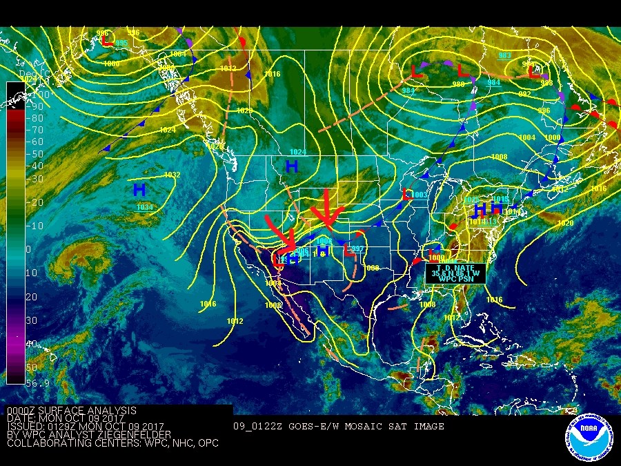
The front did hit around 6pm, and rain started around 8pm, an hour earlier than I called for. As I write, it is snowing in Cheyenne, WY, but rain has not changed over to snow in Fort Collins or Longmont yet (10pm).

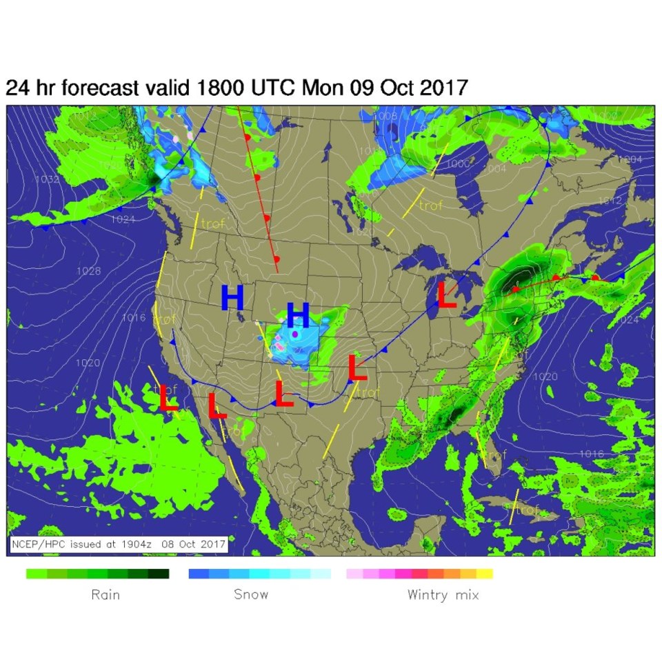
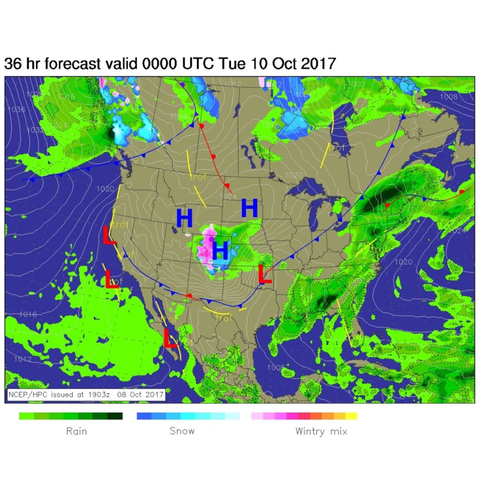
Figure 1 shows the front making its powerful push into Colorado Sunday night. Figure 2 is the noon Monday forecast surface map showing a large shield of snow over most of our state. The pink dot is Longmont. Figure 3 is the same map but Monday PM as the storm weakens and warms a bit.  We are on the edge of rain/snow.

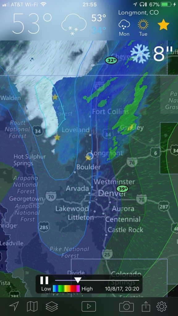
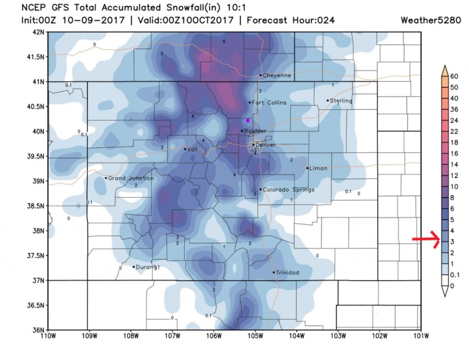
The radar image from Sunday night shows the snow moving down out of Wyoming. This forecast tool has 8" total (not counting melting and compacting) over Longmont for this storm (and 12" amounts up in the northern mountains). But the GFS total snow accumulation through Monday PM pegs us in the 3-4" area.

Figure 1: Sunday PM surface map and infrared satellite image.

Figure 2: NCEP forecast surface analysis Monday noon.

Figure 3: NCEP forecast surface analysis Monday night.

Figure 4: "Current" radar image from Sunday PM with NWS forecasted snow depth for Longmont (8").

Figure 5: GFS total snowfall accumulation through Monday PM

In the longer range:

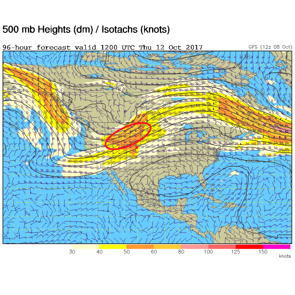
We warm up quite quickly after this storm (with Wednesday morning seeing one more hard freeze for the next week, or so. The jet-stream is north of us on Thursday morning when we might be back in the 70's. Hang in there today (Figure 6)!

Former hurricane Nate is speeding across the Tennessee Valley past the Ohio Valley. It may have the record for being the fastest moving Gulf storm observed.

Figure 6: Thursday morning GFS upper air 500mb forecast map. Red circle is the strongest "jet stream" gradient to the NW of Colorado. We sit in the warm region.

Current Weather

Cloudy

Cloudy

72°F

UV Index
2 Low
Pressure
29.71 Falling
Visibility
9 miles
Dewpoint
41 °F
Humidity
31%
Wind
NNE 3.5 mph
Gust
9.2 mph
Wind Chill
73 °F

Hourly Forecast

Today
3 PM
73°F
Intermittent clouds
Today
4 PM
72°F
Cloudy
Today
5 PM
70°F
Cloudy
Today
6 PM
68°F
Cloudy
Today
7 PM
65°F
Cloudy
Today
8 PM
62°F
Thunderstorms
Today
9 PM
59°F
Cloudy
Today
10 PM
56°F
Cloudy
Today
11 PM
55°F
Cloudy
Tomorrow
12 AM
54°F
Cloudy
Tomorrow
1 AM
53°F
Cloudy
Tomorrow
2 AM
52°F
Cloudy

7 Day Forecast

Mostly cloudy w/ showers

Thursday

73 °F

Turning cloudy, warm; an afternoon shower


Thunderstorms

Thursday Night

47 °F

A thunderstorm in spots this evening; otherwise, considerable cloudiness


Thunderstorms

Friday

70 °F

Mostly cloudy with a couple of thundershowers


Thunderstorms

Friday Night

43 °F

Cloudy with a couple of thundershowers


Rain

Saturday

46 °F

Chilly with periods of rain and a thunderstorm


Rain and snow

Saturday Night

39 °F

Cloudy with rain, mixed with a little snow late


Mostly cloudy

Sunday

59 °F

Mostly cloudy and warmer; a stray afternoon thundershower


Partly cloudy

Sunday Night

36 °F

Partly cloudy


Partly sunny

Monday

71 °F

Partly sunny and warmer


Partly cloudy

Monday Night

39 °F

Partly cloudy


Sunrise and Sunset

Sunrise
6:07 AM
Sunset
7:50 PM

Based on AccuWeather data