This content was originally published by the Longmont Observer and is licensed under a Creative Commons license.
Forecast Discussion:
Read the longer range forecast, below, for our first winter weather and hard freeze forecast!
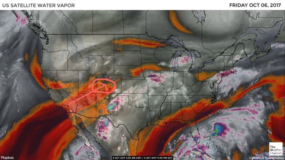
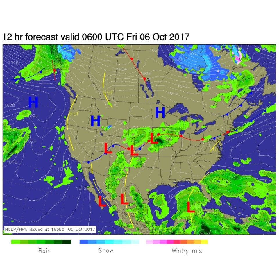
Before we get to the exciting first snow storm chance, let's look at the anticlimactic (not anti-climate) storm Thursday PM into Friday. There are still chances of some showers, but they look to be more in the few 1/100ths of an inch rather than in the few 1/10ths of an inch. The cause is sinking/drying air getting pulled in even though the rest of the weather set up is not bad for some rain. Figure 1 shows our water vapor satellite image and the orange/dry air. I'm sad, I wanted more rain now that I've turned off, and blown out, my sprinklers (thanks Fred).
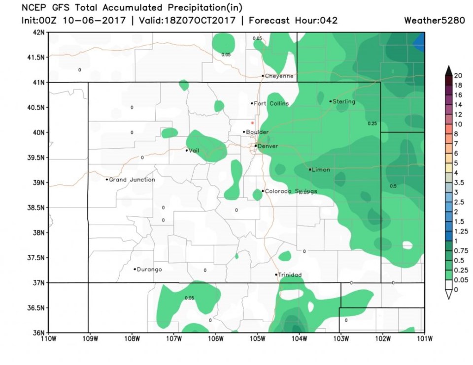
Figure 2 shows the wettest forecast map over the next 24 hours, and there isn't much falling in Longmont (pink dots on all relevant maps). Figure 3 is the total rainfall accumulation map from the GFS model through Saturday noon. Longmont remains so dry that the model doesn't assign us a color. But fog is possible like we saw Thursday morning.
In the Longer Range:
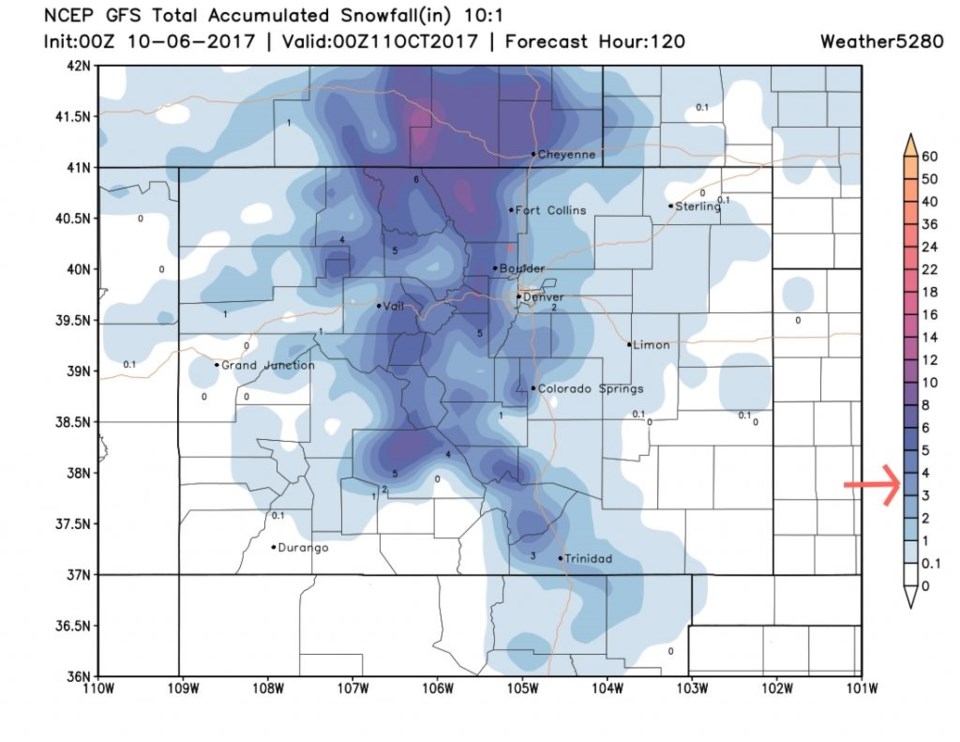
After a very warm and dry Saturday and early Sunday (80's will come *close* to us)- we'll watch a potent cold front arrive sometime Sunday afternoon, Sunday evening, or pre dawn Monday (the European and GFS models are NOT in agreement on timing right now). Rain will form quickly after the front and turn to snow pretty quickly as well. Ground temperatures will be very warm so we'll see melting and slush, but if you have a chilly surface (think awning, tent, bridge, car hood etc.) I expect an inch to three inches will be possible. The GFS is putting down almost 4" for Longmont (and 8 inches up in the mountains) (Figure 4). Snow is possible Sunday night and through Monday and possibly into Monday night if the system is slower. It gets really cold by Tuesday morning with lows in town in the lower to mid 20's. You really need that camper winterized and those sprinklers blown out by Monday. Draining garden hoses and covering outdoor faucets wouldn't hurt either.
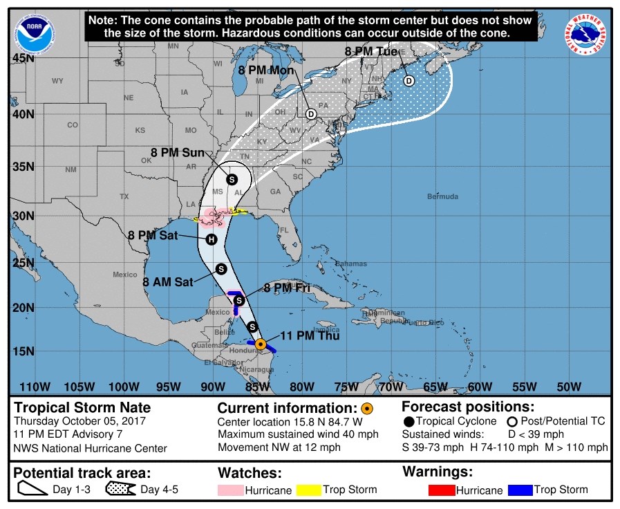
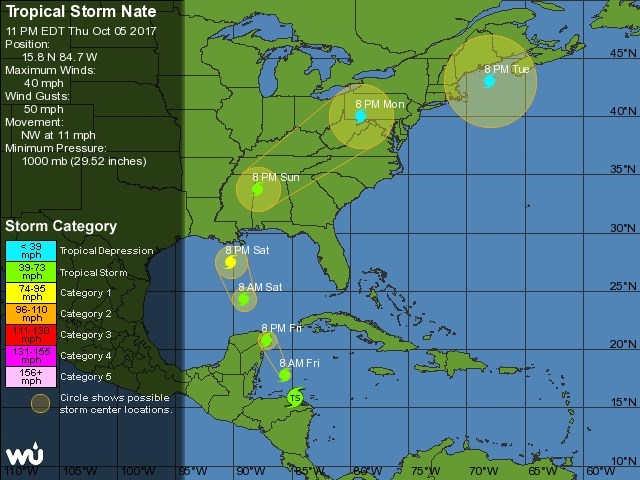
Oh, and don't forget the tropics. Tropical Storm Nate has formed and has made first landfall in central America. It might make landfall again on the Yucatan (Figure 5) and might become a category 1 storm that moves very quickly towards Louisiana to Alabama coastal areas late Saturday-Sunday (Figure 6). This is a lot further west than yesterday's forecast due to a trough in the Gulf of Mexico that is moving westward and an expected building of a ridge over Florida. We'll watch the snow and the tropics through the weekend.